“The Bike Hut” on Tunitas Creek Road, south of Half Moon Bay

IMG_0461

A quick shout out to the cool little “Bike Hut”! For some reason, they’ve been open 5 years and I never knew about them! (…because the few times I’ve been in this area I took the Lobitos Cutoff Road and missed passing by here!)

IMG_9789-bright

IMG_9796

Just under a mile inland from Highway 1, on Tunitas Creek Road, is the “Potrero Nuevo” farm. http://potreronuevofarm.org They’ve converted an old one car garage building into a 24/7 rest-and-repair stop for cyclists! (Notice the old style sliding/hanging door, now painted in vertical stripes.)

IMG_9797

A very cool aerial drone video of the area: https://vimeo.com/193404519

There are picnic tables, a bike rack, and lotsa goodies inside. Keep in mind that you’re 9 miles from Half Moon Bay at the bottom of a route that’s very popular with cyclists. What a great idea!

Self Serve coffee and tea, an “honor system” cash box, plus a log book that’s fun to read and contribute to:

IMG_9800

Opened in 2009 (and a refrigerator that sometimes has eggs for sale):

IMG_9802

A basket of tools and cycling goodies, which looks like you can leave extra stuff, if you have any:

IMG_9803

Clean water for $0.25, and some plastic tubs with dried fruit and other small snacks:

IMG_9804

Tubes for sale, plus a few books and brochures to browse through:

IMG_9807

I stopped in here on a quiet weekday morning, just after 9:00AM, and spoke briefly with one of the owners, who was tidying up a bit. She told me that the SF Chronicle was coming by for an interview! I also noted “Alex” had already signed the book that morning…he’d already done 30 miles, with 30 more to go.

After I returned home I read-up a bit on the farm. It turns out that that majority of their food is donated to low income families and charities and they’re good stewards of the land!

Home

Home

…and back on the road! You can “grind” up Tunitas Creek Road to Skyline and on to Silicon Valley, or head north on Lobitos Creek Road, Verde Road and Higgins Canyon Road for a great backroad route into Half Moon Bay!

IMG_9820

IMG_9825

Posted in Uncategorized | 2 Comments

Pacheco Falls, Willson Camp / Peak / Tower at Henry Coe State Park

IMG_9561

Pacheco Falls is another one of those secret, seasonal, hard-to-get-to waterfalls in the Bay Area! I visited Murrietta Falls just 6 weeks ago: https://alpharoaming.com/2014/03/12/murietta-falls-in-the-ohlone-wilderness/

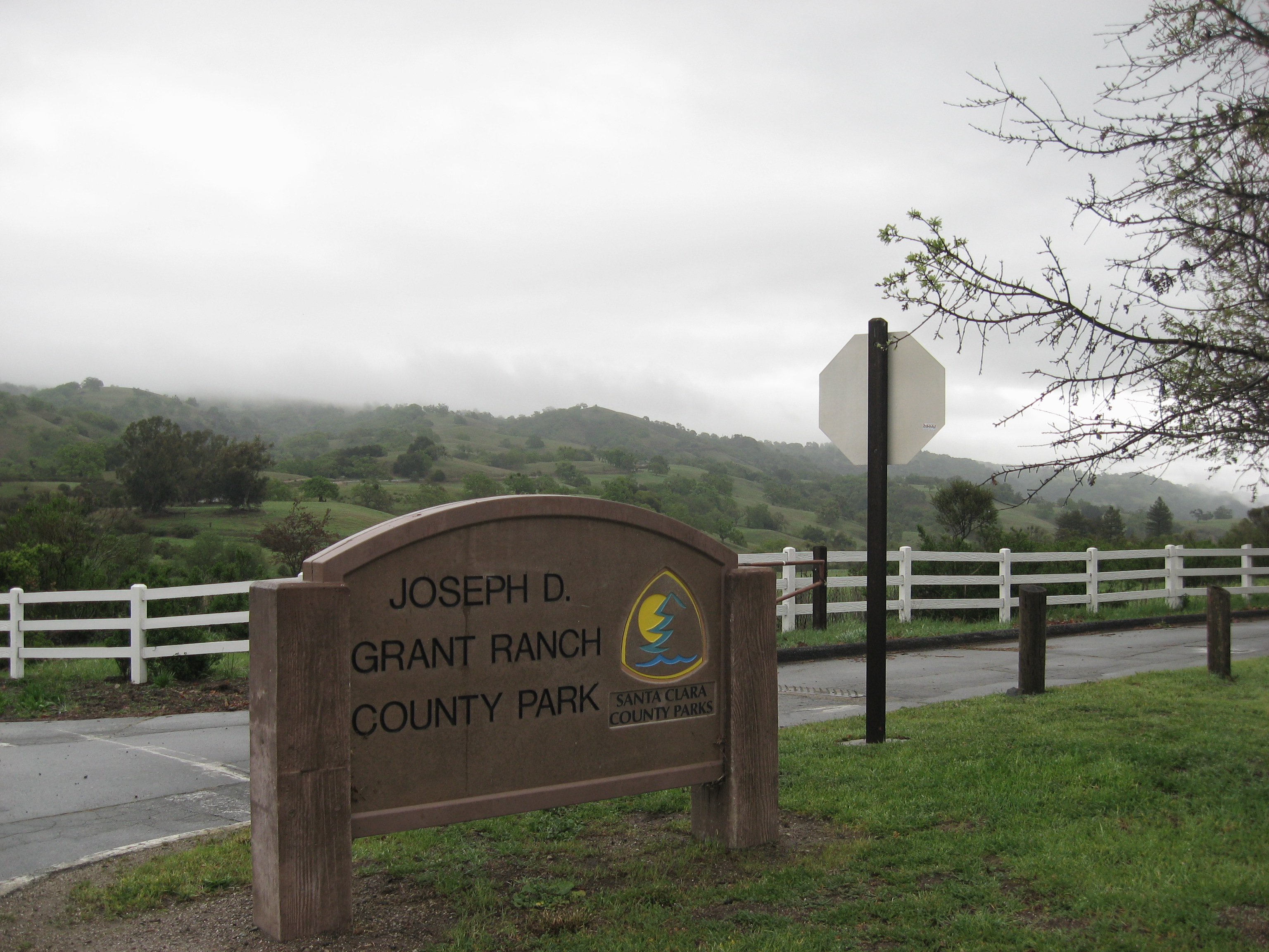
The annual “Backcountry Weekend” at Henry Coe State Park was cancelled this past weekend due to an unusual downpour on friday. I wasn’t planning to go to BCW this year, though I’ve been 3 previous times and enjoyed it! I had a conflict on friday and saturday, but not sunday. I decided that with the recent rains and the temperatures expected to climb in the next week, it would be a good time to visit Pacheco Falls!

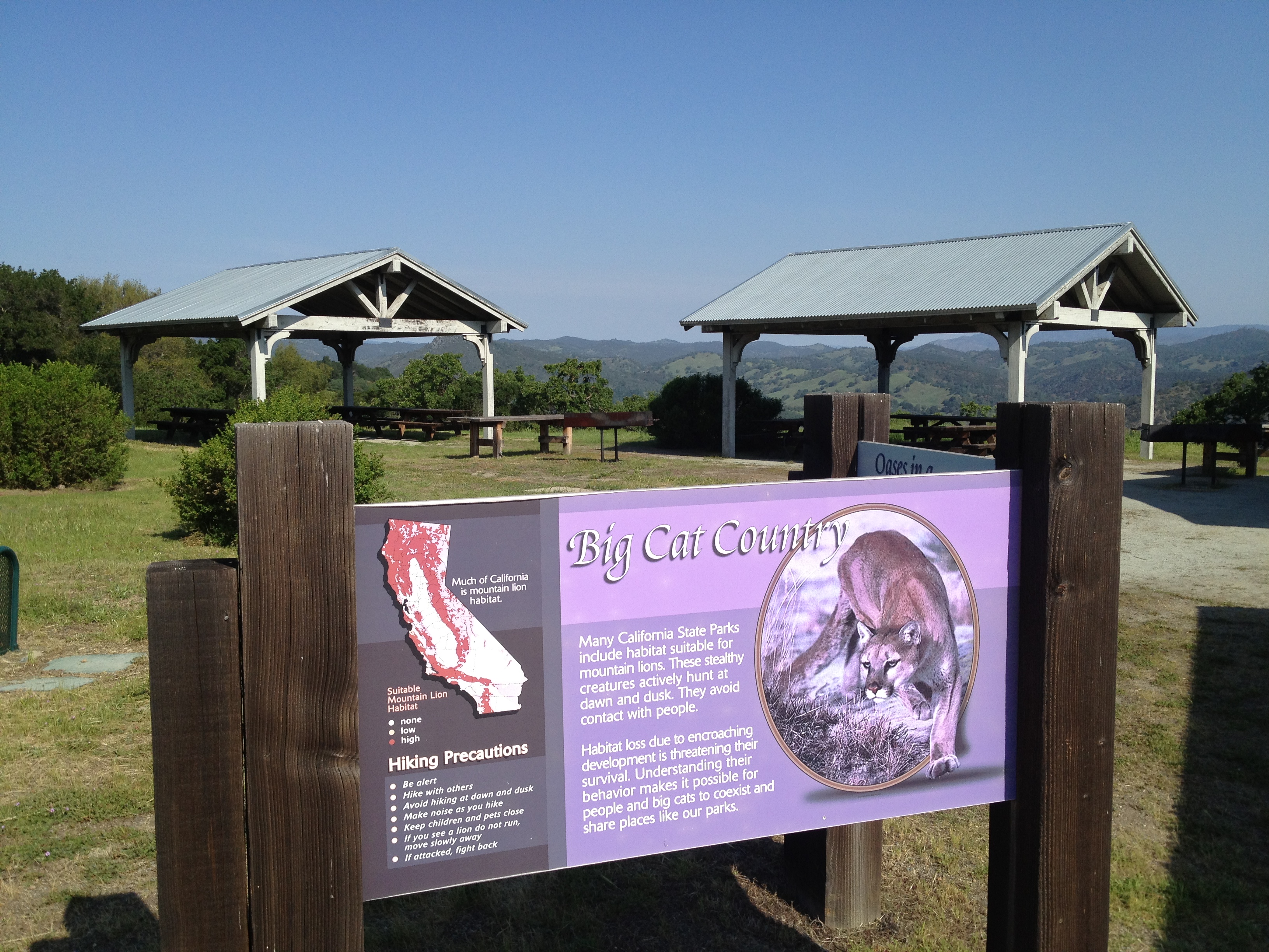
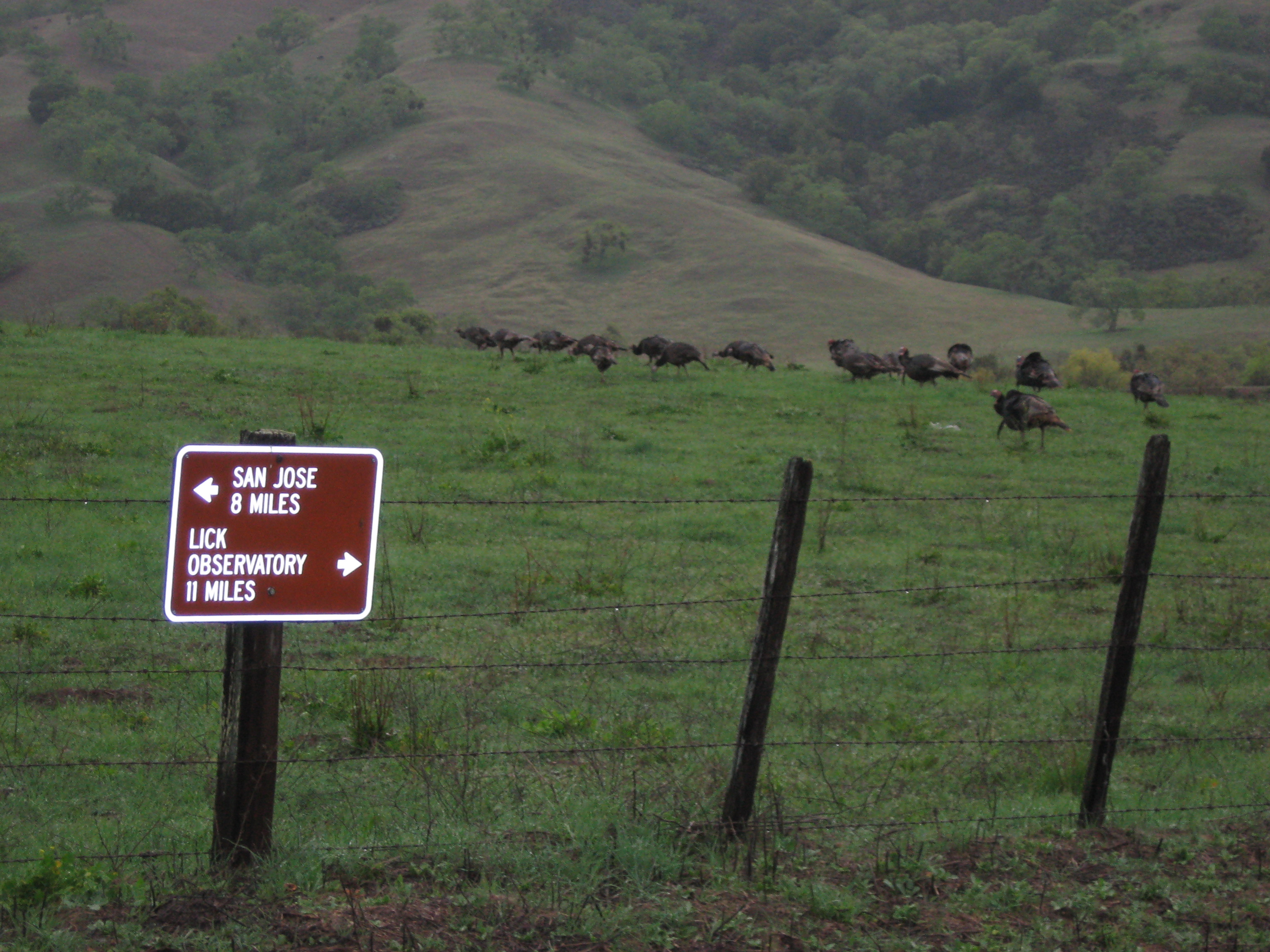
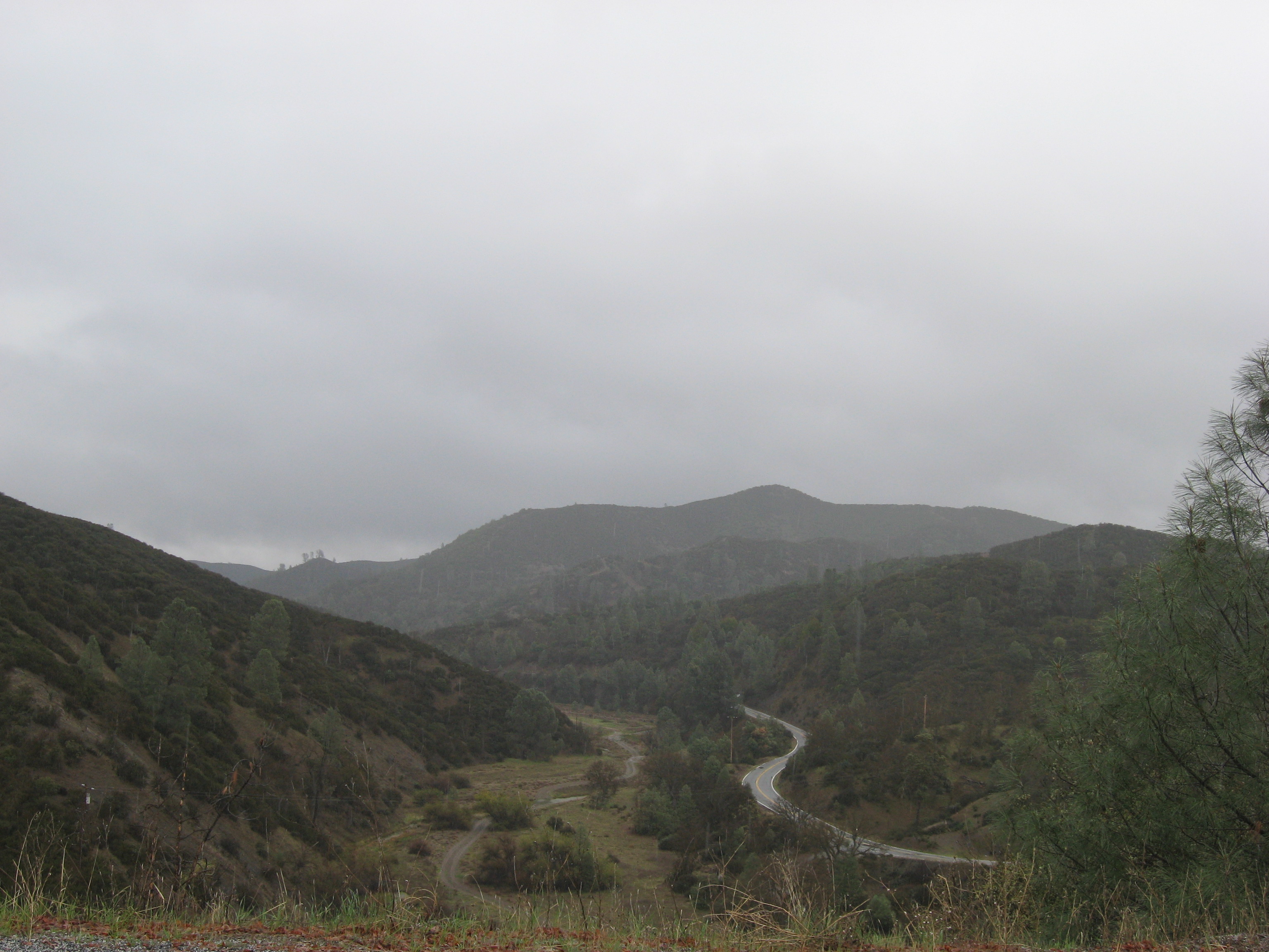
I hit the trail at the Hunting Hollow parking lot at around 9:15 after chatting with Ranger Cameron Bowers and a few other cyclists in the parking lot. The park seemed busy. Ranger Cam said there were several people who were backpacking from here, after BCW was cancelled.

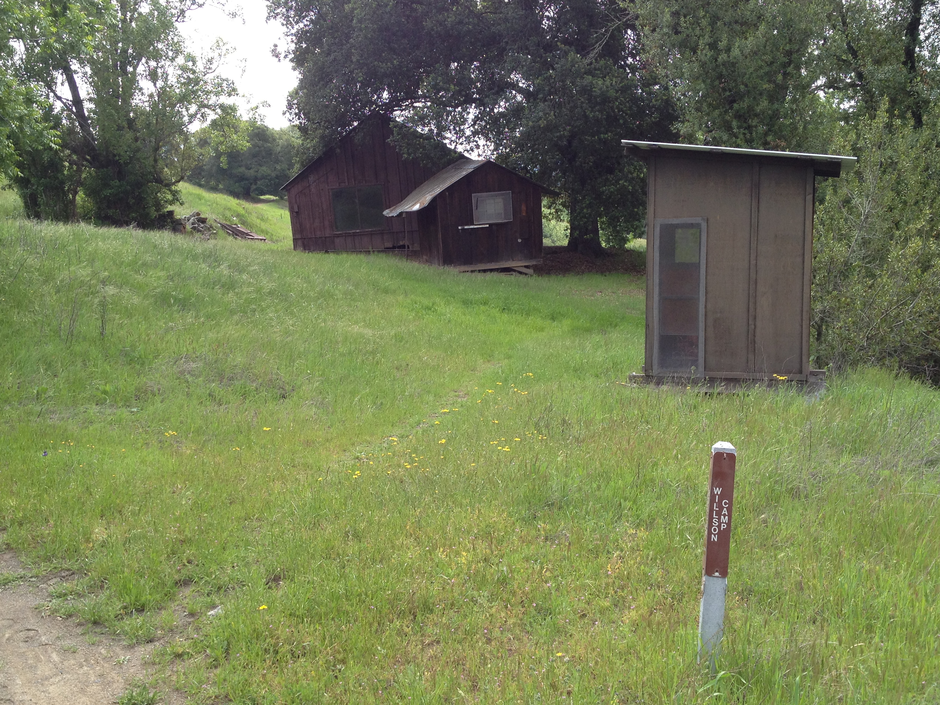
A bit chilly and overcast. Perfect weather to start cycling (and pushing the bike) up Lyman-Willson Trail

IMG_9566

…arriving at Willson Camp in 80 minutes

IMG_9570

The biggest climb of the day was done, now it was just “typical Coe” for awhile: ups-and-downs of a few hundred feet, again, and again, and again…

6 miles in, looking back from where I came, at the turnoff to Wasno Pond:

IMG_9579

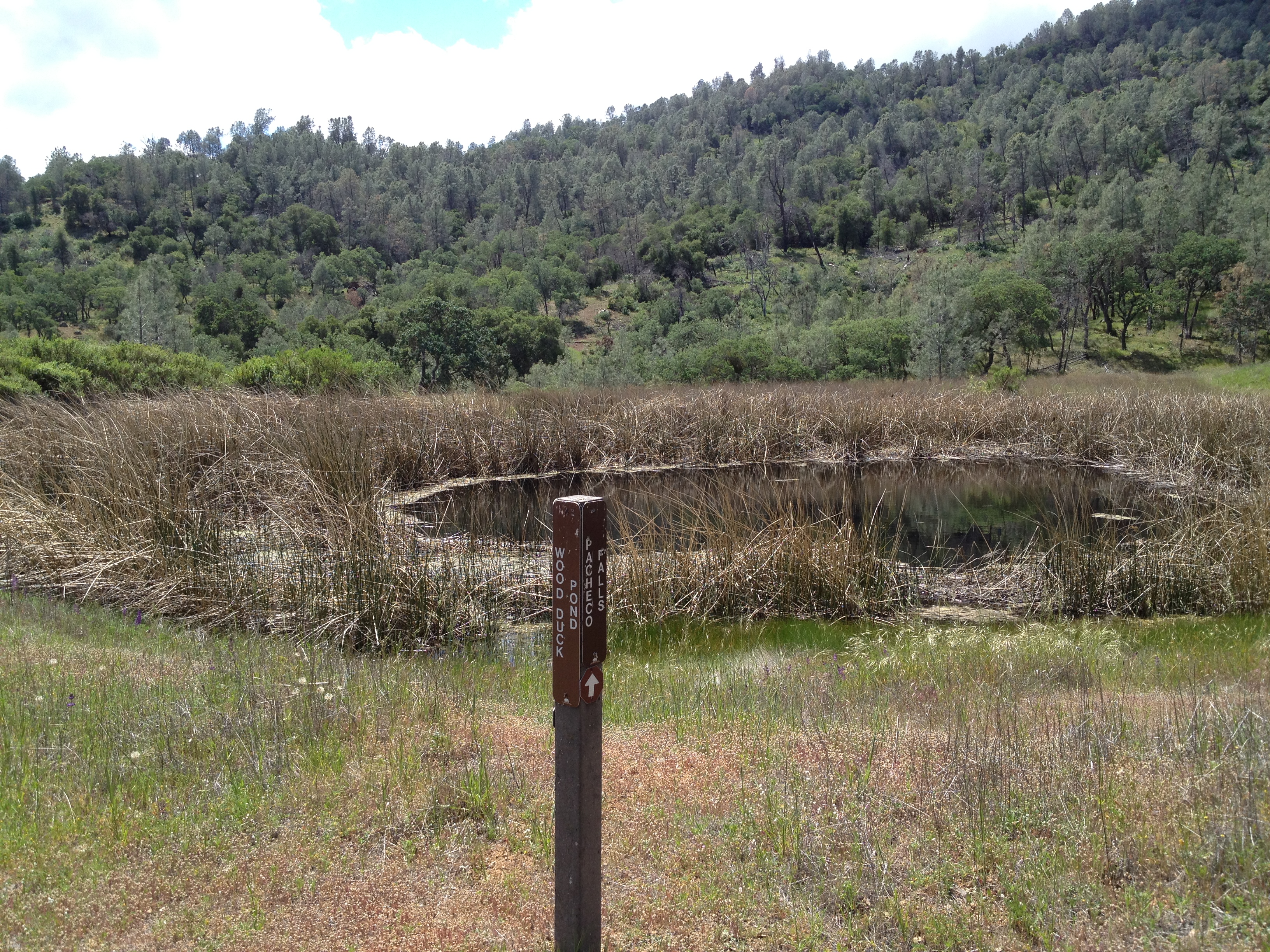
After about 12 miles and 3 hours, I finally reached the turnoff to Pacheco Falls. From here it drops about 800 feet on 0.9 miles

IMG_9581

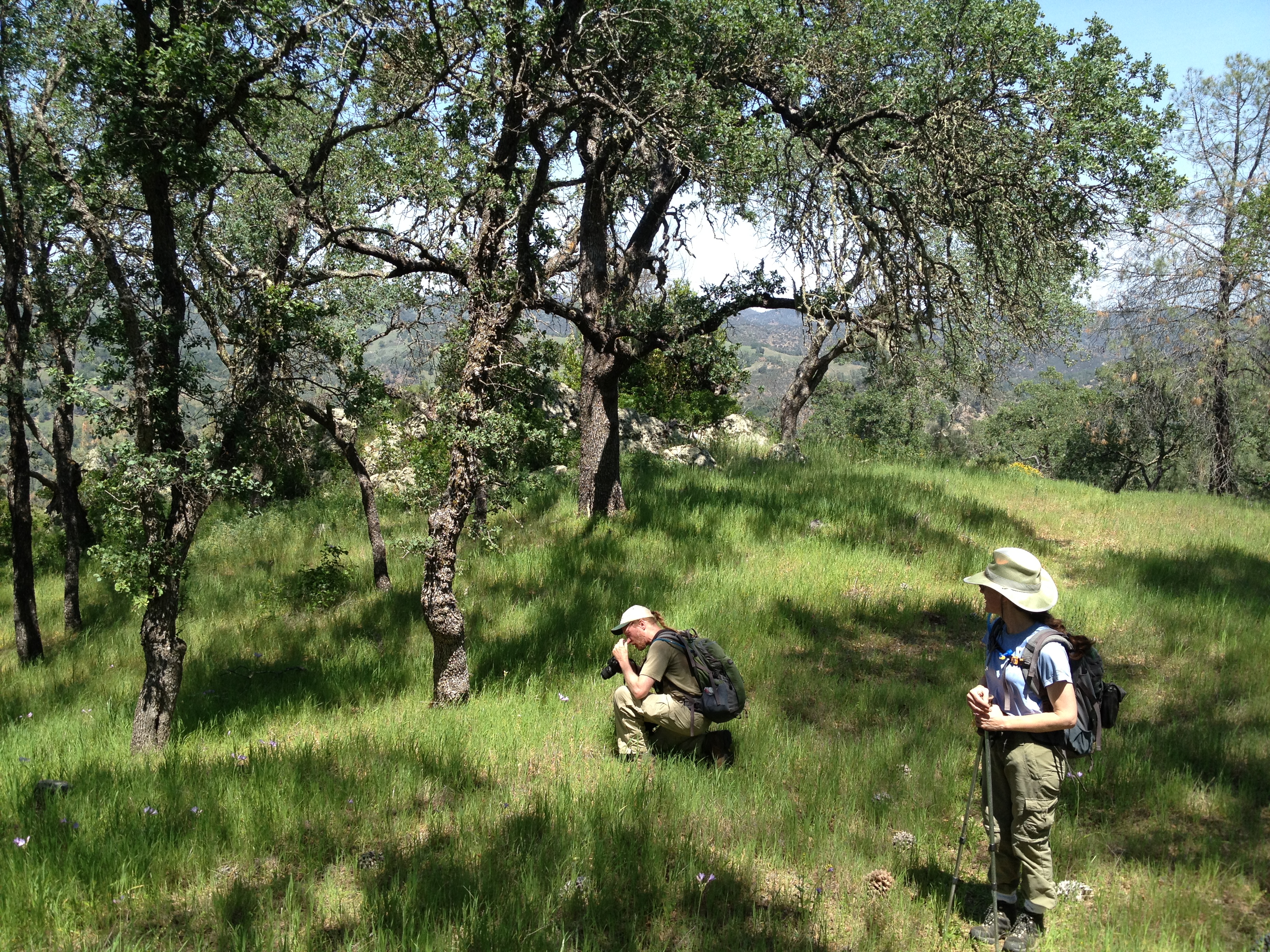
Wood Duck Pond, about 1/3 the way down to the Falls. At this spot I chatted with the 5th backpacker of the day. (I has seen 2 other singles and a couple…I had seen nobody on my previous trips out here)

IMG_9583

…and down some more into the canyon. By now I had ditched my bike.

IMG_9587

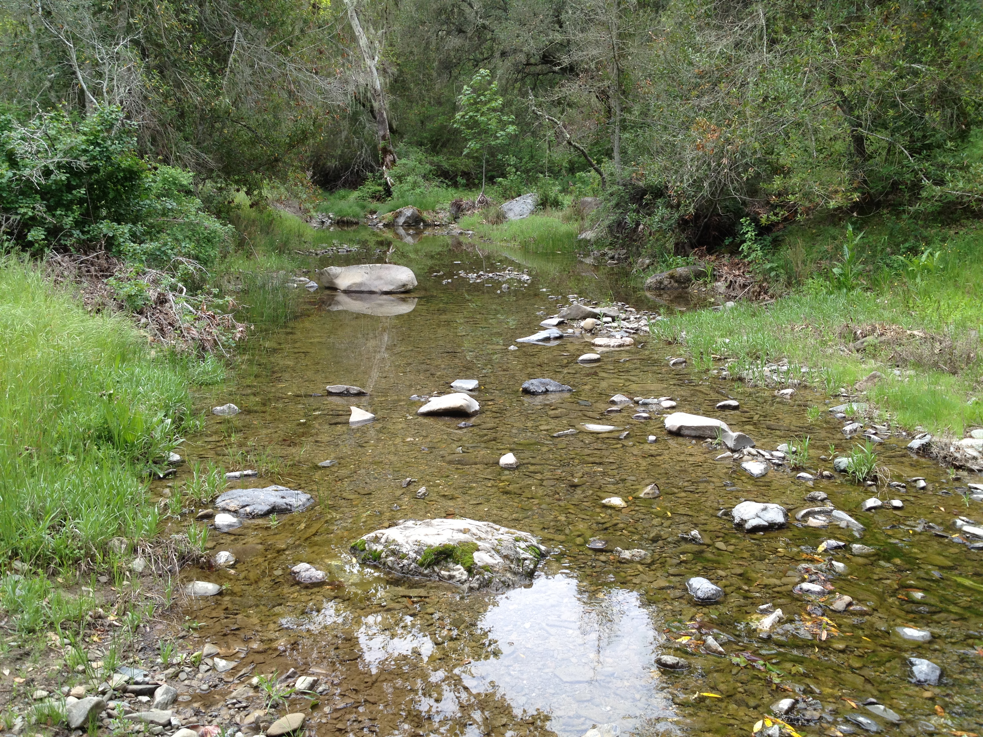
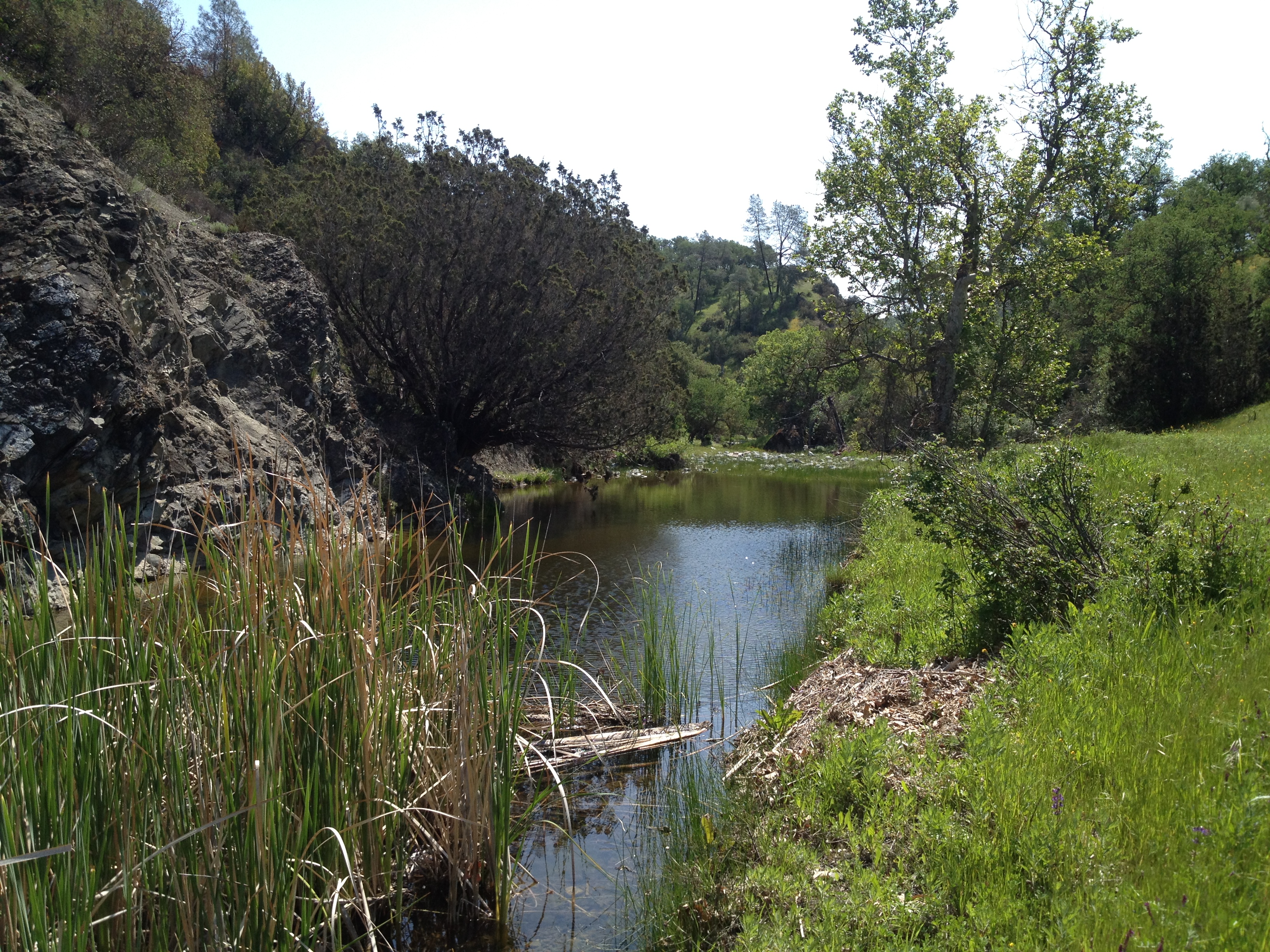
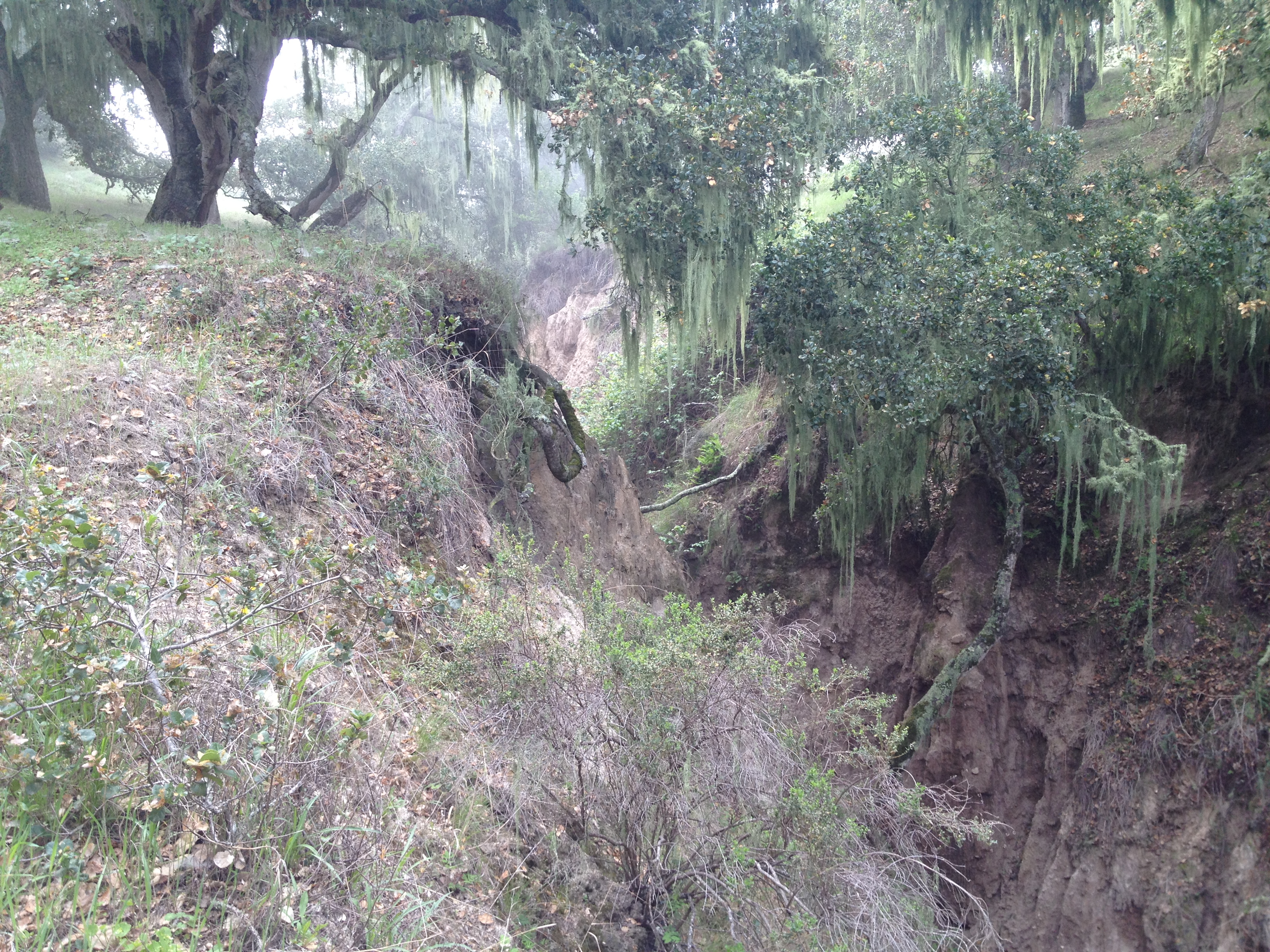
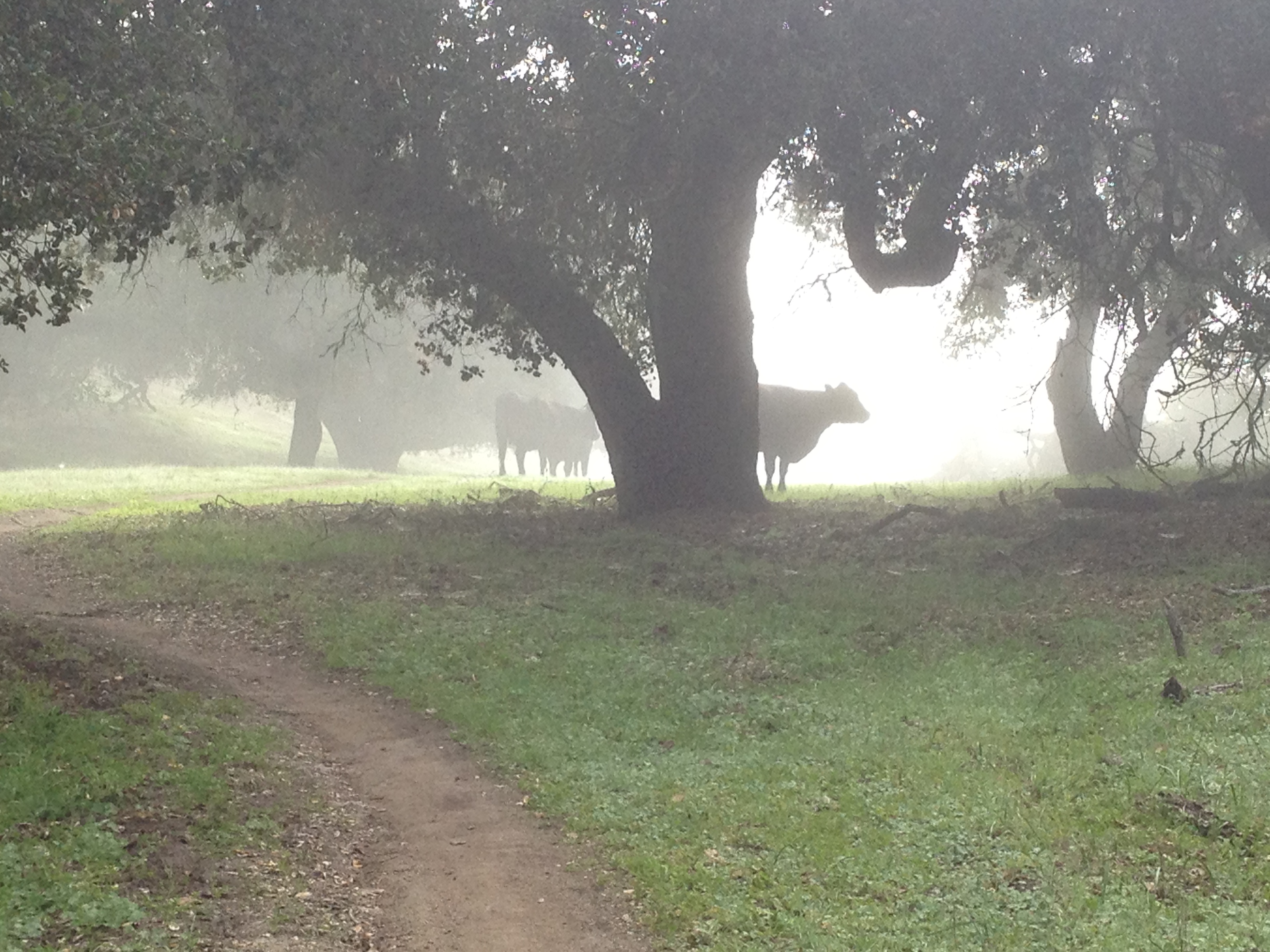
The falls…a bit disappointing! I was expecting a bit of “gushing”. I guess all the rain, less than 48 hours earlier, had soaked into the parched earth. It’s still a magical oasis in the middle of nowhere with small fish and dragonflies (and lotsa poison oak). The water was trickling slowly.

IMG_9593

I then slogged back up to the bike and the (ahem) “main” road. By early afternoon, it was no longer cool and overcast. It was a beautiful day, with some interesting cloud formations on a breezy day.

IMG_9602

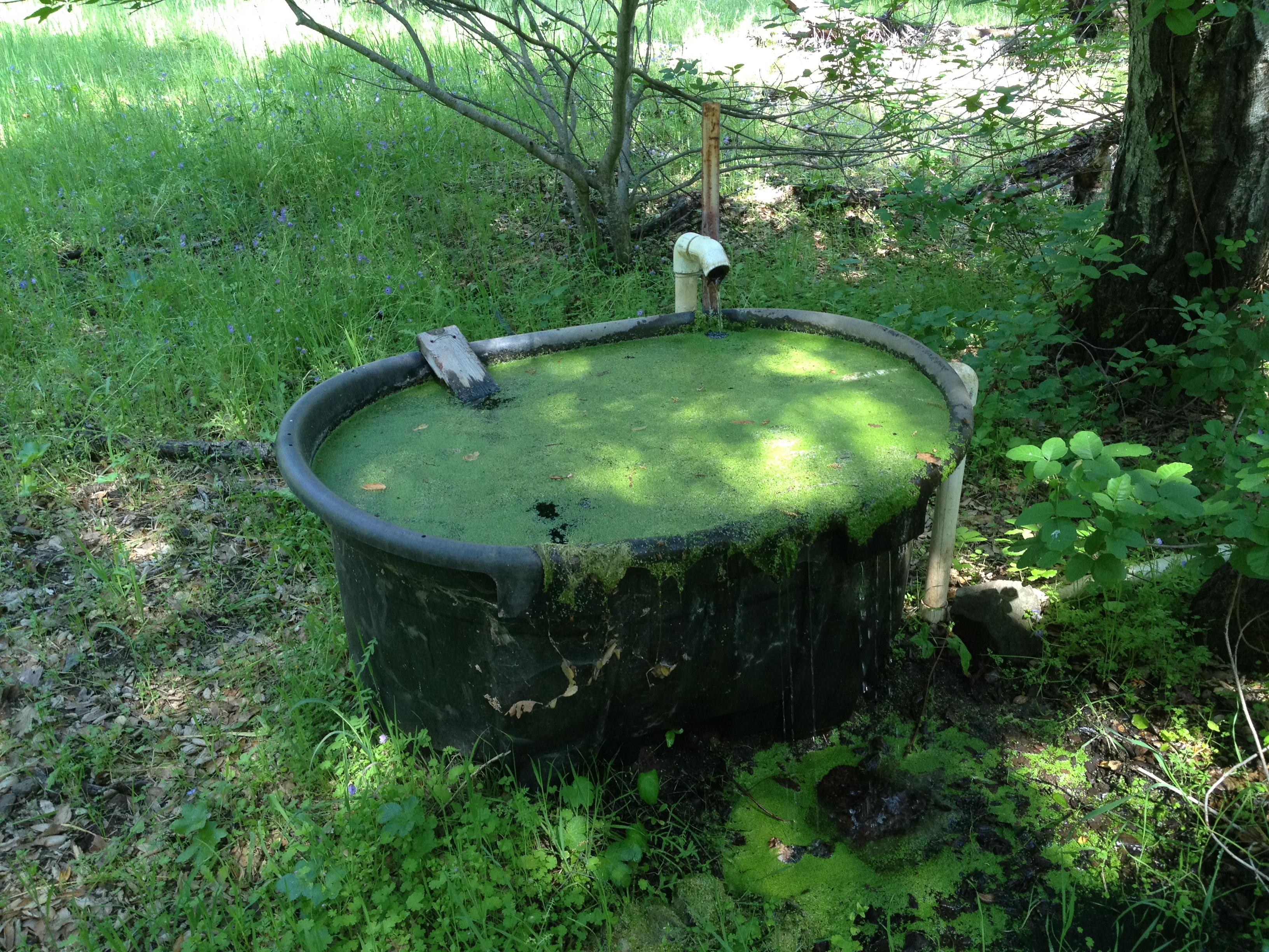
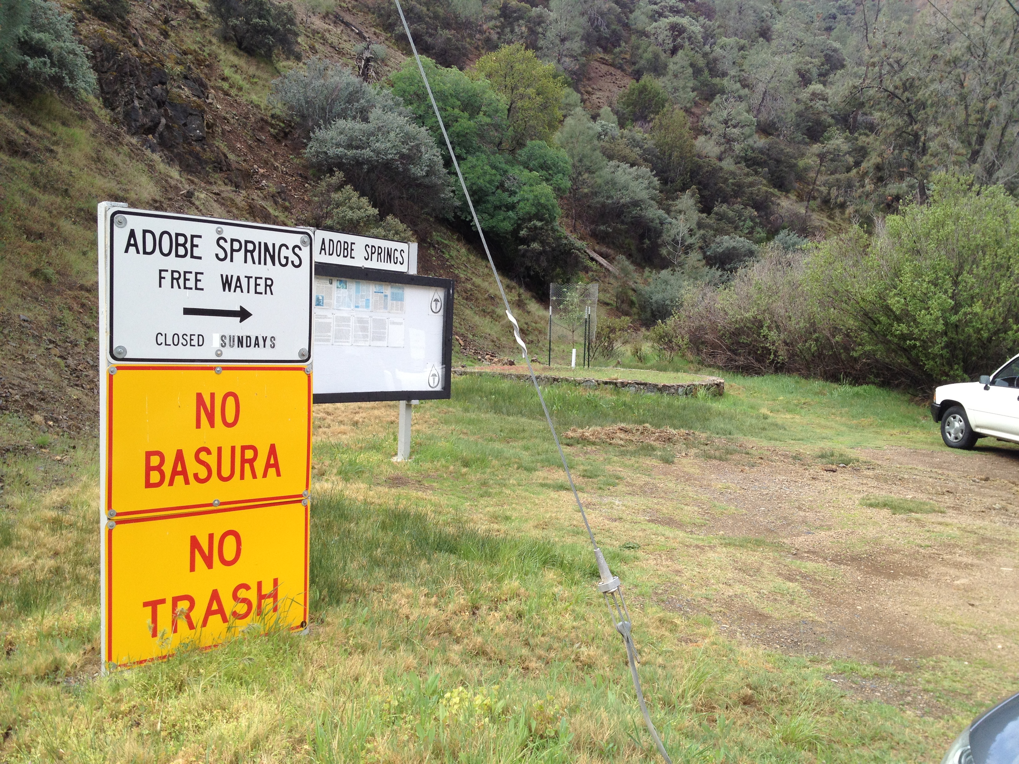
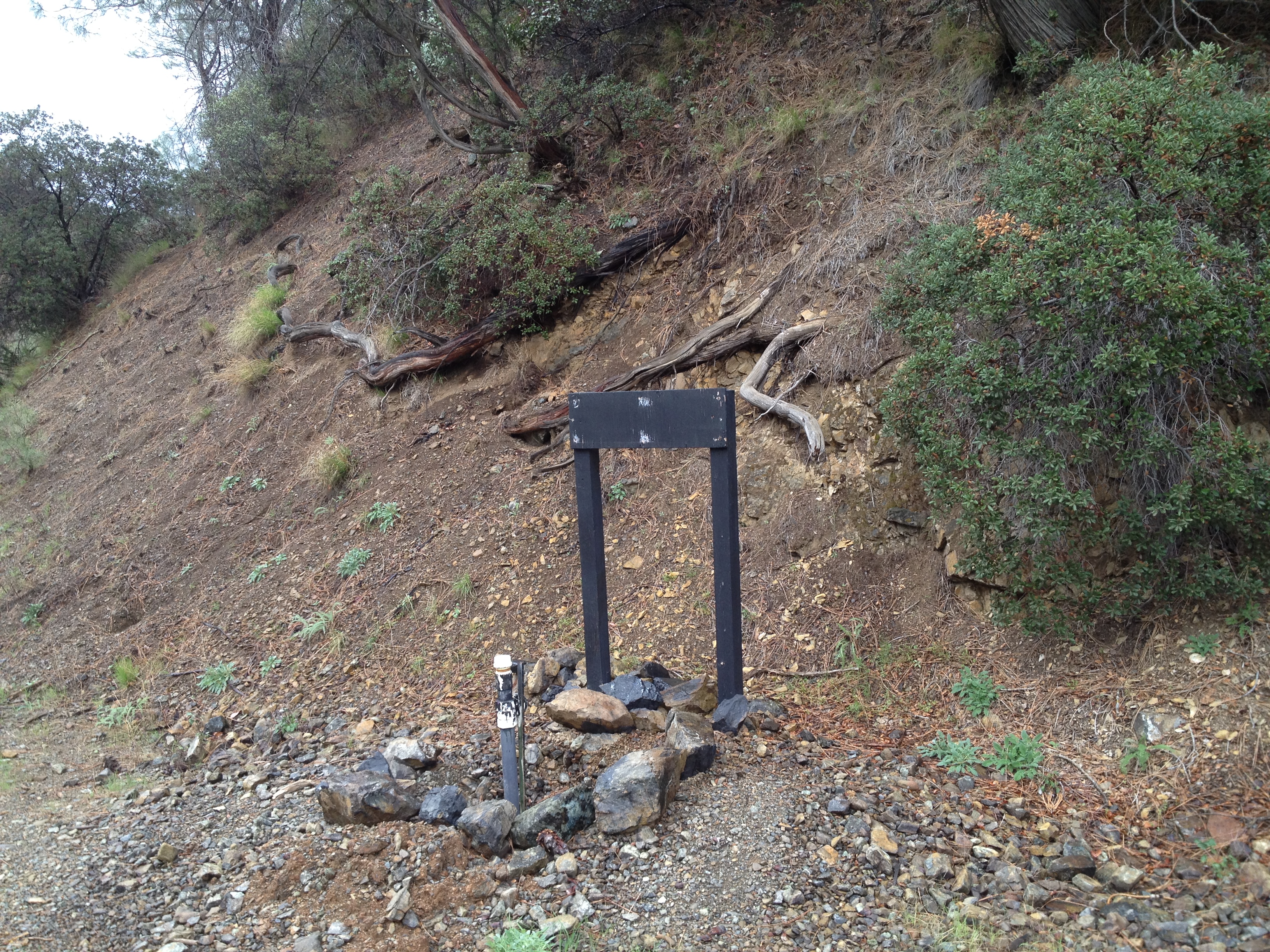
I decided to visit Live Oak Spring, which was just a few hundred feet off my path. I didn’t require more water, but it would make me a bit more comfortable if I grabbed another liter.

IMG_9603

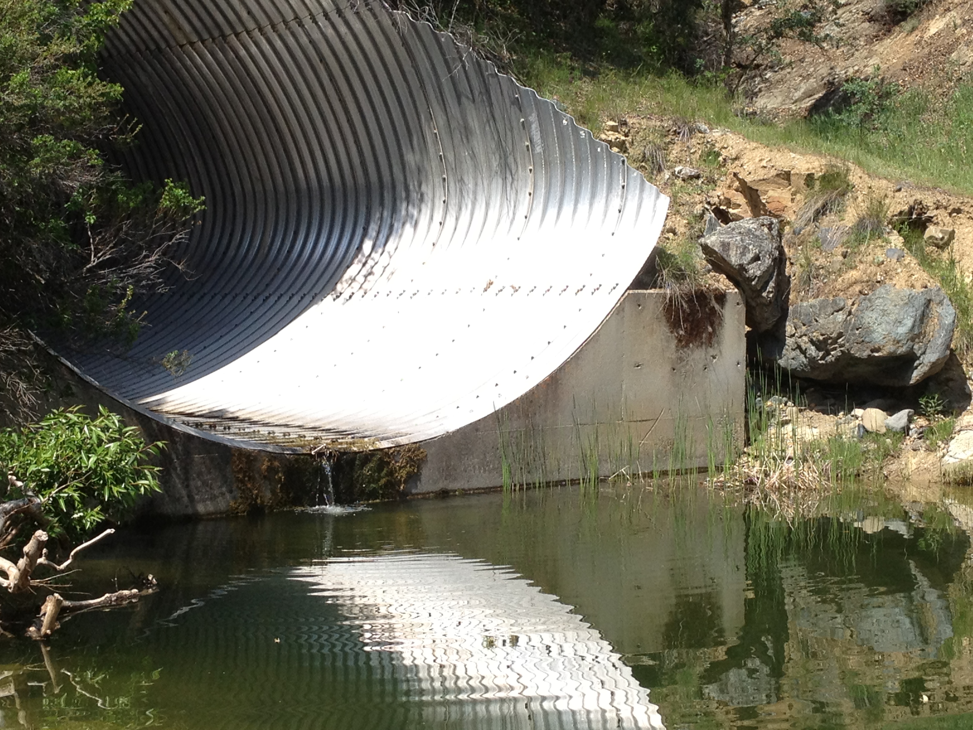
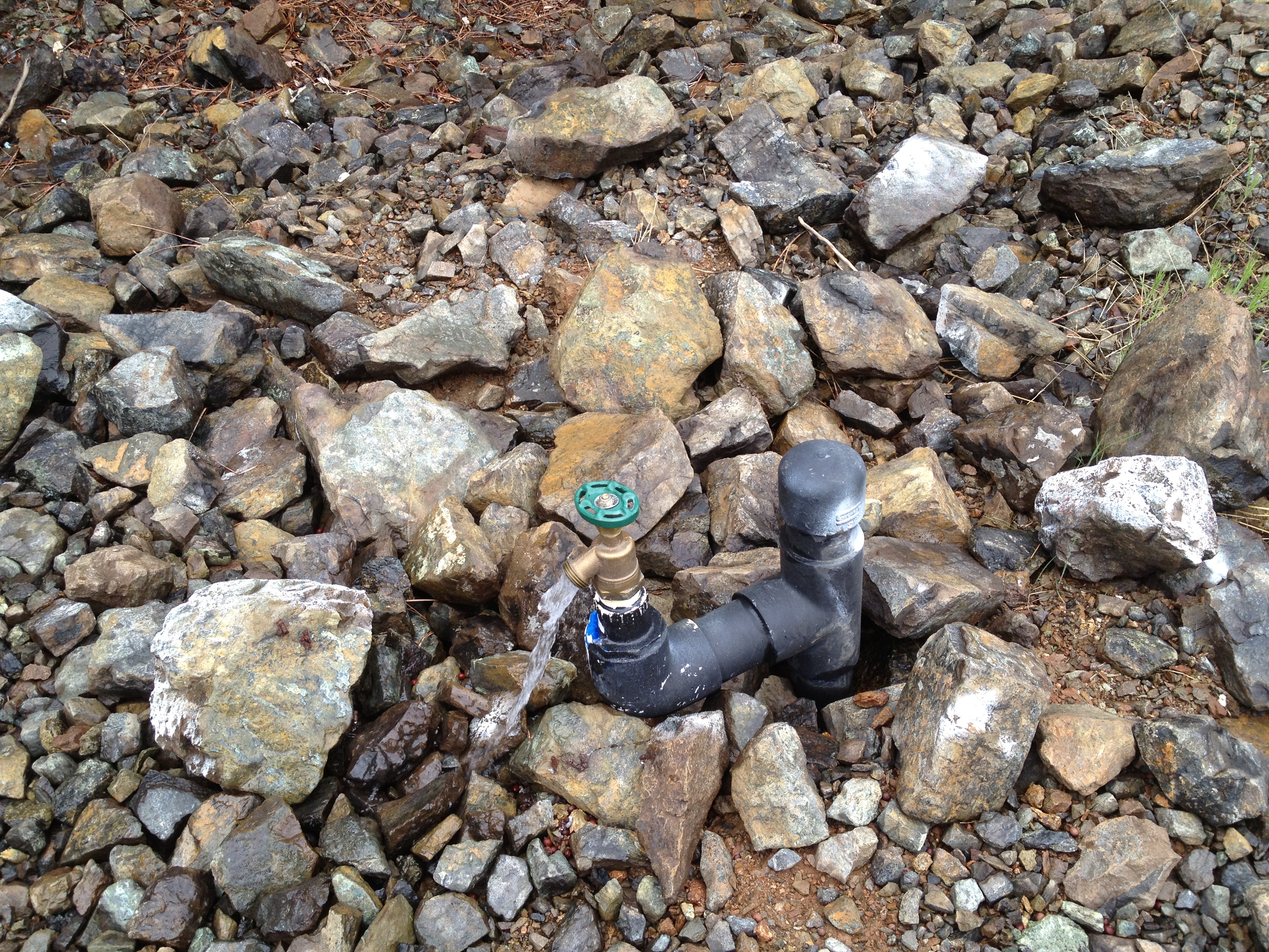
The Live Oak Spring trough was full, but a bit slimy. Usually I can grab water dripping directly from the fill tube. In this case, there was a float valve, which was completely inaccessible under the wood platform. It was securely nailed-down and definitely had some work done on it since the “Springs Report” of 2 months ago: http://coepark.net/pineridgeassociation/planning-your-visit/water-resources/water-conditions-springs

I also climbed a bit uphill towards the source, as well as looked downhill. I wanted CLEAN water to filter, not the algae and “mountain lion saliva” in the trough. Alas, this spring was recently “improved” and fresh clean water was not accessible without being destructive. I filtered from the slimy trough and am still healthy after 24 hours. (Katadyn Hiker filter) This is NOT a human-friendly design. Why not an exposed “fill tube”?

(Update: The Coe volunteer that designed and built this protected fill system tells me that there’s been vandalism(?!?) here twice. The float valve system was seriously damaged. This spring feeds into the more important water system at Pacheco Camp, which was also impacted.)

IMG_9605

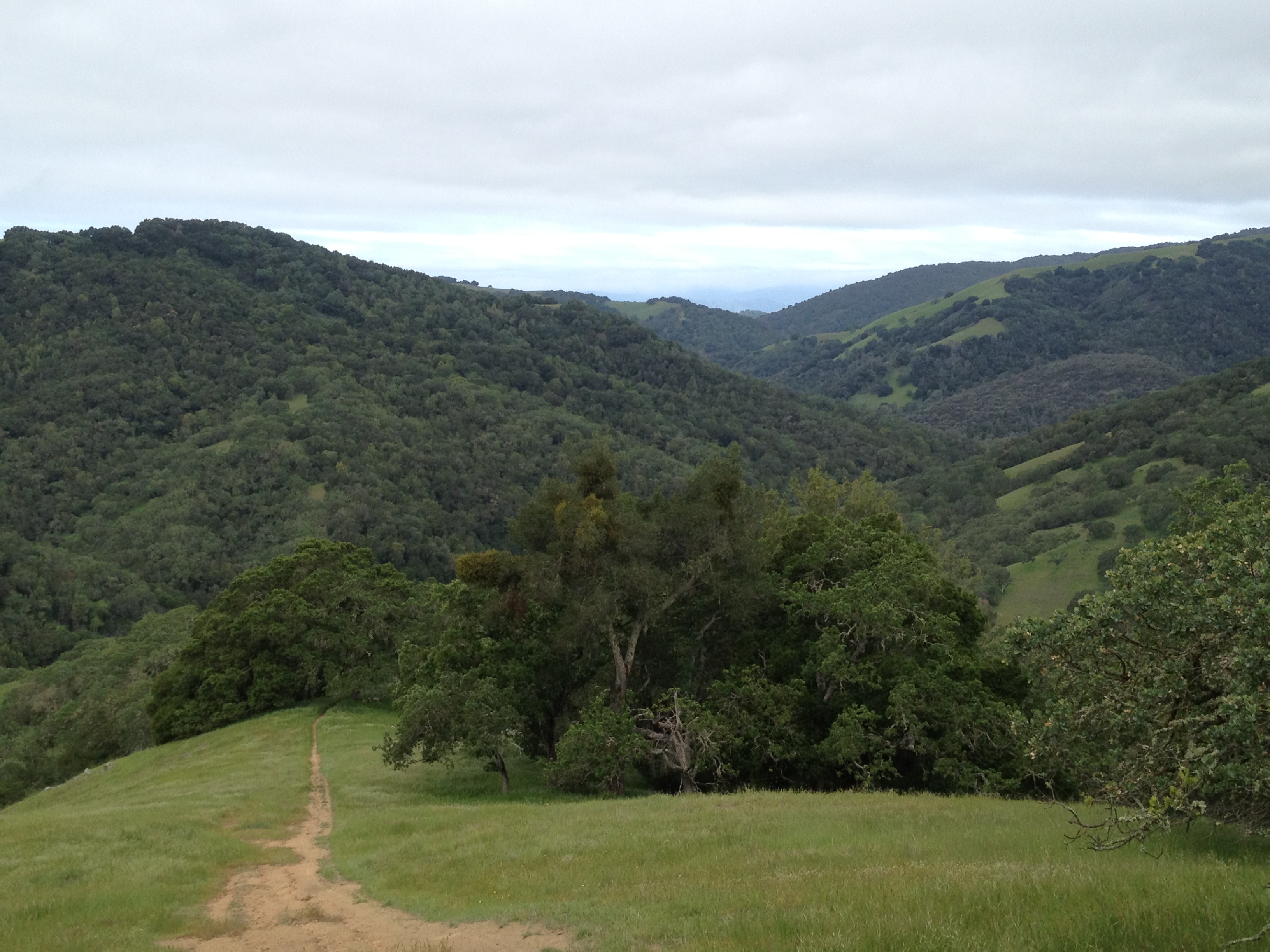
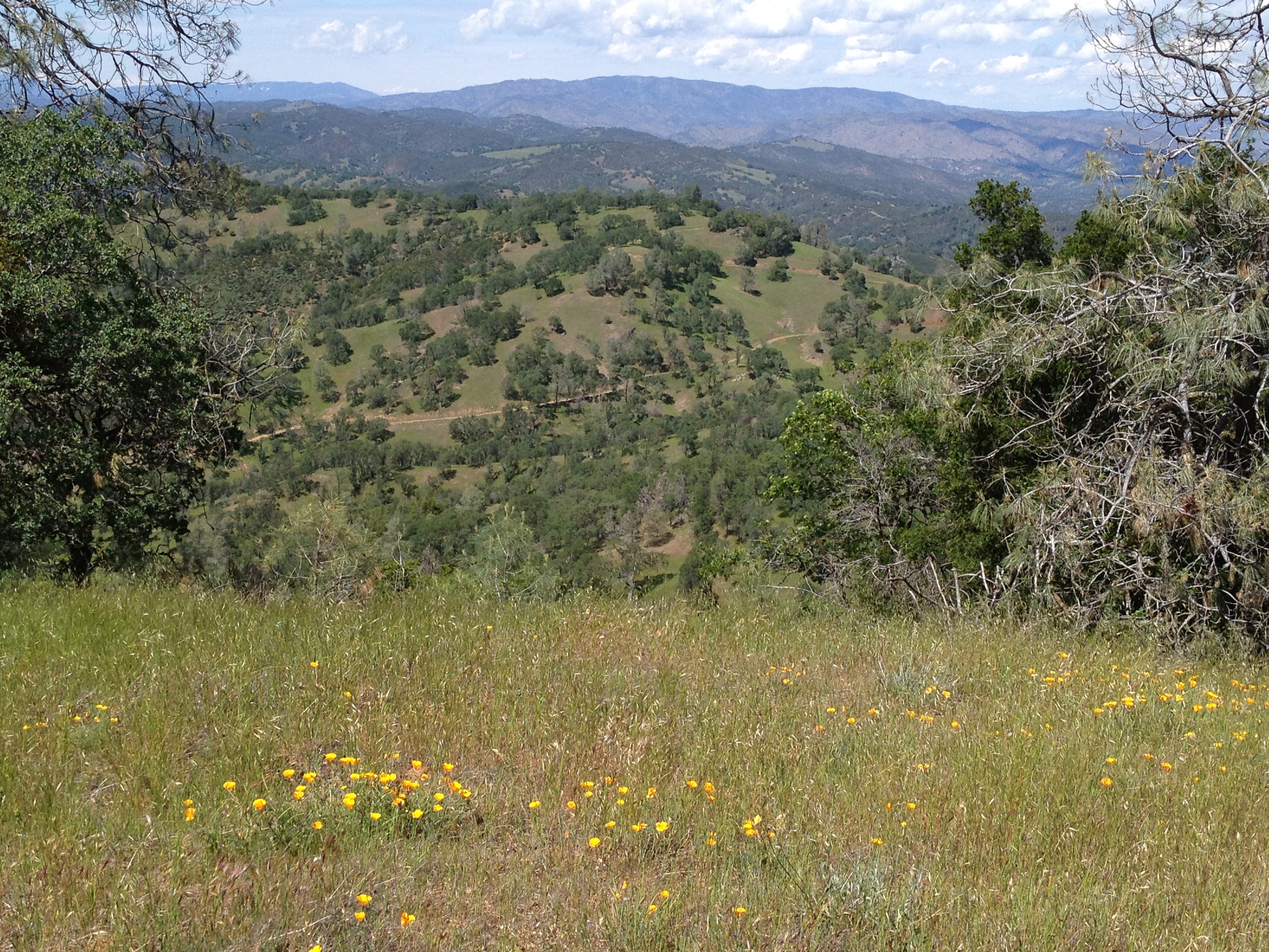
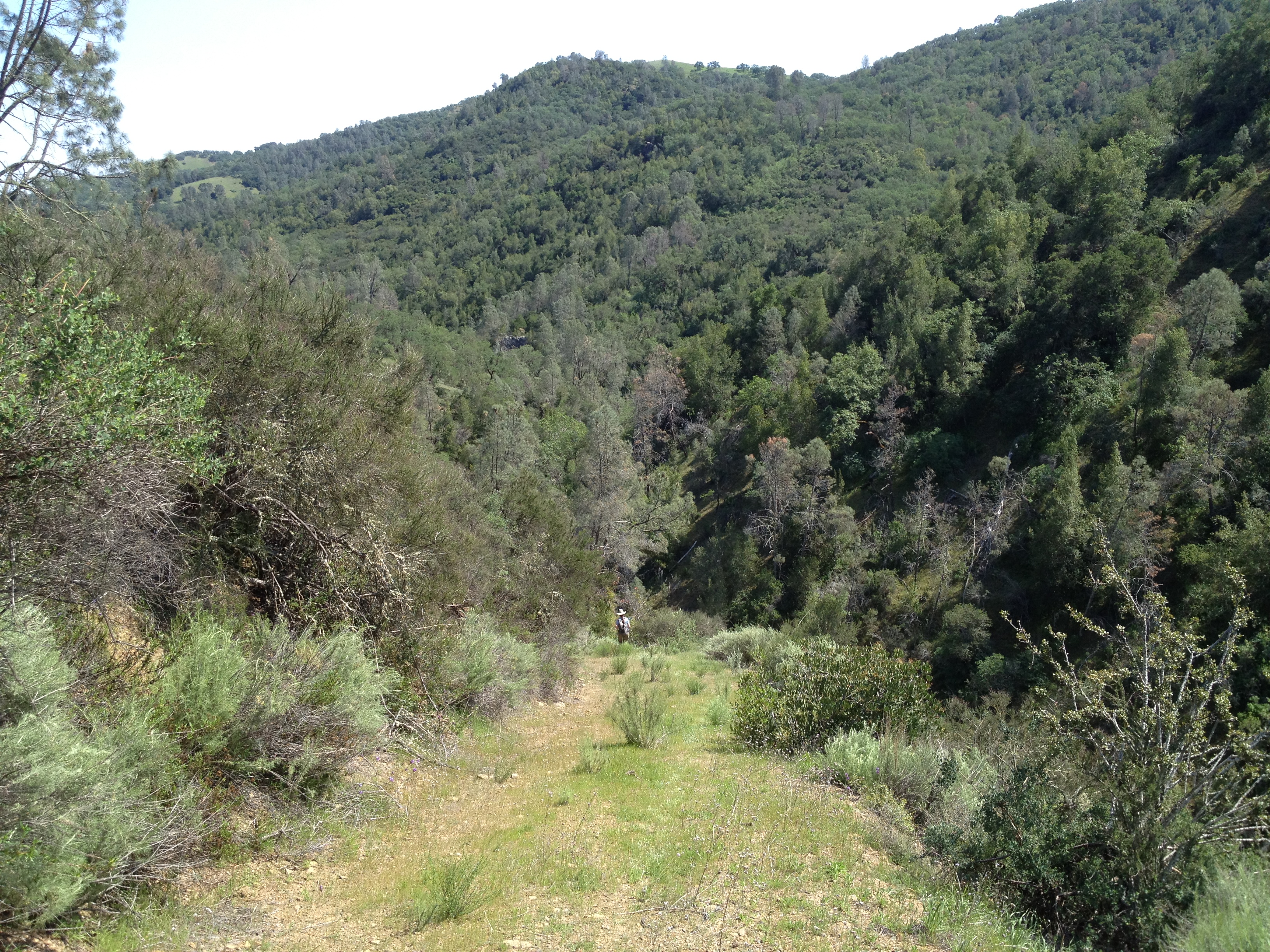
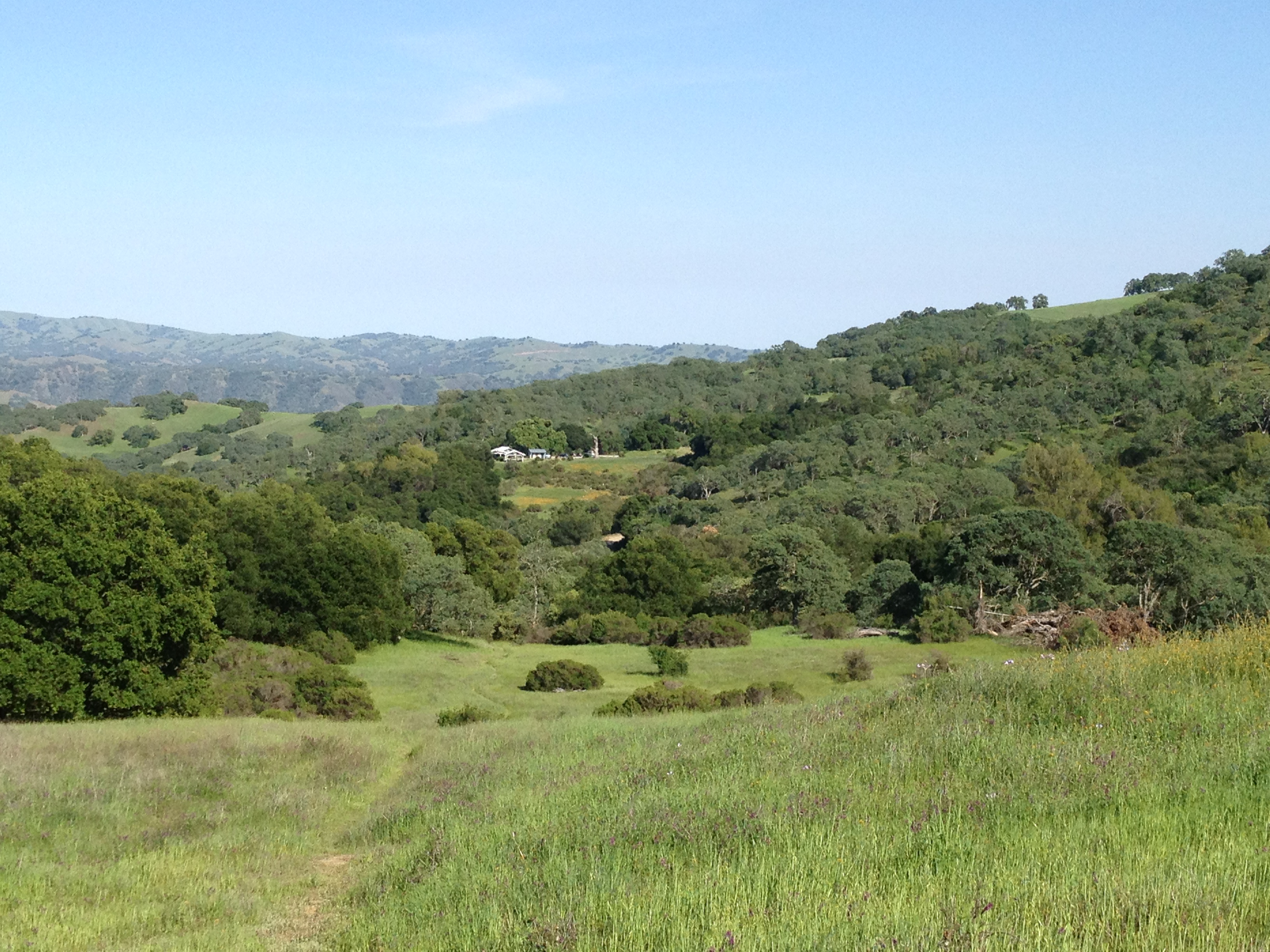
More glorious scenery, as the miles ticked by…notice the trail in the middle of the hillside, across the valley:

IMG_9607

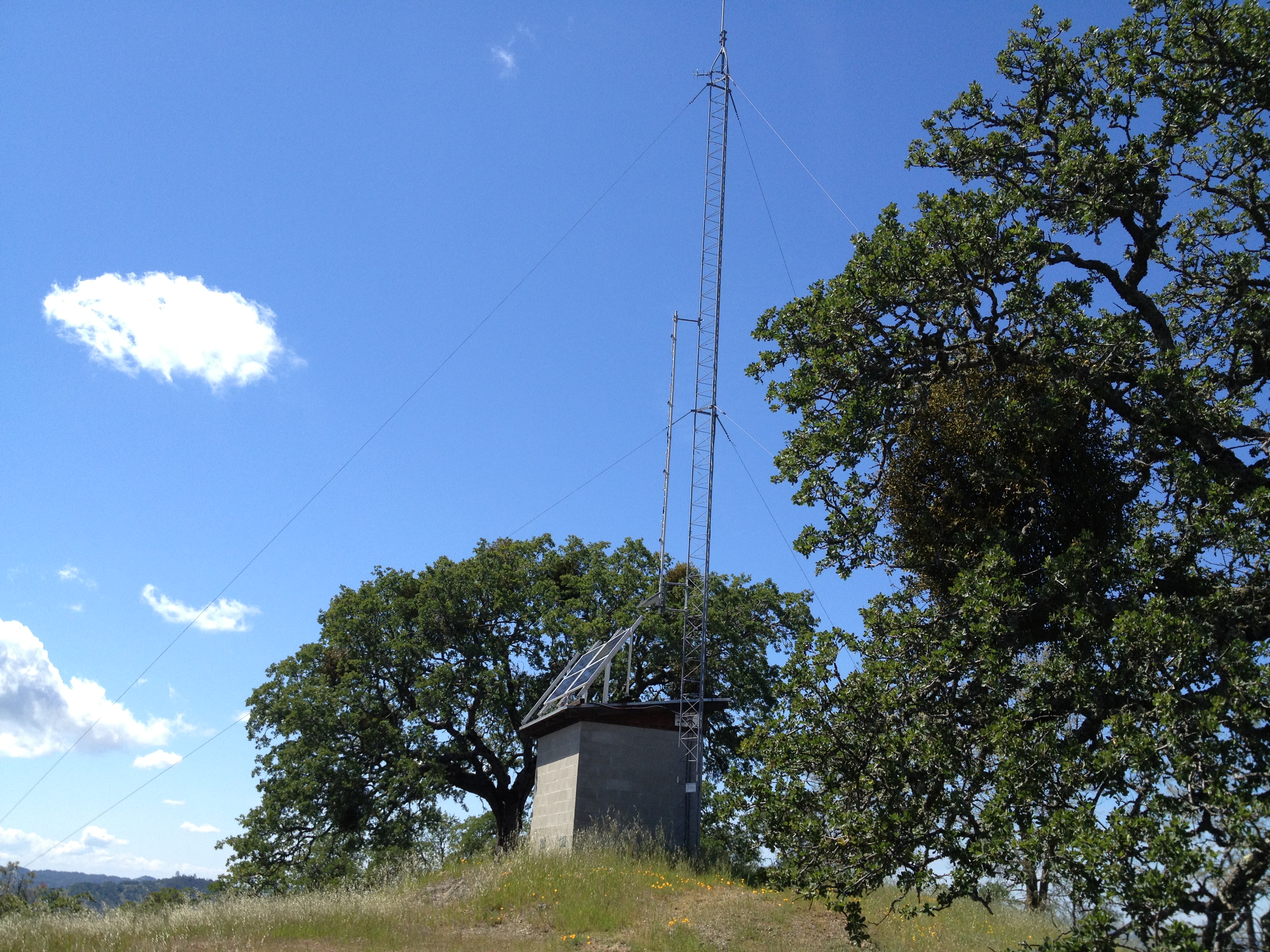
Willson Tower, which is not on the map. It has a fascinating logbook dating back 11 years. It was originated, and still used by Geocachers, but is now maintained by mountain bikers.

IMG_9610

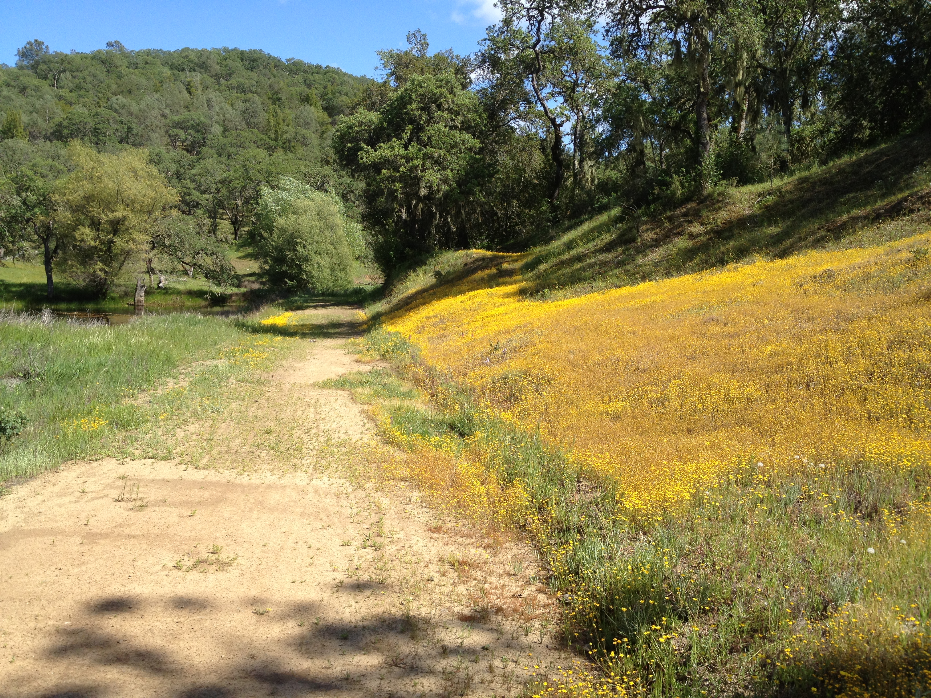
Wasno Pond, from where I left the Wagon Road. I wanted to try the Tule Pond Trail for the first time

IMG_9613

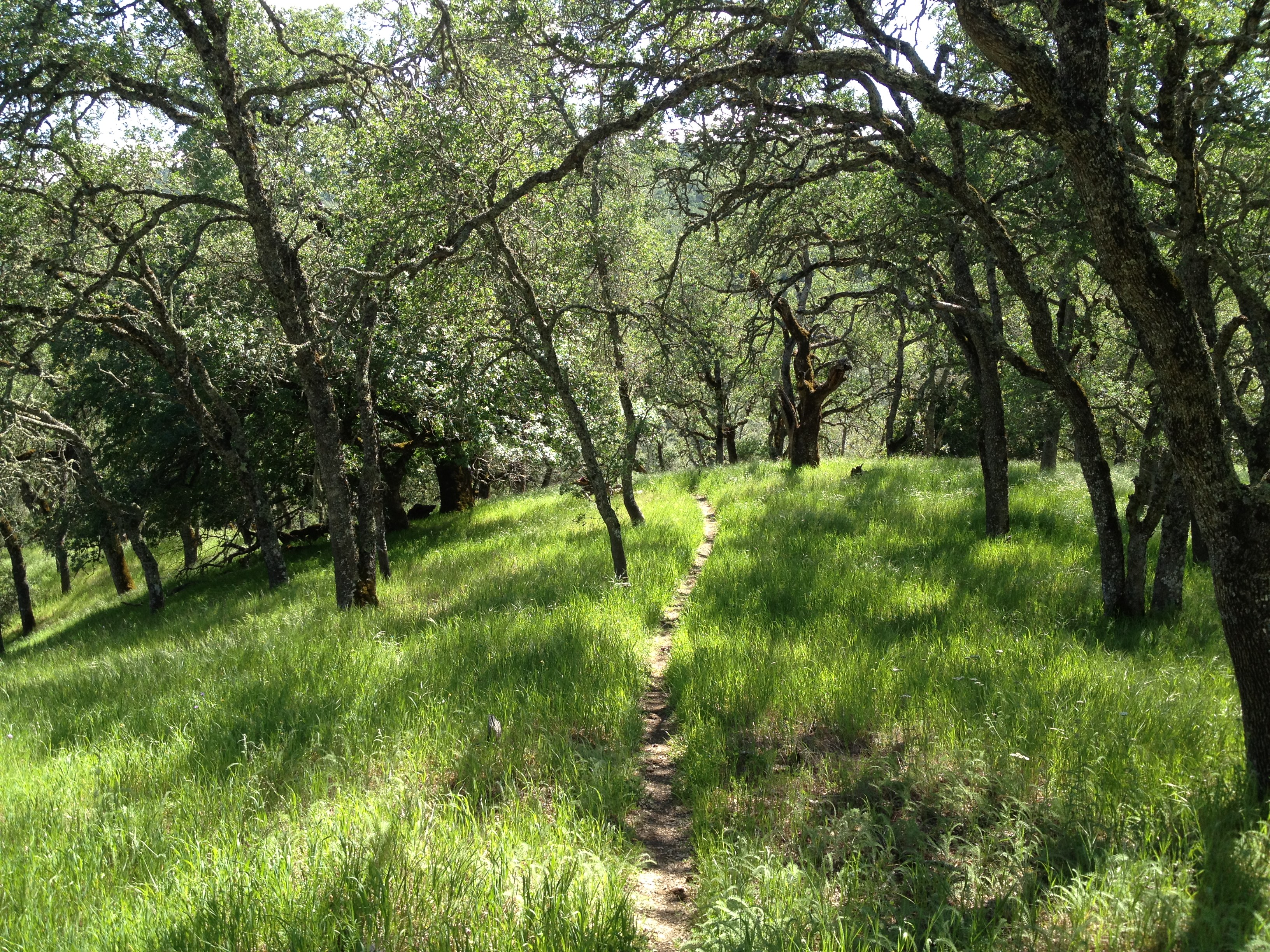
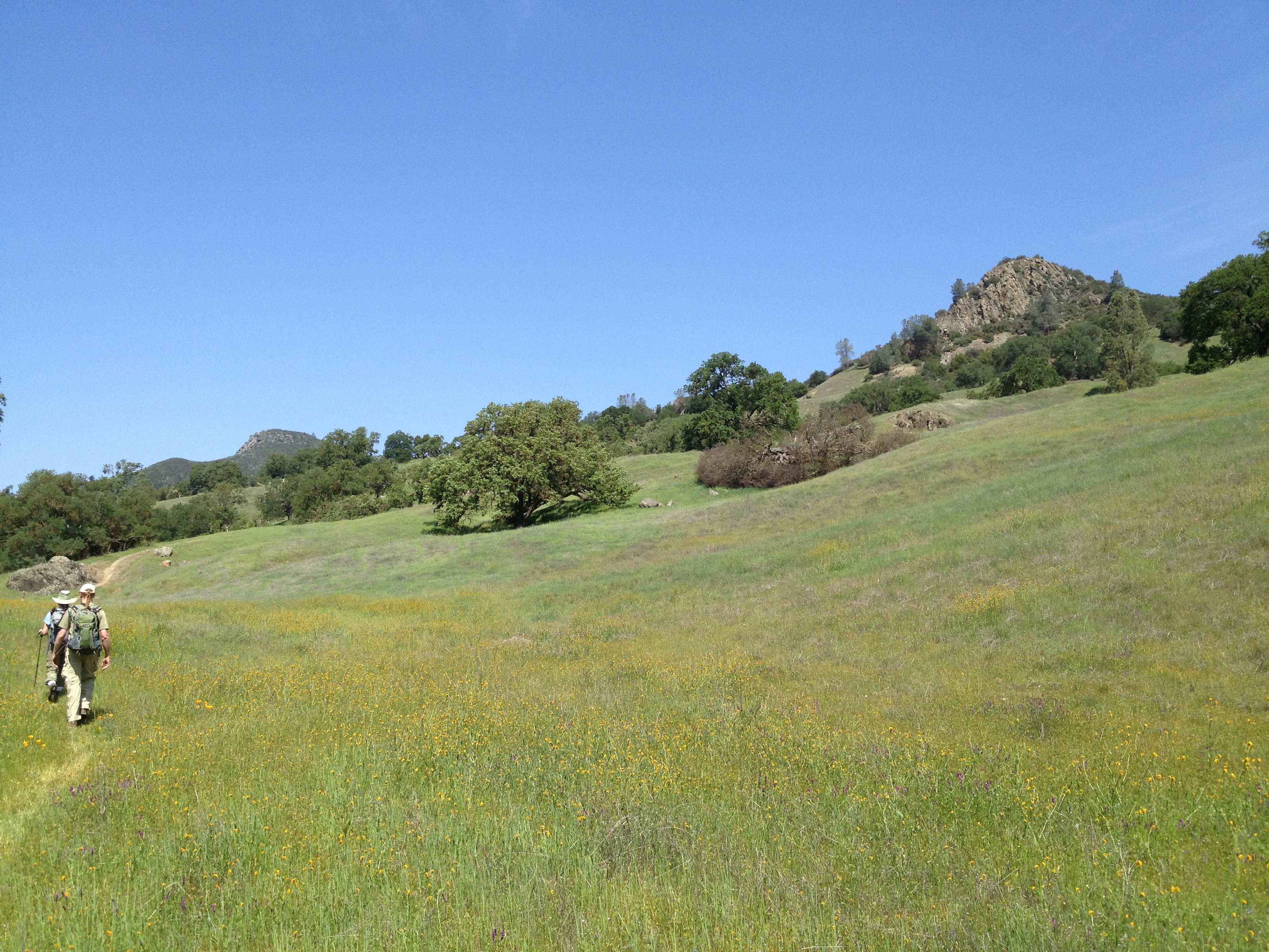
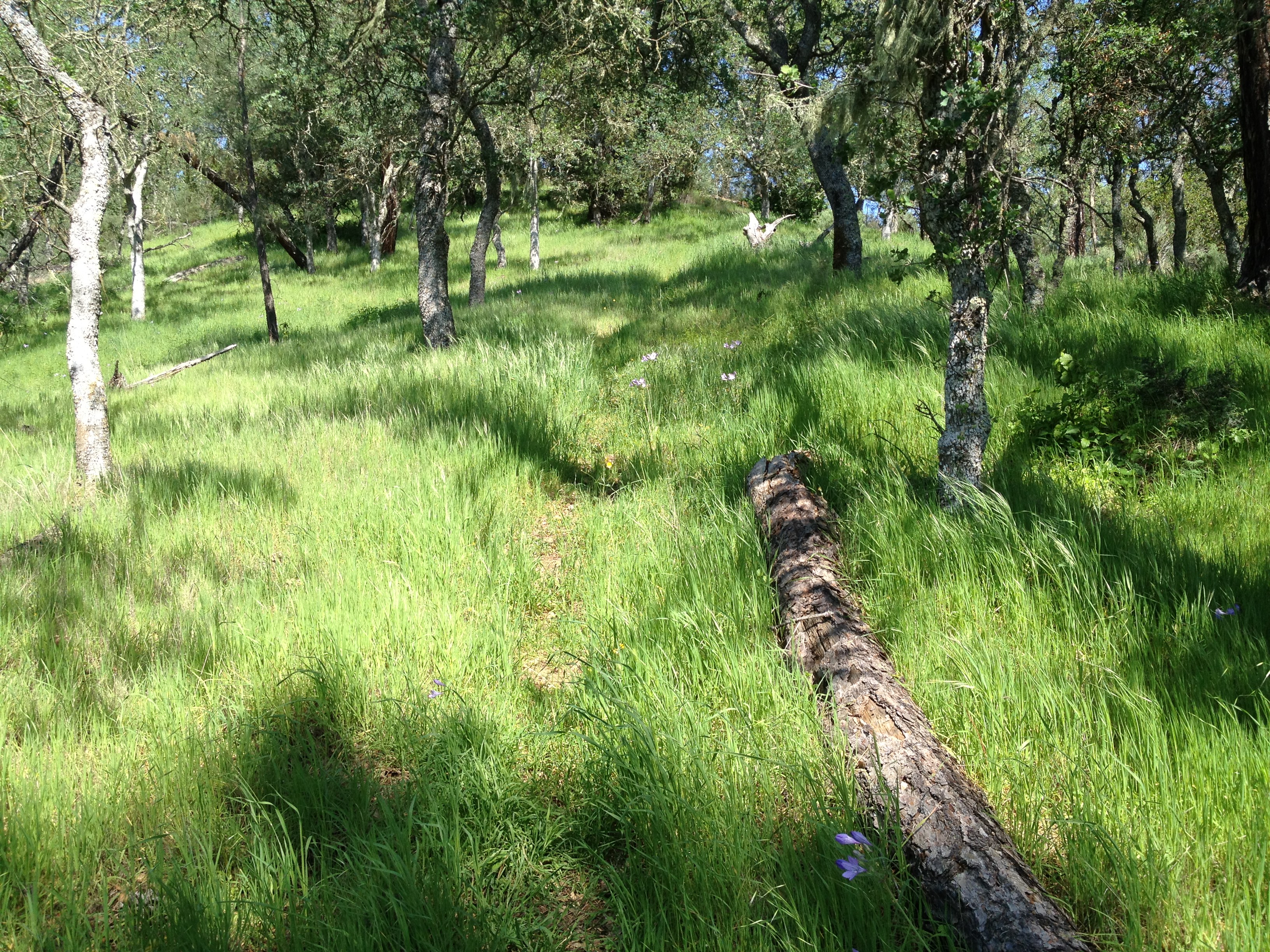
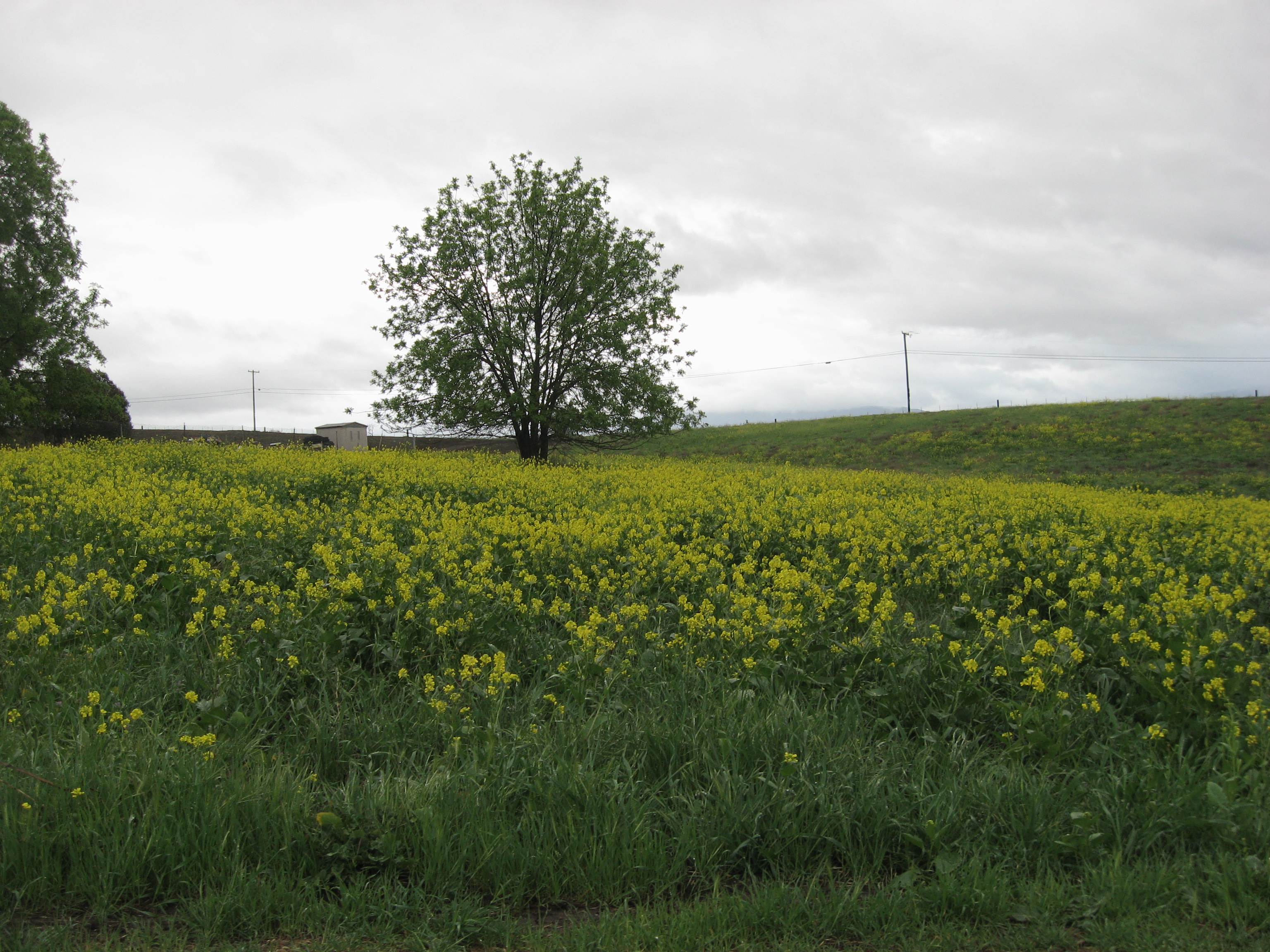
A beautiful trail, with some shade and healthy spring grass!

IMG_9617

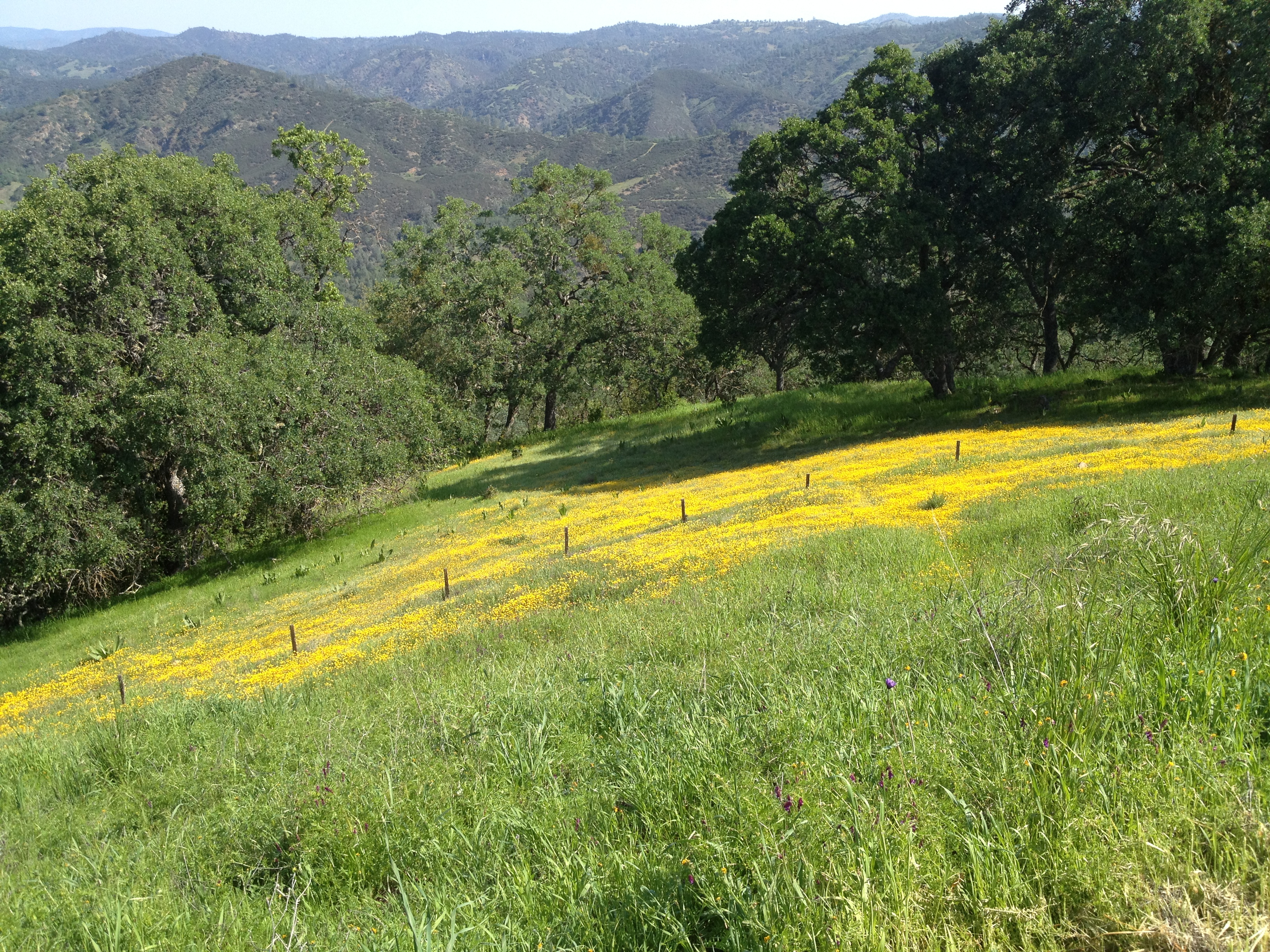
Wow! Just across the road from Tule Pond (visible at left) was a huge group of “Goldfield” flowers.

IMG_9620

Sam Drake was here, in a year with much better rainfall, and took an incredible photo just past the spot where I stopped!

Tule Pond area, Spring 2010 Courtesy of Sam Drake

Tule Pond area, Spring 2010
Courtesy of Sam Drake

The pond, next the flowers. Note the guy fishing, in the red shirt, on the opposite side!

IMG_9621

As I passed by the big serpentine outcropping, where the Serpentine Trail brought me out near Willson Peak, I was almost DONE climbing! About a mile to get to the top of the newly re-routed Jim Donnelly, then a fun 3+ miles of nicely graded curves to the parking lot!

IMG_9626

25 miles and 6000 vertical feet. “Moving time” of ~6 hours and total elapsed time of just over 8 hours.

GPS track here: http://www.everytrail.com/view_trip.php?trip_id=2757249

Posted in Uncategorized | 4 Comments

Henry Coe Dowdy Ranch (Mack’s, Pacheco Crossing, Vasquez, Dormida)

The Dowdy Ranch entrance to the massive Henry Coe State park is now seasonally open on weekends (and fridays, it seems) http://coepark.net/pineridgeassociation/planning-your-visit/visitor-centers-and-park-entrances/dowdy-ranch-visitor-center I was last there in January by bicycling from Bell Station https://alpharoaming.com/2014/01/20/henry-coe-state-park-pacheco-crossing-dowdy-ranch-bell-station/ With the road now open, Michael, Erin, and I decided to “see what we could” see!

We planned a loop from Dowdy, down into Mack’s Corral, up the creek to Pacheco Crossing, then up Scherrer, down Vasquez, and up Dormida. (Sounds like Coe: down, up, down, up…)

We arrived at Dowdy Ranch at 10AM. We saw Ranger Cameron Bowers preparing for next week’s “Backcountry Weekend” http://coepark.net/pineridgeassociation/pra-event-list/details/61-2014-backcountry-weekend We also quickly visited the “almost famous” Purple Panther sign!

IMG_9465

I hope Backcountry Weekend is not rained-out like it was a few years ago. There’s a small chance of rain in the forecast this week, and if the roads are still wet or muddy by friday…Anyway, down we went towards Mack’s Corral, past a lightly flowing spring.

IMG_9471

And bottoming-out at the nice meadow near “Mack’s Corral” and intersecting the “North Fork Trail”, which is the North Fork of the Pacheco Creek.

IMG_9472

We walked along the creek trail, upstream towards Pacheco Crossing. We soon encountered the deepest pool of water along this trail. It appears to be year-round, with cattails, frogs, fish, and a pair of mallards that fled when they saw us.

IMG_9484

On our way to Pacheco Crossing, I kept staring at the ominous (but not really that big) Tie Down Peak, where I had a really big “oh crap!” moment in late 2012: https://alpharoaming.com/2012/09/26/rattlesnake-adrenaline-rush-tie-down-peak-at-henry-coe/

IMG_9486

Upon arriving at Pacheco Crossing, I was happy to see a bit of water flowing through the large tube.

IMG_9490

We also noted the preparation for Backcountry Weekend and “field tested” the portable toilets that have been placed here in preparation for next week.

IMG_9492

The “Hole in the Rock”, a few hundred feet upstream, was likewise full and gently flowing. During my last visit, in january, it was 6 feet lower than “flowing stage” https://alpharoaming.com/2014/01/20/henry-coe-state-park-pacheco-crossing-dowdy-ranch-bell-station/

IMG_9496

IMG_9498

From there, we slogged up the Scherrer Trail. It was my first time here, and steeper than Michael and Erin remembered. (Yes, we do carry the official Coe paper map, as well as downloaded topo maps on our electronic toys). The flowers all over the park were quite good. We wondered if the drought, followed by late rains, provided for better flowers than other years?

IMG_9503

IMG_9467

We then headed down the Vasquez Trail. It was quite steep, but nicely graded and not rutted. (Yes, my two companions are waaayy down there!)

IMG_9513

We stopped briefly at the bottom, where the small creeks merge. There was a small amount of water flowing. We then looked carefully for our “exit trail”, the Dormida Trail, which can be tricky to locate and follow from either direction. We spotted the obscure trail, which concided with our downloaded “Open Street Maps” track, and up we went! These large downed trees made us think this area hasn’t burned in many decades.

In the distance is the Vasquez Trail, which we had just descended:

IMG_9516

This is the trail…not as hard to follow as the last time I was here 5 years ago. That time I came from above and actually turned-back when I lost the trail where it dipped off the ridge towards the north.

IMG_9519

Almost back! Here’s Dowdy Ranch, in the distance, from the Hersman Pond area.

IMG_9525

We stopped in the Visitor’s Center for a few minutes on our return and chatted with Ranger John Verhoeven for a bit, then headed to the car.

That’s it! Give it a try, but be prepared with water, maps, and and steep hills. Henry Coe is big and can be unforgiving!

GPX Track: http://www.everytrail.com/view_trip.php?trip_id=2744999

Posted in Uncategorized | 2 Comments

Mt Hamilton, San Antonio Valley, Isabel Creek & Patterson on a rainy (almost snowy) day

Back a few weeks ago on March 26th I decided to do a one day (~200 mile) circular road trip. I was curious about the wildflowers and water flows in the San Antonio Valley, east of San Jose’s Mount Hamilton. I was also curious to see what sort of fencing and signs were preventing, or discouraging, entry into Henry Coe State Park from where Highway 130 dips south.

It was a gloomy day, but I’d have my cozy car to keep me warm as I rose above San Jose on Mt Hamilton Road (at center, in the distance)

IMG_6099

..and saw lotsa spring greenery. I think these are mustard plants(?)

IMG_6090

Passed by Grant County Park, where I hiked in january, just before the historic Pala Seca cabin burned to the ground: https://alpharoaming.com/2014/01/09/pala-seca-cabin-joseph-grant-county-park/

IMG_6101

…and a flock of turkeys just outside the front entrance

IMG_6107

This is a picture of the upper end of the valley where the main Joseph Grant ranch was:

IMG_6111

After many twisting miles of interesting (and limited) views, I reached the top of Mt Hamilton and the historic Lick Observatory. http://www.ucolick.org/ (Yes, the snowplows were manned and on standby! It was a blustery 37F degrees in late morning. The main observatory dome is on the right end of the building, in the fog)

IMG_6121

Indeed, as hinted in the “please remove cleats” sign, this is a cycling destination. Despite the intermittent rain, and near-freezing temperatures, I passed one cyclist on the way up. He actually summited, then turned-around without stopping!

IMG_6120

There are at least a dozen various buildings up here. Some are private residences, and some are part of the observatory facility.

IMG_9281

IMG_6122

I continued east, towards I-5 and Patterson, CA, through the remote San Antonio Valley. Eventually descending to “Isabel Creek”. It was flowing just a little bit in this very dry year for California. I was hoping to see some elk in this area, or on my return over Pacheco Pass, but no luck…

IMG_6126

IMG_6128

Below is the gate I wanted to check out, where Highway 130 dips to within 1.5 miles of Henry Coe State Park. Very flat..which is unusual for Henry Coe State Park! The gate had several locks on it, indicating access to several private properties, including the “Shanti Ashrama” http://sfvedanta.org/the-society/history/shanti-ashrama-historical-overview/

IMG_6132

Onwards to the junction of Highway 130 and Mines Road. At this point, the choice is to turn left (north) towards the city of Livermore, or turn right (south) towards Patterson and I-5

IMG_6134

The appropriately named “Junction Bar and Grill” is closed on wednesdays. The other days of the week, it’s a gathering place for roadtrippers of all sorts, including motorcyclists. http://www.yelp.com/biz/the-junction-livermore

IMG_6144

I turned right, towards Patterson, spotting some cows barely hanging onto a steep hillside

IMG_6144

…and some a bit closer to me!

IMG_6146

A bit further I passed by “Adobe Springs”, which was interesting enough that it warranted it’s own blog post! https://alpharoaming.com/2014/04/05/adobe-springs/

As I dropped much closer to sea level, away from the barren hills near Adobe Springs, I found a marginal orchard, on the semi-arid hills.

IMG_6149

Further down, near Patterson, I found the more familiar Central Valley nut trees, lined up neatly as far as you can see!

IMG_6153

Orestimba Creek? Hmmm…that sounds familiar! Indeed, it does drain from the northeast corner of Henry Coe State Park, all the way past I-5 towards the town of Newman!

IMG_6155

So, yes, “curious me” drove upstream as far as I could, west towards Henry Coe’s Orestimba Wilderness.

IMG_6157

This particular gate, about 2 miles west of I-5, appears accessible to hikers and cyclists. Following along past that using Google Earth, towards Henry Coe State Park, it appears to get more sketchy. The road gets narrower, and I see additional gates further to the west. Probably not a good idea…

IMG_6159

From here I headed south on I-5, then west over Pacheco Pass to Gilroy and back home.

Anyway, that’s my “rainy day road trip”! I completely circled Henry Coe State Park and visited Mount Hamilton on a zero-visibility day. Fun! (Don’t forget to bring some empty containers to Adobe Springs if you’re passing through!)

Posted in Uncategorized | 6 Comments

Russian Ridge, Borel Hill & Mindego Hill on a beautiful spring day!

Last weekend I went on a hike with some local friends. I met Paulina (@Paulina_dao http://www.littlegrunts.com/), Russ (@WineHiker), and Paulina’s boyfriend at a coffee shop in Cupertino and we carpooled up to Russian River Open Space Preserve. http://www.openspace.org/preserves/pr_russian_ridge.asp

Paulina was MUCH faster in doing her blog post this week AND I didn’t take many pictures since this was all familiar terrain to me…so, maybe I’ll just link to her blog and then add a little bit more of my own narrative. Take a look here, then c’mon back and read more below! http://www.littlegrunts.com/russian-ridge-osp-ancient-oaks-charquin-borel-hill/

Within a few hundred feet of Alpine Pond, there’s an interesting little spot that is easily overlooked. It’s a cluster of Native American “grinding rocks”. These little (~6 inch / 15 cm) depressions, along with a loose rock, where how acorns were ground-up for food, like a mortar and pestle.

Photo Credit: Paulina Dao www.LittleGrunts.com

Photo Credit: Paulina Dao http://www.LittleGrunts.com

We finished our hike on the Mindego Hill Trail, which ends at a “closed” area to the northwest. The area of Mindego Hill was purchased for park land from the family that had been ranching the area for over 50 years. Here’s a story about Chris and Veronica True. He sounds like quite a character! http://www.paloaltoonline.com/news/2007/10/11/chris-true-recalls-a-life-on-mindego-hill

Mindego Hill is such a locally prominent hill that many people hop the fence anyway (I have not done it and I’m not suggesting it…). While it was private property, it never really said “No Trespassing”, but rather had a sign that was likely taken even more seriously! (The sign is gone now)

Circa 2008 at the base of Mindego Hill

Circa 2008 at the base of Mindego Hill

That’s it! Here’s the detailed trail map: http://www.openspace.org/preserves/maps/pr_coal_creek_rr.pdf

Access from Silicon Valley is to head west up Page Mill Road from Highway 280. Cross Skyline Boulevard, then look for the parking lot immediately on your right.

Posted in Uncategorized | Leave a comment

Roaming Toro County Park: Simas, Eagle and Ollason Peaks (Monterey / Salinas)

IMG_9242

A wee bit outside my normal dayhike radius, near Salinas, CA, lies “Toro County Park” http://www.co.monterey.ca.us/parks/toro.html (…not to be confused with the prominent “El Toro”, visible from Highway 101 in Morgan Hill http://www.morgan-hill.ca.gov/index.aspx?NID=1054 )

Back a few weeks ago, after chatting with a small group of local friends about weekend plans, Rebecca and I headed out to Toro County Park to summit the high points. Her blog post is here: http://calipidder.com/wp/2014/03/tour-toro-county-park-peaks-eagle-simas-ollason/#more-7506

It started out a bit gloomy and cool, but having looked at the forecast, we were expecting better things later.

IMG_9229

“Sticky Monkey Trail”?!? Must be a good story behind that! (Addendum: http://www.Outdorky.com @TheGreatOutdork just reminded me that Sticky Monkey is a flower!)

IMG_9227

Eagle Peak was the first summit, and still not much of a view!

IMG_9231

After Eagle Peak, we dipped down into a small valley and saw a “mini Yosemite” and “Cows in the Mist”!

IMG_9235

IMG_9238

IMG_9236

Finally the skies were clearing-up as we got closer to our destination at Simas Peak. We stopped at the fork in the road…

IMG_9244

If you’re familiar with hiking in the coastal ranges of northern California, the rolling ridgetops and vegetation should look familiar.

IMG_9249

Finally! Near the top of Simas Peak! Note the flat farmland in the middle of the picture, under the clouds. These peaks rise quite abruptly from the plains below.

IMG_9258

…and then a leisurely walk back, including more cows. This youngster was neither afraid, nor accompanied by Mom.

IMG_9269

This was an interesting tree we spotted on the way back: Split almost symmetrically down the middle!

IMG_9271

BTW: There isn’t any decent topo map of this park. Load-up your GPS and study your route before you go. http://www.co.monterey.ca.us/parks/images/toro/Toro-hiking-map.jpg It seems few people venture beyond the drive-up picnic tables…

Posted in Uncategorized | 1 Comment

Stan’s Donuts – a Santa Clara treasure, hiding in plain sight since 1959!

Strict Paleos, folks who don’t work off their excess calorie intake, and those not interested in history, please keep moving…there’s nothing to see here!

Credit: Rebecca Sowards-Emmerd (www.Calipidder.com)

Credit: Rebecca Sowards-Emmerd (www.Calipidder.com)

There is very little in Silicon Valley that’s more than a few decades old. Santa Clara County was mostly farmland until the 1960’s and 1970’s. Even the buildings from that era were low-density and have mostly been pushed aside in favor of even higher density construction. One beautiful exception to this “everything is new” situation are the Victorian and other older homes in the older core areas of San Jose, Santa Clara. Mountain View, and Palo Alto.

(All of which reminds me to stay away from the Apple construction site, where Wolfe and Homestead Roads have become a mess! https://alpharoaming.com/2013/12/06/new-apple-spaceship-campus/)

Then, there’s “Stan’s Donuts“! They’ve been in business since 1959, when Stan opened his shop in Santa Clara. He eventually retired and sold his shop to the current hard working family.

IMG_9201

Talk about nostalgia, the menu, painted right on the wall, has not been touched in decades (except the prices, which are quite reasonable)

14 - 1

Their $1.40 cinnamon rolls are huge! I recently measured one at over 6 inches diameter and 1.5 inches thick (hand-rolled, and still warm from the fryer!)

cinnamon-cropped

There are no machines and conveyor belts here. There are big tubs of dough, dumped on the floury table, which are then hand-rolled and cut before being manually lowered into the fryer…all in the front window for everyone to see!

IMG_9013

14 - 2

Yes, you can join the cupcake or “cake pop” fads, if you wish. You can also have a bit of kitschy fun locally at Psycho Donuts http://www.psycho-donuts.com/ (…or Portland’s similar VooDoo Donuts http://voodoodoughnut.com )

However…if you want a classic, hand-made, family-owned, dose of comfort food and three major foods groups (flour, sugar, frying oil), then Stan’s is my go-to place!

Stan’s Donuts, 2628 Homestead Rd, Santa Clara, CA 95051 (near San Tomas Expressway. At the left end of the Safeway plaza, across from the Santa Clara Library)

BTW: They’ve got huge and awesome Yelp ratings, and more photos to browse! http://www.yelp.com/biz/stans-donut-shop-santa-clara

Posted in Uncategorized | 7 Comments

Adobe Springs – Magnesium-rich water near Patterson / Mt Hamilton

IMG_9290

I was recently planning an interesting loop trip, which I had never completed in it’s entirety before. The loop is to go from San Jose, east over the prominent Mt Hamilton, then turn right towards Patterson CA (near Interstate 5), and back via Pacheco Pass. I discovered in my planning that there’s a source of Magnesium-rich water that is bottled and sold, yet is available FREE at the source. It’s called “Adobe Springs”.

IMG_9288

I stopped-in here on a weekday in late March and chatted with a few guys from Turlock who were loading-up some large containers in the back of their Toyota truck. They were quite convinced of the health benefits of magnesium, as is the owner of this spring!

IMG_9292

The owner, Paul Mason, seems to be quite convinced, through his own research, that the low amount of Magnesium in our water is a huge health issue. This prompted him to share his knowledge on his site http://www.mgwater.com/ as well as provide his water free to the public. (Benefits, water test reports, etc: http://www.mgwater.com/adobe.shtml)

Adobe Springs water is also bottled and sold via the Modesto 7-Up bottling plant under the “Noah’s” label, if you want convenient packaging and are not interested in the beautiful drive out here! http://www.noahs7up.com/

(The “Life Extension Foundation” did an article in 2005, including some additional details on Adobe Springs. A reprint of this article is posted on the main signboard at the spring http://www.lef.org/magazine/mag2005/sep2005_awsi_01.htm )

Up the canyon is some sort of fenced-off infrastructure. I also believe the owner lives at the property.

IMG_9291

Yes, this area is steep and barren, and has been scientifically linked to the planet Mars! http://www.geology.wisc.edu/~wiscsims/pdfs/Blank_PSS2009.pdf (…and also some good information and photos of this area)

Quote from Paul Mason’s website http://www.mgwater.com/adobe.shtml :

ABOUT ADOBE SPRINGS

The Adobe Springs flow at a rate of 75,000,000 gallons per year, and contain 110 mg/L magnesium. Nearly all other American bottled spring waters contain less than 6 mg/L magnesium. This magnesium may prevent up to 40% of all heart disease. Two books mention Adobe Springs as one of the world’s healthiest waters, thanks to the high magnesium content:

•In Search of the World’s Best Water, by Bill Sardi
•The Miracle of Magnesium, by Dr. Carolyn Dean

Adobe Springs is the source for multiple brands of bottled water. One is bottled at the Seven-Up plant in Modesto, CA, under their label, Noah’s Spring Water, and distributed in California and several other states. Another brand, hiOsilver Oxygen Water, is bottled in glass in Modesto. The water is oxygenated for extra energy and to promote fresh breath.

The Adobe Springs are located in western Stanislaus County in an area so remote that there are no schools or delivery of U. S. mail. The area is so mountainous that no bottling plant can be built at the springs, so the water is trucked out in “doubles” carrying 6,600 gallons per load. The owner is Paul Mason, who lives at the springs. He spends most of his time doing research on the health benefits of magnesium and lobbying for greater recognition by the FDA of the health benefits of magnesium in water.

The elevation at the Adobe Springs is 1,375 feet above sea level, which keeps the springs pure. At that elevation in such rocky terrain, there is no agriculture or industry using insecticides, herbicides, chemicals, no smog, or anything else. The area is a rugged wilderness, too steep for any development.”

Thank you to Paul Mason for his research and generosity in sharing his water with the public!

Note: I was looking for Adobe Springs, driving east from Mt Hamilton, using the GPS address of 19000 Del Puerto Canyon, Patterson, CA. It took me to this place (below), which looks like it used to be a “watering hole” of some sort. The sign is painted-over, but there is one small useable faucet at ground level. I don’t know anything about this water or location. The “Adobe Springs” you’re looking for is just a bit downhill (east) from here.

IMG_9286

IMG_9285

Note: I am not a doctor or scientist, and I don’t want to hear from your lawyer. 😉 I am not giving any specific medical or nutrition advice, other than to say “this is an interesting place to visit.” Your comments are welcome at the end of this blog post!

Posted in Uncategorized | 3 Comments

Kayaking Elkhorn Slough, Moss Landing, CA (Monterey)

If you’ve ever driven the coast between the funky surf town of Santa Cruz and the touristy location of the Monterey Bay Aquarium (http://www.montereybayaquarium.org/) and John Steinbeck’s “Cannery Row”, you’ve surely seen the Moss Landing Power Plant. …but, did you ever stop here to explore California’s abundant wildlife?

IMG_5999

(The Moss Landing power plant has been in operation, using natural gas, since 1950. It appears to be quite environmentally safe, having been recently upgraded for cleaner emissions. Though I wonder where the 1.2 BILLION gallons of cooling water is discharged each day? In some places, like with the Manatees in Florida, there are interesting environmental effects of the warmer water near the discharge pipes. http://en.wikipedia.org/wiki/Moss_Landing_Power_Plant )

Anyway, back to the day’s adventure! I did a “walk in” rental from Kayak Connection http://www.kayakconnection.com/ and they were quite helpful and friendly. In addition, Monterey Bay Kayaks http://www.montereybaykayaks.com/monterey_and_elkhorn_slough/ is right next door. It’s probably wise to make a reservation during weekends and the summer holiday season. I had no problems on a gloomy weekday in March!

After a quick safety video and assurances to the staff that I’m an experienced kayaker, off I went! I paddled around the end of the dock, past a protected sandy beach with some seals and birds watching me.

IMG_6083

IMG_6084

I paddled under the bridge, which is Highway 1, and headed east into the “open” water of the slough.

IMG_6025

Pretty soon I became an item of interest to the seals…which, along with the otters, can actually try to board the back of a kayak!

IMG_6021

There were quite a few sea birds, as well as many of the incredibly cute sea otters:

IMG_6022

Smile for the camera. Nice teeth! (They love wrapping themselves in kelp and floating on their backs)

IMG_6061

This is actually a pair of otters. The head you see belongs to the body on the left. It was hugging a smaller otter on the right (a large baby, perhaps?)

IMG_6051

During my 3 hour foray of about 3 miles each way, I saw one group on the shore that appeared to be scientists. In addition to some fancy cameras and tripods, they were carrying a large antenna. I suspected they were tracking a seal or otter that had a transmitter on it.

IMG_6013

Additionally, there were a handful of other kayakers, plus one larger tourist boat, which was moving carefully and slowly in this protected area

IMG_6031

Did I mention there’s a very active dairy farm on the southern shore? It smelled a bit, but I’m fairly certain they’re a “clean” operation and not allowed to have waste runoff into the open water. I suspect it pre-dates when Elkhorn Slough became valued and protected for it’s wildlife.

IMG_6027

After about 3 miles, where the wide part of the slough goes from “eastbound” to “northbound”, I hugged the right shore and turned around where the smaller “off limits” side channel began.

IMG_6048

On my return trip, I hugged the right (northern) shore. Right near the Highway 1 undercrossing is a dock that is well known for the many sea lions that hang out in a very noisy and smelly group. The smell of the dairy farm was actually better!

IMG_6076

That’s it! Make a reservation for you and your camera, or bring your own kayak to the nearby public launch site. When you’re done, consider checking out Phil’s restaurant a few blocks away http://www.philsfishmarket.com/ They’ve won awards (Bobby Flay’s “Throwdown” and from BBC Travel), but I’ve never been there…yet!

Posted in Uncategorized | 2 Comments

Private Property, Trespassing, “Closed” Areas – an open discussion

During my various adventures out in the “wildlands” and suburbs of California it’s not uncommon to see barbed wire fences and various sorts of “No Trespassing” and “Private Property” signs. I’m sure most people that encounter these have some level of curiousity or disappointment. Would you, could you, or have you gone past those signs or fences anyway?

I’ll admit that I’ve been on the other side of these signs before, on occasion. A few times were by accident, and once or twice on purpose in a remote location…where the odds of seeing an irate landowner were quite low. These were minor incursions in order to make my hiking target much easier to access…was it legal? was it “right”?

I’ve been eyeing Mt Stakes recently, which is a California “County Highpoint”. I found that it’s been successfully summitted (and documented), though it’s on private land. http://www.summitpost.org/mount-stakes/153878 http://www.snwburd.com/bob/trip_reports/stakes_1.html

Another example would be Mt Bielawski (aka: Mt McPherson) http://www.summitpost.org/mount-mcpherson/207752

I’ve never intruded to the extent of some of these “County High Pointers” on private lands. The “nightmare scenario” would be that I’d see the “business end” of a rancher’s shotgun, but I think that’s more the stuff of folklore, third world countries, and (maybe, occasionally) claim jumpers in California’s Gold Country.

But…what is “legal”? Well, I did a bit of research and came to the conclusion that much rural land is not legally protected from hikers passing through, and being asked to leave is the “expected” outcome. It seems to me (I’m NOT a lawyer; NOT telling you this is acceptable; NOT going to bail you out if I’m wrong) that if it’s not agricultural or grazing land, and you’re only walking through (not staying and only leaving footprints), I believe only Sec 602(l)(1) applies:

California Penal Code section 602 http://www.dmv.ca.gov/pubs/vctop/appndxa/penalco/penco602.htm

“Entering any lands under cultivation or enclosed by fence, belonging to, or occupied by, another, or entering upon uncultivated or unenclosed lands where signs forbidding trespass are displayed at intervals not less than three to the mile along all exterior boundaries and at all roads and trails entering the lands without the written permission of the owner of the land, the owner’s agent, or of the person in lawful possession, and

Refusing or failing to leave the lands immediately upon being requested by the owner of the land, the owner’s agent or by the person in lawful possession to leave the lands, or…”

Summary: If you’re only leaving footprints, there must be a fence *or* signs every 1/3 mile *and* can then only be cited if you refuse to leave upon request of the landowner or their agent.

Do you agree or disagree with my findings? Is it legal? Is it “right” or “moral”?

This is California law, which in a quick look, is much more forgiving than other states. It is, however, not as explicitly “free to pass” as the laws in the U.K. for undeveloped, non-agricultural lands http://www.ramblers.org.uk/go-walking/advice-for-walkers/your-access-rights/trespassing-in-england-and-wales.aspx

Also note that “Public Lands” which are (sometimes oxymoronically) “closed to the public” for various reasons of safety, habitat protection, or cultural artifact protection, have different rules. I believe in most cases you can be cited for being on closed Public Lands, even without clear fences and signs. (So, therefore, it appears to be lower risk to venture onto private property…at least in California).

In conclusion, it appears to me that passing through unmarked, unfenced, non-agricultural “private property” is not a legal offense called “Trespassing”, in the State of California. Even if it is fenced and/or marked, the worst that can (legally) happen is you’ll be asked to leave…as long as you’re only leaving footprints.

What do you think? Am I correct? Is hopping a fence or walking past a sign not such a big deal in California, based on my legal reading and the reports on Summitpost.org?

Comments are encouraged. If you uncover information that contradicts, or reinforces, my understanding, I’d be happy to update the blog text and provide credit to you!

Remember: I am not a lawyer and this not legal advice…this is an open discussion of my understanding of the law in laymen’s terms.

Posted in Uncategorized | 2 Comments