
How many folks in the San Francisco Bay Area have heard of the highest local waterfall “Murietta Falls”, or the “Ohlone Wilderness”? If it was not a grueling hike to get there, I think “everyone” would have heard about it. As it is, it’s not even mentioned on the park’s own website! http://www.ebparks.org/parks/ohlone …though the locally famous Tom Stienstra knows about it. http://www.sfgate.com/sports/article/Brutal-hike-to-Murietta-Falls-can-yield-stunning-2662044.php
The falls are VERY seasonal, due to their high elevation and not draining too large of a watershed. Being a drought year, though about a week after some decent storms, we had moderate expectations of water flow. During or immediately after a storm, the falls are really impressive!

Credit: http://www.bayesianinvestor.com
With three local friends, who are accustomed to challenging day hikes, off we went! It was the third trip for three of us, and the first trip for the other person.
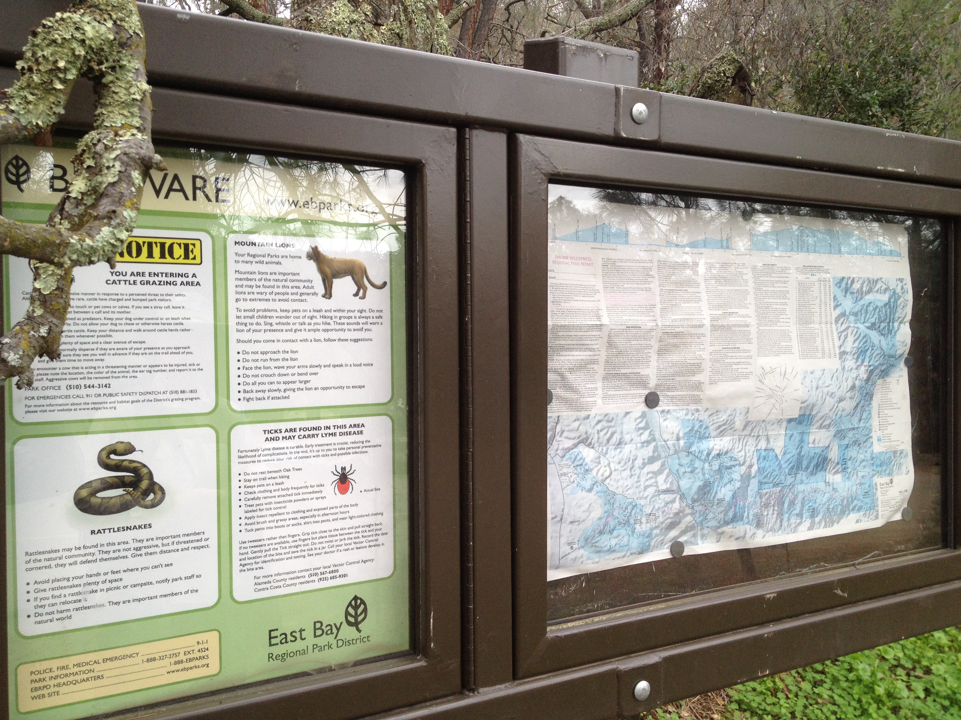
The signboard, about 1/2 mile up the trail from Lake Del Valle, a bit south of Livermore, California. (Are the ticks really larger than a mountain lion’s head? We found a few babies on this early March day.)
…and up we go! An easy part of the first of three grueling climbs

…and finally some views!

…and photo opportunities up on the first ridge, just as we start down

From that ridge, it was about a 600 foot drop into a quiet creekbed off in the distance

The creek! Some shade and a chance to (seasonally) filter some cool water!

…before the “Big Burn”, which is over 1200 vertical feet, with grades as steep as 40%. It closely rivals (and we think surpasses) the steepest grade of Mt Sizer in Henry Coe State Park. Both are known as among the most difficult hikes in the Bay Area. (my most recent Mt Sizer trip, with some info on the other “steepest hike”: https://alpharoaming.com/2013/10/05/bikepacking-henry-coe-state-park-day-1/)
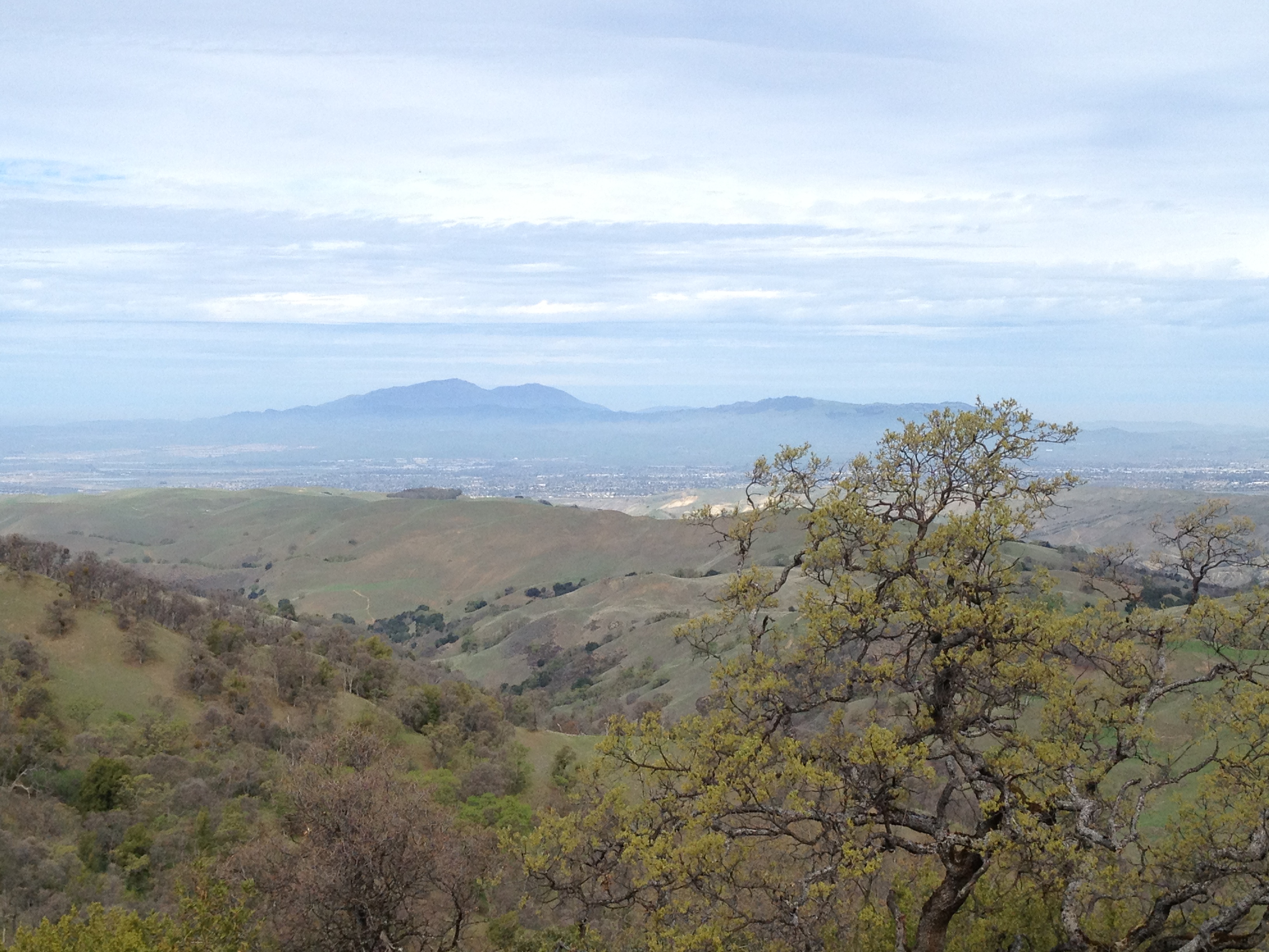
Up on the second ridge, which is the “we’re almost there” point of the hike, the distinct Mt Diablo is visible to the north, with the I-580 corridor cities in between (Dublin and Livermore)
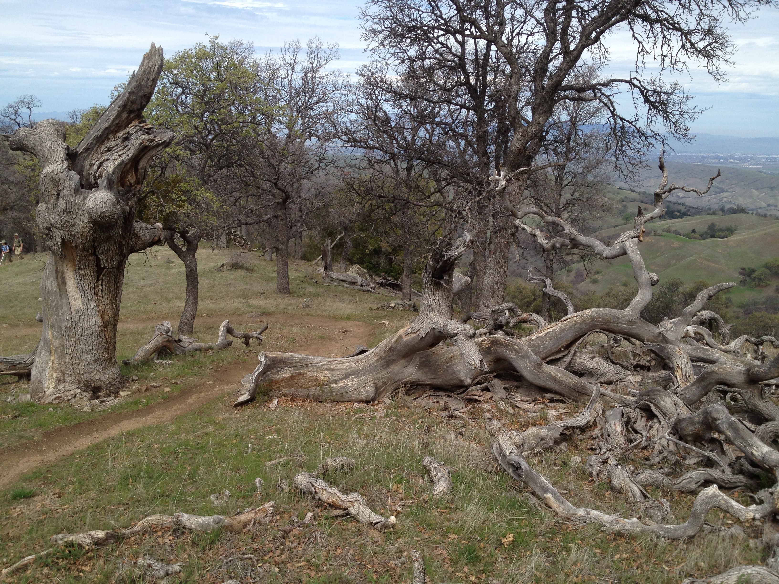
Joyfully cruising along the ridge, it’s surprising how much dead wood is here. The area has not burned in many decades.
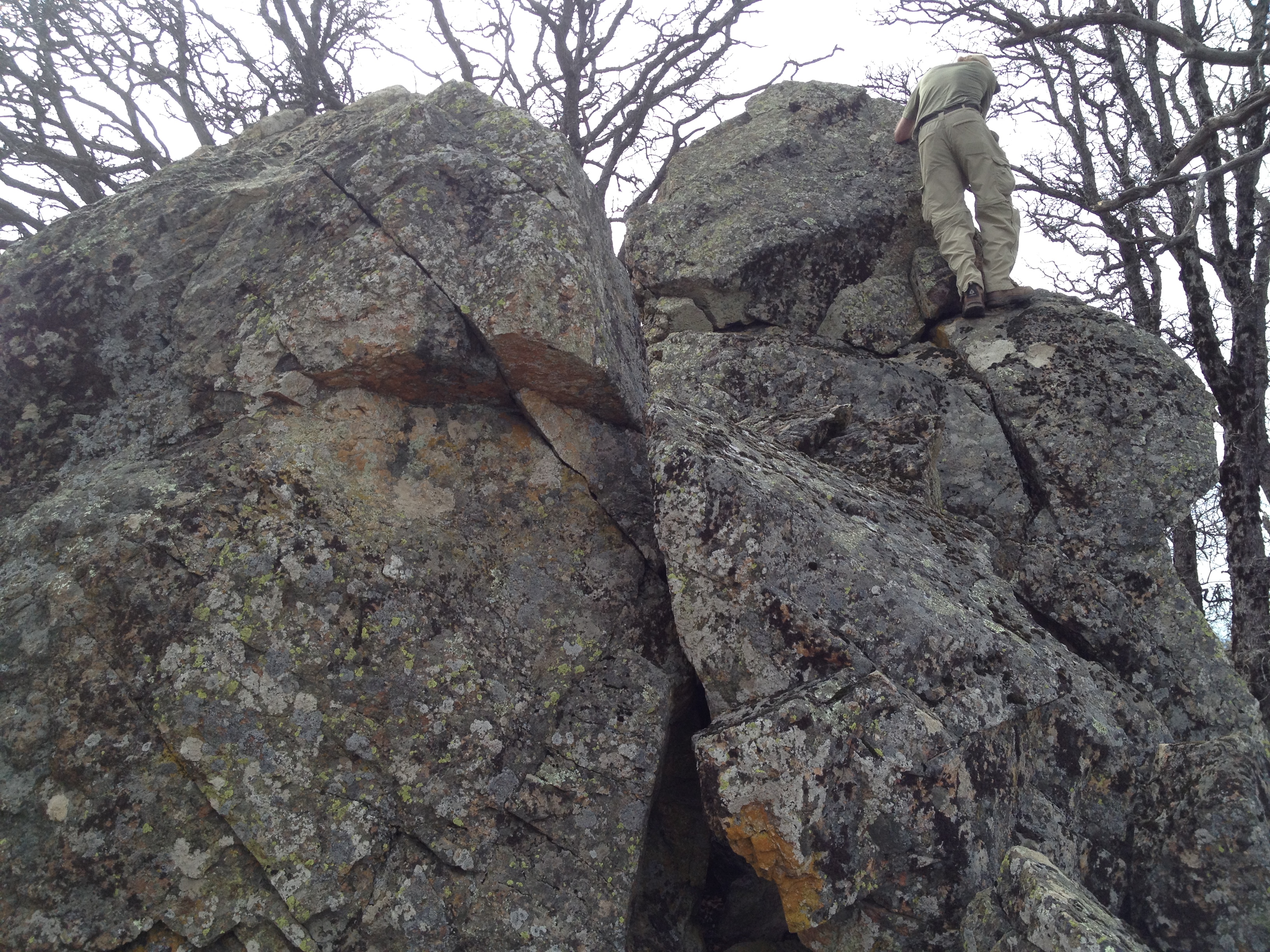
We had a few brief stops to hunt for some remote geocaches! Most of us are “laid back” geocachers, who love it as a research tool for new adventures, though rarely going after the urban caches. Notice the guy in the upper-right, climbing a rock formation. http://coord.info/GC3G0WP
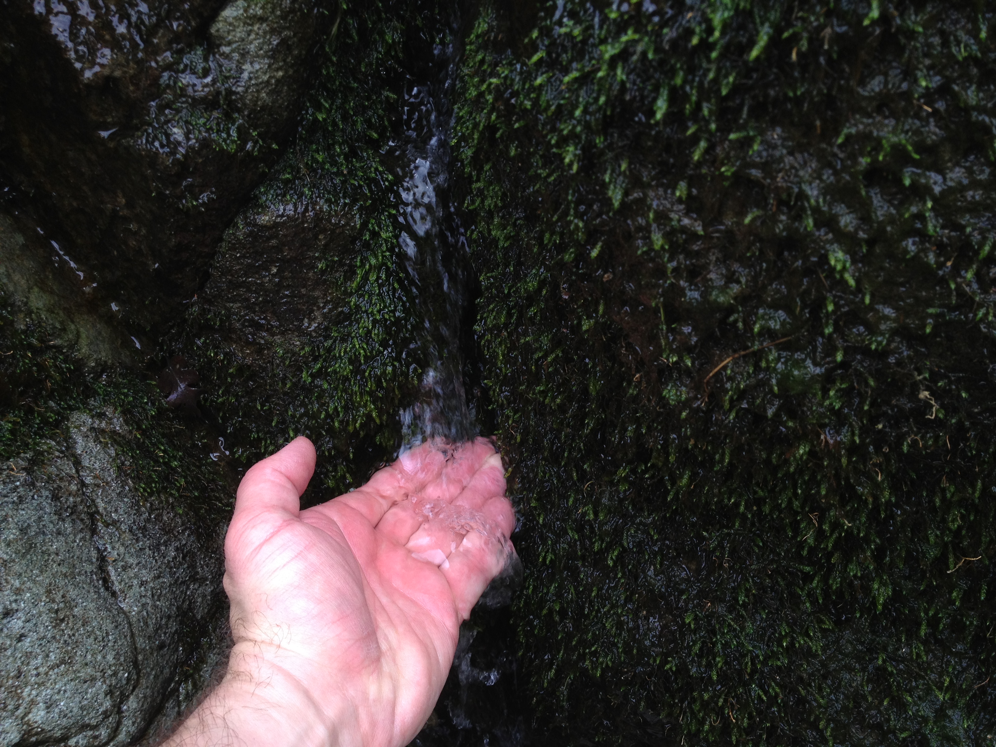
Ahhh…finally at the falls! Flowing just enough to have that soothing sound.

…about 10 gallons/minute (~38 liters/minute)
A rest and some pictures!
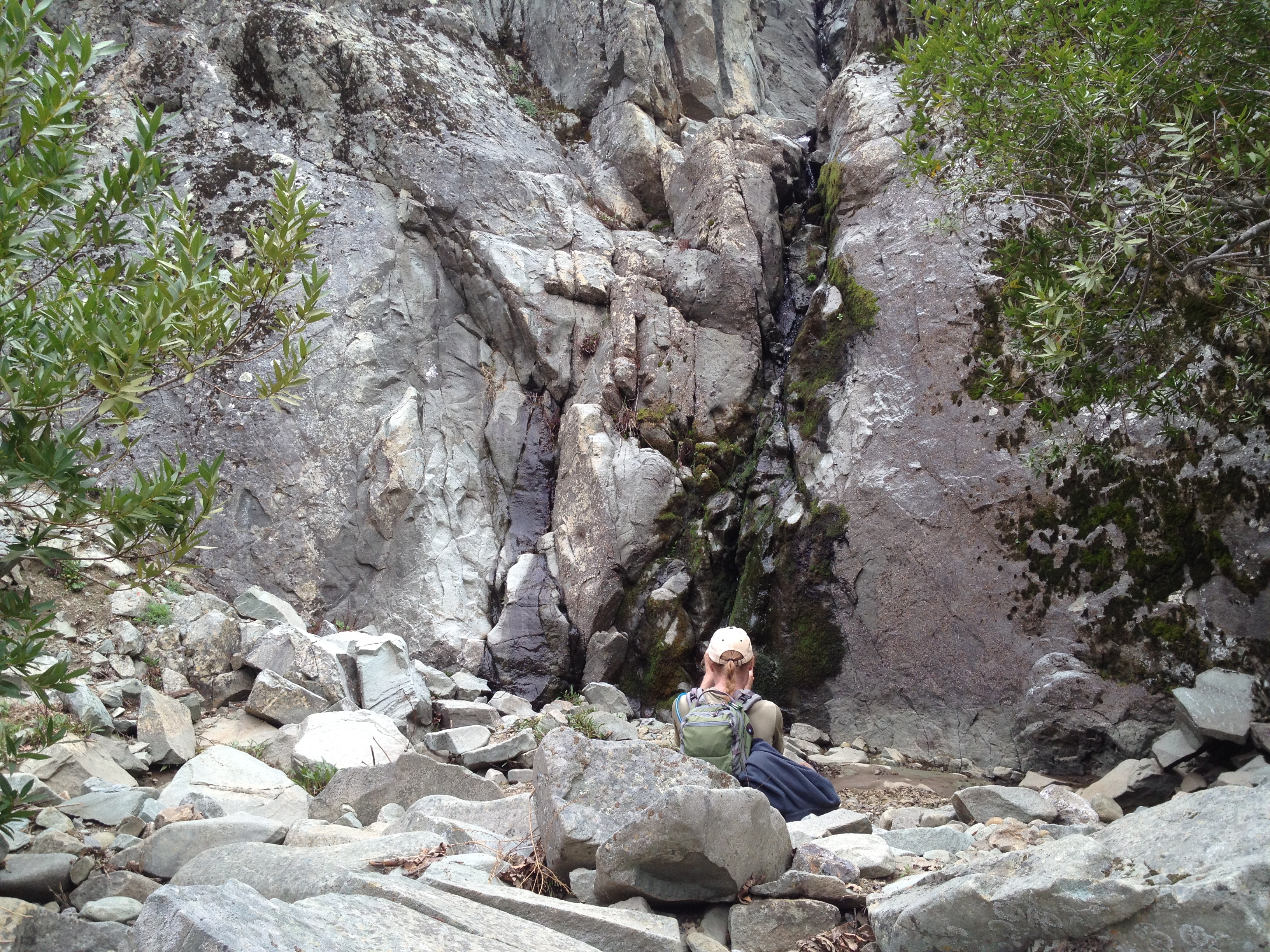

From the top it doesn’t look like much, but I didn’t get any closer than that!

Time to head back! The returning steep downhills can be harsh on the knees and toes, and taking smaller steps consumes a bit of time. We were too weary to take pictures of our sore toes jammed into the end of our boots. You wouldn’t want to see those pictures, anyway…

Great trip! Visit right after a rainfall, and be sure you’re prepared for a steep hike of about 14 miles and ~4500 vertical feet.
GPX track on a map: http://www.everytrail.com/view_trip.php?trip_id=2695464


")


Thanks for the writeup. I’d love to get back up there sometime soonish.
You made me go lookup my info on the grades through Ohlone. I gave some information to sammydee about it a while back (http://sammydee.net/blog/steep-hikes) and that lists the Big Burn as 15.7% grade, 1.9 miles, 1589 vertical feet. That’s consistent with one of the tracks I just (re)analyzed.
According to my little analyzer, the steepest 0.25, 0.50, and 1.0 mile segments between Del Valle and Sunol are all on the Big Burn. The grades are 27.13%, 23.40%, and 17.17%, respectively. It wouldn’t surprise me if shorter segments clocked in at the 40% you mention above. It sure seems like it when you’re doing them!
Thanks for the post — I was wondering how you guys did. How’d you measure (or estimate) the flow of the falls?
I still contend that the hardest part of that entire hike isn’t the Big Burn — it’s the descent to the cars at the very end. Not be the steepest section, but it’s the point where my knees let me know that they’re decidedly unhappy and unwilling to go downhill any more — usually fairly close to the ridge, with another mile-plus downhill still remaining I think I’m going to pack icepacks for the car, next time I end up over there.
I estimated the flow (order of magnitude) by envisioning a 10 gallon fish tank while I had my hand in the water flow and counted to 10 (or 60). Very unscientific, but a general guess-timate between 5 and 15gpm, perhaps.
Pingback: Pacheco Falls, Willson Camp / Peak / Tower at Henry Coe State Park | AlphaRoaming