

So where do I start? Well…my first experience in the Dowdy Ranch area was 6 years ago as a novice Geocacher. I asked on www.theGBA.net for any unfound caches in the Silicon Valley area, and I was pointed to 2 that had been sitting for 4 months http://coord.info/GCVT3D and http://coord.info/GCTNBG Since that time, I’ve been back to Dowdy a handful of times, both by car and under human power.
This particular time, I was “inspired” by 2 friends who recently went to Tie Down Peak and documented their mis-adventures. http://www.everytrail.com/view_trip.php?trip_id=1771571 http://www.everytrail.com/view_trip.php?trip_id=1772344 On a day that was about 20 degrees cooler (83F at Bell Station when I returned), I decided to go for it, alone!
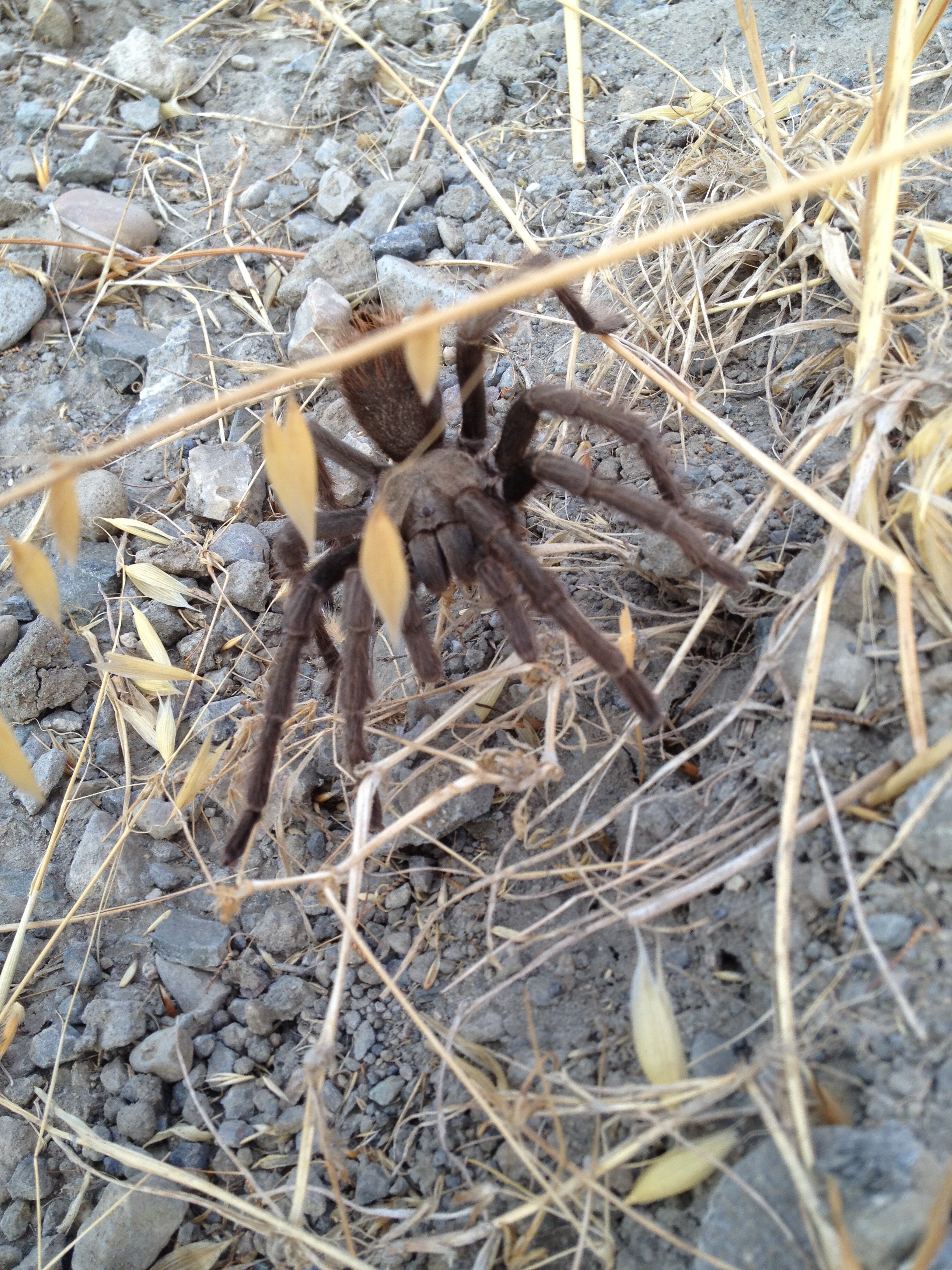
I departed Bell Station at 8:45 by bicycle, and summited Tie Down peak, 2hr 45min later, after leaving my bike at the intersection of the road and the Tie Down Trail. Other than being surprised to see a lonely tarantula on the side of Kaiser-Aetna Road, it was uneventful until I got near the summit.
As you can see from my track, I did not take the most direct route! My iPhone failed to download AntonyW’s previous track, but I had a general idea how to approach the face of the peak, while trying to stay on the marked trail as long as I could.
Scrambling up the left side of the cliff face is probably the same as what Antony did. The other parts of the peak are covered with VERY heavy undergrowth. It looks like this area hasn’t burned in over 100 years. I made it up, on the loose rock, but was not happy about having to go down the same way! The rock scramble to the top didn’t look bad, but everything was loose and crumbly. Ugh!
After a short while on the summit, I started looking at exiting to the north-west, through deep underbrush. Some scratches were inevitable, but it seemed easier and safer than going down the way I came up. I started picking my way down, stepping over numerous logs and downed trees. Indeed it was a good decision UNTIL I almost stepped-on a very large and angry rattler. I froze in place, well within striking distance of this bad boy (or girl). I was wearing my rattlesnake pattern Dirty Girl Gaiters at the time.
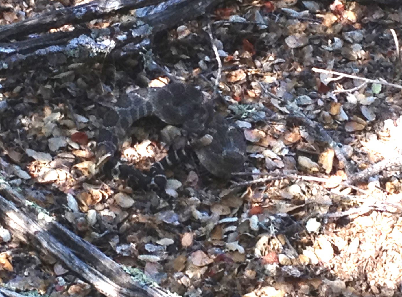

I wonder if the rattler delayed striking me, due to my similar coloration? Anyway, after slowly backing away, and waiting for the HUGE adrenaline rush to subside, I headed down to the open meadow and back to the road. Whew! (I had a friend who once put his hand on a surprised rattler while climbing…another good reason not to step or grab where you can’t see!)
On my return trip on the road, Ranger Cameron Bowers passed me 4 times in his truck. We stopped and chatted the first time. He asked about my trip, asked where I came from, and checked to see I was OK. (“I faked it”! I was happy to be alive and in a place where my body would be found, but I was still a bit shaken.)Until then, I had not seen anyone else the entire 6-hour and 20-mile roundtrip. My snake encounter was off-trail, over a mile from a desolate road with no phone signal. Hmmm..what did I learn today?
Would I do it again? …maybe next year on a different peak…maybe after I buy a SPOT locator…maybe not alone
Photos here: http://www.flickr.com/photos/59666465@N00/sets/72157634896967755/
GPS Track here: http://www.everytrail.com/view_trip.php?trip_id=1785673
Addendum, May 2014: My local hiking friend at http://www.Calipidder.com just did Tie Down Peak. Whereas I went up the rock face and down through the brush, she did the opposite. There is no easy way and nobody does Tie Down twice! http://calipidder.com/wp/2014/05/burra-burra-tie-down-henry-coe-state-park/


")


Hi there, I check your blog on a regular basis. Your writing style is awesome, keep it up!
Pingback: Henry Coe Dowdy Ranch (Mack’s, Pacheco Crossing, Vasquez, Dormida) | AlphaRoaming
Pingback: Orestimba Wilderness, Rooster Comb, Robison Creek @ Henry Coe State Park | AlphaRoaming
Pingback: Merrill Moab Ventilator – “Long Term Test”! | AlphaRoaming
Pingback: Merrell Moab Ventilator – “Long Term Test”! | AlphaRoaming
Pingback: Henry Coe State Park: Dowdy Ranch, Pacheco Crossing, Bell Station | AlphaRoaming
Pingback: Walsh Peak Trail, Pacheco Camp @ Henry Coe State Park | AlphaRoaming