Colonel Allensworth State Historic Park

Waaayyy out in rural Tulare County is a former town, which was founded, owned, governed, and entirely populated by African-Americans, around 1910. It’s now a State Park, with about a dozen nicely restored buildings, and a handful of others. Camping is available, too. http://www.parks.ca.gov/?page_id=583

Worth a stop, if you’re in the area. It’s just off Highway 99, between Visalia and Bakersfield. I was headed from San Jose to Sequoia-Kings Canyon National Park, and it was a small detour.

IMG_5530

Entry sign, and one of the smaller buildings. (About 20 buildings total)

IMG_5534

This tells the story!

IMG_5501

Colonel Allensworth was the highest ranking African-American soldier of his time. Unfortunately, the town failed due to being bypassed by the railroad, plus farming difficulties (lack of water and/or pool soil)


IMG_5499

Inside the small Visitor’s Center

IMG_5503

The Schoolhouse, which is the most prominent building

IMG_5505

A peek through the window, There were no docents that day, to let me inside.

IMG_5504

About the skool

IMG_5510

The Colonel’s house. It was a kit, which arrived by rail, like many homes of the day, including “Craftsmen” homes

IMG_5512

A peek inside the house

IMG_5511

About the house

IMG_5524

One of 2 or 3 stores. Odd architecture, but hard to miss!

IMG_5525

The store

IMG_5517

Barber shop. Most buildings are wood, This is concrete

IMG_5519

A peek inside

IMG_5526

About the barbershop

That’s about it! I recommend a weekend, or one of their periodic special events, to get a better feel for the place. On a June weekday, it was just me and a maintenance guy! A nice stop, way out on the country. Plan ahead for food, water and gasoline. There’s none nearby!

Posted in Uncategorized | Leave a comment

Schulties Road, Laurel, Redwood Lodge, Skyland Church (Los Gatos, Summit Road)

Back a few years ago, when I first started using Strava, I followed alot of local cyclists to discover interesting new routes, preferably with wide shoulders and few cars. One of those routes I spotted was Schulties Road and Redwood Lodge Road. These roads are on the Santa Cruz side of Summit Road, east of Highway 17.

It was a beautiful ride back in 2015, and it became even more interesting when the road suffered multiple mudslides during the winter of 2016-2017. They have not been repaired in 2 years, and Santa Cruz County has no immediate plans…

Here is my previous blog post, from 2015, with a few different pictures, plus Holy City: https://alpharoaming.com/2015/11/17/schulties-road-and-the-laurel-train-tunnel-los-gatos-mountains/

Bicycle up Old Santa Cruz Highway from Los Gatos, or park along Summit Road, for an easier day.

IMG_5211

Where Old Santa Cruz Highway meets Summit Road, you’ll see the sign, below. It politely tells you that going straight is not the way to get to Santa Cruz. Go straight!

IMG_5212

Head slowly down some bumpy pavement. When you get to the fork in the road, take it! (left)

IMG_5213

It’s closed to cars. Keep peddling, I hear banjos! There are a total of four places where the road is not passable by cars, but fine for cyclists who can carry their bike a few hundred feet.

Below is a beautiful scene, from the road, where SoCal palm trees meet NorCal redwoods and grapes.

IMG_5214

Another warning, before the first closure, below. The really bumpy pavement becomes packed dirt. I took it slow on my 23mm skinny tires, and it was fine/

IMG_5216

OK, so here you are at the first closure. An easy hike-a-bike, if it hasn’t been raining recently.

IMG_5218

The same closure from the other side. You can see where the slide came down the hillside. The below truck is owned by a family that is stranded between two closures…and has been for two years! Their truck takes them a short distance from their driveway to where they need to walk to get anywhere.

IMG_5219

The second slide I did not get a picture of, but the local residents have made a nice little log plank to make the walk easy.

After that, you’ll arrive at the former town of Laurel. It used to be timber harvesting town. It now has only a few homes, and an abandoned train tunnel, back behind that telephone pole. (Private Property.)

IMG_5222IMG_5223

In Laurel, take a left onto Redwood Gulch Road, and descend a bit more, past additional “Road Closed” signs. You’ll come across the below scene, where the road appears to dead-end into someone’s driveway. This is your third closure of the day! Walk to the right of the vehicles, behind the middle orange cone. IMG_5225

It feels like you’re walking into someone’s yard, but that’s where the road was. The steep, but clearly defined path is there, and I waived to the homeowner as I passed.

IMG_5226

Down, down, down you go, to the fourth closure of the day.

IMG_5227

Rideable with a bike, but too narrow for cars, and gated on both ends. The Private Property sign, below is puzzling, on a public road. Possibly it refers to the land to the left.

IMG_5229

Redwood Lodge Road is quite steep after this final slide, eventually taking you out to Soquel San Jose Road. Go down SSJ Road a bit, and turn left on Stetson Road. Dig out your navigation device, and make your way up to the historical Skyland Church. http://skylandchurch.com/ (The dinosaurs are across the street!)

IMG_5235

IMG_5236

The church was built in 1891, which is quite old, in California terms! There is a bell tower in the parking lot, to the left. On the clear day I was there, Monterey Bay and the Monterey Peninsula were visible to the left of the church (below)IMG_5238

From the church, you can close your loop back to Highland Way and Summit Road, including a stop at the Summit Store’s outdoor tables. (Check out the single slice pies and cakes, next to the coffee counter!) https://www.summitgrocerystore.com/

More info: Ray Hosler’s ride on Schulties Road, in early 2017, right after the slides. https://rayhosler.com/2017/05/21/santa-cruz-county-still-digging-out-from-winter-storms/

Ray’s more recent ride, which reminded me to go again! (He always talks about Jobst Brandt. Jobst was a local local cyclist who did alot of long and interesting rides.) https://rayhosler.com/2019/04/14/two-roads-immortalized-on-jobst-rides-fading-away/

A big PDF of the church’s history, published a few decades ago: http://skylandchurch.com/wp-content/uploads/2014/01/Skyland-Church-the-First-Hundred-Years-Fast-Web-Searchable.pdf

If you want to see what inspired me to seek out 8 train tunnel portals, in one day, read this! (I drove from one to the other!) http://coursetrained.blogspot.com/2008/08/lost-tunnels-los-gatos-to-santa-cruz.html

My Strava track, starting and ending in front Burrell School Winery, near the Summit Store. https://www.strava.com/activities/2359880228

Posted in Uncategorized | Leave a comment

Martin’s Beach (near Half Moon Bay)

Martin’s Beach is a scenic little cove, on the coast, a few miles south of Half Moon Bay. For years I have been hearing about the legal challenges to reopen beach access at Martin’s Beach, which was closed when Vinod Khosla, a wealthy Silicon Valley individual, bought the whole place and closed public access. The battle was between private property rights versus historical access and coastal access laws.IMG_4248

I’d been past the closed gate a few times, and knew that people had recently parked on Highway 1 (Pacific Coast Highway) and walked down, without any problems. There was a break in our lengthy, wet winter, and I was itching for a bicycle ride. Over the hill I went. Up Kings Mountain Road from Woodside, where it intersects Skyline Blvd.IMG_4235

It becomes the even more peaceful “Tunitas Creek Road” on the coastal side of Skyline Blvd.IMG_4237

Just after the road flattens out, about 2 miles from the coast, is the fabulous Bike Hut! Water, coffee, tea, snacks, porta-potty, and a place to rest and maybe chat with other cyclists. The nicely restored building was a small garage or barn, with a hanging / sliding door, now painted in stripes! (My previous write-up here: https://alpharoaming.com/2014/05/05/bike-hut/ )

IMG_4238

Turn right when you get to the coast, and be sure you check your map. The street sign was missing. Below, the gate was open, and the “Right to Pass” sign at the top was new, and less threatening. There is an old sign below that new one…IMG_4242

It’s about 1/4 mile down the street, from the gate to the beach. Just below the public parking lot, which may try to collect $10 from you, the scenery gets beautiful!IMG_4244IMG_4245

Below is the view from the northern end of the cove, looking south. There’s about 30 modest homes and cabins of assorted “casual” architecture. I saw nobody there, and very few vehicles, on a cool weekday morning. Mostly vacation or weekend homes, I guess.IMG_4246

A nice sign, between the Bike Hut and the coastal highway. You’ll notice it heading back, but not headed westbound.IMG_4250

I was quite chilly on my final descent back into Woodside. As I stopped to warm myself a bit, I notice this photogenic dirt island, on Kings Mountain Road, highlighting how steep these roads can be!IMG_4253

That’s it! Go visit sometime. You can leave your car on Highway 1 and walk down, or drive down to the parking lot and see if there’s room and someone collecting money. I imagine it may be quite popular in the summer!

My route: https://www.strava.com/activities/2200133723/embed/14192a8cb1bc90fd1dca7b2e46af03c859b961ce

Wikipedia “Martin’s Beach dispute”: https://en.wikipedia.org/wiki/Vinod_Khosla#Martins_Beach_dispute

Yelp, with more pictures: https://www.yelp.com/biz/martins-beach-half-moon-bay

Surfrider Foundation, with a bunch of historical legal news links at bottom: https://www.surfrider.org/priority-campaigns/open-martins-beach

October 1, 2018: Supreme Court refuses to hear his appeal. CASE CLOSED! https://www.sfchronicle.com/bayarea/article/Supreme-Court-refuses-to-take-up-Martins-Beach-13271592.php

THE END!

Posted in Uncategorized | Leave a comment

Cataract Falls @ Mt Tamalpais (in the rain)

A brief post to freshen-up my blog. My last post was about 2 months ago, and this hike was quite fun!

A little circle of friends was talking about climbing Mt Tam, to the summit, for the Northern California Sixpack of Peaks Challenge. https://sixpackofpeaks.com/norcal/ When rain appeared in the forecast, the hike shrunk into something more manageable, with waterfalls..and fewer intrepid hikers.

How did I plan this and how did I get there? I was chauffered in a new Tesla Model 3, to the trailhead, with no planning whatsoever. (Thanks, Sam!)

Somewhere north of the Golden Gate Bridge, we hiked:

img_3677

Water, and more water!

img_3678img_3682img_3687img_3691img_3692img_3693img_3694img_3697

Sorry…not my usual blog post quality. (Actually, I’m not sorry! I want to post the photos and don’t have much of a story to tell.) If you’re pressed for time, just do the first few miles (CCW direction), then go back the way you came. The best part generally is the first few miles. Enjoy!

Posted in Uncategorized | Leave a comment

American Heritage Museum (Collings Foundation)

Back around 2000 I heard whispers, on the internet, of a collection of military tanks in nearby Portola Valley at the “Pony Tracks Ranch”. It was not open to the public, but some groups were getting private tours. I tracked down a few crumbs of information on the internet, and left a telephone message to ask if the Studebaker Club could have a tour. (Yes, I own a 1963 Studebaker convertible that my grandfather bought new. I rode in it when I was a baby!)

Jacques Littlefield, the billionaire with one of the best collections of “toys” in the world, promptly called me back, and we were in! We had an amazing tour, led by Jacques himself, of his huge collection of about 200 tanks. It also included his restoration shop with Russian-language manuals, a (very serious) hoist to lift the turret off a tank, and other such exotic tools to restore these beasts to full operating condition.

Fast forward a few years, Jacques passes-away at a relatively young ago of cancer, and his wife wants the stuff outta there! His “Military Vehicle Technology Foundation”, with a group of loyal members, is disbanded and the collection went to auction.

A quick overview of the former collection: https://www.youtube.com/watch?v=zfPRdmXCKXI and one of many longer YouTube videos of the former collection: https://www.youtube.com/watch?v=SWU0AsxOQiQ

Fortunately, the same awesome Collings Foundation, which has a WW2 warplane tour every year, stepped up and bought the best parts of the collection. It was all trucked to the Boston suburbs, and beautifully presented in this new building!

IMG_2914

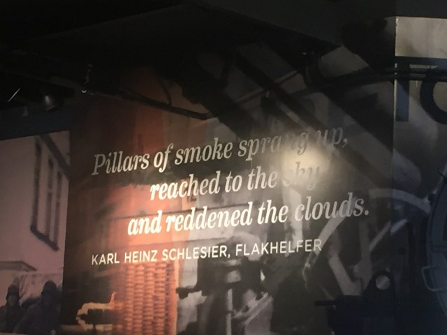
Just inside the front door, it honors Jacques:

IMG_2915

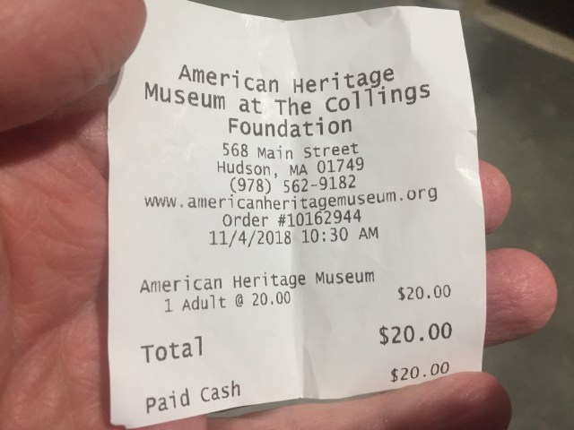
Below is the address and website, should you wish to plan a visit! (Note they are in a “pre-opening” phase right now in late 2018, with very limited hours.)

IMG_2916

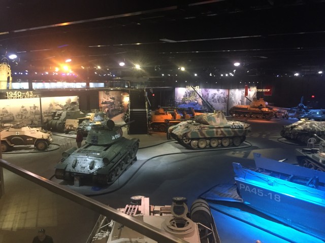
Jacques’ space in Portola Valley, was a massive garage, in the hills above Silicon Valley. Below is what you see upon entering the new space:

(A few items are not from Jacques’ collection, including 2 airplanes and the amphibious landing craft at lower-right below (PA45-18). It was purchased from a fisherman in Normandy who had still been using it since the Americans left it behind in 1945…)

IMG_2924

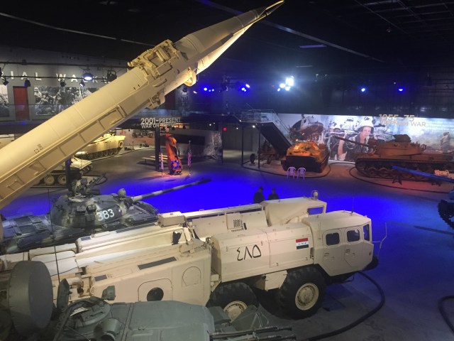
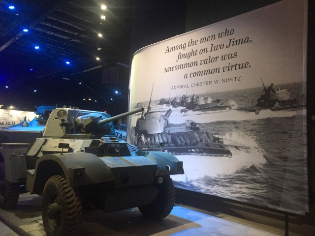
Some really rare stuff, sorted by military campaign or theater.

IMG_2928

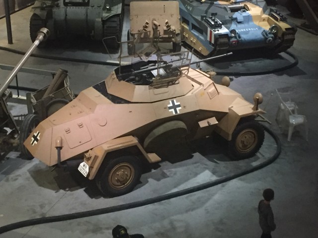
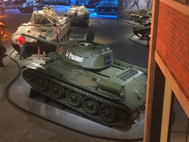
Heavy on German and American armor, there is a little bit of Soviet hardware, too! (The signs explaining what each item is have not been added yet. “Coming soon”!)

IMG_2929

Below is one of two SCUD Missile Launchers that Jacques owned. This one has Iraqi markings. (Jacques told me a great story of how his first one was hung-up in Customs at the Port of San Francisco for a very long time. He had to document that it was not capable of operating if it was going to be in private hands. The second one he bought went right through!)

IMG_2934IMG_2936IMG_2938

The exhibits do not discuss winners and losers, and right versus wrong. The goal is to preserve the lethal hardware, and present it in a historical context.

IMG_2948

My favorite quote of Jacques’, which explains his fascination of these machines, I saved from the defunct website of the Military Vehicle Technology Foundation:

“For me, the important part of the tanks is understanding the industrial know-how that allowed them to be built, and then document those findings. There may not be much appreciation for them now, but hopefully after I’m gone people will look back and say, ‘Thank God he saved these historical vehicles instead of just letting them rust away and disappear forever.”

IMG_2953

The large camouflaged tank, below, to the right of the Soviet tank, was Jacques’ prized German “Panther”. It spent 70 years at the bottom of a river in Poland. Jacques acquired it, and restored it to operating condition! (Here is the restored Maybach V-12, being fired-up for the first time. Jacques is the bald guy, to the rear https://www.youtube.com/watch?v=4VZQVLQAk94 )

IMG_2924

All of the tanks have had their barrels cut and reattached so as to make them incapable of firing properly. Jacques used to hold an Open House every year for his neighbors and law enforcement. He knew his hobby was unusual, and he knew his neighbors did a double-take every time there was a new “toy” being trucked thru the neighborhood. Opening the gates and letting them look around was a really good idea!

IMG_2927

Where did he get these? Well, just like old warplanes, they are sold to collectors by small countries who often use them for many years after the original countries have moved on to newer stuff. Some the items are a bit trickier. The first SCUD Missile launcher was from, I think, the Czech Republic when the Soviets pulled-out. The second one was left when the Iraqis were pushed out of Kuwait.

IMG_2952

One of his other stories that I recall, was hearing of a vintage WW2 American tank that was owned by a warlord in Bosnia, back in the 1990s. He sent someone there, with a big wad of cash and said “buy it”! Due to the fragmented war in the former Yugoslavia, it was quite a task. It included paying-off other warlords to allow the tank to pass thru their territories, on the way to the port.

IMG_2940

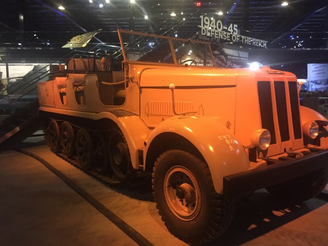
The below German tracked troop carrier is huge! The top of the grille is about 7 feet off the ground.

IMG_2935
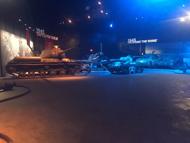
Many of my pictures are from the elevated walkway. You’re also able to walk to within a few feet of each tank, on the lower level, and look at it closely. They have plans to keep at least some of them operational and take them outside for public events.

Should you decide to visit, be sure to check their hours and days at https://www.americanheritagemuseum.org/ I believe they are now closed until April 2019, when they will have their formal Grand Opening.

Here is a link to the Collings Foundation’s annual magazine, with discussion of both the tanks and their aircraft: https://issuu.com/collingsfoundation/docs/2018-collings-foundation-annual-mag?e=35563074/65926028 The aircraft collection is quickly expanding, as well. New additions include an iconic twin-tailed P-38 Lightning, an F-4 Phantom, and a 1914 Curtiss.

Enjoy your visit, and tip your hat to the memory of Jacques, who did indeed create a collection that is like nothing else.

Posted in Uncategorized | Leave a comment

Ugh! Let’s do it again! Mount Sizer (Henry W. Coe State Park)

Back in August, I saw a post on the Henry W. Coe State Park Facebook page, asking about doing Mt Sizer. The first bit of advice was NOT IN AUGUST. After answering some questions, we decided to do gather a few friends and do it in October! So it began…three of my friends, and two new ones I hadn’t met yet, arriving at the Henry Coe HQ parking lot at 8AM in mid-October. (I also planned to do this hike before the end of 2018, to qualify for the “SixPack of Peaks” challenge https://sixpackofpeaks.com/#howitworks so setting a date was a helpful motivator!)

IMG_2686

It was my 10th time doing Mt Sizer (once with a loaded 60 pound bicycle https://alpharoaming.com/2013/10/05/bikepacking-henry-coe-state-park-day-1/) My three friends had all done it before. It’s a challenge every time…especially since we were experiencing a heatwave that day. It was forecast to be 85F in Morgan Hill, and likely a little more on the ridges of the park. One friend bailed-out due to the weather, and one woke up with a headache (really…?)

First stop: Frog Lake! (Yes, somebody drained the swamp.)

Sam-4

After peering over the edge, down into the valley, where the “Shortcut” is, we went down…to the bottom. We spent a few minutes discussing how dry it was. I looked a few feet downstream, where I had seen hundreds of hibernating ladybugs in the past. That spot was empty, but we did see a few random ones flying around.

Khevin-5

OK, check your clocks, and record your uphill “creek-to-bench” (C2B) time. It’s about 1500 vertical feet, over ~1.2 miles. (A Geocacher started measuring his C2B time, so others now do too. I also use it to record my 9 prior visits: https://www.geocaching.com/geocache/GCFD2F )

The picture below, unlike most, really does show how steep the road is.

Khevin-4

Finally…THE BENCH! My time was “acceptable”, being 3rd out of 6 in the group, and because my “hiking mojo” has been low for the past year, or so. My lungs were not complaining, like they usually do…it was my legs this time!

Sam-1

I actually didn’t take a picture of “the summit”, as it’s not much more than a bump on Blue Ridge. The scattered pine trees on the ridge provided a little shade!

Khevin-2

Looking down a side road, to the east, from near the summit: (That’s me, on the road, looking like part of the tree trunk!)

Khevin-1

After awhile, we turned right onto the Jackass Trail, and headed downhill to Poverty Flats, where we would experience our second big climb of the day.

Khevin-3

The fall foliage was in full color! (This being the dreaded Poison Oak!)

Sam-2

We paused for a bit at Poverty Flats, but not long…we calculated that we’d be running out of daylight. Up we go!

IMG_2692

Below is a park sign, at a trail intersection. We’re still about a mile from park HQ and our cars.

Sam-3

That’s it! About 18 miles and 4000 vertical feet, over the course of 11 hours.

Strava GPS track: https://www.strava.com/activities/1917472612

Aerial flyover: https://www.relive.cc/view/1917472612

Facebook link, with photos: https://www.facebook.com/phunti/videos/10155962862946376/

Additional info from a friend, who hiked it awhile back: http://calipidder.com/wp/listing/henry-coe-mount-sizer/

I didn’t take many pictures myself. Many of these photos were used, with permission, from www.DryFJ.com and Sam D. Thanks!

THE END!


Posted in Uncategorized | 1 Comment

Alleghany, CA – Jeeping to a Gold Mine!

A few weeks back, I again visited the heart of the northern Mother Lode, including Alleghany. With a posted population of 58, I was told it’s more like 20 year-round residents. 18 miles up a lonely ridge from Highway 49, I visited a retired Silicon Valley engineer who first started coming here on weekends about 50 years ago!

IMG_2329

The town includes this building, below, which has a part-time Post Office on the right, and the Underground Gold Miner’s Museum on the left http://www.undergroundgold.com/ (open occasionally…)

IMG_2355

There’s also Casey’s Place, which is a circa-1890 bar and restaurant. That, too, is pretty quiet. https://www.yelp.com/biz/caseys-place-alleghany

IMG_2333IMG_2335

Last, but not least, there’s the Volunteer Fire Department, with my friend’s Jeep in front. He’s also the “radio guy” for the Fire Department, being from Silicon Valley, and all that…

IMG_2331

There are several historical and/or operational mines in the area. The “Sixteen to One Mine” is the oldest hard rock mine in America, founded in 1896. http://www.origsix.com/

IMG_2381

There’s also the Ruby Mine, (currently For Sale https://www.rubymine.com/ ) which is still producing, and the Plumbago mine, which we’re going to see, as we hop in the Jeep, and descend 2000 feet to the bottom of the canyon!

IMG_2360

Below, is the bottom of the first canyon, at Kanaka Creek, near the Ophir Mine.

IMG_2365

Those red roofs, below, are buildings at the lower Plumbago Mine. I was told that a few years back, the place was cleaned-up reeaaallll nice, just before they helicoptered some deep-pocketed investors to look around. (Painted the buildings, told some stories, and caught some naive investors and mined their wallets!)

My friend was also part of the first crew to use metal detectors in the old Plumbago tunnels. They found $1 million in two days, though the mine owners got almost all of that!

IMG_2361

Down we go, even more…it’s a shelf road, built for mules! I only took photos on the easy parts. I was not holding a camera on the more exciting parts of the road!

IMG_2362

Finally…we reach the bottom of the canyon, where Wolf Creek joins the Middle Fork of the Yuba River. The cabin, below, was built in ~1925, using wood strips from an abandoned redwood flume from the 1880’s. (Flumes carried water downhill, often for many miles, to be used in large-scale sluicing operations.)

IMG_2366

Below, is the roof of the cabin. My friend stabilized the old structure, about 20 years ago, and lived in it for awhile.

IMG_2371

I should have taken more pictures, but I didn’t…the river and creek are quite scenic and peaceful. It’s not recommended to go into the canyon alone, though. The road is rough, and there bears and a few odd characters that live in the canyon, at their claims.. If you go to the town of Alleghany, call ahead and see when Casey’s and/or the Museum are open.

Also consider a small side-trip to Forest City. They took $200 Million in gold out of the ground in about 10 years. The town had 1000 people at one time, and the mine tunnel included an underground steam locomotive (cough! cough!) Today, it’s a crumbling historic Dance Hall, plus a few homes. It’s also a Registered Historic District. https://www.sierranevadageotourism.org/content/forest-city-national-register-historic-district/siee4a502e56807fbb36

The End!

Posted in Uncategorized | Leave a comment

Peter’s Creek Grove @ Portola Redwoods State Park

IMG_1296

Entry sign, before the Visitor’s Center

I haven’t organized a group hike in awhile. Partly due to other things going on, and partly because I’m running out of good ideas. It was forecast to be over 95F, and I had some friends interested in Peter’s Creek Grove, so…let’s go to the redwoods, where it should be cooler!

We made the deceptively long drive, west from I-280 on Page Mill Road, over Skyline, then the long descent into park HQ. We planned on it being a bit cooler, and it was! (Park website: https://www.parks.ca.gov/?page_id=539 Park brochure and small map: https://www.parks.ca.gov/pages/539/files/PortolaRedwoodsWeb2016.pdf

IMG_1310

Image from the sign at HQ

It was warming quickly, which reminded me of a prior hike closeby, on a warm day. It was to the natural crude oil seep in “Tarwater Creek”. On a warm day, it was evaporating and giving off a smell. An easy hike for another time! https://alpharoaming.com/2013/08/31/up-from-the-ground/

IMG_1297

A bit of a warning, at Slate Creek Trail Camp, when turning north

A bit after the left turn at Slate Creek Trail Camp, your next interesting stop is at a 1941 Buick Super Sport Coupe! It’s a few feet off the trail, to the right, at N 37° 16.033 W 122° 11.382 (If you’re a Geocacher, the details are here: https://coord.info/GC4NG8J

IMG_6569_cropped

IMG_1299

A burned-out shell, leaning against a younger tree

7 of us eventually made it down into the Grove, and near the water, the temperature dropped considerably! And yes, we saw trees!

IMG_1303

“lookee that big tree”

These trees are some of the only virgin redwoods in the area. They did not meet their fate at the nearby “Page Mill”. Page Mill was a shingle cutting operation, owned by “Mr. Page”. The more famous Page Mill Road was his route from the mill to the port, on San Francisco Bay, from where he shipped his shingles.

IMG_1304

Crossing Peter’s Creek, with a huge tree and root ball behind us

Heading out of the grove, one of our group noticed this very active wasp nest. I went the closest, for a picture, but I moved very slowly and carefully!

IMG_1306

Yes, a real wasp nest, with alot of activity on the right side

A very thoughtful friend brought a 22oz beer to share, but we had to improvise for cups!

IMG_1308

Water bottles + pocket knife = drinking cups!

That’s it! Have fun…oh, there was alot of poison oak! Here’s our Strava track: https://www.strava.com/activities/1658000109

Posted in Uncategorized | 1 Comment

Big Sur, Indians Road, South Coast Ridge Road

This past weekend I got my new Subaru dirty for the third time! I was interested in both the South Coast Ridge Road, which I could not do with my previous 2WD sedan, and Indians Road, which connects from Fort Hunter Liggett to Arroyo Seco. (I was here a year ago, when there were 3 closures on Highway 1 https://alpharoaming.com/2017/07/06/big-sur/  and 3 years ago, when I did a chilly winter hike to Cone Peak https://alpharoaming.com/2015/01/05/cone-peak/

Michael joined me on our 3 day, 2 night adventure. We headed down Highway 1 (the Pacific Coast Highway), through Monterey, Carmel, and Big Sur to our first planned stop in Gorda. (Did I mention the large numbers of tourists along the Big Sur coast? Some of them are amateur motorhome renters, and some of them walk into the roadway while thinking only about their next selfie.)

Gorda is as far south as you can go, before the “Big Slide”, where Highway 1 washed out last year, between there and San Simeon. We had lunch at the Treebones Resort, out on the deck, overlooking the water. http://www.treebonesresort.com/

IMG_1051

IMG_1052

We made a quick gas stop, as we were about to go off-road for awhile, and the next gas stop would be 2 days later. (Yes, $6.59 a gallon. I bought 4 gallons! I’m happy they were there, and happy I was only “topping off”, just in case…)

IMG_1053

From Gorda, we headed uphill on Los Burros Road, then to the South Coast Ridge Road. About 3000 feet of climbing and 15 miles total on dirt Forest Service roads. (Los Burros Road was likely originally created to access the small mines and claims in a “mini Gold Rush” in this area. A few statistics: https://westernmininghistory.com/articles/550/page1/ …and an interesting story about the area, with many sequential links at left https://sites.google.com/site/hobbitmine/true-story-of-the-hobbit-mine

Below, we reach the top of Los Burros Road and turn left and start the rollercoaster ridge road:

IMG_1060

IMG_1061

Most of the crud washed off the car…there are a few permanent scratches on the right side, but that’s what I bought it for!

IMG_1055

Below, is the sign describing where we had just come from, after we hit pavement at the top of Nacimiento-Ferguson Road. Prewitt Ridge was a place we considered for our first night’s camp, but it was fairly full and still early in the day. We kept moving! (We averaged 8 mpg on the dirt road.)

IMG_1065

We drove through Fort Hunter Liggett, to Memorial Campground, and found a nice site. The next morning we drove a few miles further, through a seasonal gate, to Escondido Campground. From there we continued a mile or two on Indians Road, to the permanent gate that only allows hikers and cyclists for the next ~15 miles to Arroyo Seco. (The road was closed awhile back, after some landslides and a decision not to maintain it any more.)

Below is part of our hike, beyond the permanent gate on Indians Road.

IMG_1074

It was hot and dry, but there were quite a few flowers on the hillsides and shady areas, where a bit more water might be in the soil.

IMG_1078

We climbed about 600 feet, very gradually, while seeing this lonely mountaintop pinetree get closer.

IMG_1085

Following that hike, where we failed to find 2 geocaches that were not logged in over 10 years, we did another short hike from the Escondido Camground.

IMG_1092

Two short hikes accomplished by late morning, as the temperatures headed towards 100F. We drove to the historic 1771 Mission San Antonio de Padua, which included an air conditioned Visitor’s Center!

IMG_1097

IMG_1100

Inside, there was a museum, telling the history and displaying artifacts. This mission is particularly isolated, with the building and the grounds being well preserved. The grounds include a cemetery, a millrace and old millhouse.

IMG_1103

The Mission’s web page. They still have weekly Sunday masses! http://missionsanantonio.net …and more detailed history http://californiamissionsfoundation.org/mission-san-antonio/

IMG_1104

200+year old wine vat, in a lower level of the Visitor’s Center area. They had their priorities in order…

IMG_1105

IMG_1106

The inner courtyard, of a sizeable place!

IMG_1107

The interior of the chapel was restored by William Randolph Hearst in 1949. He owned the vast Army property, prior to WW2, including the Mission and his nearby large Hacienda. He sold it to the Army, during WW2, as a training ground for tanks. (The smallest road bridges, over the creeks, have a posted weight limit of 80 tons!)

IMG_1111


IMG_1112

From there, we headed to Lake Nacimiento, about 25 miles south. It’s a boating and swimming lake, quite close to Paso Robles. We had an early dinner there, then camped back not far from the previous night, at the Nacimiento Campground. The third morning we headed down Nacimiento-Ferguson Road, into the coastal fog bank, and headed back up the coast.

IMG_1118

About 1/2 mile from the Mission, within the barbed wire center of the Army Base, is Hearst’s historic Hacienda. It’s possible to book one of the ~10 rooms, but securing a reservation is really difficult! Maybe some day… https://en.wikipedia.org/wiki/The_Hacienda_(Milpitas_Ranchhouse) Reservations for the general public: https://hunterliggett.armymwr.com/programs/historic-hacienda

That’s it! Remember to fill your tank before Gorda and have fun.!


Posted in Uncategorized | 4 Comments

My New-to-Me 1978/79 Guerciotti

IMG_9533

When I first moved to the Bay Area in 1990, I shared a condo with an old family friend. She introduced me to one of her friend’s boyfriend (are you following me so far?) who became a very good friend of many years. Well…he passed away recently. Way to soon!

He made an “adult cyclist” out of me. That means I got into cycling as something more than short-distance transportation, like at college. He helped me buy a “real bike” and make a healthy hobby out of exploring the hills of Silicon Valley. (He was very patient in waiting for me at the top of iconic local climbs, like Old La Honda Road.)

His wife (widow) contacted me recently to ask if I wanted his old racing bicycle “because he’d want you to have it”. I choked-up a bit, and shed a tear, and picked it up at her house. With a hug, I told her I’d take good care of it.

He bought it new, around 1978 or 1979, and raced it until sometime in the 1990s, when he replaced it with a Colnago. The Guerciotti was put in the garage, with the tires and brake pads getting hard and dry with age.

IMG_9539

IMG_9585

It’s an interesting combination of Campagnolo, Dura-Ace and 600 components. He had made some swaps and upgrades over the years. I tinkered with it a bit, then decided it really should be disassembled and completely lubed. I didn’t want to damage any of the long-dormant components, and I didn’t have the tools and expertise to do it all myself.

IMG_0206

IMG_0203

The local shop did a great job. New chain, brake pads, and cables. Everything else was completely cleaned and polished. The yellow seat cover and two color handlebar tape was left as it was. It rides very nicely!

IMG_9848

IMG_9850

Yes, my friend, your memory is alive. I will take good care of it!

Posted in Uncategorized | 1 Comment