
You may be familiar with the Beverly Hillbillies if you watched 1960’s Black and White TV reruns (…or was it just that my parents TV was B&W when I was a kid?) http://www.youtube.com/watch?v=NwzaxUF0k18
…but did you know that there’s natural crude oil in San Mateo County, very close to San Francisco?
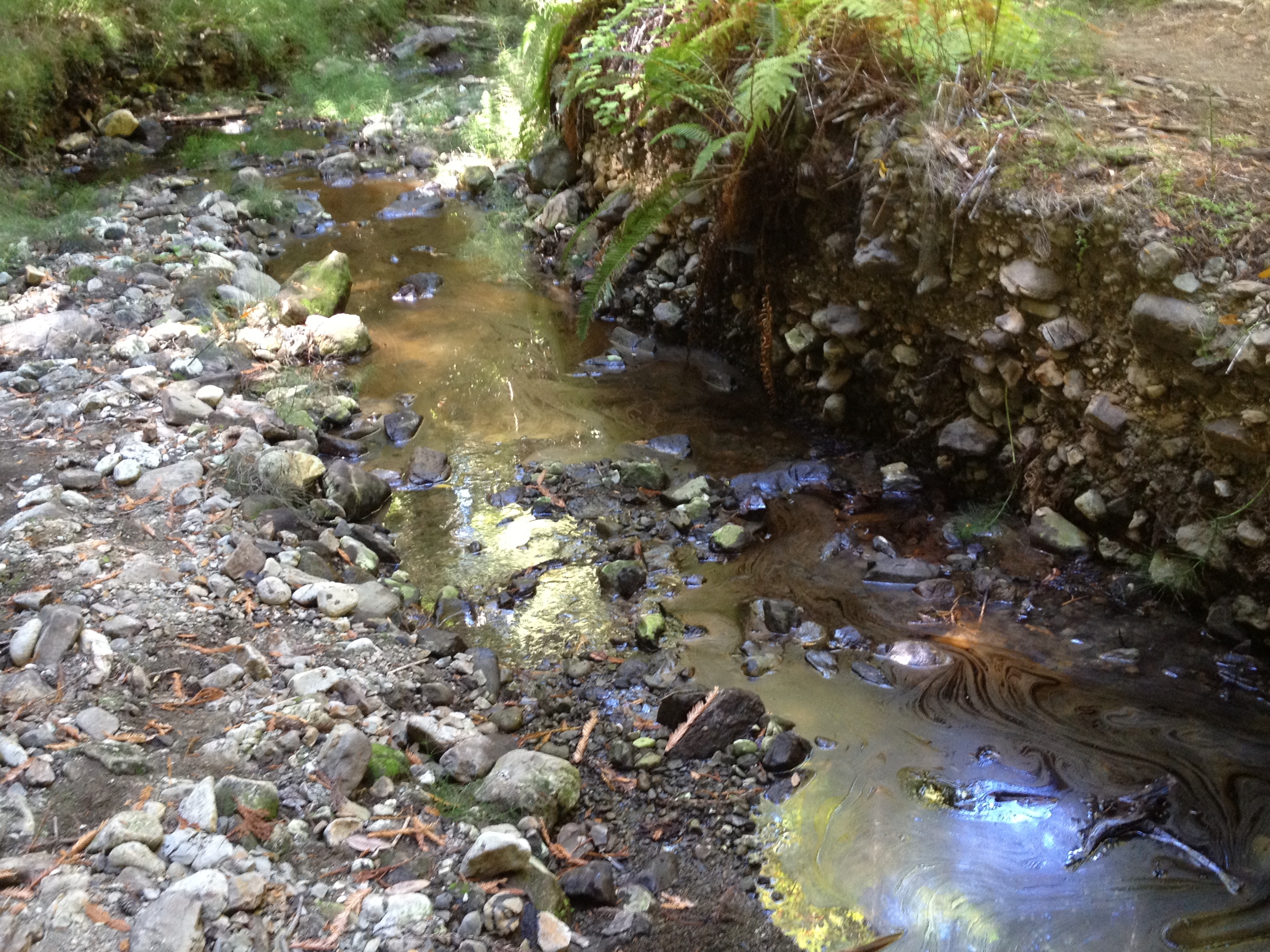
Indeed, there is a natural oil occurrence in the appropriately named “Tarwater Creek” in Pescadero Creek County Park. Quotation from the park’s website:
“Pescadero Creek Park sits atop a deposit of natural gas and oil. Natural gas occasionally bubbles up through seams near Hoffman Creek producing a strong gas odor. Crude oil pools up in the channel of Tarwater Creek, and seeps into Jones Gulch Creek staining the rocks. Oil exploration was attempted in the 1970’s but failed to hit the pool. Natural gas under San Mateo County has been estimated at 10 billion cubic feet but no exploration wells have been attempted in the park.”
There was also some limited historical oil production in the 1880’s on the coast to the west http://www.pescaderomemories.com/?p=892
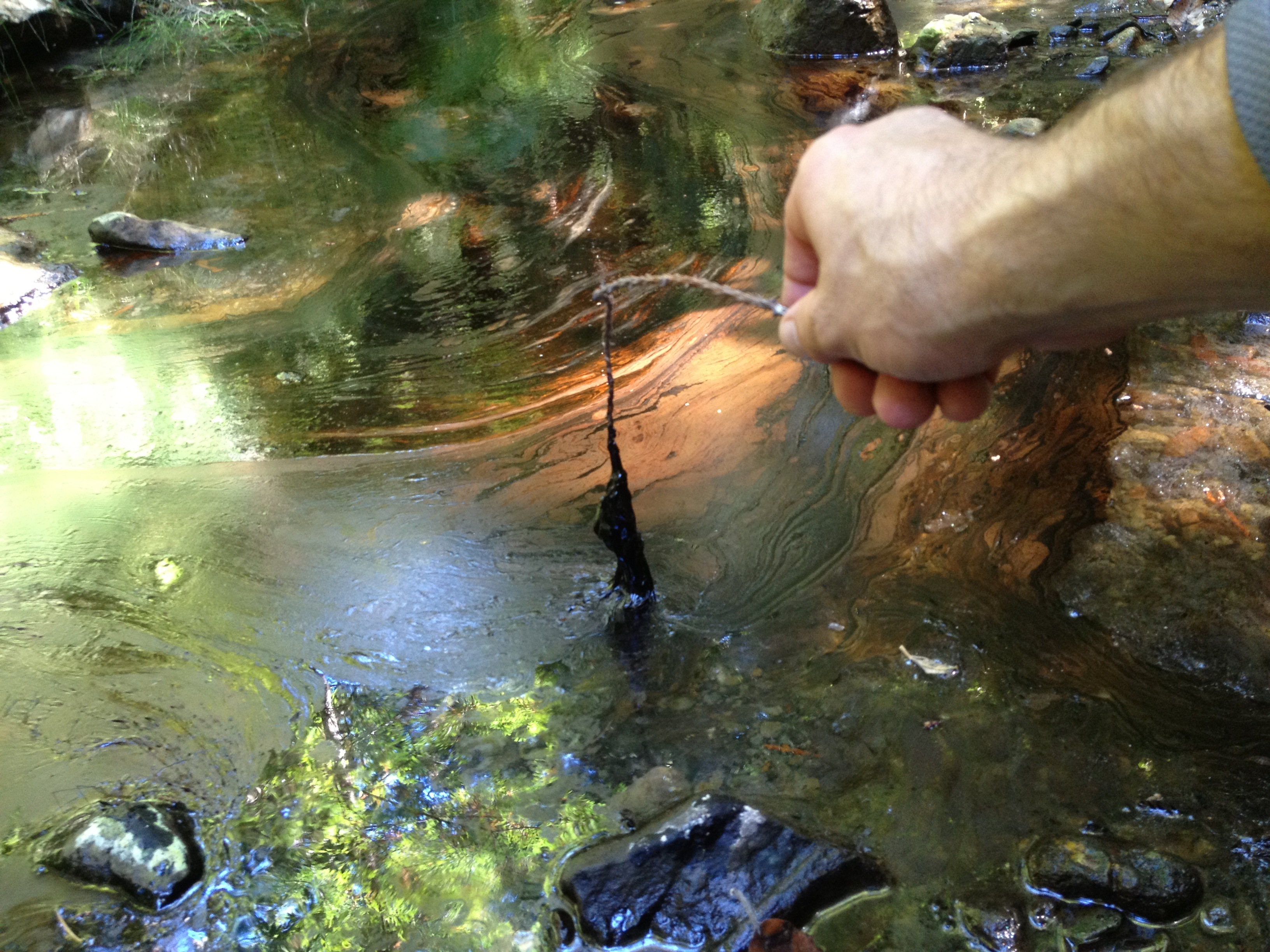
The primary spot on Tarwater creek consists of a pool of tar, within some old river rocks. Poking a stick in it, it seems to be a few inches deep and about 2 foot diameter. This thick tar slooowwwly makes it’s way down the creek, which is flowing quite slowly this time of year. We maybe saw 2 or 3 gallons in all, with a very distinctive smell on an ~85F degree day.

So…our goal for the day was to visit this oil seep for the second time (and my friend’s first time). We parked at the obscure trailhead on Camp Pomponio Road, off Alpine Road and started an ~11 mile clockwise loop. If you notice the GPS track, linked below on Everytrail, you’ll see that the first ~5 miles are not recorded, due to the App crashing on my iPhone.)
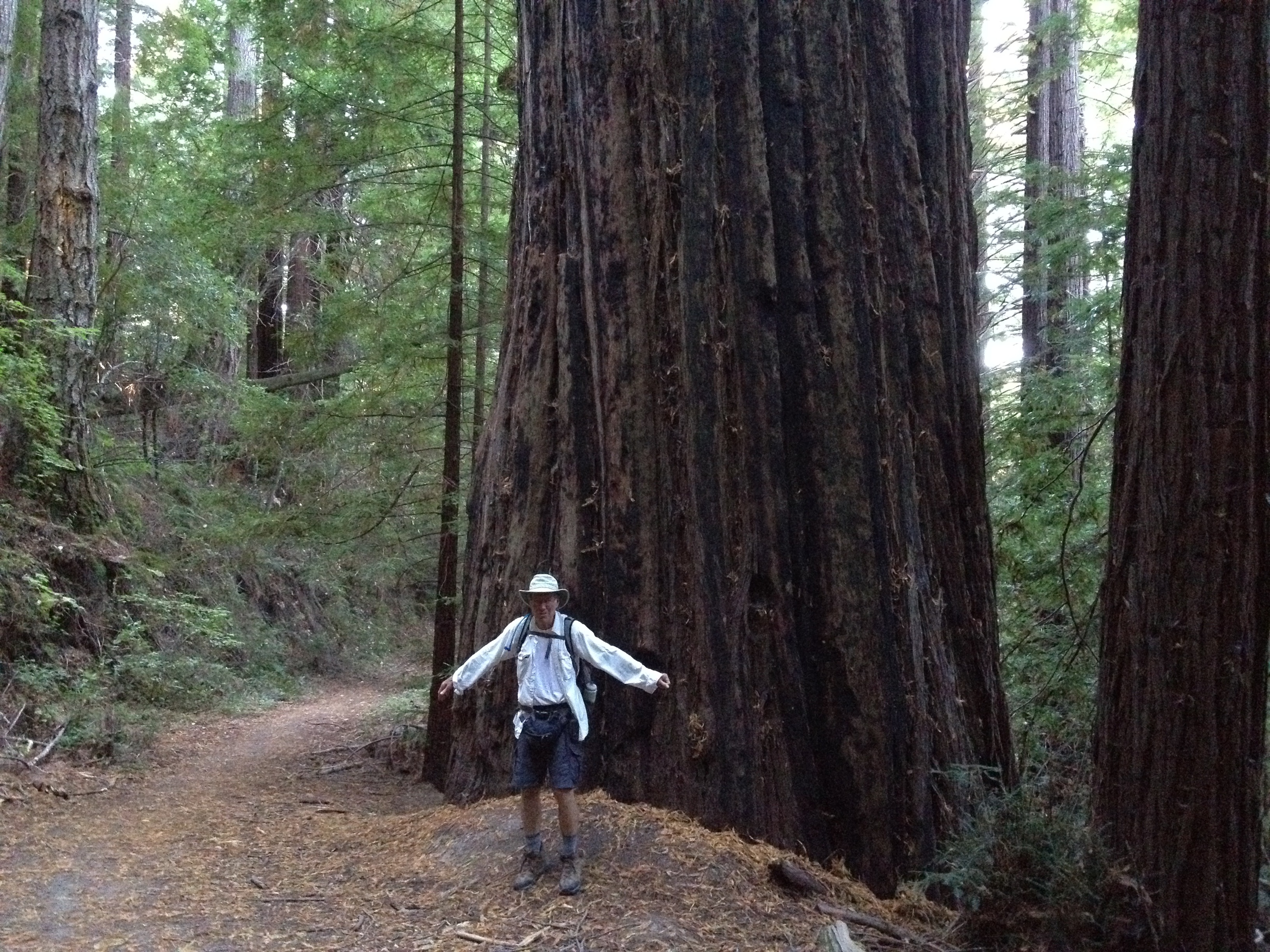
We saw some of the remaining old growth redwoods. Like some of the other areas of redwood habitat, an occasional single redwood tree was left behind because it was oddly shaped, or otherwise damaged by fire or lightning and did not make good lumber. This one was oddly shaped way up high.

The loop was largely uneventful, but a nice shady hike, on an otherwise warm day. We saw nobody else on this beautiful weekday hike, except for 3 small groups of equestrians. Judging from the “steaming piles” along the trail, there’s quite a bit of equestrian usage around here.
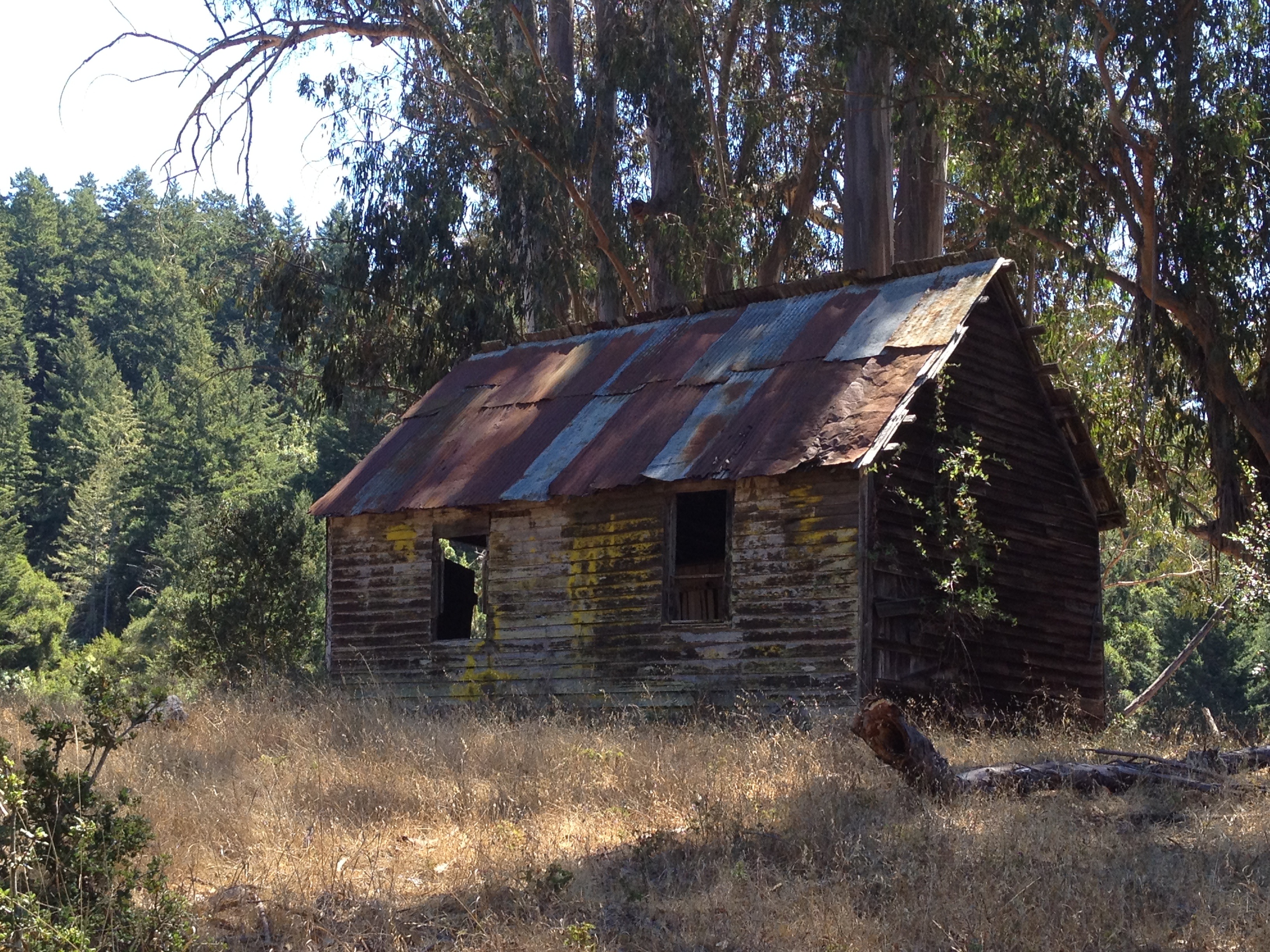
Towards the end of our hike, we stumbled upon the abandoned Beverly Hillbillies home, used prior to their move to the 90210 zip code!

The main park description is here: https://parks.smcgov.org/pescadero-creek-park
Here’s the trail map. We came down from the upper-right corner, via Alpine Road, from Skyline Blvd. Parking was at the “Tarwater Trailhead”: https://parks.smcgov.org/sites/parks.smcgov.org/files/Pescadero-SamMcDonald-Memorial-Complex-Map.pdf
That’s it! Have fun!
GPS track: http://www.everytrail.com/view_trip.php?trip_id=2294301
More photos: https://www.flickr.com/photos/59666465@N00/sets/72157635310604953/


")


Pingback: “Secret” Entrance to Pescadero Creek Park from Big Basin | AlphaRoaming
Pingback: THE FIRST OF TWO TRIPS TO THE AREA OF PORTOLA REDWOODS STATE PARK ( 1 of 2 ) – Emails sent by Mike McCullough