
Wouldn’t it be interesting to learn of a “back door” to Pescadero Creek County Park (and upper Big Basin State Park)? No crowds, no entrance fees, and great views of the Pacific Ocean if the weather is cooperating!
In the upper reaches of Big Basin State Park:

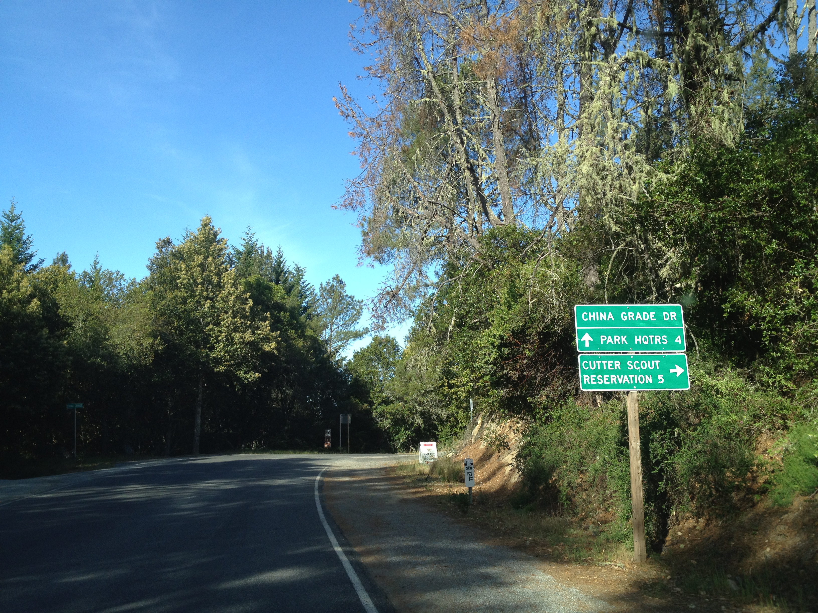
About 4 miles north of the park HQ, you’ll find a westbound turn on to China Grade Road. This is the upper boundary of the park and is quite sunny and dry compared to lower elevations.
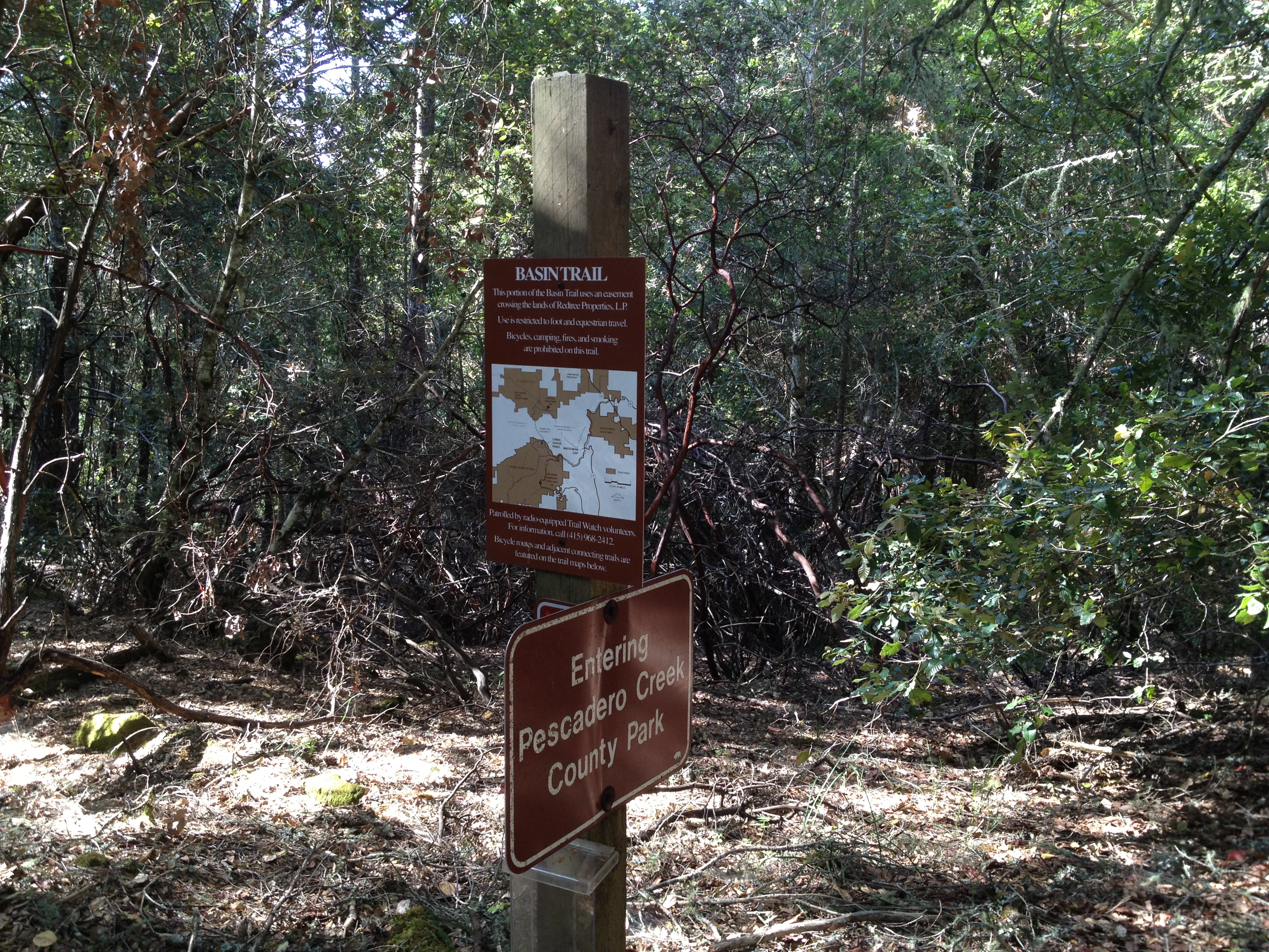
Drive a few miles to approximately N 37° 12.900 W 122° 13.290 and look for a gated logging road and a small trail sign on your right at a pullout. (The coords are within about 100 feet of being accurate.) The logging road is not open to the public, but there’s a foot trail next to it that’s an “easement” for hikers and equestrians. It’s a bit over a mile, on the easement, from there to the boundary of Pescadero Creek County Park.
Be sure you have some sort of navigation skills and mapping tools. The first time I was here with a few friends, we ended-up missing where the trail crosses a logging road and went down the road for awhile…
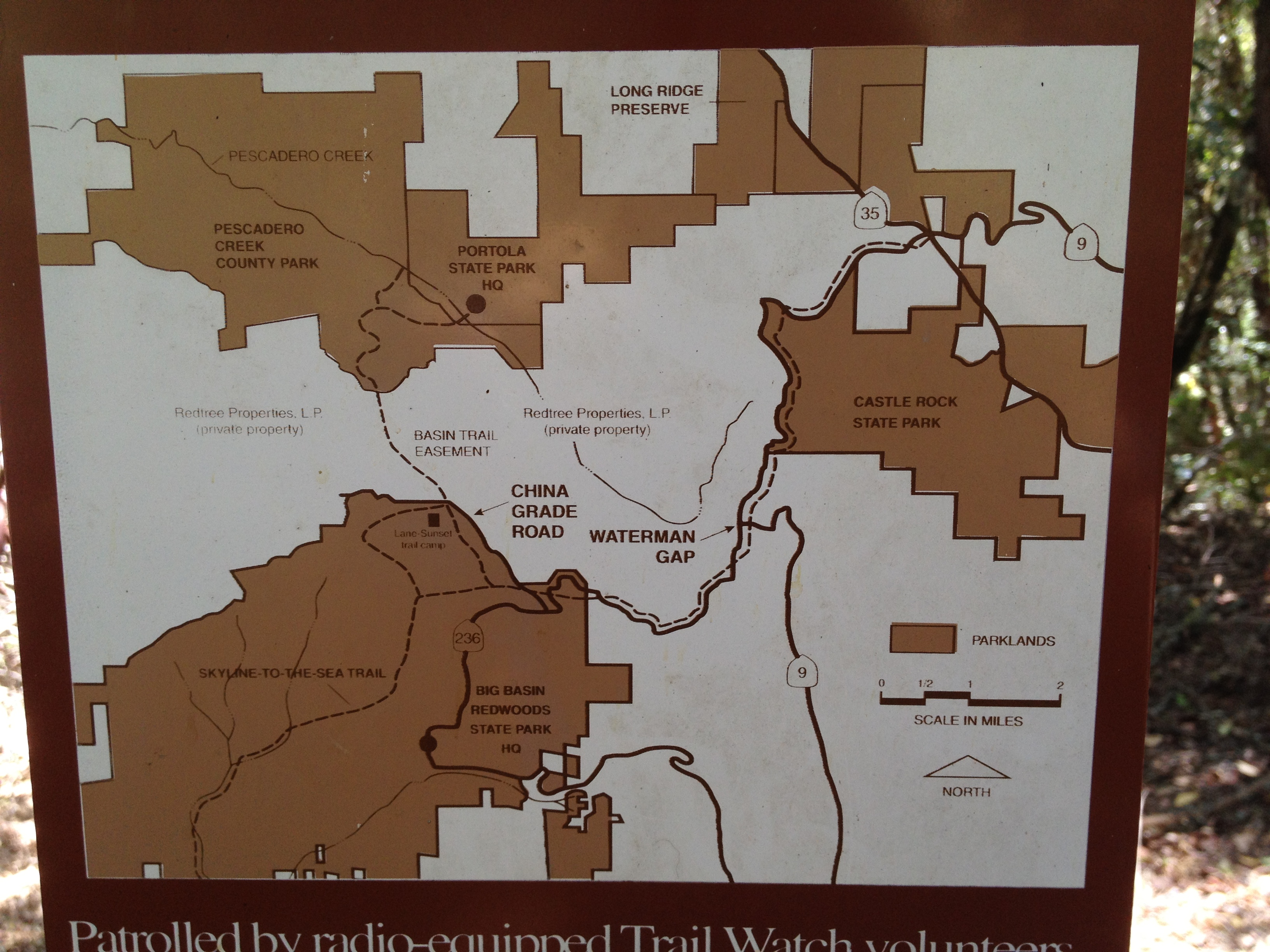
Here’s the official map. The easement enters the main map at the extreme botton corner “Basin Trail Easement” https://parks.smcgov.org/sites/parks.smcgov.org/files/Pescadero-SamMcDonald-Memorial-Complex-Map.pdf …and the park brochure: https://parks.smcgov.org/sites/parks.smcgov.org/files/Pescadero-Complex-Brochure.pdf
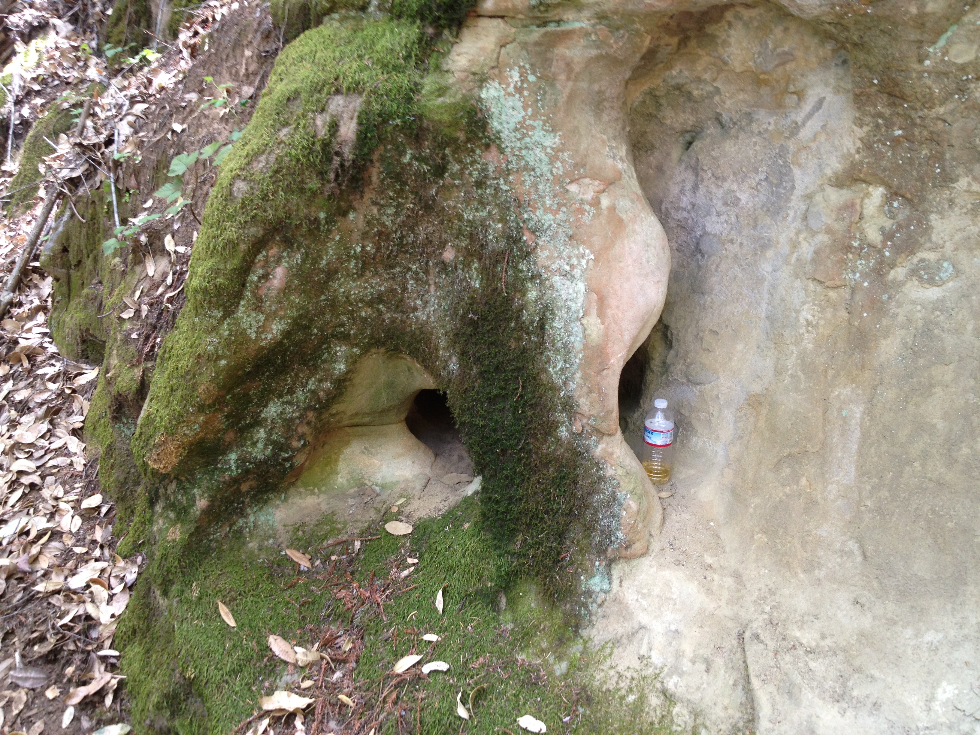
Eventually you’ll “hang a left” and see some sandstone formations.

This one looks like a face. My water bottle was placed there for scale. (One friend asked what was the colored stuff in the bottom of the bottle! It’s a Nuun Electrolyte tablet. It is not a lab sample…
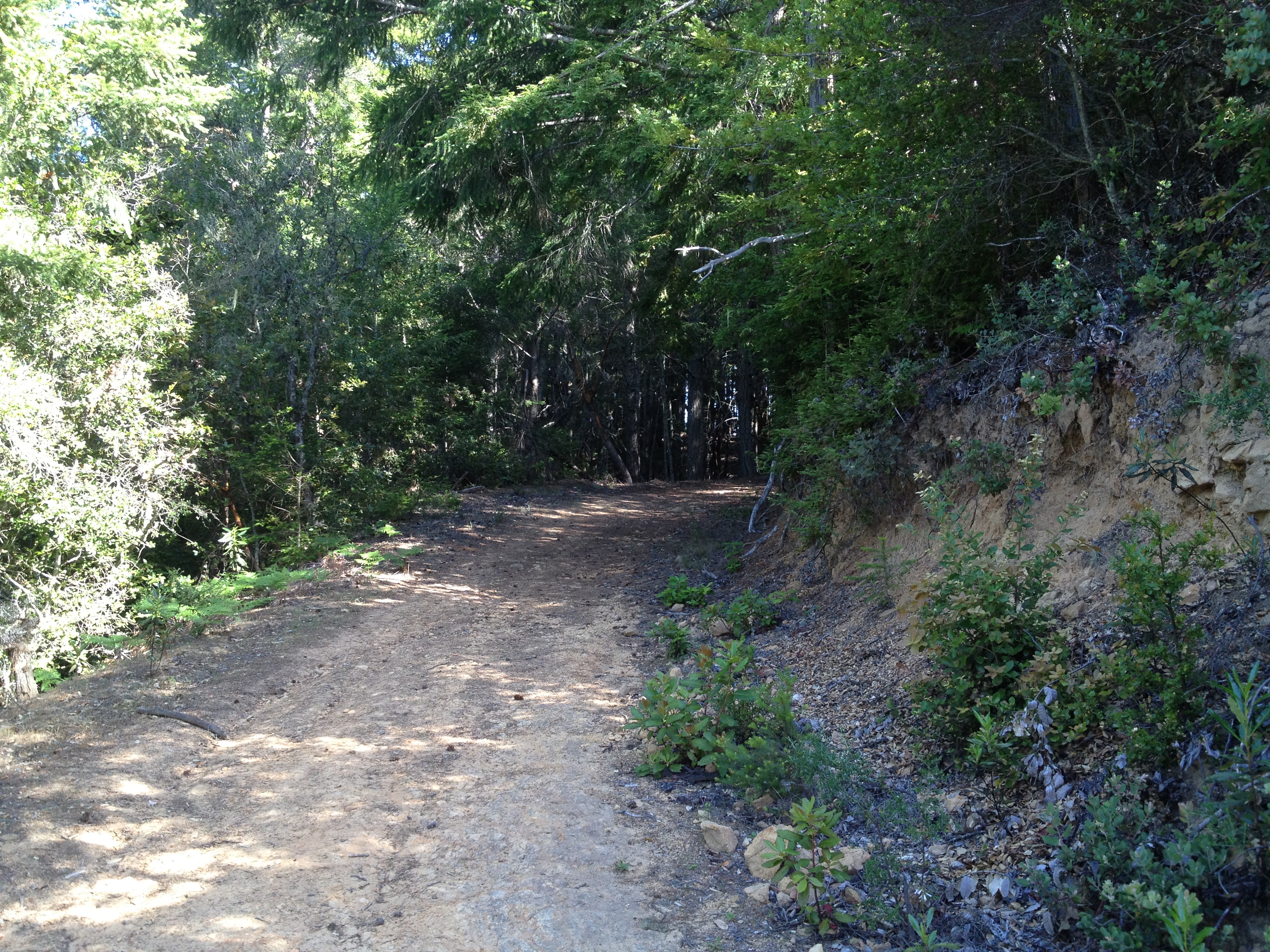
…and more typical views of the trail:
If you choose to continue to the north-west like I did, along the park’s boundary, you’ll eventually see a crossroads down to the main (lower) part of the park. If you REALLY want to “get remote” and do another few miles of even steeper dips…

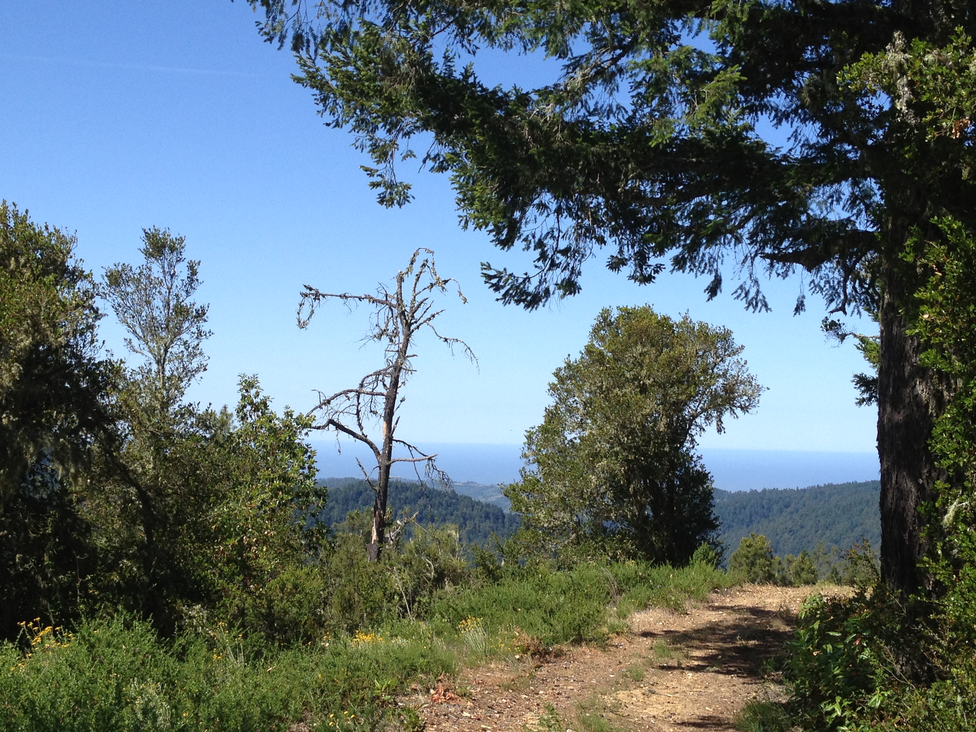
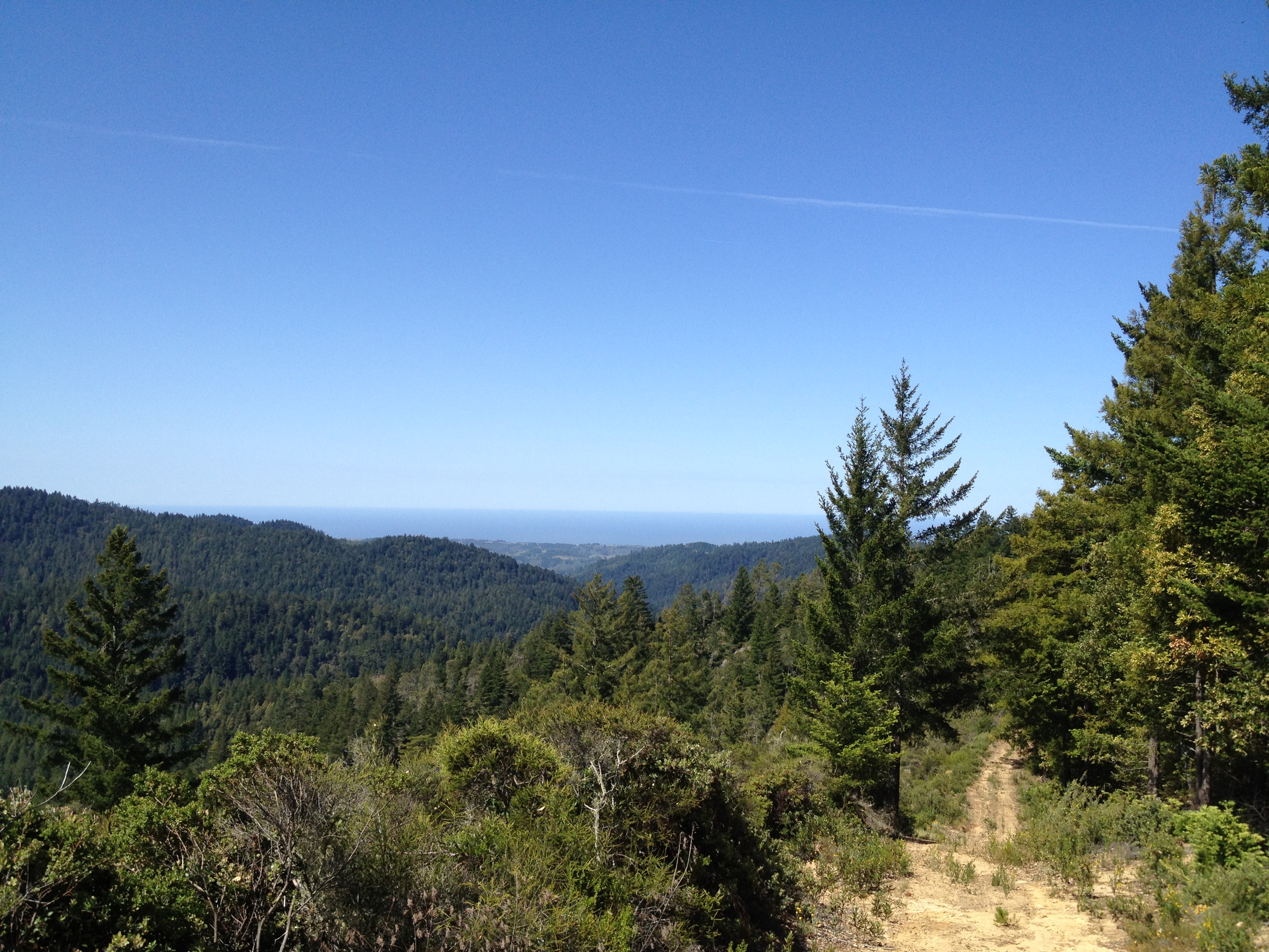
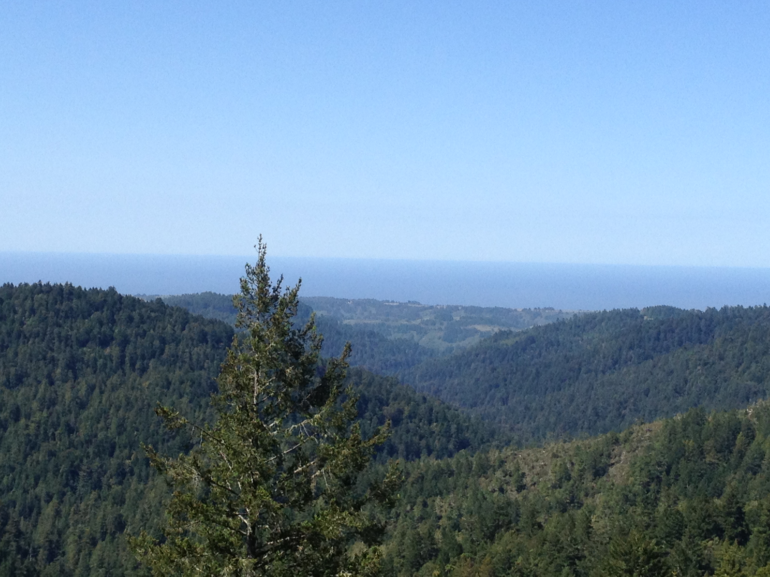
You should (weather permitting!) be rewarded with some magnificent ocean views!
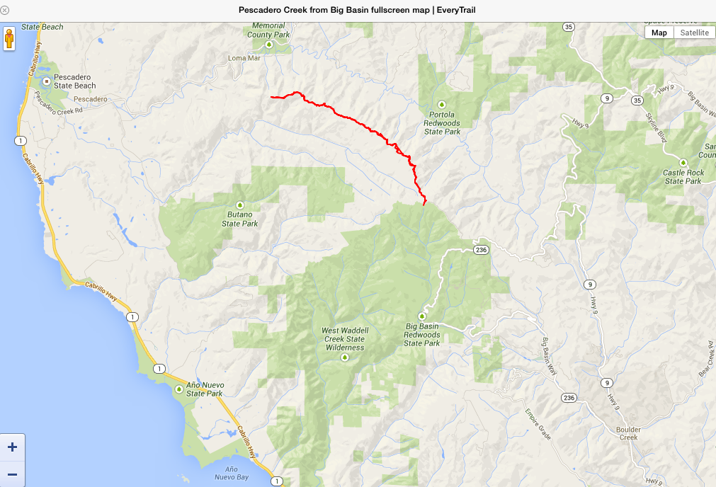
It’s a hilly roundtrip hike of 15+ miles:

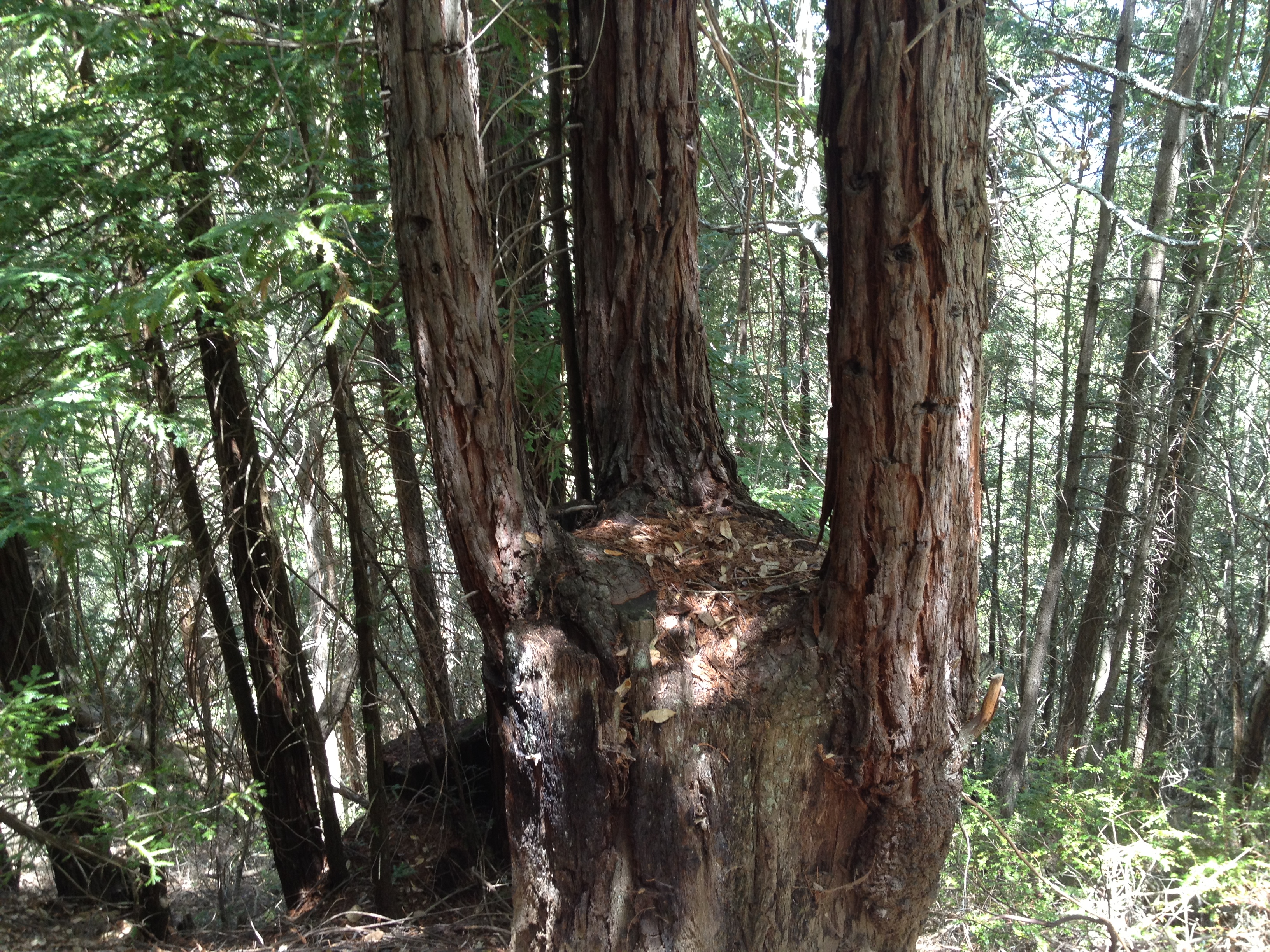
You may even spot this odd stump with 3 significant “children” growing out of it:
That’s it! Enjoy your “no crowds, no entrance fees, and no drinking water” hike from Big Basin to Pescadero Creek Park.
Also consider a bit further down the road you parked on is Big Basin’s “Johansen Road” trail, as well as an even more obscure easement into Butano State Park. http://www.parks.ca.gov/pages/540/files/BigBasinRedwoodsFinalWebLayout030311.pdf
and http://www.everytrail.com/view_trip.php?trip_id=2061281
There are also 2 other awesome hikes not “too” far from here. You’ll have to surf a bit (or drop me a note) to find those entrances. “Beverly Hillbillies crude oil” https://alpharoaming.com/2013/08/31/up-from-the-ground/ and Peter’s Creek remote old growth redwoods! https://alpharoaming.com/2013/09/16/peters-creek-old-growth-redwoods-portola-redwoods-state-park/


")


Great story! Always enjoy reading about your adventures. I miss hiking this area.
Thanks Steve! I wish I were a bit closer to the Sierra sometimes!