
Back a few years ago, when I first started using Strava, I followed alot of local cyclists to discover interesting new routes, preferably with wide shoulders and few cars. One of those routes I spotted was Schulties Road and Redwood Lodge Road. These roads are on the Santa Cruz side of Summit Road, east of Highway 17.
It was a beautiful ride back in 2015, and it became even more interesting when the road suffered multiple mudslides during the winter of 2016-2017. They have not been repaired in 2 years, and Santa Cruz County has no immediate plans…
Here is my previous blog post, from 2015, with a few different pictures, plus Holy City: https://alpharoaming.com/2015/11/17/schulties-road-and-the-laurel-train-tunnel-los-gatos-mountains/
Bicycle up Old Santa Cruz Highway from Los Gatos, or park along Summit Road, for an easier day.
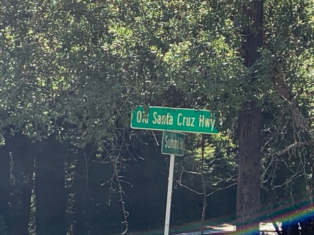
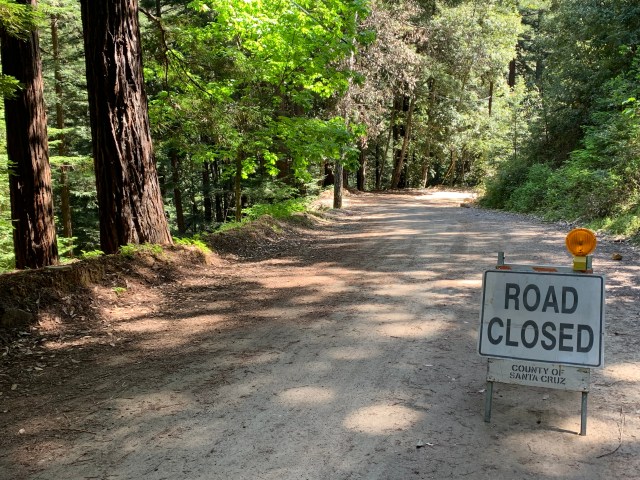
Where Old Santa Cruz Highway meets Summit Road, you’ll see the sign, below. It politely tells you that going straight is not the way to get to Santa Cruz. Go straight!
Head slowly down some bumpy pavement. When you get to the fork in the road, take it! (left)
It’s closed to cars. Keep peddling, I hear banjos! There are a total of four places where the road is not passable by cars, but fine for cyclists who can carry their bike a few hundred feet.
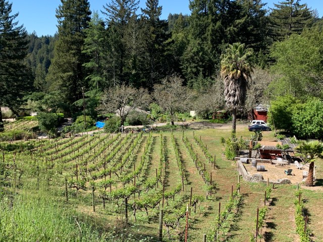
Below is a beautiful scene, from the road, where SoCal palm trees meet NorCal redwoods and grapes.
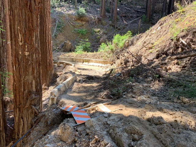
Another warning, before the first closure, below. The really bumpy pavement becomes packed dirt. I took it slow on my 23mm skinny tires, and it was fine/
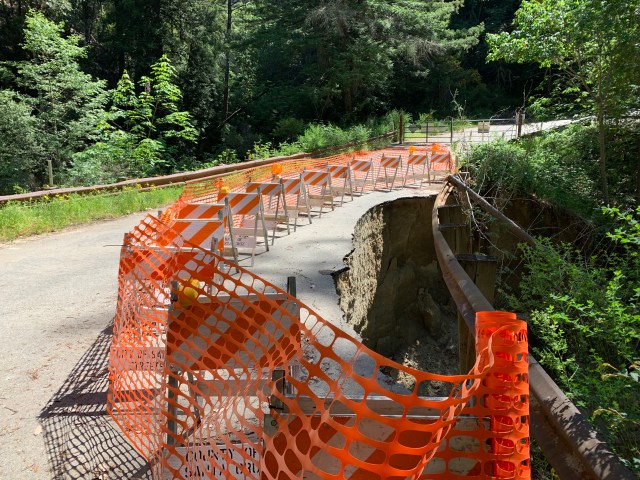
OK, so here you are at the first closure. An easy hike-a-bike, if it hasn’t been raining recently.
The same closure from the other side. You can see where the slide came down the hillside. The below truck is owned by a family that is stranded between two closures…and has been for two years! Their truck takes them a short distance from their driveway to where they need to walk to get anywhere.

The second slide I did not get a picture of, but the local residents have made a nice little log plank to make the walk easy.
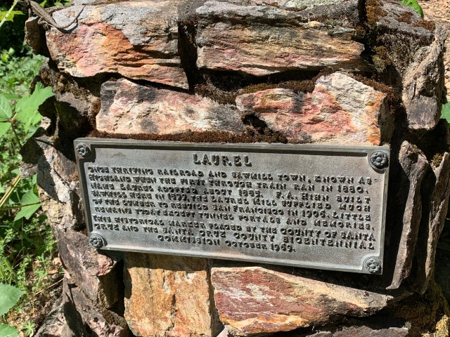
After that, you’ll arrive at the former town of Laurel. It used to be timber harvesting town. It now has only a few homes, and an abandoned train tunnel, back behind that telephone pole. (Private Property.)

In Laurel, take a left onto Redwood Gulch Road, and descend a bit more, past additional “Road Closed” signs. You’ll come across the below scene, where the road appears to dead-end into someone’s driveway. This is your third closure of the day! Walk to the right of the vehicles, behind the middle orange cone. 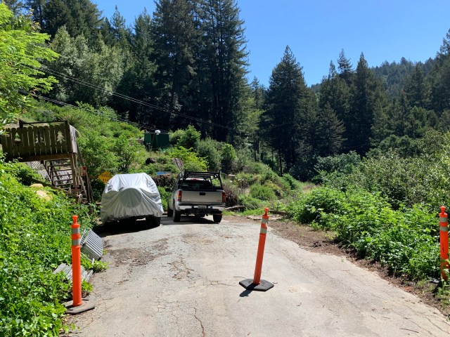
It feels like you’re walking into someone’s yard, but that’s where the road was. The steep, but clearly defined path is there, and I waived to the homeowner as I passed.

Down, down, down you go, to the fourth closure of the day.
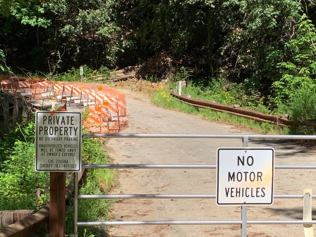
Rideable with a bike, but too narrow for cars, and gated on both ends. The Private Property sign, below is puzzling, on a public road. Possibly it refers to the land to the left.
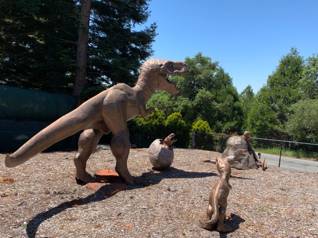
Redwood Lodge Road is quite steep after this final slide, eventually taking you out to Soquel San Jose Road. Go down SSJ Road a bit, and turn left on Stetson Road. Dig out your navigation device, and make your way up to the historical Skyland Church. http://skylandchurch.com/ (The dinosaurs are across the street!)

The church was built in 1891, which is quite old, in California terms! There is a bell tower in the parking lot, to the left. On the clear day I was there, Monterey Bay and the Monterey Peninsula were visible to the left of the church (below)
From the church, you can close your loop back to Highland Way and Summit Road, including a stop at the Summit Store’s outdoor tables. (Check out the single slice pies and cakes, next to the coffee counter!) https://www.summitgrocerystore.com/
More info: Ray Hosler’s ride on Schulties Road, in early 2017, right after the slides. https://rayhosler.com/2017/05/21/santa-cruz-county-still-digging-out-from-winter-storms/
Ray’s more recent ride, which reminded me to go again! (He always talks about Jobst Brandt. Jobst was a local local cyclist who did alot of long and interesting rides.) https://rayhosler.com/2019/04/14/two-roads-immortalized-on-jobst-rides-fading-away/
A big PDF of the church’s history, published a few decades ago: http://skylandchurch.com/wp-content/uploads/2014/01/Skyland-Church-the-First-Hundred-Years-Fast-Web-Searchable.pdf
If you want to see what inspired me to seek out 8 train tunnel portals, in one day, read this! (I drove from one to the other!) http://coursetrained.blogspot.com/2008/08/lost-tunnels-los-gatos-to-santa-cruz.html
My Strava track, starting and ending in front Burrell School Winery, near the Summit Store. https://www.strava.com/activities/2359880228


")


