
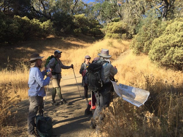
Back in August, I saw a post on the Henry W. Coe State Park Facebook page, asking about doing Mt Sizer. The first bit of advice was NOT IN AUGUST. After answering some questions, we decided to do gather a few friends and do it in October! So it began…three of my friends, and two new ones I hadn’t met yet, arriving at the Henry Coe HQ parking lot at 8AM in mid-October. (I also planned to do this hike before the end of 2018, to qualify for the “SixPack of Peaks” challenge https://sixpackofpeaks.com/#howitworks so setting a date was a helpful motivator!)
It was my 10th time doing Mt Sizer (once with a loaded 60 pound bicycle https://alpharoaming.com/2013/10/05/bikepacking-henry-coe-state-park-day-1/) My three friends had all done it before. It’s a challenge every time…especially since we were experiencing a heatwave that day. It was forecast to be 85F in Morgan Hill, and likely a little more on the ridges of the park. One friend bailed-out due to the weather, and one woke up with a headache (really…?)
First stop: Frog Lake! (Yes, somebody drained the swamp.)

After peering over the edge, down into the valley, where the “Shortcut” is, we went down…to the bottom. We spent a few minutes discussing how dry it was. I looked a few feet downstream, where I had seen hundreds of hibernating ladybugs in the past. That spot was empty, but we did see a few random ones flying around.

OK, check your clocks, and record your uphill “creek-to-bench” (C2B) time. It’s about 1500 vertical feet, over ~1.2 miles. (A Geocacher started measuring his C2B time, so others now do too. I also use it to record my 9 prior visits: https://www.geocaching.com/geocache/GCFD2F )
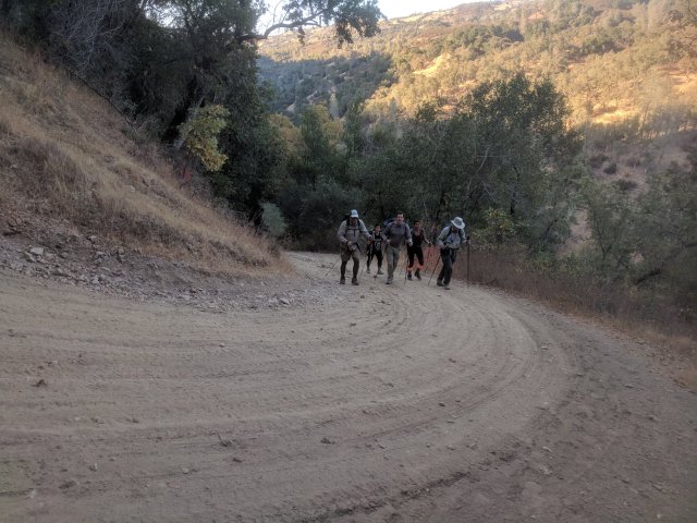
The picture below, unlike most, really does show how steep the road is.
Finally…THE BENCH! My time was “acceptable”, being 3rd out of 6 in the group, and because my “hiking mojo” has been low for the past year, or so. My lungs were not complaining, like they usually do…it was my legs this time!

I actually didn’t take a picture of “the summit”, as it’s not much more than a bump on Blue Ridge. The scattered pine trees on the ridge provided a little shade!

Looking down a side road, to the east, from near the summit: (That’s me, on the road, looking like part of the tree trunk!)

After awhile, we turned right onto the Jackass Trail, and headed downhill to Poverty Flats, where we would experience our second big climb of the day.
The fall foliage was in full color! (This being the dreaded Poison Oak!)

We paused for a bit at Poverty Flats, but not long…we calculated that we’d be running out of daylight. Up we go!

Below is a park sign, at a trail intersection. We’re still about a mile from park HQ and our cars.

That’s it! About 18 miles and 4000 vertical feet, over the course of 11 hours.
Strava GPS track: https://www.strava.com/activities/1917472612
Aerial flyover: https://www.relive.cc/view/1917472612
Facebook link, with photos: https://www.facebook.com/phunti/videos/10155962862946376/
Additional info from a friend, who hiked it awhile back: http://calipidder.com/wp/listing/henry-coe-mount-sizer/
I didn’t take many pictures myself. Many of these photos were used, with permission, from www.DryFJ.com and Sam D. Thanks!
THE END!


")


Congratulations! It’s ahead on the Nifty Ninety Peak Challenge for us. Poison Oak so pretty when red like that, wicked stuff!