
Head south from Big Sur or head north from the Hearst Castle on California’s remote coast, between Los Angeles and San Francisco, and you’ll see these amazing views. Up close you’ll also see distracted tourists driving rented motorhomes at 30mph. Take your time and enjoy!
Immediately south of the scenic Kirk Creek Campground begins the Nacimiento-Fergusson Road.
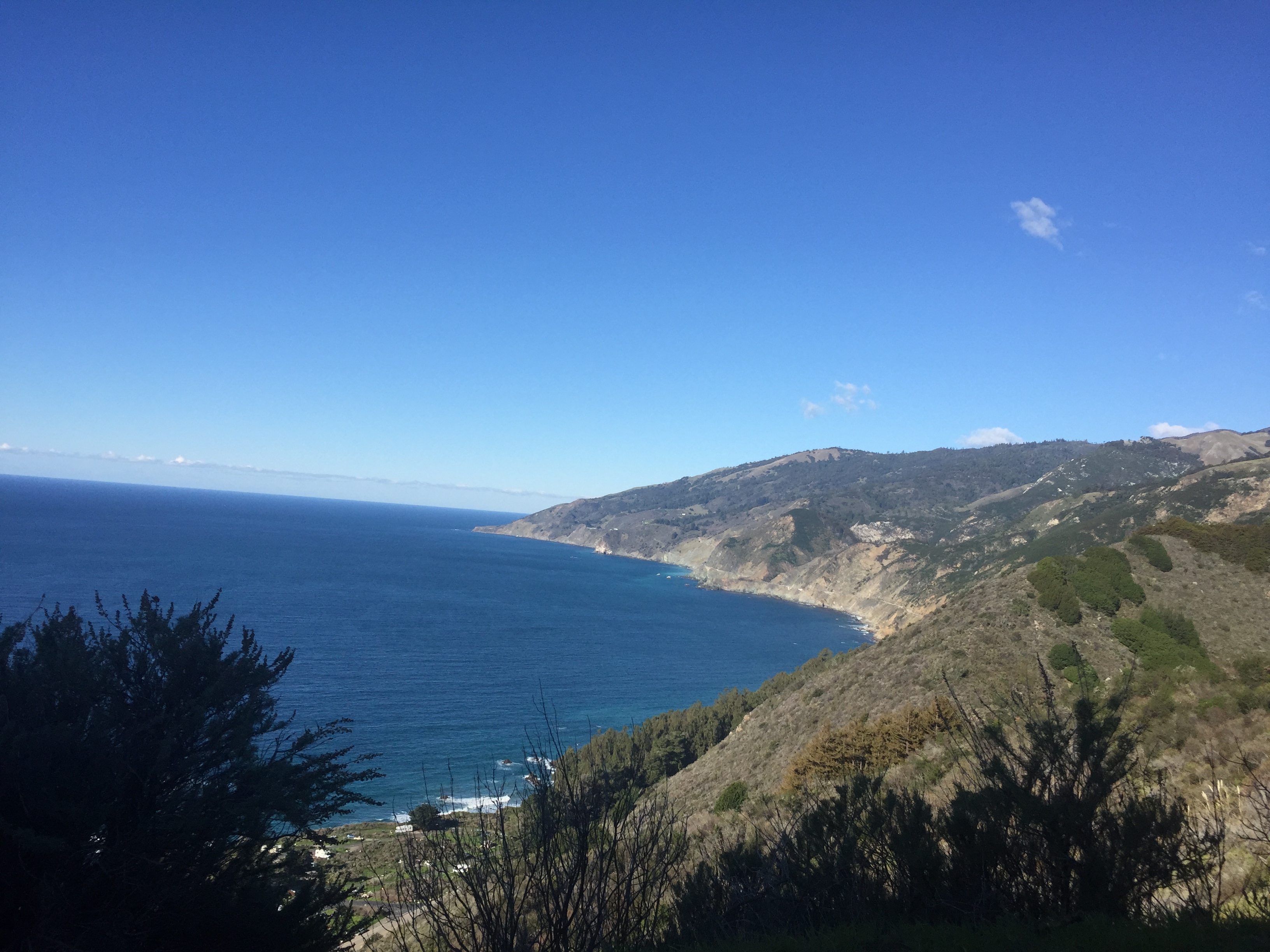
This road is the only road over the steep Santa Lucia Range http://en.wikipedia.org/wiki/Santa_Lucia_Range The road also provides great access to the mountains, along with some incredible views (without guard rails! Pull over for pictures and post to FaceBook later when you’re back in cell range!)

At about 3000 feet above sea level, you’ll come to a plateau and crossroads. (20 miles further east is the Army’s Fort Hunter Liggett. It’s open to the public if you have ID, insurance and registration for your vehicle. There, you can visit the very well preserved Mission San Antonio de Padua (1771) http://missionsanantonio.net/. There’s also the very cool “Hacienda Hotel”, open to the public and formerly owned by William Randolph Hearst http://fhlfmwr.com/hacienda.html


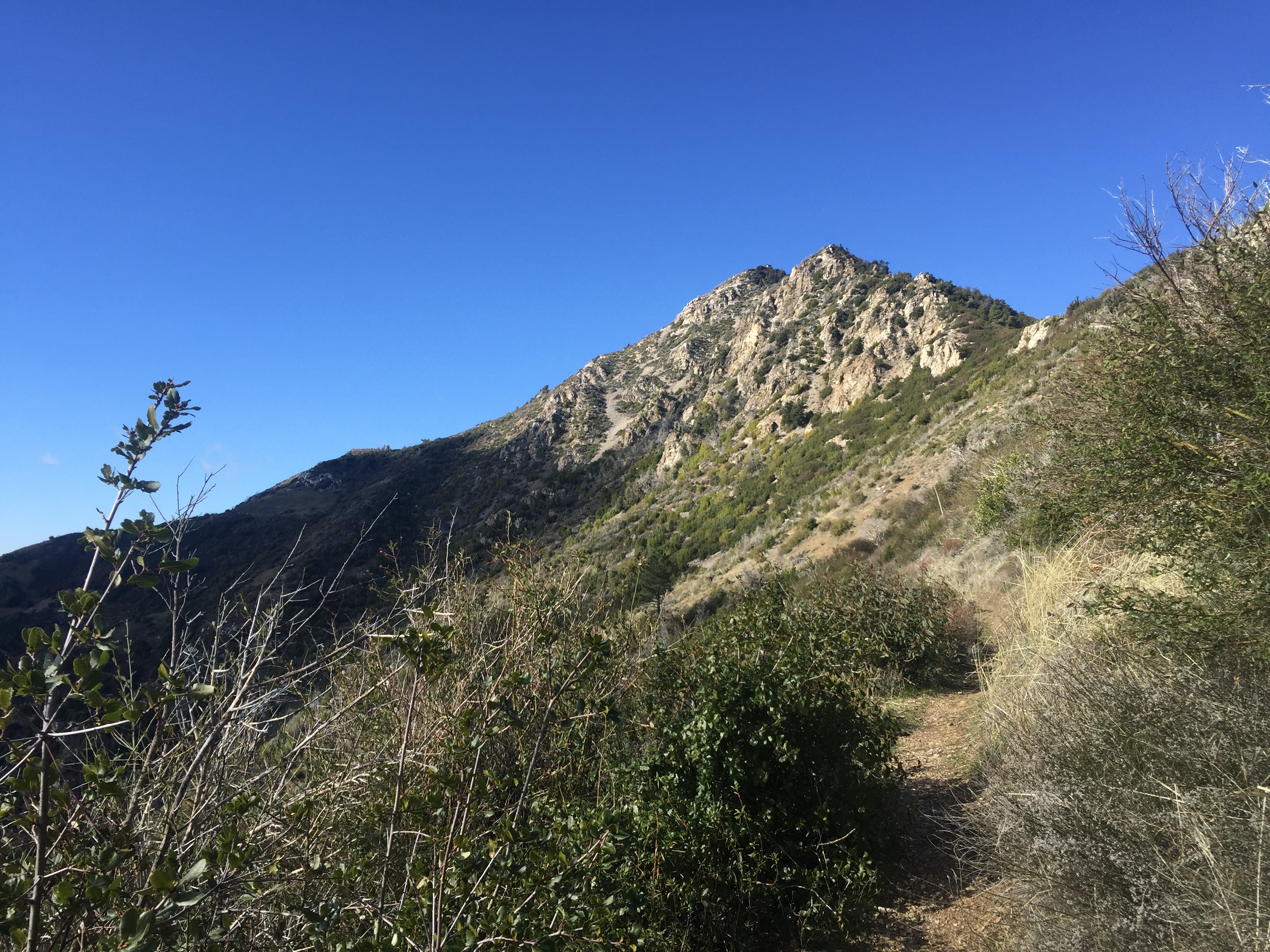
This crossroads is also the trailhead for my “bike-and-hike” up Cone Peak. It’s the second highest peak in the Ventana / Big Sur area and (according to Wikipedia) the tallest “coastal mountain” in the lower 48 states: over 5100 feet and only 3 miles from the ocean.
Below is the start of my journey. 7 miles of Fire Road, then 2 miles of steep hiking trail. I’ve heard the road is open in the summer. (It’s reasonable for a normal 2WD car to give it a try, though there’s no passing or turnaround space in many sections.)

A chilly day, with ice on the fire road in the shady sections. (The photo below is not actually ice. This section has white marble or limestone on the road and hillside. There was real ice…really…but I didn’t take any pictures of that)

The patch of white stone is visible below, in the distance, on the right side of the photo:

The views keep getting better and better!


After 7 miles of gravel road, at about 3800 feet elevation, it’s time to hide the bicycle in the bushes and enter the Wilderness Area on foot.

Yup! That’s the 5100 foot summit, with a teeny-tiny fire lookout building on top
Alas, 2 miles and ~1300 vertical feet (on foot) later, we reach the top and take a picture of the coast to the south, just like the one in Wikipedia! http://en.wikipedia.org/wiki/Santa_Lucia_Range

…and the summit lookout, which was very securely covered with heavy steel panels and strong padlocks. It’s not an “emergency shelter” if you’re up here in a blizzard (without bolt cutters).

And a view due west, with the surf being only 3 horizontal miles away.

Did I mention it was 30F degrees at the top, with howling winds? California was experiencing unusually cold and windy weather. I was a bit underdressed for standing still, though the uphill climb made me quite toasty. Time to head down!

I was racing sunset a bit, though I had a good flashlight in my pack, if necessary, and the Fire Road is easy to follow. The sun looks low on the eastern side of the mountains

Back to the car, and a scenic drive down the hill. Remember “no guard rails!”.

Below you can see Highway 1 clinging to the coast:

My Strava track (plus 3 additional miles in the car until I remembered to turn it off!) http://www.strava.com/activities/234929657
Footnote: I was inspired to try this trip by reading Jill Homer’s recent blog post http://www.jilloutside.com/2014/11/cone-peak-getaway.html I had been unaware that I could go most of the way up a big coastal peak by bicycle. I’m also impressed with someone who came up from sea level by bicycle! Long sections of 10% and 11% grades, on a mountain bike, with camping gear: http://www.strava.com/activities/222946009 (No thank you, maybe another time!) I’ve read all of Jill’s books and recommend them if you’re interested in endurance racing in incredibly beautiful and challenging environments.
")


Last year around this time the road was still open!
Too easy! 😜 There was one huge downed tree about 2 miles in from the gate that will need to be removed before the gate is opened.
Well done chap. Nice post. I never made it up there. Not keen on 18 mile hike or riding my bike up either.
I think the Hacienda is closed to the public now. It was a few years ago anyway. We used to use it for an annual Eagle Watch/social trip with a kayak group, but had to switch to another location. The military had it booked out for officers.
That may have been a temporary booking. The web site still shows it’s open to the public. Worth a call to try!
Looks like a great trip! When I was there in November the dirt road was open (before the deluge of December, obviously), and even still we only saw two backpackers who weren’t even parked at the trailhead (the trailhead is where we camped.) Winter seems a great time to visit Big Sur and I hope to go back and do some hiking in the Ventana in the next few months.
Thanks for the mention. 🙂
Pingback: Big Sur – Exploring the Isolated Sections (Limekiln, Gorda, Kirk Creek) | AlphaRoaming