The Western Spine of Silicon Valley: Black Mountain (Montebello Open Space) to Alice’s Restaurant

IMG_6980

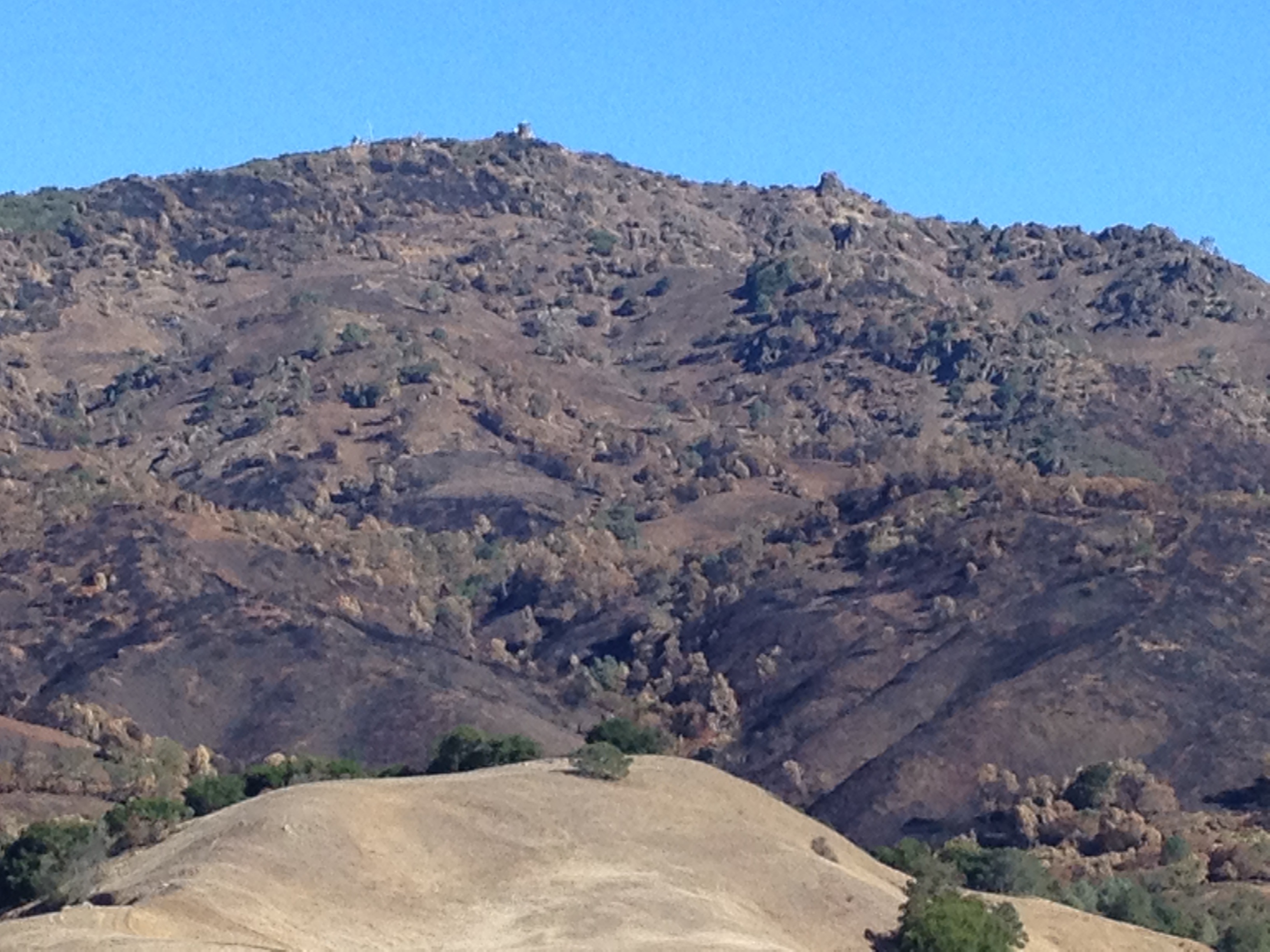
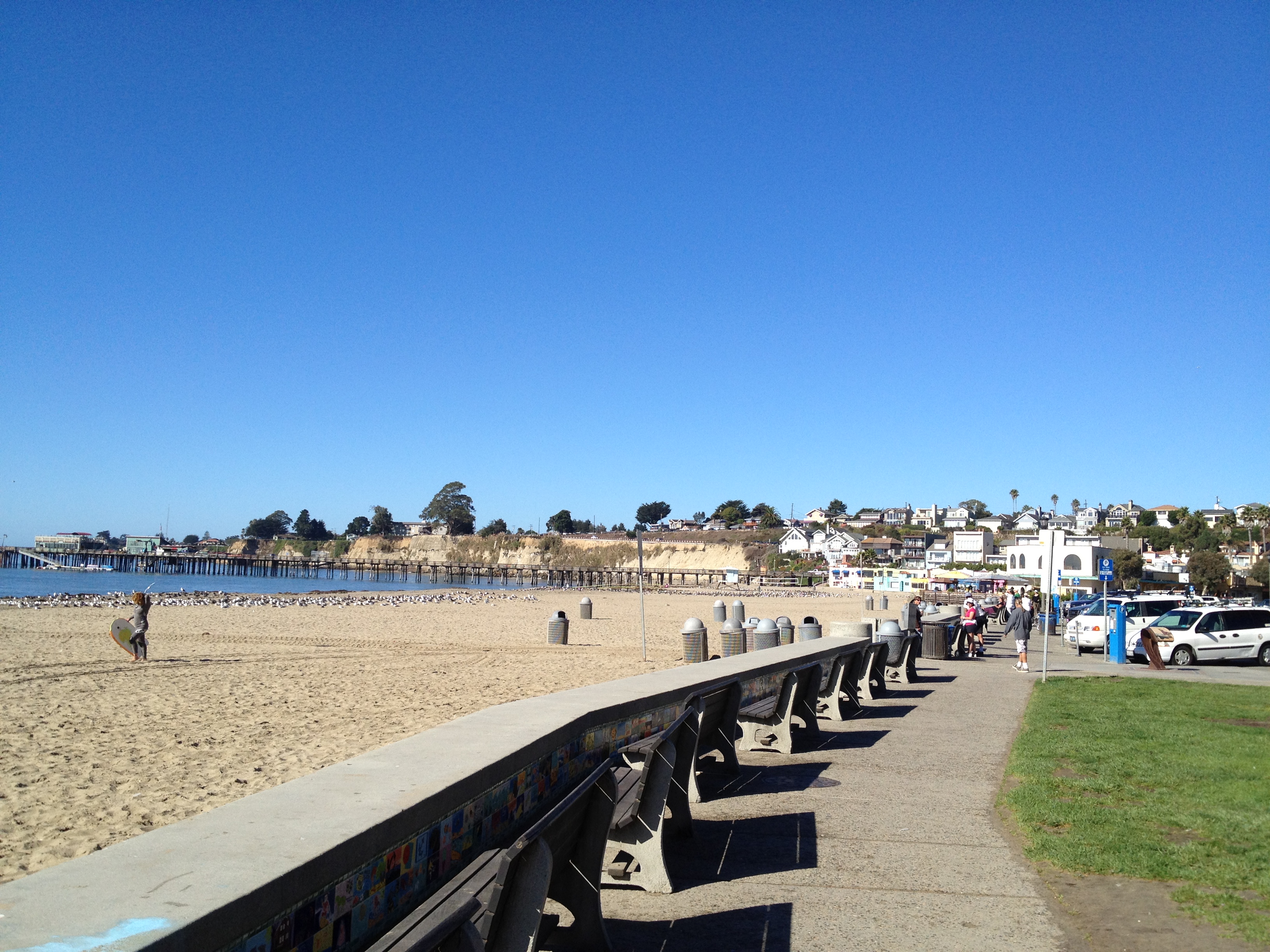
From down in Silicon Valley, the Santa Cruz Mountains separate the valley from the Pacific Ocean. From a distance it can look ominous. Up close you’ll see homes, a rock quarry, a few wineries, and some towers on Black Mountain if line of sight allows you to see beyond some smaller hills.

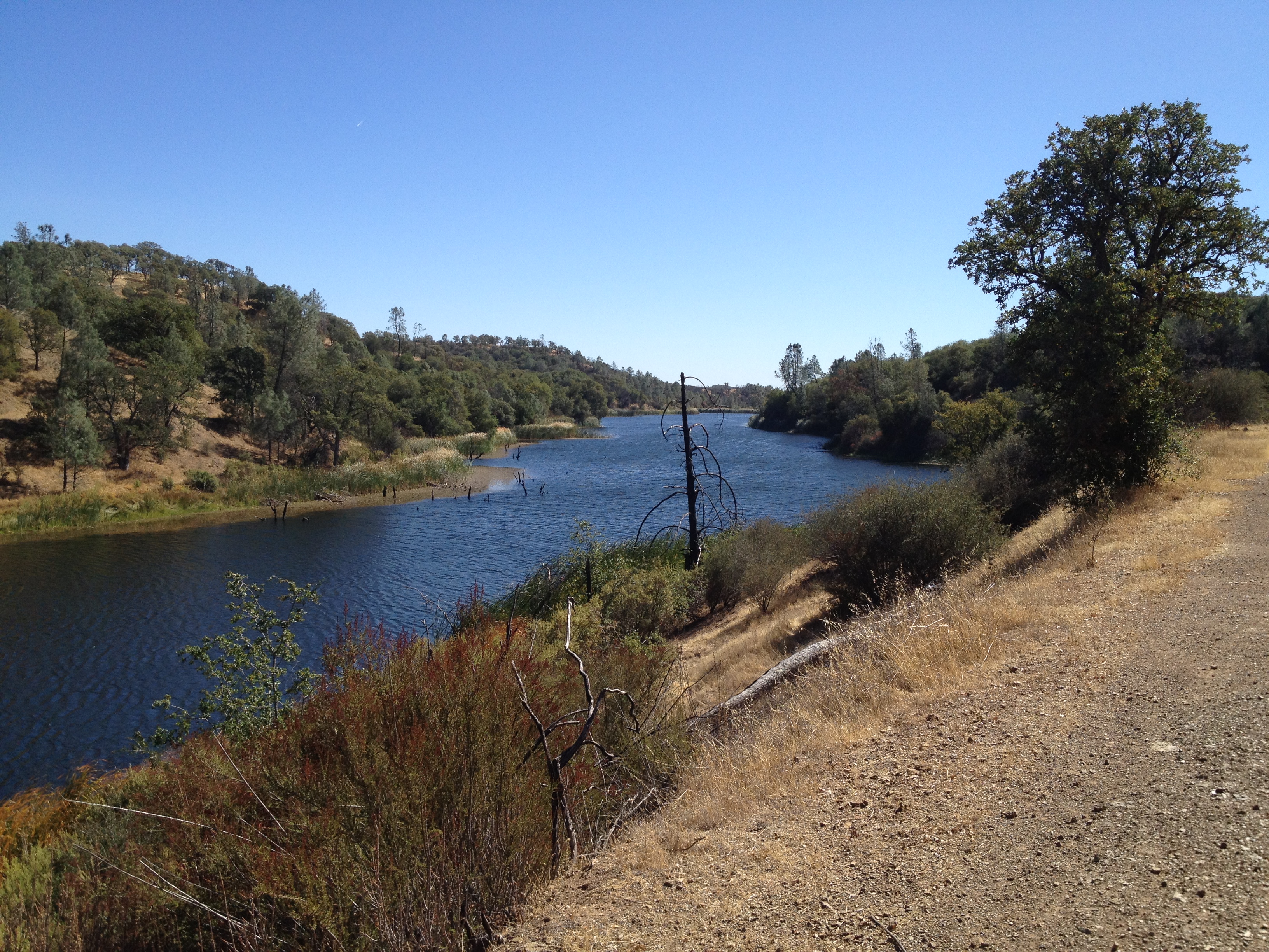
As you drive from I-280 and pass the Steven’s Creek Reservoir and the quarry, you’ll then see a right turn onto Montebello Road. Montebello Road goes up about 6 miles, past a few wineries, an old elementary school, and on to some magnificent views, but..there’s NO PARKING anywhere up there…unless you know who to ask!

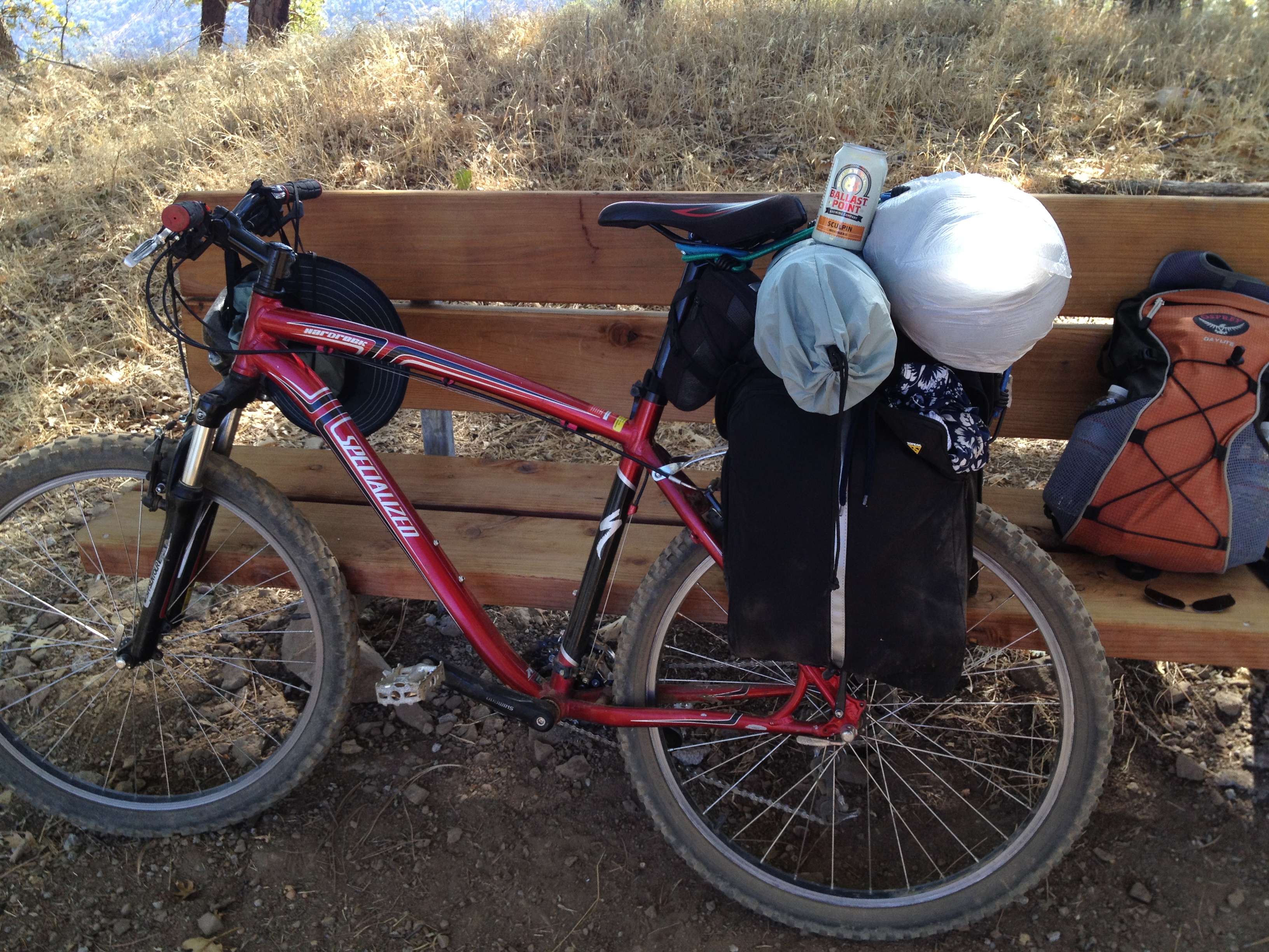
What to do? Bicycling from the reservoir is possible. I’ve done it a few times in a very steep 80 minutes. I have also asked Ridge Vineyards (http://www.ridgewine.com/) if it was possible to park there and take a hike. They seemed OK with it if you were there for the winery also. Unfortunately, they’re only open weekends!

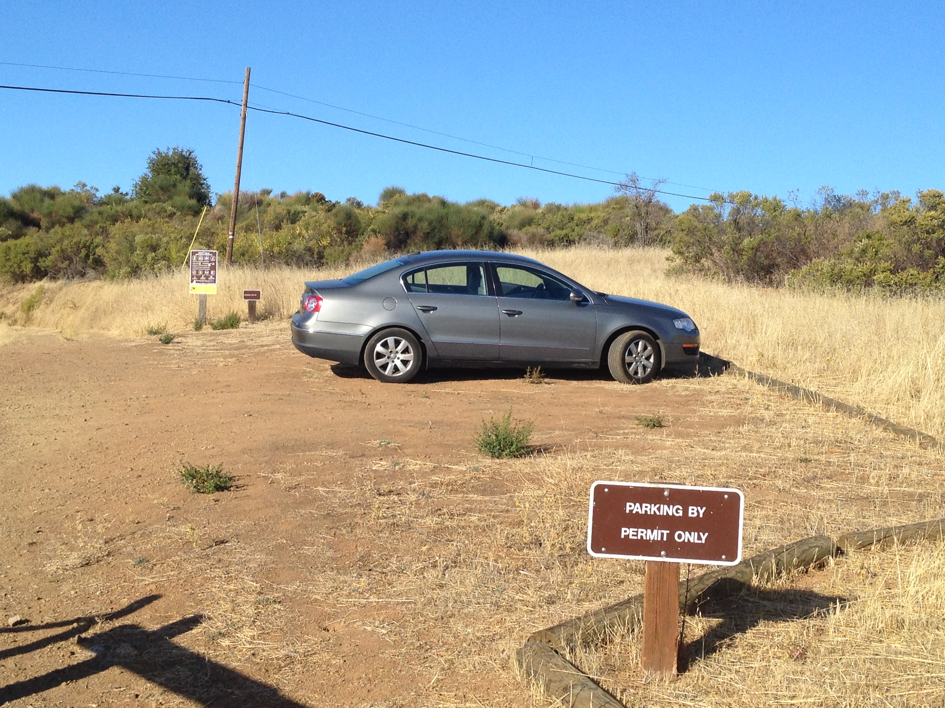
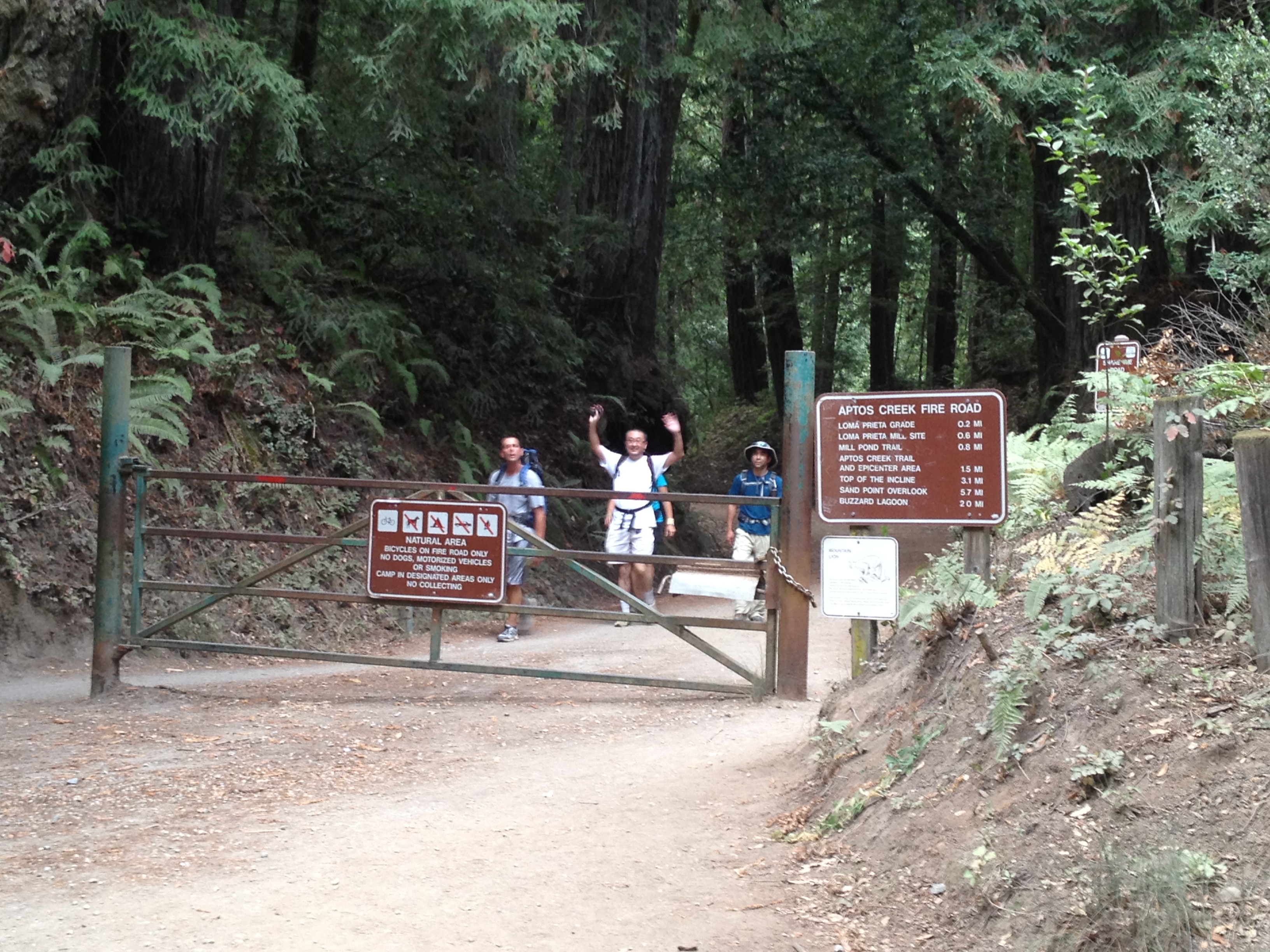
The “little secret” to easily access the trails up here is to apply for a permit for “Permit Parking Only” at the Waterwheel Creek parking lot. http://www.openspace.org/activities/permit_information.asp Fill out the form a day or two in advance, and you’ll get a printable permit by e-mail and the combination to the gate! You can park all day, during daylight hours, very close to the top.

IMG_6981

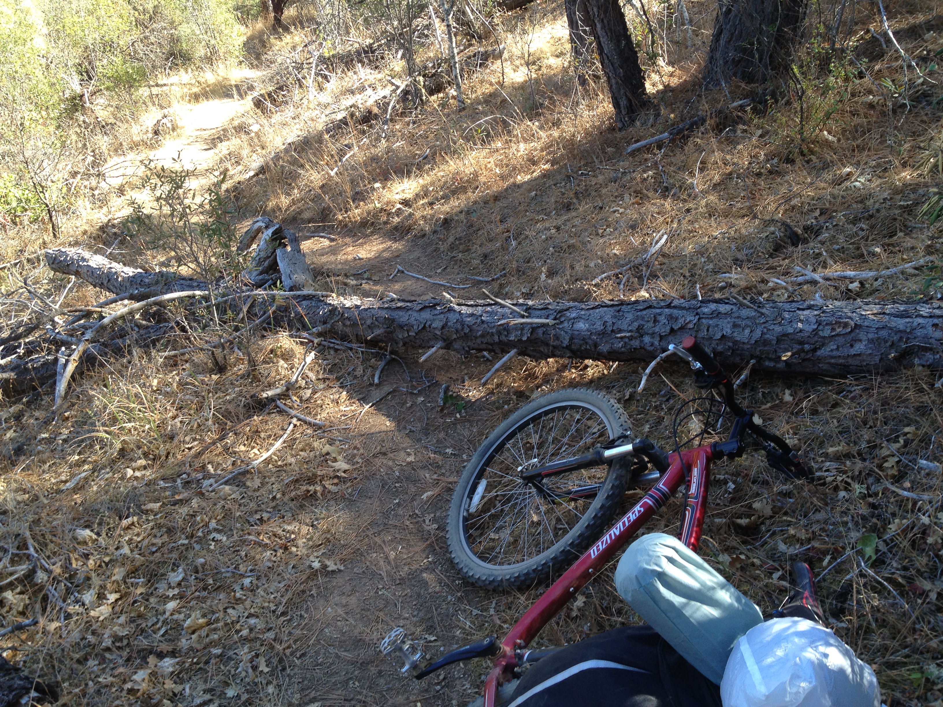
My goal today was to head north, either paralleling Skyline Boulevard on safe trails, or cautiously riding on the road itself. The road has little or no shoulder, but there are quite a few cyclists up there and not much weekday traffic.

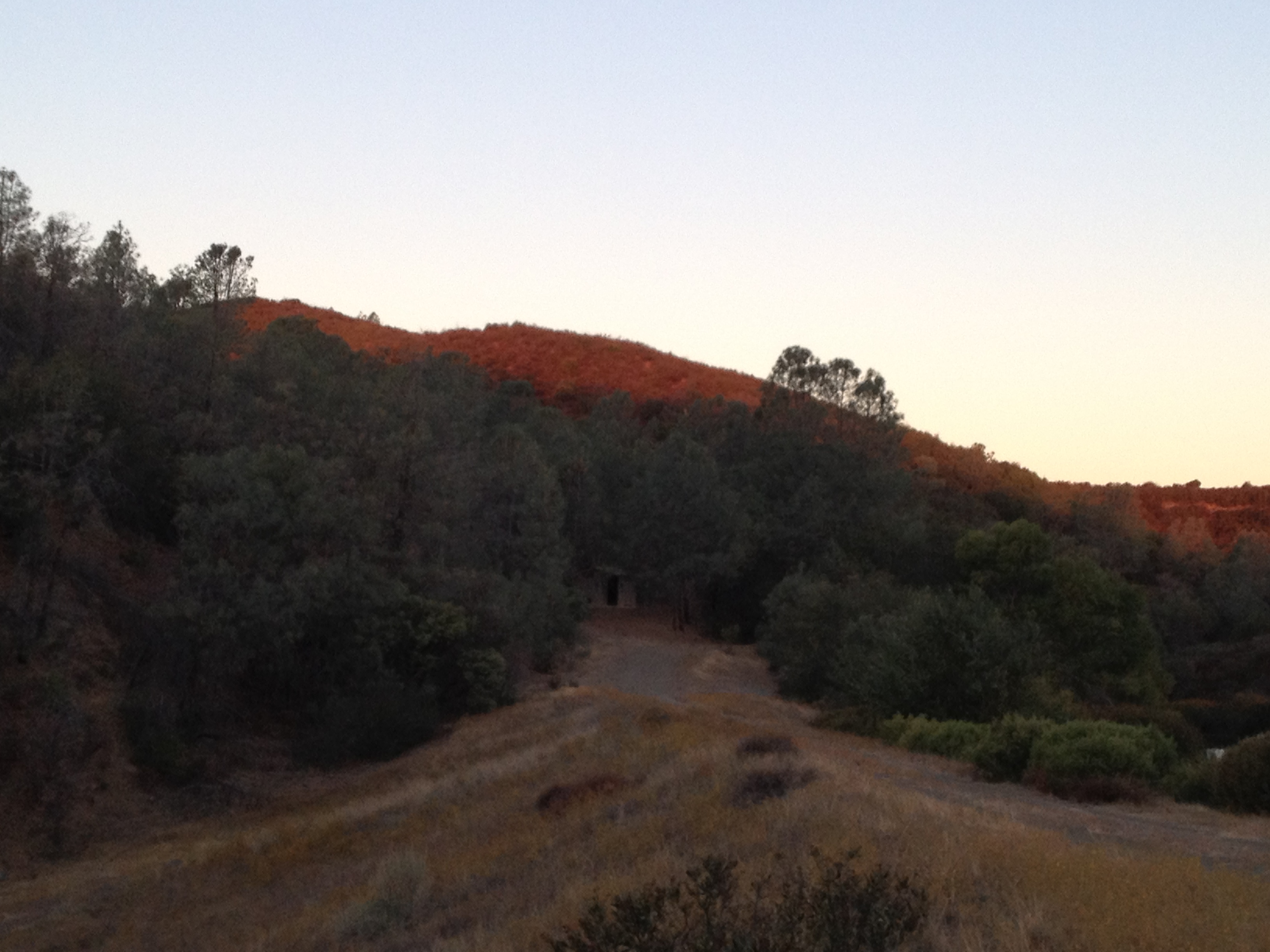
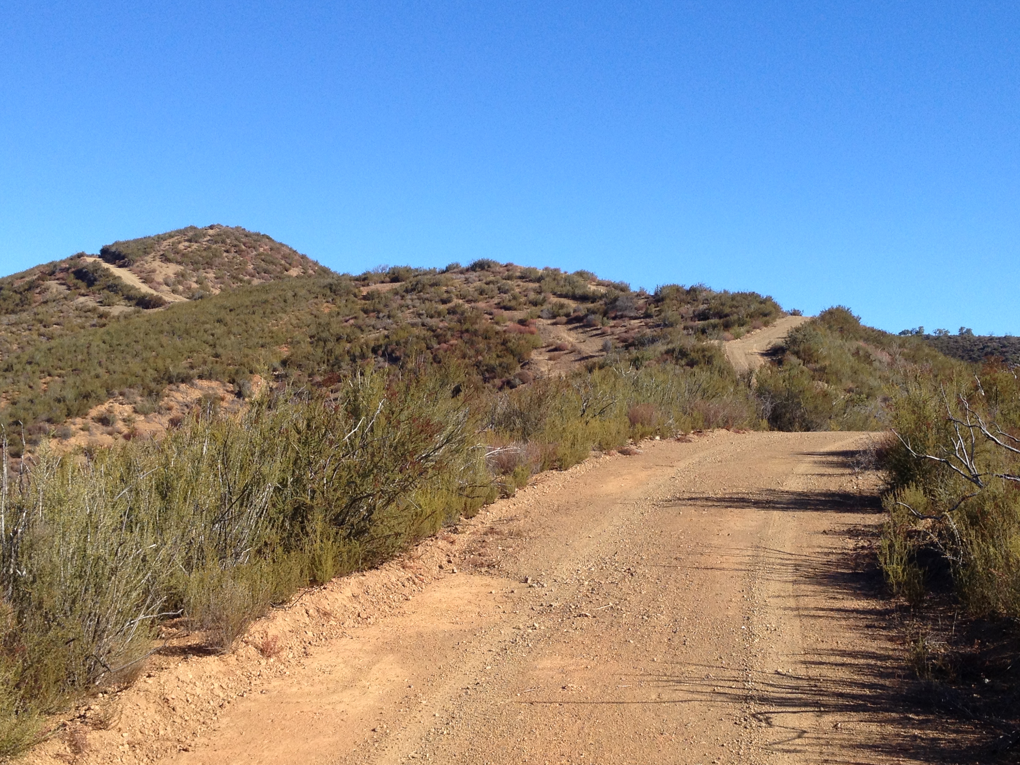
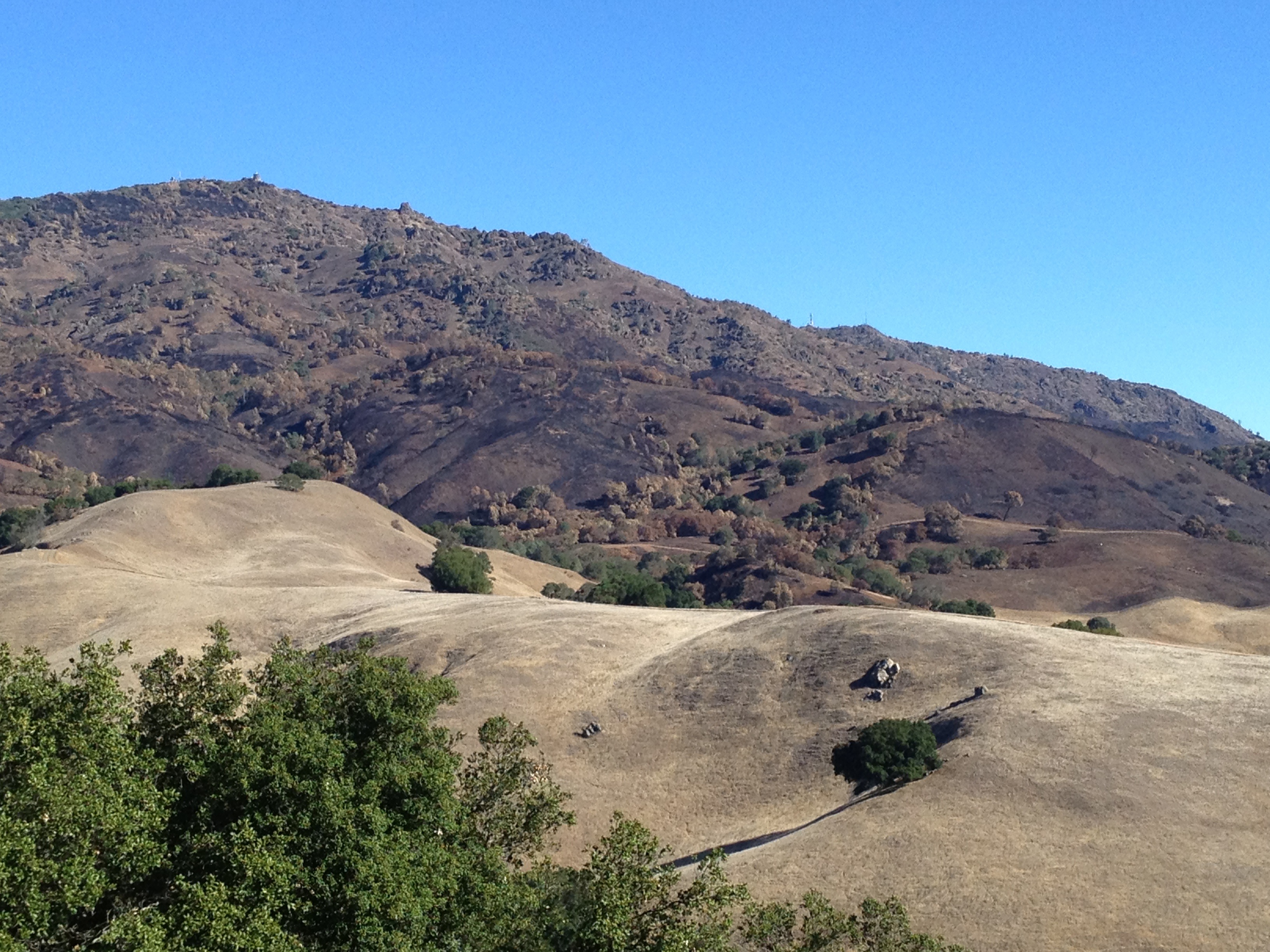
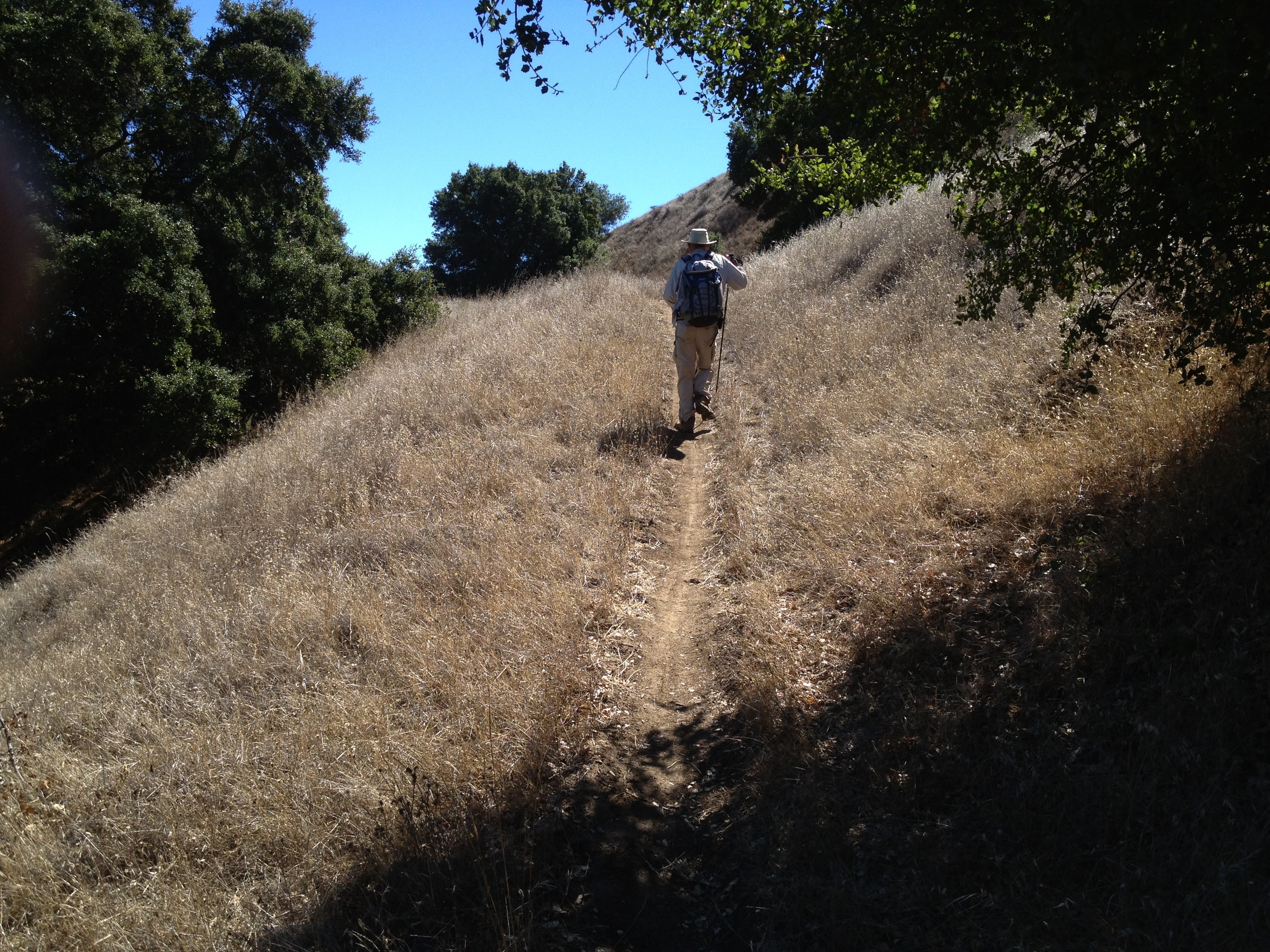
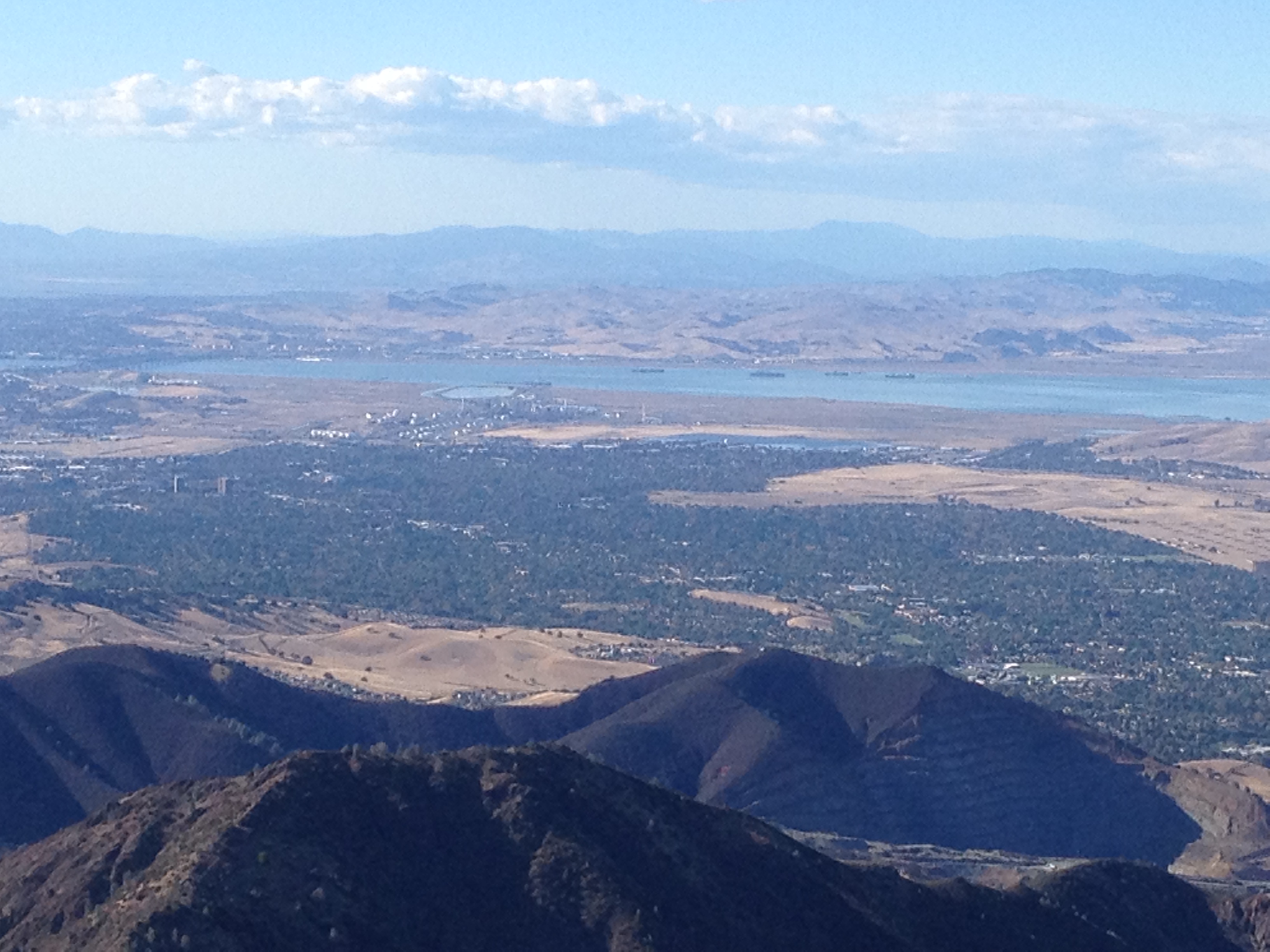
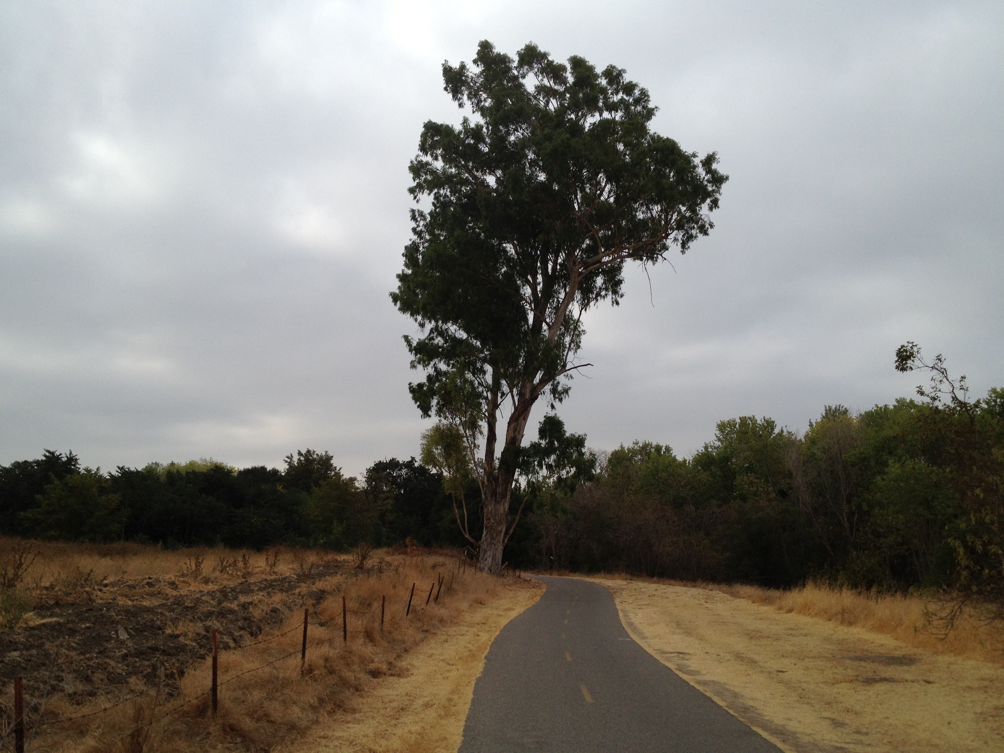
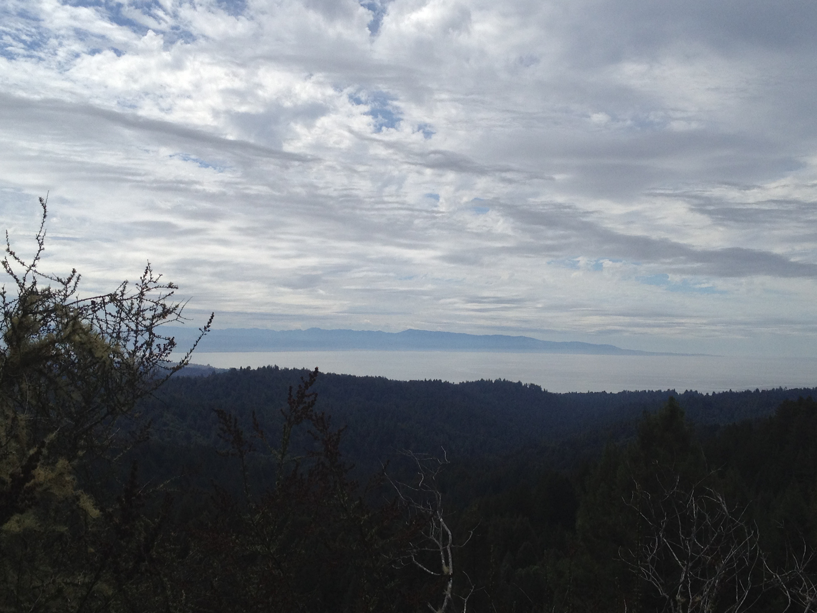
I left my car behind the locked gate at 9:00AM, and was soon headed up the remaining grade to the summit of Black Mountain. (The coast is out there, under a fog bank, about 20 miles away)

IMG_6988

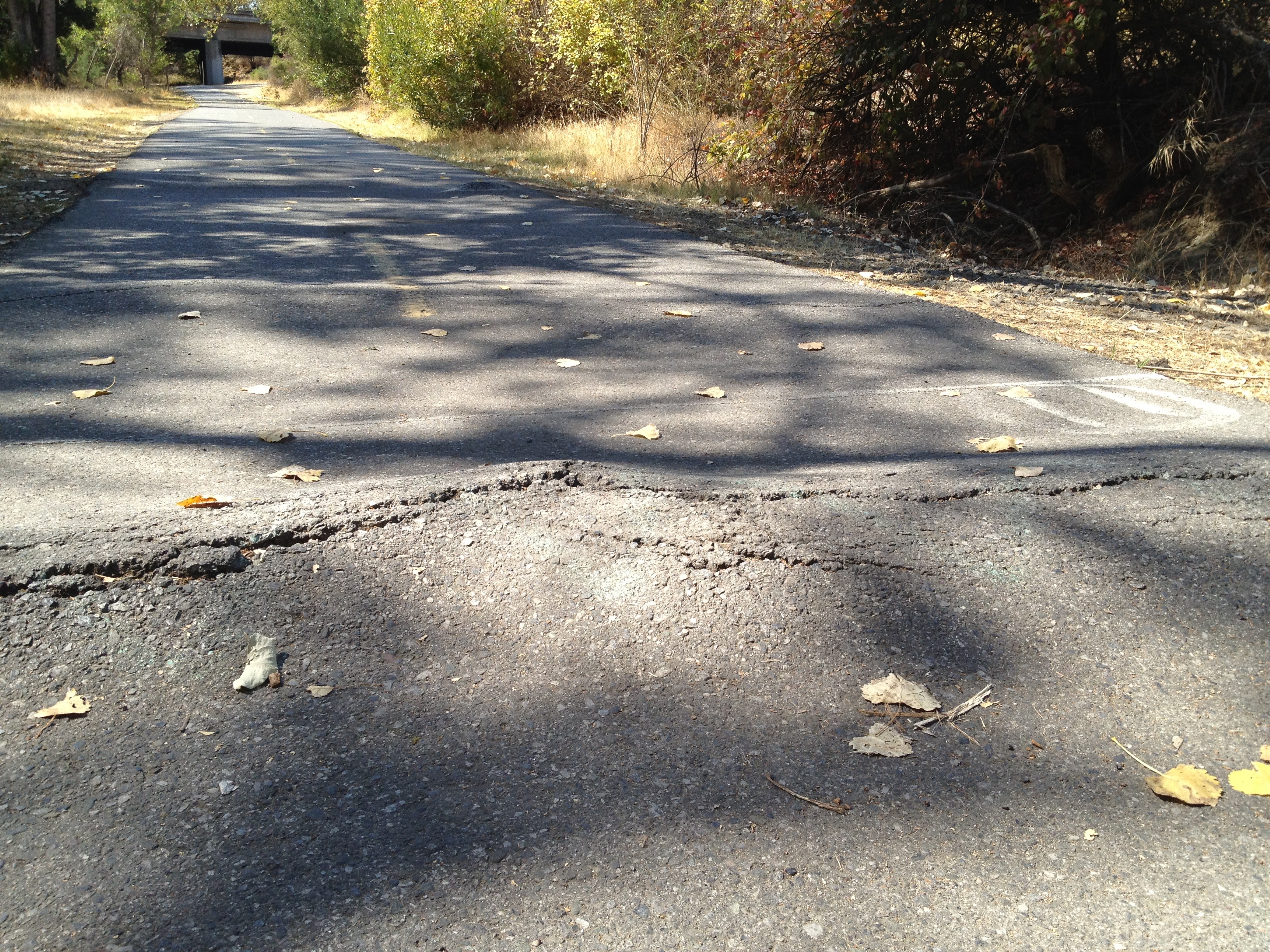
From there, it was mostly downhill or flat cycling to Page Mill Road (which is has a public parking lot), then up the road to Skyline Blvd. I decided to “go for it” on Skyline to go as far as Alice’s Restaurant http://www.alicesrestaurant.com/

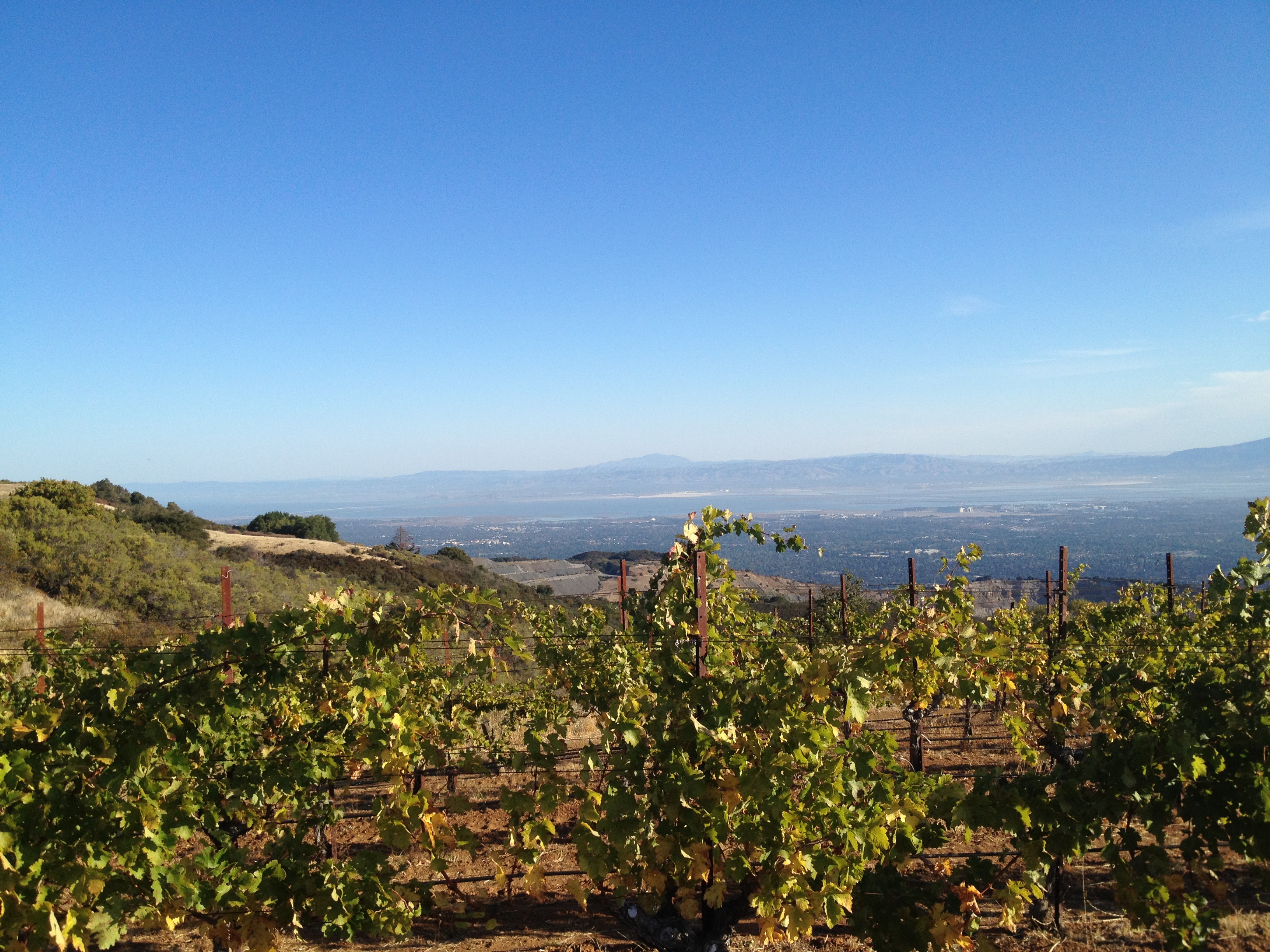
On the way I passed the Thomas Fogarty winery, with it’s attractive sign and vineyards visible beyond.

IMG_6995

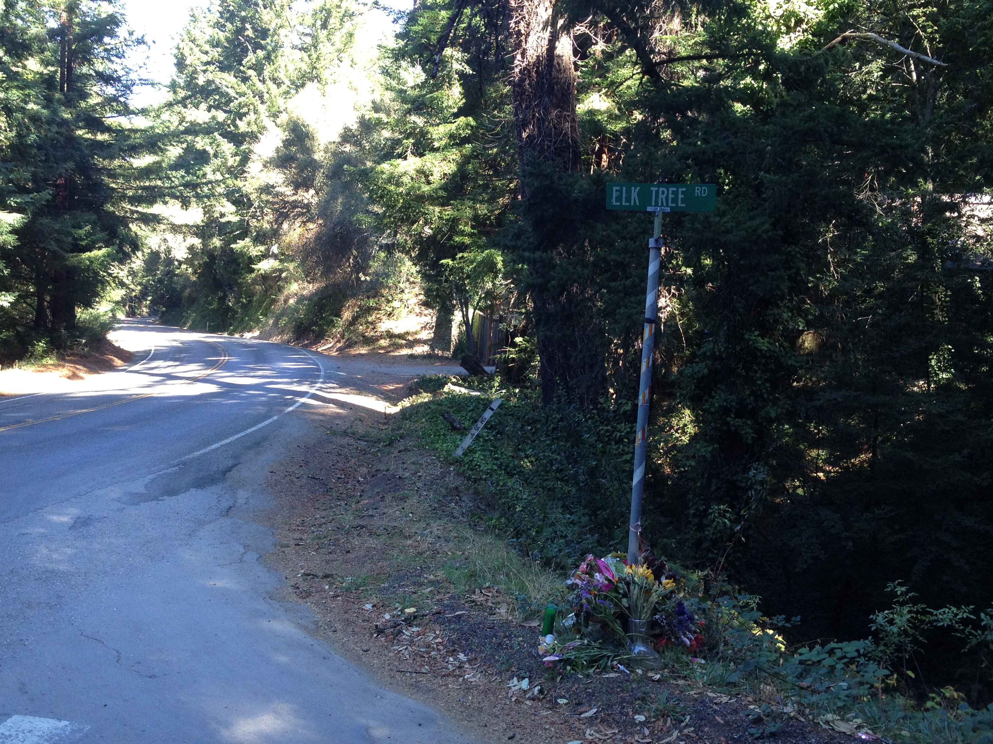
About a mile before arriving at Alice’s, there’s a steep and winding stretch of road where Joy Covey tragically died recently. She was the first CFO of Amazon, as well as playing other valuable roles in the early days of the company. An OnTrac truck (ironically delivering packages for Amazon!) turned left across her path as she was coming down the long downhill section. There were bunches of flowers at the base of the street sign. She left behind an 8 year old son. http://www.almanacnews.com/news/2013/09/18/bicylist-killed-near-woodside

IMG_7004

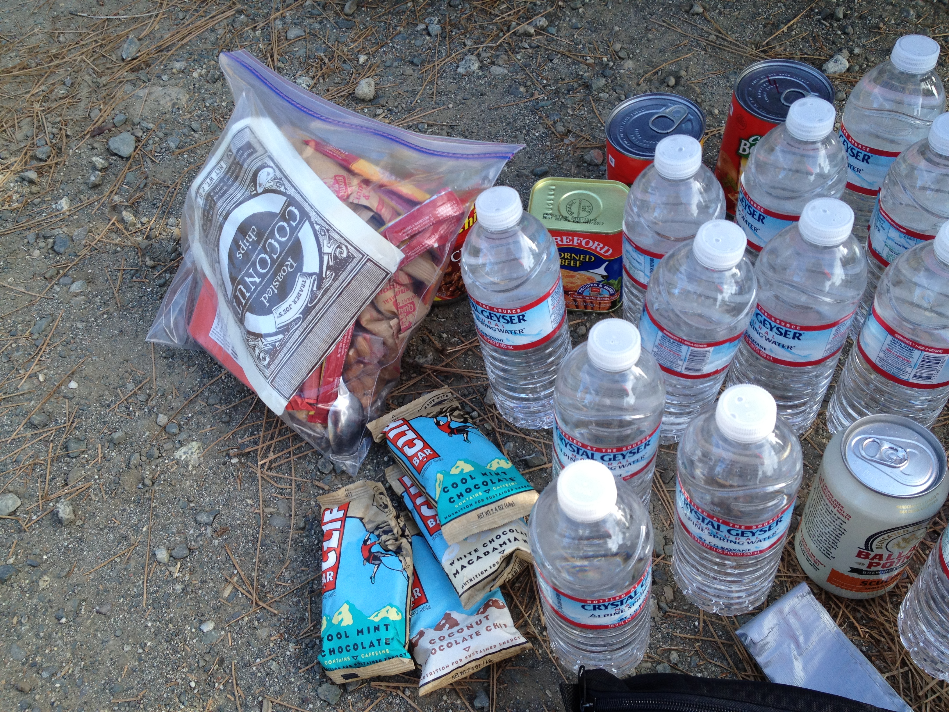
Onwards to lunch at Alice’s, and back the way I came!

– A beautiful autumn day
– A “secret” parking area
– A great bike ride
– A solemn visit to a fatal crash scene
– Lunch at Alice’s

Oh yeah..then there was this guy on a tree crew in Portola Valley who was carving a bear on his lunch hour! I’ve only seen this done up in the Sierra for the tourists.

IMG_7018

More Photos: http://www.flickr.com/photos/59666465@N00/sets/72157636671035746/

GPS Track: http://www.everytrail.com/view_trip.php?trip_id=2354850

Posted in Uncategorized | Leave a comment

Bikepacking Shakedown Cruise: Equipment & Gear Thoughts

Loaded 80 pound rig, near the top of Mt. Sizer. Panniers, tent, sleeping bag inside a trash bag, and a small Osprey Daylite backpack (and a sun hat near the handlebars, which fit snugly under my helmet):

IMG_6799

My first real BACKpacking trip was a bit over 35 years ago, and BIKEpacking is largely analogous to backpacking, except for the bicycle! (easy, right?) It’s important, though, because it’s a mechanical device than can break-down and you’re going a bit further than you may want to walk, should something go wrong!

Bicycle: 2010 model Specialized Hard Rock. Used heavily, and maintained well at home, with the exception of a recent professional replacement of a worn chain, chain ring (front gears), cassette (rear gears), and bottom bracket (bearings for the pedals).

I carried 2 tubes, a patch kit, wrenches, a chain tool, a master link, a pump, CO2 cartridges, a spoke wrench, and a derailleur hanger (I didn’t know what this was until a friend’s failed out in the woods). What I consciously did not bring was a spare (folding) tire, a cassette removal tool, and extra spokes. I expected that most normal repairs could be done in the field, barring the failure of any major component.

Rack and Panniers: Though I inquired with the DryCyclist.com about his equipment, I decided to do “entry level” the first time, as long as I wasn’t a ridiculous distance from the car. My philosophy is to try a new sport or activity with a low investemnt, then upgrade later. How many people have a garage full of “lightly used” shiny and expensive gear that they no longer use? I bought a Topeak Explorer rack and their matching MTX panniers for under $100. This matching pair works well with the panniers sliding on the “track” and the yellow plastic tab snapping under the front bar of the rack.

Rack:

IMG_6958

Underside of panniers, with the slide-on track and yellow attachment clip:

IMG_6959

The equipment worked very well. I can see that the panniers may not hold up to extended heavy use, but for short trips or “entry level”, it worked great! The design, including the roll-down hard sides on the panniers, make it a good choice for beginners.

(While we’re on the subject, I always try to have a “what if” backup plan, especially on solo adventures. If the rack or pannier failed, I carry steel wire and heavy zip strips for makeshift attachments and repairs.

Other equipment: Kelty Cosmic 20F down bag, Eureka Spitfire tent, assorted lightweight cycling clothing as described in previous posts, off-the-shelf food from home, and water. The water consisted of a one gallon grocery store jug. plus a dozen 1/2 liter bottles of Crystal Geyser. (Again, the theme here being a low investment with a backup plan. If one or more of my water containers failed I’d still be fine. I also carry a Katadyn Hiker filter, plus iodine tablets in my survival kit. Never have more than half your eggs (or water) in one container if it could put you in danger.)

Some of the off-the-shelf food and water, totalling ~6000 calories:

IMG_6768

Clothing, before I gave up the gray wool sweater:

IMG_6771

For the most part I was not concerned about weight as much as volume. I wanted to load-up the bike and do some steep hills as a test of myself and the gear. The volume (size) became more the issue with the water (and beer) taking up half of my storage space. This caused me to leave my sweater and sleeping pad behind, which I regretted only a little.

I also carried my normal day trip stuff, including a survival, repair, and First Aid kit, Garmin GPS (and batteries), SPOT locator (and batteries), iPhone (and 2 “New Trent” brand USB battery packs), as well as a paper map.

Given that I’m travelling solo, I also plan for injury or snakebite. I know I can often get AT&T signals on hilltops for quick “check-ins”, as well as carrying (and testing daily) my SPOT locator…also with 2 sets of extra batteries.

How did everything work out? More or less perfectly! ~6000 calories of food was almost used up, the water was almost used up, I was only chilly for a short time, and there were no equipment failures…except for a broken spoke on the last morning!

I noticed a rear wheel wobble and brake rub the last morning from a broken spoke. It wasn’t bad, just a bit of extra friction that I didn’t need. After my last long descent of the day I disconnected the rear brake and was on my way. On a longer trip I would have wanted to replace the spoke. This time, given that I was almost done with the trip, I would not have done so, even if I had a spare spoke.

As previously blogged, I had concerns about the rim brakes overheating and damaging the tires. Besides the spoke, a spare folding tire would be a good idea on a long trip.

I would also buy a handlebar bag or front panniers to put some weight up front. With a rear-heavy rig, I didn’t have as much steering control as I wanted.

Remember: Though I love shiny new gear as much as the next person, simple and inexpensive are OK if you have confidence in Plan A, as well as having a Plan B. That Plan B should ensure your safety and hopefully allow your trip to continue as-planned.

Think about what you’d do “what if”…Safety and survival capabilities make for peace of mind and a more enjoyable trip under a variety of conditions. Have fun and “be careful out there!”

Day 1: https://alpharoaming.com/2013/10/05/bikepacking-henry-coe-state-park-day-1/

Day 2: https://alpharoaming.com/2013/10/05/bikepacking-henry-coe-state-park-day/

Day 3: https://alpharoaming.com/2013/10/05/bikepacking-henry-coe-state-park-day-3-mississippi-lake-to-hq-via-poverty-flat/

Posted in Uncategorized | 1 Comment

Bikepacking Henry Coe State Park. Day 3: Mississippi Lake to HQ, via Poverty Flat

Last day! The direct route back to Henry Coe HQ, and my car, was similar to my 2 previous days: roughly 12 miles, including one huge climb and lotsa smaller ones.

Dawn on the hills, from camp:

IMG_6903

I packed-up a little more slowly than the day before (because I was warm!), and was on the trail before 8:00 in search of sunshine and a breakfast spot. It didn’t take long to find the sun as I climbed out of the lake valley.

Side-trip to Caviata Spring, which was flowing nicely at 0.7 liters/minute (measured and reported to the webmaster (http://coepark.net/pineridgeassociation/planning-your-visit/water-resources/water-conditions-springs):

IMG_6919

More ”rollercoaster” hills on the Willow Ridge Road, and I soon passed the “famous and mysterious” steel ball.

IMG_6927

IMG_6928

The Willow Ridge Road rollercoaster hills were made a bit more “interesting” due the road having been graded recently. This means the former ruts now have very loose sand in them. With a tail-heavy rig, my steering control was not very good, so I took the descents very cautiously. This grading makes sense for the long-term, but it will also allow quite a bit of erosion this winter of the “loose stuff”. (Note: next time I may add a handlebar bag and put some of the cargo weight up front!)

Soon I reached the single track portion of Willow Ridge.

IMG_6936

I stopped at the “normally-reliably-flowing-but-dry-now” Willow Ridge Spring and checked my messages. (I had been here before several times, so I looked forward to the shady bench and the AT&T 4G signal.)

Trail maintenance, before and after, tree across the road. It’s amazing how light a very dry log can be:

IMG_6940>

IMG_6941

Down the hill into Los Cruzeros, I spotted my first human in almost 48 hours. A mountain biker stopped to chat on his way down the hill during his loop around to China Hole.

Up and over that climb, and down into Poverty Flats, where my final big climb awaited me. Henry Coe HQ and my car were now a few short miles, and 1500 vertical feet above me. As I sat and had some lunch in Poverty Flats, I waived at the first of about eight 4WD vehicles on their way to the private Booze Lake for the weekend. Most of them were quite polite, while others seemed clueless about the cloud of choking dust they were kicking-up as they passed me. None of them offered me a beer from their large coolers, though I flippantly asked one friendly driver if he was delivering my order…he was amused, but kept going.

I was rested-up in Poverty Flats, and had 1.5 liters of water left for the big climb. I mentally divided my water supply into the vertical feet I had to climb before I got to the new water tank at the top of the hill. OK, it’s going to be ½ liter for each 500 vertical feet. I wasn’t short of water, but it was something to look forward to and break the task into manageable pieces. I then checked my elevation, started broadcasting some iTunes for the first time in many weeks, and started pushing and pulling the “lighter-than-it-used-to-be” rig.

Water tank where Poverty Flats Road meets Manzanita Point Road, where many campers and Scout groups visit.

IMG_6950

Back at HQ at 2:30PM, for a total of 6.5 trail hours today.

I stopped in the Coe office and chatted for awhile and bought a newly released 2013 Coe map and some cold drinks. I also bought a book written by Winslow R. Briggs, whom I had the pleasure of meeting and talking to last year at the annual Backcountry Weekend. He’s a famous Stanford biology “Professor Emeritus”, as well as a generous Coe volunteer. His many awards and publications include one presented to him by the Emperor of Japan relating to the research of photosynthesis. (State Park discussion starts at 16:20, and meeting the Emperor & Empress of Japan at 26:28 http://www.youtube.com/watch?v=T55JqEBSaq8 )

I talked with the 2 nice folks behind the desk about the changes on the new map. Of particular concern was the Lakeview Zone now being shown as “No Access”! I’ve been there 4 times, based on the marked trails on the 2006 map and it was beautiful! Similar to the “no bicycles in Orestimba” and “no camping at Dowdy” policies, I am curious how these decisions are made and how they’re documented. There’s no detail on the internet (isn’t “everything” on the Internet?), though it seems to be accepted as “coming from Sacramento”. Understanding the closure process and reasoning is a goal for another time…(yes, I know that the Rangers and several Volunteers may read this on FaceBook. “Hi! Any feedback and thoughts are welcome!”)

GREAT TRIP! I’ll have to do it again, and maybe even try one in the Mojave Desert, like the DryCyclist, who gave me serious thought and motivation to try such a crazy adventure!

Day 1: https://alpharoaming.com/2013/10/05/bikepacking-henry-coe-state-park-day-1/

Day 2: https://alpharoaming.com/2013/10/05/bikepacking-henry-coe-state-park-day/

A review of my gear: https://alpharoaming.com/2013/10/05/bikepacking-shakedown-cruise-equipment-gear-thoughts/

More Pictures: http://www.flickr.com/photos/59666465@N00/sets/72157636219878645/

3-Day GPS Track: http://www.everytrail.com/view_trip.php?trip_id=2345398

Posted in Uncategorized | 1 Comment

Bikepacking Henry Coe State Park. Day 2: Bear Mountain and Mississippi Lake

With about 12 hours from sunset to sunrise, I had plenty of time in my tent to watch the Milky Way through the netting in my tent roof (I did not use the rain fly) and to be woken by a noisy helicopter at 1:50AM.

I rose with the sun, just after 7:00AM and it was COLD! The temperatures in nearby Morgan Hill were expected to bottom-out in the high 40’s and I had a 20 degree down sleeping bag. What could go wrong! 😉 I was wearing only swim trunks and a t-shirt and had added my wool hat and mittens during the night. The insulating sleeping pad was in my car back at Coe HQ.

IMG_6842

I put on the long fleece cycling pants, a second shirt, and decided the best thing was to break camp quickly and move up into the sun (versus hiding in the sleeping bag a few hours longer, and I had been there long enough!). While I was packing-up in my 2 short-sleeve shirts, I noticed a bit of frost on the corner of my tent. The water bottles in my panniers were not frozen, so I guess the temperatures may have been mid-30’s and that spot on the tent may have had a bit of evaporative cooling.

IMG_6847

I packed up the rig quickly and got outta dodge, lookin’ for some sun! I was on the trail in 20 minutes and in the sun shortly thereafter. I only missed having the wool sweater I left in my car for about an hour.

A few miles up the creek trail, the big Bear Mountain climb loomed ahead of me. This is just a little less than yesterday’s Mt Sizer climb, but still as “staircase steep” in many places. I had no interest in timing myself on this lesser-known trail. I crossed the dry stream at the bottom and started up, stretching the slightly sore leg muscles from yesterday.

See that road cut on the top-right, and that distant one on the top-left? Yup, that’s (a small part of) the route!

IMG_6861

On top of the first sunny plateau, it was time for breakfast, consisting of nuts, trail mix, and a double-sized cold instant coffee, mixed in a Crystal Geyser pint bottle. (Warm coffee would have been nice, but feeding my caffeine dependency was at least as important. My MSR Pocket Rocket stove is quite small, but it was a reasonable decision to leave it behind.)

Another leg-numbing hill, and false summit, ahead:

IMG_6864

Finally at the top of the big climb, I stopped to browse my messages (yes, there was fairly stable AT&T 4G signal), as well as contemplate visiting Bear Mountain Peak. My original plan was to leave the bike on Bear Mountain for awhile and do an out-and-back hike into the Orestimba Wilderness on the Chaparral Trail. Instead, I decided to go to Bear Mountain Peak, then spend the few extra hours in the afternoon lounging by Mississippi Lake.

A foray into Orestimba would have consumed all of my extra daylight and I had never been to Mississippi Lake except during the annual Backcountry Weekend when it’s possible to drive most of the way http://coepark.net/pineridgeassociation/pra-event-list/details/46-2013-backcountry-weekend

Summit view (the white dome of Mt Hamilton is on the horizon, just to the right of center):

IMG_6866

Decision made: At the turnoff to Bear Mountain Peak, I laid down the bike and put on my Dirty Girl gaiters ( http://www.dirtygirlgaiters.com/ ) which were made “famous” last fall during my close rattlesnake encounter (http://www.everytrail.com/view_trip.php?trip_id=1785673 ). I now also have a SPOT locator/transmitter in case of snakebite, injury, or a need for delivery of cold refreshments by the Park Ranger. http://www.findmespot.com/en/ I was last on this peak 6 or 7 years ago to help complete a Geocaching challenge in an 11 hour roundtrip on foot.

Rattlesnake pattern gaiters. Did they contribute to my incident last fall, or prevent It from being worse?

IMG_6868

I found it fascinating that the top of Bear Mountain Peak used to be part of an ancient riverbed! See those rounded river rocks embedded into the softer sedimentary rock? This is the summit!

IMG_6875

Bear Mountain summit, not be confused with the nearby “Bear Mountain Peak” (“Diablo #1 1943):

IMG_6881

Back to the bike, then a “rollercoaster” ridgetop ride down to Mississippi Lake. I arrived about 3:30PM and grabbed the best site around, at the eastern edge of the dam. Nobody else around!

IMG_6893

I set up the tent, devoured a cold meal that was high in fat and salt, and dozed for an hour in the sun.

View from the tent. No sounds except for a few ducks and birds!

IMG_6896

After the nap, I washed-up with some lake water, took some pictures, ate again, and soon it was dark. This time I put the rain fly on the tent and wore the long fleece pants. It took a LONG time to get to sleep, due to fierce gusty winds for many hours after sunset.

Eventually the wind died down and I slept. I was comfortable the whole night, and was not uncomfortable getting out of the tent the next morning. It was noticeably warmer than the night before.

Trail time for the day: 8 hours (7:30 – 3:30)

Day 1: https://alpharoaming.com/2013/10/05/bikepacking-henry-coe-state-park-day-1/

Day 3: https://alpharoaming.com/2013/10/05/bikepacking-henry-coe-state-park-day-3-mississippi-lake-to-hq-via-poverty-flat/

A review of my equipment: https://alpharoaming.com/2013/10/05/bikepacking-shakedown-cruise-equipment-gear-thoughts/

More pictures: http://www.flickr.com/photos/59666465@N00/sets/72157636219352373/

3-Day GPS Track: http://www.everytrail.com/view_trip.php?trip_id=2345398

Posted in Uncategorized | Leave a comment

Bikepacking Henry Coe State Park. Day 1: Mt Sizer and Arnold Horse camp

A juvenile stuffed “kitty” in the Visitor’s Center

IMG_6765

The pieces of my budding interest in “bikepacking” finally came together this past week. I purchased my first mountain bike in late 2010 because I wanted to go further into the huge 86,000 acre Henry Coe State Park. http://coepark.net/pineridgeassociation/ The bicycle certainly did the trick, by extending my range by about 50%, such as a 20 mile loop around Kelly, Coit, and Hoover Lakes, http://www.everytrail.com/view_trip.php?trip_id=2020743 or a 27 mile round-trip from Highway 152 (Bell Station) to Orestimba Corral. http://www.everytrail.com/view_trip.php?trip_id=202900

About 2 years ago I stumbled upon the web pages of http://www.DryCyclist.com and his bikepacking adventures in Henry Coe and the Mojave Desert. I’ve received some valuable advice and encouragement from him since then. His reports on weeklong adventures in Coe were both inspirational and helpful in planning. http://henrycoe2006.drycyclist.com/main.php http://henrycoe2007.drycyclist.com/main.php http://henrycoe2008.drycyclist.com/main.php

The sweltering summer temperatures in Henry Coe State Park have become reasonable. With the shorter days and one quick rainstorm a few weeks ago, autumn seems on its way. I decided that if I were to go to Coe before the mud and swollen creeks became a factor, the time was “soon”. I carved out 3 days and 2 nights in the family schedule.

I did a “test packing” the day before and rode my loaded rig around the block at home. I had a new Topeak rack and panniers, plus a few bungee cords for the tent and sleeping bag (and back-up attachment straps if the bungees went “boing!”). The weather was expected to be very mild, though the park is extremely dry, with normally reliable springs, like the Willow Ridge Spring being unavailable.

I checked the recent water reports http://coepark.net/pineridgeassociation/planning-your-visit/water-resources/water-conditions-springs and decided that my only reliable water would be Mississippi Lake. It looked like there would probably be water at Arnold Horse Camp Spring or the nearby Tin Cup Spring. That would save me a significant amount of weight over the most difficult climb of my trip. However…being that this was planned as a shake-down cruise for my new bikepacking gear and my own abilities (and interest level), I proceeded with a full load of 2.5 gallons of water, plus some beer. I should be good for 2 days and one night until I got to Mississippi Lake.

Soo…my bike, which is about 35 pounds with the new rack, was “saddled” with over 25 pounds of liquids, plus very minimal camping gear. (Food, one change of light cycling clothing, t-shirt, swim trunks, wool hat and gloves, and long fleece cycling pants). I decided against a camping stove, and left the wool sweater and the sleeping pad behind…minor creature comforts that reduced the bulkiness, if not weight. I would not be lacking for water before (or “if”) I got to Mississippi Lake the 2nd day. About 80 lbs, all together, headed up Mt Sizer!

After having a long and enjoyable chat with Jim Brady (Coe Senior Volunteer) in the office, off I went…up Hobbs Road, then DOWN Hobbs Road where my big climb of the day awaited me.

Yes, Mt Sizer is over there!

IMG_6786

Side note: I have wondered, but never heard a good reason, why disc brakes are better than rim brakes for my “slow and steady” riding style. I’m not into jumping or technical trails, and I like equipment that is simple to repair at home or in the backcountry. With simple hand tools and few repair parts in the backcountry, I’d rather be driving a basic Pickup Truck instead of a Ferrari if I need to make trailside repairs! (On this prior trip https://alpharoaming.com/2013/08/22/kelly-coit-and-hoover-lakes-henry-coe-state-park/, a friend’s disc brakes acted up and we ended-up tearing out the guts and disabling the brakes due to their complexity and small pieces). On my ~1500 foot descent into “The Hole”, I realized my rims were getting very hot from brake friction. (Let’s see students: 270 lbs (me and the bike) and 1500 vertical feet, minus rolling friction and wind resistance, equals a hecka lotta heat calories being dissipated into my wheel rims…) I stopped frequently to let the rims cool to avoid damaging the tires. Disc brakes don’t touch the tire, though I wonder if they have any issues, like disc warping, under extreme heat?

Soon I was at the bottom, in the dry branch of the Coyote Creek, looking up. 1500 feet of climbing in just over a mile. It’s often called the “steepest trail in the Bay Area”. A local hiking group, consisting of some VERY fit hikers, records their impressive ascent times of under 30 minutes. I’ve previously done it in a little under 50 minutes on foot, and 80 minutes pushing this (unloaded) mountain bike a few years back. Today it was a full 160 minutes, including a generous lunch stop half-way up. I quickly found myself pulling on the seat post, versus pushing the handlebars as I could not get any traction with my feet as I pushed. It seemed like 80 pounds of dead weight on the steepest part.

Eventually I reached the top, at the new bench. The new bench replaces the previous “absurdly tall bench” (story on page 2: http://coepark.net/pineridgeassociation/documents/Summer_2013.pdf ).

IMG_6799

After leaving the bench, it was a relatively easy (“steep rolling hills” in non-Coe terminology) down to “The Narrows” and the Arnold Horse Camp.

Top of the single-track “Jackass Trail”. Note that this area burned in 2007. The smaller plants are doing well amidst the larger burned bushes and trees.

IMG_6806

I arrived at 5:00PM, which was about 2 hours before sunset. There was a nice campsite and water in the trough, so I decided to stay the night, instead of getting a little closer to the big Bear Mountain climb a few miles up the creek. That will be for tomorrow morning…

I chose my campsite about 100 feet downhill from the structure (old green 2 room cabin with a large metal canopy over it, presumably to keep the direct sun off the roof). There were creaking noises in the wind, and some large dead branches nearby (“widow makers!”). I also recalled the DryCyclist wishing he had camped a bit further away after hearing rodents scurrying around at night. http://henrycoe2006.drycyclist.com/03105-tent-in-coyote-creek.jpg.html There certainly was plenty of feces piled inside portions of the cabin, which I did not enter (Hanta virus!)

IMG_6818

iPhone charging station? They must have had generator power here at one time:

IMG_6823

The water trough was 95% full, but not flowing with new water. I put on my swim trunks, grabbed my soap and got the salt, sweat, and trail grime off of me while there was still sun to keep me warm. A quick dinner of cold food and warm beer, and into the tent I went, just after sunset.

Trail time: 6.5 hours (10:30 to 5:00)

IMG_6836

Day 2: https://alpharoaming.com/2013/10/05/bikepacking-henry-coe-state-park-day/

Day 3: https://alpharoaming.com/2013/10/05/bikepacking-henry-coe-state-park-day-3-mississippi-lake-to-hq-via-poverty-flat/

A review of my equipment: https://alpharoaming.com/2013/10/05/bikepacking-shakedown-cruise-equipment-gear-thoughts/

More Pictures: http://www.flickr.com/photos/59666465@N00/sets/72157636218894954/

3-Day GPS Track: http://www.everytrail.com/view_trip.php?trip_id=2345398

Posted in Uncategorized | 5 Comments

Mt Diablo: First time in 20 years, just after the 3100 acre fire

The last time I had been to Mt Diablo, which looms over the area just southeast of San Franciso, was over 20 years when I didn’t wander far from the car. This time, one of my hiking accomplices and I made a rough plan for a 10 – 12 mile loop (which ended-up being 14 miles)

IMG_6739

We drove bright and early, against the weekday commuter traffic, and were on the trail by about 9:30AM at Curry Point.

IMG_6682

The start of our hike offered views of the recent 3100 acre fire. From our vantage point we could see a wide horizontal strip across the lower slopes of peak which had burned.

IMG_6688

IMG_6689

The hike was wonderful, and the first time in this area for the both of us (which included a small bit in the neighboring 4000 acre Morgan Territory preserve. http://www.ebparks.org/parks/morgan )

The area very much reminded me of Henry Coe State Park to the south. I suppose the stretch between here and there is called the “Diablo Range” for a reason!

IMG_6702

There were some interesting rock formations as we went in and out of dry, exposed grasslands.

IMG_6708

Later in the day we drove to the summit, where the fire had also come up to the edge of the road, as well as up to the Depression-era stone building at the top.

IMG_6743

Looking northeast towards Benicia

IMG_6736

All in all, it was a “proper” length hike for both of us (given that my previously blogged knee injury was slowing me a bit) and a beautiful autumn day.

…and we have sooo much more to cover in this large park. I don’t expect it will be 20 years before I return!

More pictures: http://www.flickr.com/photos/59666465@N00/sets/72157635995789426/

GPS track: http://www.everytrail.com/view_trip.php?trip_id=2333236

Posted in Uncategorized | Leave a comment

Santa Cruz: A Beautiful Place to Nurse an Injury and Watch Whales

A quiet monday morning and I was itching to get out of the house, despite nursing an injured knee. Hmmm…no hiking, no steep cycling…how about a low-key fall outing along the Santa Cruz coast?

(“Injured knee” you ask? I recently tumbled off my bike twice, which makes it a grand total of 3 times since I was about 13 years old. The first recent tumble involved a low-speed U-turn and hitting the lip of a sidewalk slab on a construction detour around the new Niner’s stadium. Scratched the side of my helmet, tweaked my neck just a bit, and bent-up the front rim on my old road bike. The second recent tumble was following a friend on his soft tail (which I don’t have) on a twisty singletrack that he knows very well. Hit my right pedal on a rock and fell on my left knee. The knee is still sore and a bit puffy after 5 days.)

Anyway…so I drove over to Santa Cruz and parked near Costco. Costco is near where Highway 17 ends at Ocean Street and where all the (mostly friendly and harmless) homeless come wandering out of the woods in the morning. From there I gently cycled through downtown and past the Santa Cruz boardwalk.

IMG_6642

…and towards my favorite morning spot on the Capitola waterfront.

IMG_6660

If you’re familiar with Capitola, you’re probably familiar with the weekend beach crowds. On an autumn weekday morning it’s quite peaceful. Even Zelda’s, which was serving breakfast on the beach, had plenty of seats and sunshine with no waiting!

IMG_6656

While hanging out and checking my e-mail, I noticed people talking, pointing, and looking through cameras and binoculars. “Lo and behold” I see whales off the beach! They’re breaching, spouting and circling. With the birds circling overhead, it appears to be the feeding frenzy I read about in the local paper. Big schools of anchovies were coming close to the shore and the whales were following. Unfortunately, my iPhone 4s was not up to the task of zooming-in properly, but I definitely saw tail fins and waterspouts with my eyes. http://www.santacruzsentinel.com/santacruz/ci_24091445/whale-time-anchovies-bring-record-numbers-humpbacks

On my lazy way back to the car I grabbed a picture of the Capitola pier

IMG_6655

…and stopped to watch the surfers at the famous Pleasure Point.

IMG_6648

I stopped for a yummy lunch at the Surfrider Cafe, which is in an area of Santa Cruz that I hadn’t been before, but it Yelped very well. I’d definitely go back for the fish tacos with “avocado fries”. (a small wedge of avocado, breaded and deep-fried) http://www.surfridercafe.net/

Oh yeah, don’t forget the slogan “Keep Santa Cruz Weird”! This is a Mazda Miata parked on the street.

IMG_6671

After about 6 hours of wandering around and about a dozen slow bicycling miles, all was well with the world, except my knee, which was a bit more aggravated than when I arrived.

Worth it? Yes

Will I still make it to the long hike I commited to for later this week? I’ll take a few Ibuprofens (“Vitamin I”) and give it a go!

Santa Cruz and Capitola: give it a try when everybody else isn’t!

Posted in Uncategorized | Leave a comment

Time for a new seat, or more carbs? 78mi trip Santa Clara to Morgan Hill

Some people call them “seats” and some call them “saddles”. So as not to confuse the title of this post with equestrian sports, I’m saying “seat”!

Last week I decided to stretch my recent cycling range beyond the 100km trip I did up to Crystal Springs a few months ago: http://www.everytrail.com/view_trip.php?trip_id=2155621

If I was going to try for 100 miles, it would have to be mostly flat and mostly away from the roads for safety. I had been on the Guadalupe River Trail to downtown San Jose, The Coyote Creek Trail to Morgan Hill, as well as the trails along the San Francisco Bay from San Jose to Palo Alto. Why not link them all together?

I was quite confident of doing 100 miles if I took my time and had no mechanical failures. Should I choose my newer Specialized Mountain Bike with fat 2.1″ knobby tires, or my ~22 year old Specialized Epic Allez carbon frame with skinnny 700-23c tires and weighing half as much? Despite the “old skool” road bike having had some minor issues with the front rim and some occasional broken spokes, I decided I needed the mechanical advantage of the skinny road bike.

(A few days later I wiped-out in a low speed U-turn near the new 49ers stadium. I bent the front rim enough that I have a new one coming in the mail. The rear rim I had recently rebuilt with new spokes and spoke nipples. Reliability problem solved, except for those rusty cables…)

I parked my car a few miles from home, at the beginning of the San Tomas Aquino Creek Trail, so as to avoid busy local streets and crossing Lawrence Expressway. Off I went!

IMG_6520

Mostly relaxing and uneventful ride past the San Jose Airport, and downtown San Jose.

IMG_6530

Fron downtown, I proceeded on a few carefully chosen local streets until I picked up the Coyote Creek Trail, just north of Hellyer Park (home of our local Velodrome: a small banked cycling track)

IMG_6535

IMG_6538

Proceeding south, the trail became quieter and more peaceful EXCEPT for many significant roots and bumps in the pavement. It’s hard to see in photos, but they were jarring bumps on a skinny tire with 100psi. Many of the bumps have been marked with white paint, presumably by frequent cyclists…or maybe it’s early plans for the county to repair them! Either way, they slowed me down and required extra attentiveness.

IMG_6554

This odd plaque along the trail was allegedly placed by IBM engineers in the 1980’s. Coded in binary (only in Silicon Valley!) it says “Santa Clara Valley” and is located at the geographical center of the county…or so I’ve heard!

IMG_6541

Eventually, 2.5 hours and ~38 miles later, I reached my turnaround point at El Toro Brewing Company in Morgan Hill. http://www.eltorobrewing.com/ I timed it perfectly to match their 11:30 opening time. They welcome cyclists, including a newly installed bike rack. I knew I could find a bite to eat, ice water and a beer, and a clean restroom, while securing my bike.

IMG_6543

Left there at 12:15 and headed north…at a much reduced speed. Instead of 13-15mph I was now slowing almost to 10mph. Ugh! Why?

…well, besides just plain tired, and the weather warming-up to over 80F, the 23 year old seat was digging a bit. It was really skinny and not ergonomic, unlike my mountain bike.

The original plan was to continue past Santa Clara, as far as Palo Alto, then back. That would be an almost perfect 100 mile loop, on the full extent of the major South Bay trails. Tired, saddle sore, and happily exhausted, I instead made the turn back towards the car.

78 miles, at a leisurely pace, some photo stops, a friendly destination, and no issues with my 23 year old bike. A good day!

GPS track: http://www.everytrail.com/view_trip.php?trip_id=2313493

More pictures: http://www.flickr.com/photos/59666465@N00/sets/72157635574827016/

Posted in Uncategorized | Leave a comment

Peter’s Creek Old Growth Redwoods @ Portola Redwoods State Park

Yesterday I enjoyed a 14 mile loop with 2 hiking friends. It was a trail we’d all been on a few times before…in fact this same trail was the first time we hiked together back in 2008!

The air in Silicon Valley is getting just a bit cooler and crisper in the evenings, indicating fall will soon be here. Until fall really does arrive, the mountains and parks will remain very dry. This particular hike was chosen due to the cool deep forest with year-round water flow. Quite a respite from the dry grasses and hillsides elsewhere!

Yes, the trees are kinda big around here!

IMG_6573

IMG_6579

…and they’re old, too. The sign will help you recognize an old tree when you see one

IMG_6590

To get to the virgin grove on Peter’s Creek, it’s a substantial hike, but nowhere else in the area have I seen a warning sign like this.

IMG_6568

…and after awhile you’ll enter the magical, quiet area of old growth redwoods and year-round streams.

IMG_6578

You never know when you’ll stumble across a 1941 Buick Super Sport Coupe deep in the woods. The “road” (trail) to this spot hasn’t been passable in at least 50 years, based on the washouts and new trees grown in the way. (Credit to my hiking buddy, Michael, for identifying the car!)

IMG_6569_cropped

Great hike, great friends, and a cool, quiet location.

GPS Track: http://www.everytrail.com/view_trip.php?trip_id=2317584

More Pictures: http://www.flickr.com/photos/59666465@N00/sets/72157635574827026/

Posted in Uncategorized | 1 Comment

West Ridge Trail @ Nisene State Park

I thought I’d had enough of Nisene Marks State Park for awhile, following a very strenuous off-trail experience on August 10th. https://alpharoaming.com/2013/08/12/bushwhacking-aptos-creek-near-santa-cruz-ca/ Being the slow learner that I am, I jumped at the chance to join a group that had a plan to do a long >>>on-trail<<< hike on Labor Day.

We met at the main entrance in Aptos at 8:00AM http://www.parks.ca.gov/?page_id=666 At the "Epicenter Bicycle Shop", on the entry road, there's still cell phone coverage and a chance to jump into one vehicle to reduce our entry fees.

First stop for our motley crew was under a high bridge, and across some water, to retreive a geocache puzzle the others had solved.

3 people waaay below the bridge!

(4 Trolls under the bridge)

After that, we went to the gate at the end of the road and proceeded on a 18.6 mile loop, with an overall elevation change of about 3000 feet. (EveryTrail.com on my iPhone 4S grossly exaggerates the elevation change at 4700 feet http://www.everytrail.com/view_trip.php?trip_id=2299783 )

The great hiking group took turns taking the lead on the ~9 hour day, including ~26 stops for most of the group who were geocachers…this included 2 tree climbs and at least 2 hillside scrambles!

Why all the interest in a burned-out stump?

Why all the interest in a burned-out stump?

The easier of the 2 tree climbs!

The easier of the 2 tree climbs!

Occasional views through the trees on the ridge included this sweeping view of Monterey Bay and the Monterey Peninsula to the left and on the horizon.

Monterey Bay and Peninsula (on the horizon)

Monterey Bay and Peninsula (on the horizon)

Towards the end of the day, we stopped to examine these 60 foor high vertical bits, just as we started hearing a rain sprinkle deep in the forest.

Unbalanced 60 foot high bit of a burned-out redwood

Unbalanced 60 foot high bit of a burned-out redwood

…and this beautiful view of an arched bridge on our next switchback as we descended. GREAT TRIP!

Arched Bridge

Arched Bridge

Done!

Done!

Done! Too bad the excellent and unusual Sante Adairius Brewery was not open! http://rusticales.com/

GPS Track: http://www.everytrail.com/view_trip.php?trip_id=2299783

Additional photos: http://www.flickr.com/photos/59666465@N00/sets/72157635397072909/

Posted in Uncategorized | Leave a comment