
With about 12 hours from sunset to sunrise, I had plenty of time in my tent to watch the Milky Way through the netting in my tent roof (I did not use the rain fly) and to be woken by a noisy helicopter at 1:50AM.
I rose with the sun, just after 7:00AM and it was COLD! The temperatures in nearby Morgan Hill were expected to bottom-out in the high 40’s and I had a 20 degree down sleeping bag. What could go wrong! 😉 I was wearing only swim trunks and a t-shirt and had added my wool hat and mittens during the night. The insulating sleeping pad was in my car back at Coe HQ.
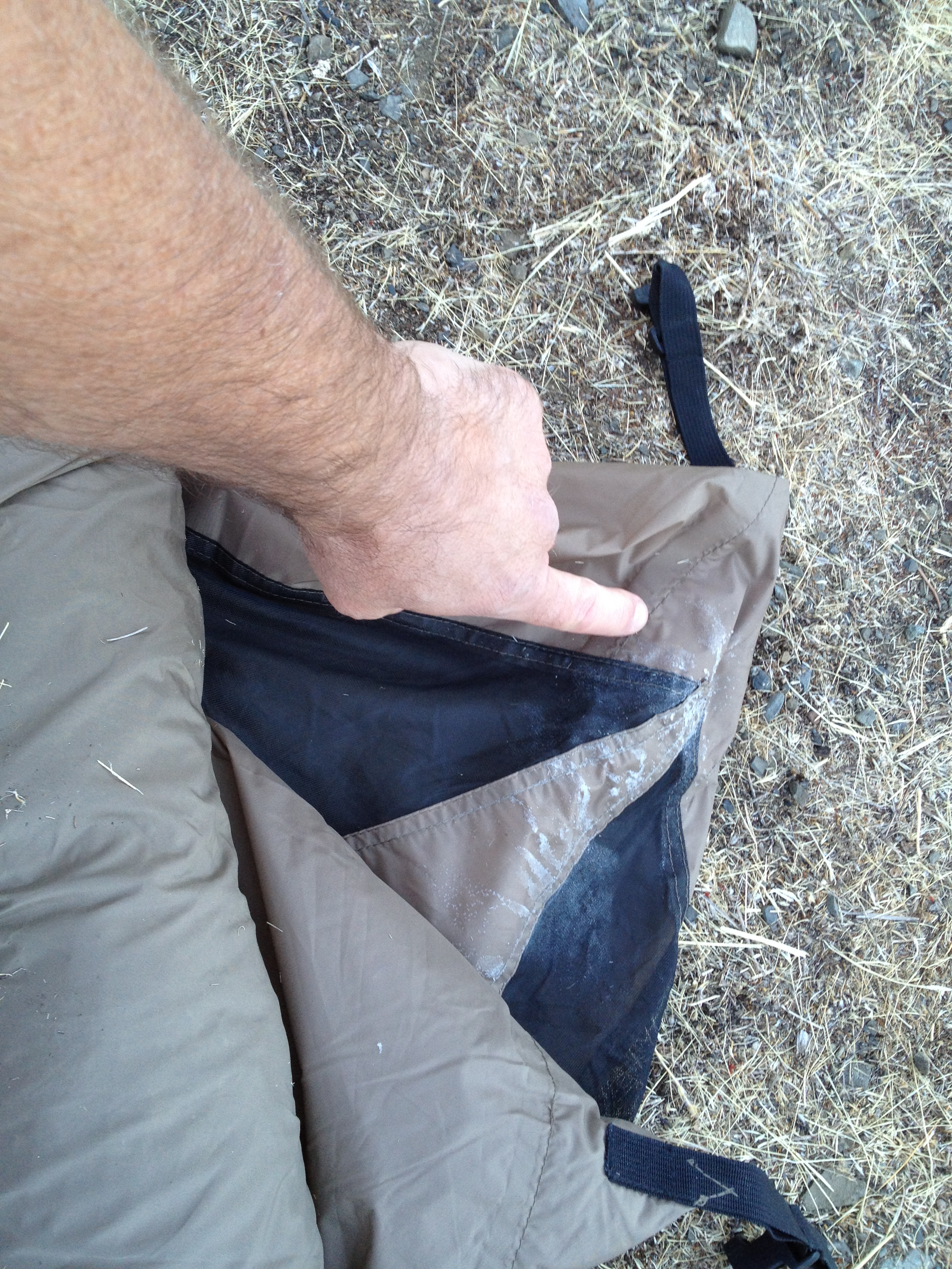
I put on the long fleece cycling pants, a second shirt, and decided the best thing was to break camp quickly and move up into the sun (versus hiding in the sleeping bag a few hours longer, and I had been there long enough!). While I was packing-up in my 2 short-sleeve shirts, I noticed a bit of frost on the corner of my tent. The water bottles in my panniers were not frozen, so I guess the temperatures may have been mid-30’s and that spot on the tent may have had a bit of evaporative cooling.
I packed up the rig quickly and got outta dodge, lookin’ for some sun! I was on the trail in 20 minutes and in the sun shortly thereafter. I only missed having the wool sweater I left in my car for about an hour.
A few miles up the creek trail, the big Bear Mountain climb loomed ahead of me. This is just a little less than yesterday’s Mt Sizer climb, but still as “staircase steep” in many places. I had no interest in timing myself on this lesser-known trail. I crossed the dry stream at the bottom and started up, stretching the slightly sore leg muscles from yesterday.
See that road cut on the top-right, and that distant one on the top-left? Yup, that’s (a small part of) the route!
On top of the first sunny plateau, it was time for breakfast, consisting of nuts, trail mix, and a double-sized cold instant coffee, mixed in a Crystal Geyser pint bottle. (Warm coffee would have been nice, but feeding my caffeine dependency was at least as important. My MSR Pocket Rocket stove is quite small, but it was a reasonable decision to leave it behind.)
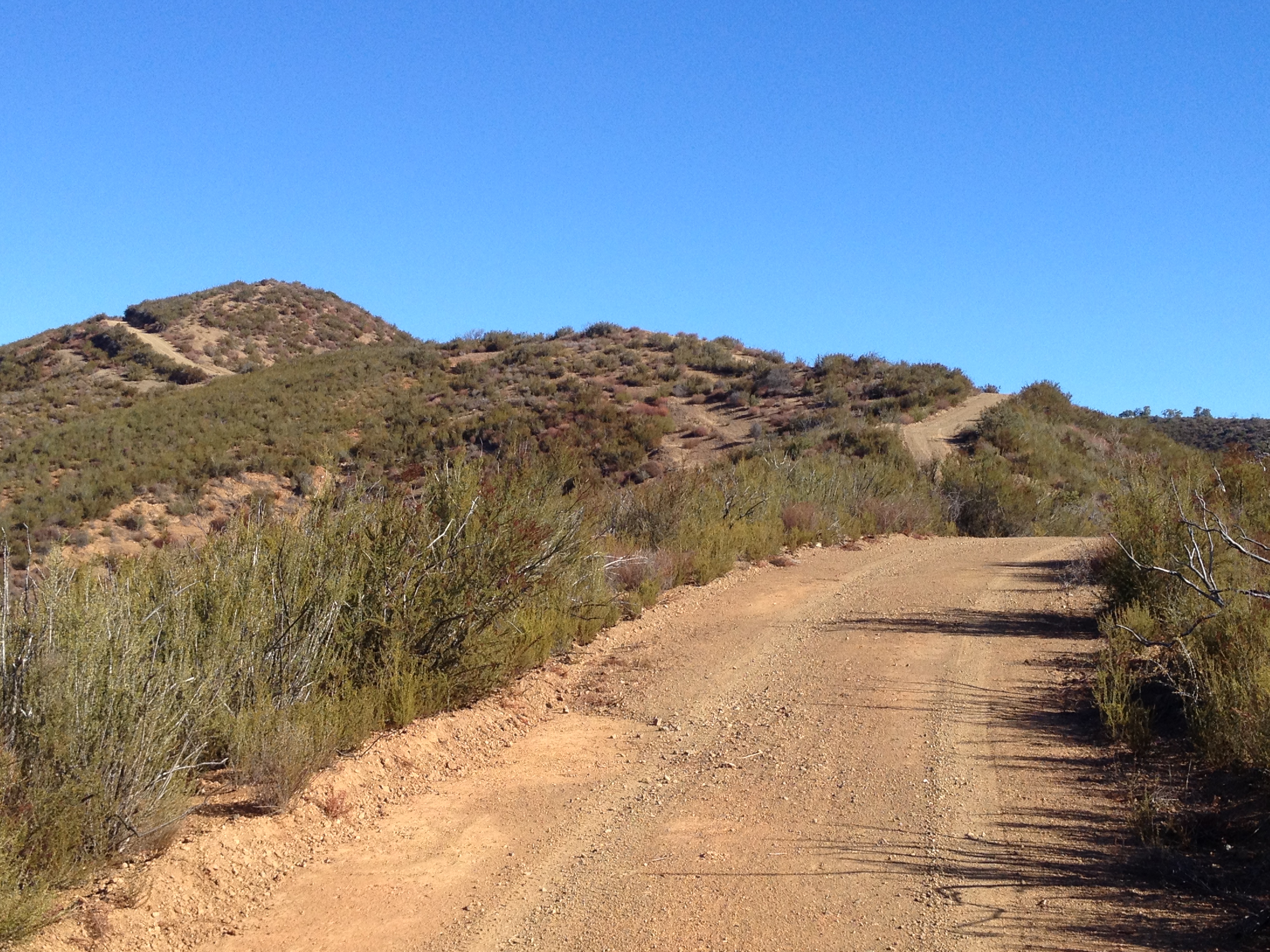
Another leg-numbing hill, and false summit, ahead:

Finally at the top of the big climb, I stopped to browse my messages (yes, there was fairly stable AT&T 4G signal), as well as contemplate visiting Bear Mountain Peak. My original plan was to leave the bike on Bear Mountain for awhile and do an out-and-back hike into the Orestimba Wilderness on the Chaparral Trail. Instead, I decided to go to Bear Mountain Peak, then spend the few extra hours in the afternoon lounging by Mississippi Lake.
A foray into Orestimba would have consumed all of my extra daylight and I had never been to Mississippi Lake except during the annual Backcountry Weekend when it’s possible to drive most of the way http://coepark.net/pineridgeassociation/pra-event-list/details/46-2013-backcountry-weekend
Summit view (the white dome of Mt Hamilton is on the horizon, just to the right of center):

Decision made: At the turnoff to Bear Mountain Peak, I laid down the bike and put on my Dirty Girl gaiters ( http://www.dirtygirlgaiters.com/ ) which were made “famous” last fall during my close rattlesnake encounter (http://www.everytrail.com/view_trip.php?trip_id=1785673 ). I now also have a SPOT locator/transmitter in case of snakebite, injury, or a need for delivery of cold refreshments by the Park Ranger. http://www.findmespot.com/en/ I was last on this peak 6 or 7 years ago to help complete a Geocaching challenge in an 11 hour roundtrip on foot.
Rattlesnake pattern gaiters. Did they contribute to my incident last fall, or prevent It from being worse?

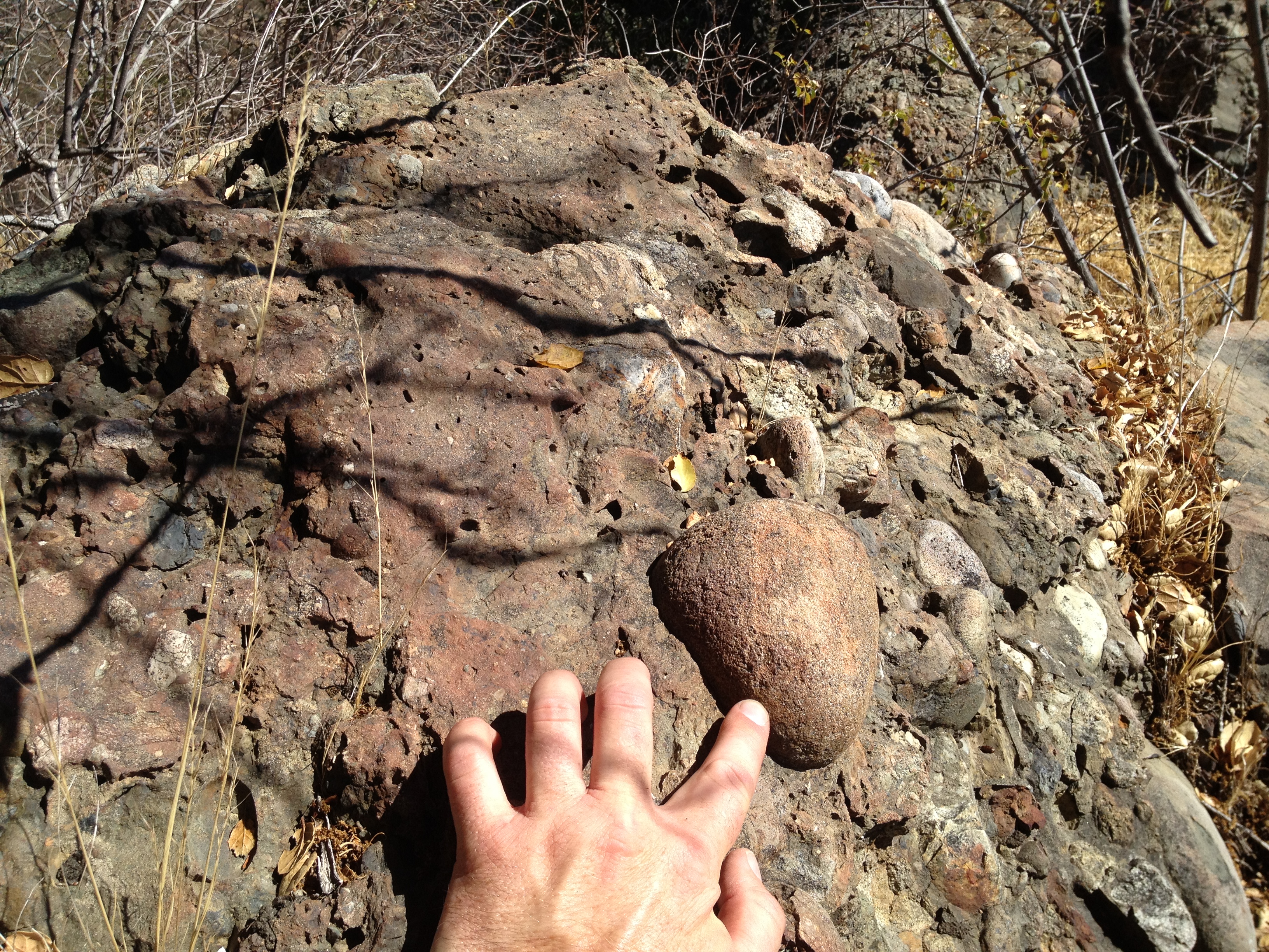
I found it fascinating that the top of Bear Mountain Peak used to be part of an ancient riverbed! See those rounded river rocks embedded into the softer sedimentary rock? This is the summit!
Bear Mountain summit, not be confused with the nearby “Bear Mountain Peak” (“Diablo #1 1943):

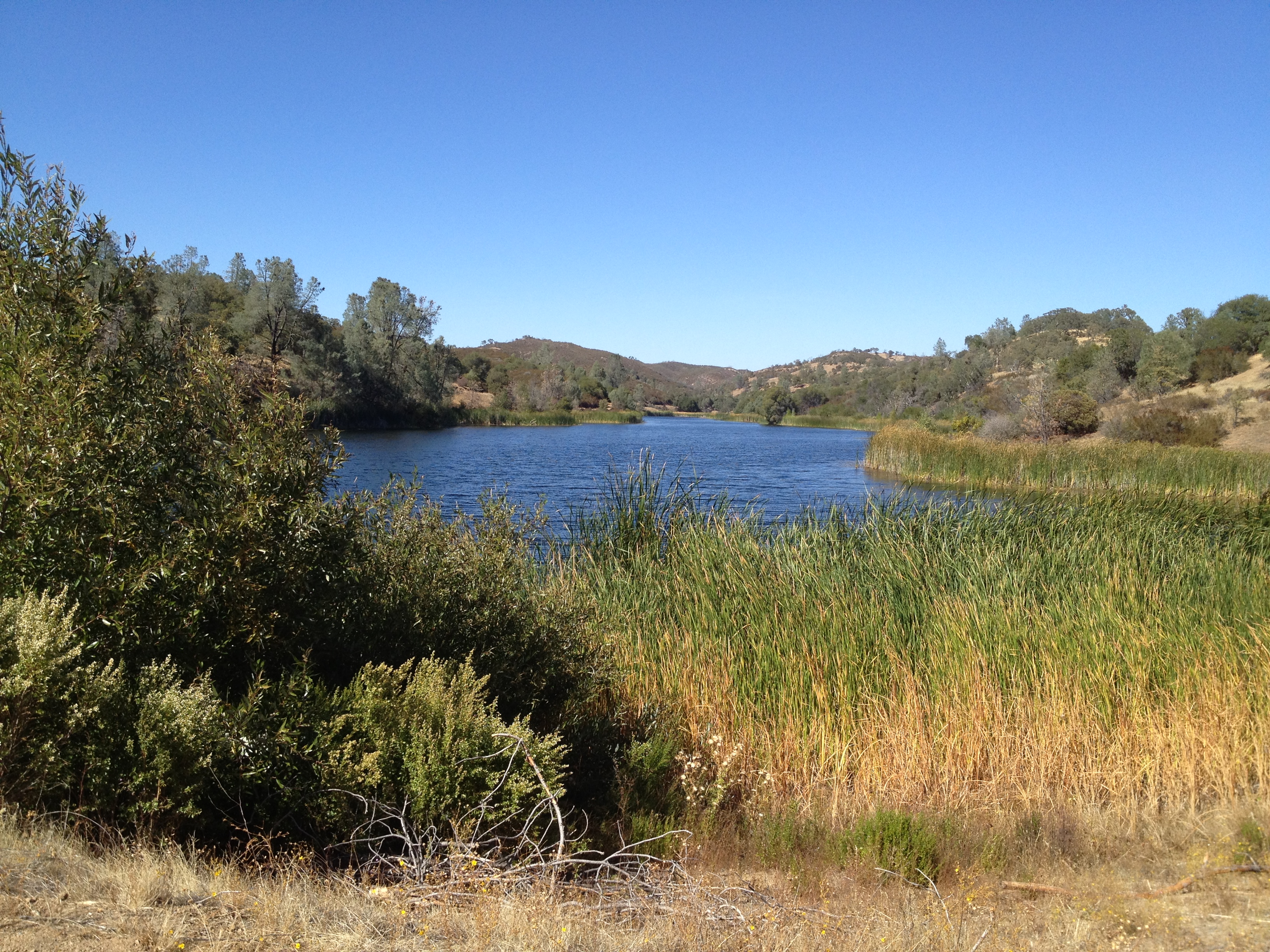
Back to the bike, then a “rollercoaster” ridgetop ride down to Mississippi Lake. I arrived about 3:30PM and grabbed the best site around, at the eastern edge of the dam. Nobody else around!
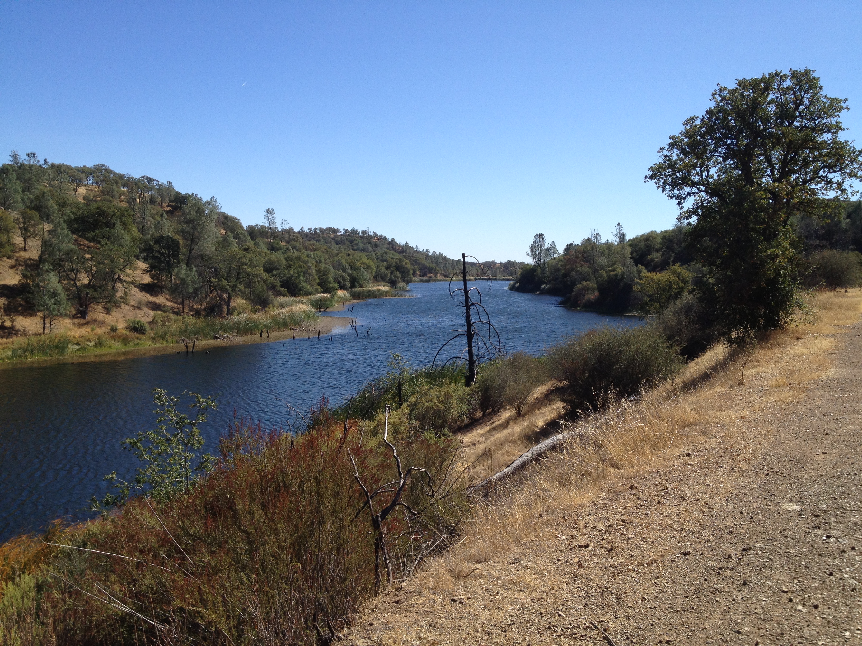
I set up the tent, devoured a cold meal that was high in fat and salt, and dozed for an hour in the sun.
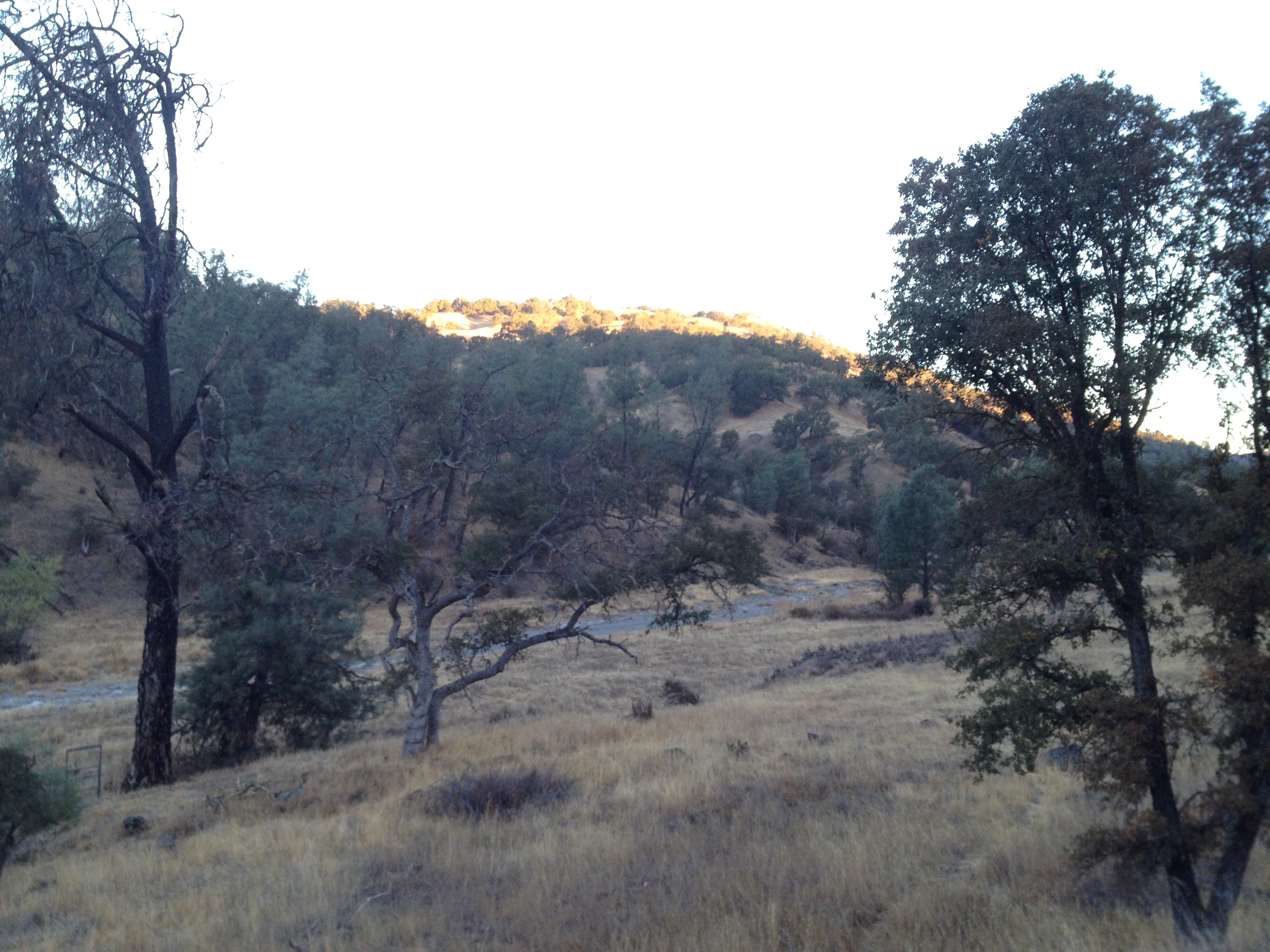
View from the tent. No sounds except for a few ducks and birds!
After the nap, I washed-up with some lake water, took some pictures, ate again, and soon it was dark. This time I put the rain fly on the tent and wore the long fleece pants. It took a LONG time to get to sleep, due to fierce gusty winds for many hours after sunset.
Eventually the wind died down and I slept. I was comfortable the whole night, and was not uncomfortable getting out of the tent the next morning. It was noticeably warmer than the night before.
Trail time for the day: 8 hours (7:30 – 3:30)
Day 1: https://alpharoaming.com/2013/10/05/bikepacking-henry-coe-state-park-day-1/
A review of my equipment: https://alpharoaming.com/2013/10/05/bikepacking-shakedown-cruise-equipment-gear-thoughts/
More pictures: http://www.flickr.com/photos/59666465@N00/sets/72157636219352373/
3-Day GPS Track: http://www.everytrail.com/view_trip.php?trip_id=2345398


")


