Walsh Peak Trail, Pacheco Camp @ Henry Coe State Park

IMG_5757

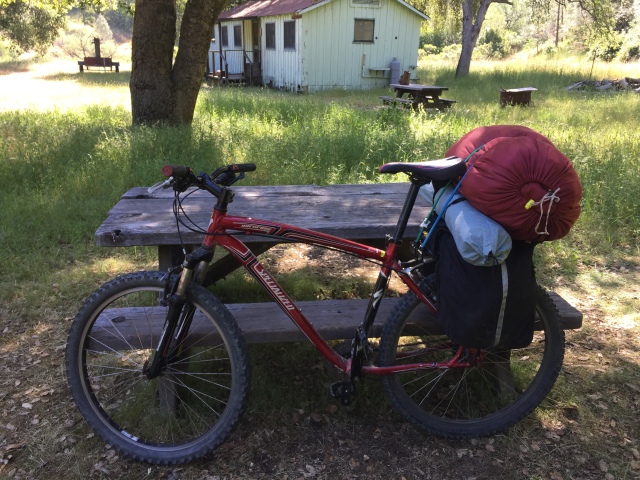
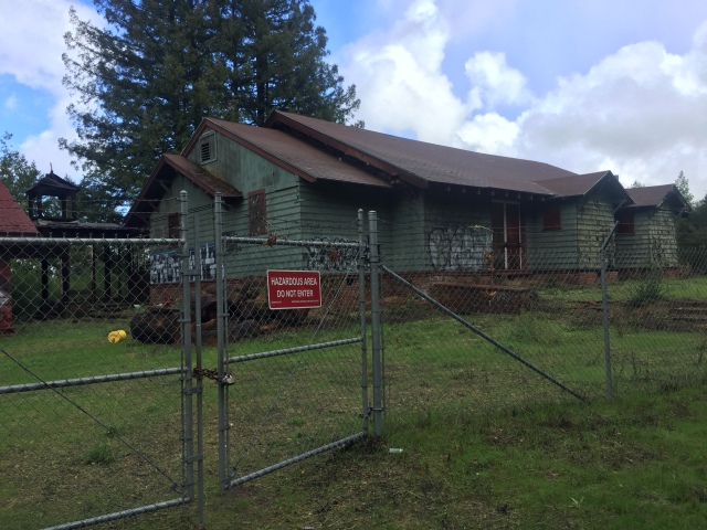
I had been to Pacheco Camp a few times before, but never had a chance to camp there. It has a great old cabin (no access!), plus clean fresh water and a cold shower, piped from a spring uphill.

During the recent Backcountry Weekend I was again reminded that the abandoned trail across Walsh Peak had been restored about 2 years ago. I had a free weekend, and I hadn’t been bikepacking in awhile…

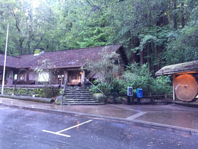
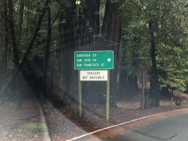
With a bit of free time for an overnight, I headed to the (summer weekends only) Dowdy Ranch entrance. I registered for my trip, including leaving my car overnight. http://coepark.net/pineridgeassociation/planning-your-visit/visitor-centers-and-park-entrances/dowdy-ranch-visitor-center

Just after you leave the Visitor’s Center, you’ll see this welcoming sign, below!

IMG_5677

Welcome to Henry Coe! 20% grade is perfectly normal!

…and below is Tie Down Peak. (Never again! https://alpharoaming.com/2012/09/26/rattlesnake-adrenaline-rush-tie-down-peak-at-henry-coe/
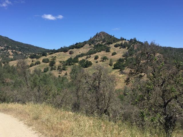
IMG_5680

Tie Down Peak!

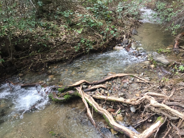
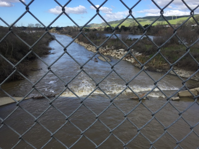
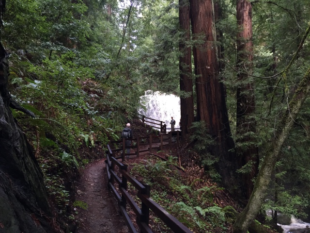
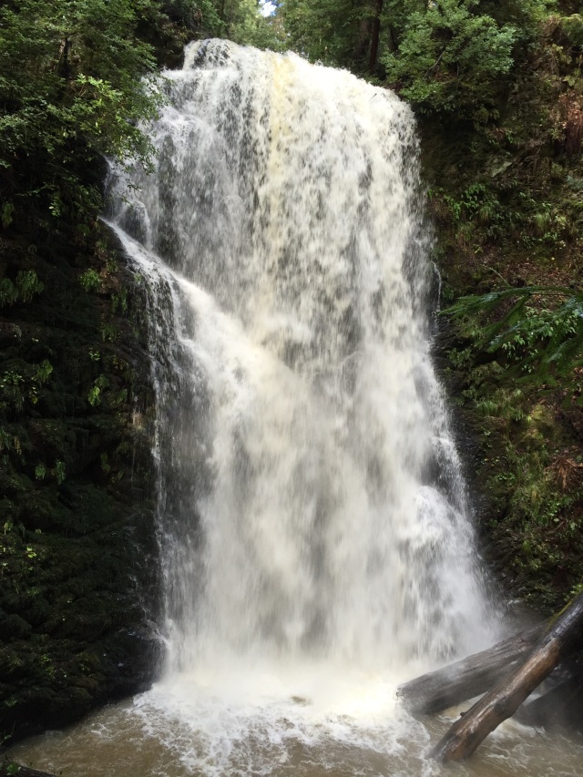
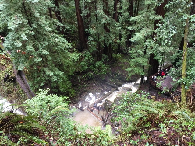
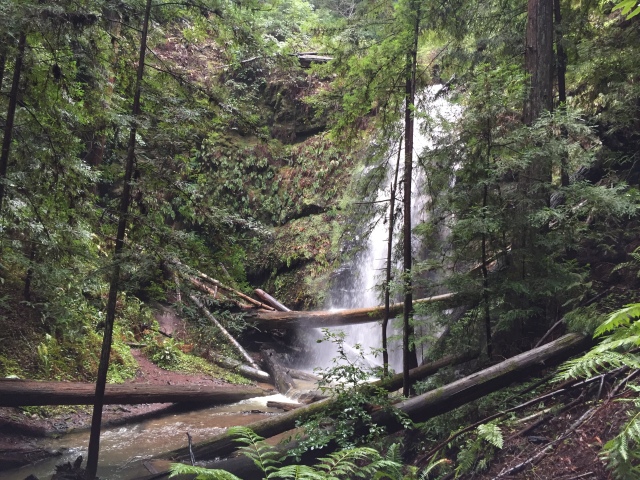
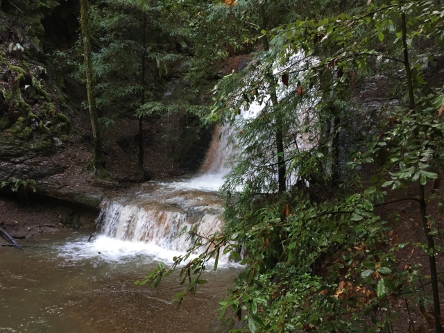
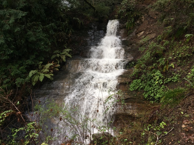
“Hole in the Rock” is a beautiful swimming hole, just upstream from Pacheco Crossing. It was clean, clear, and flowing, though it can dry-up in the summer

IMG_5684

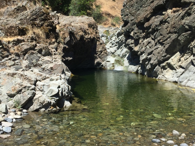
Beautiful flowing water “Hole in the Rock”

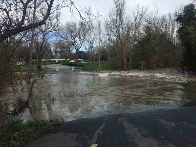
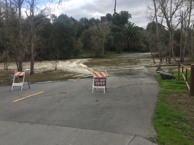
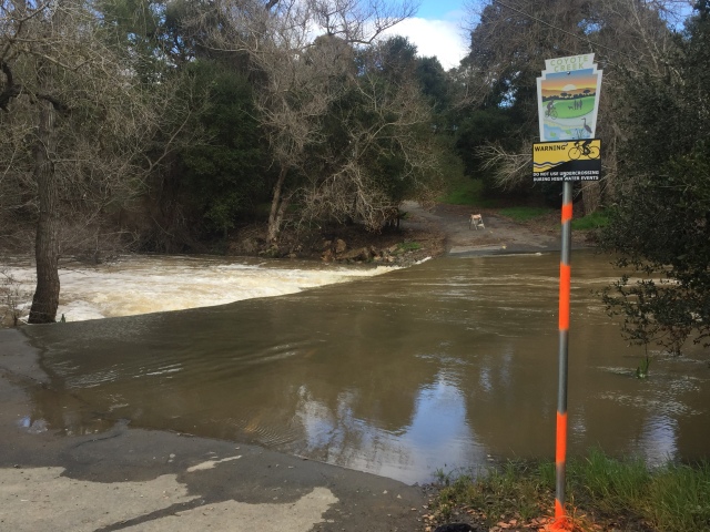
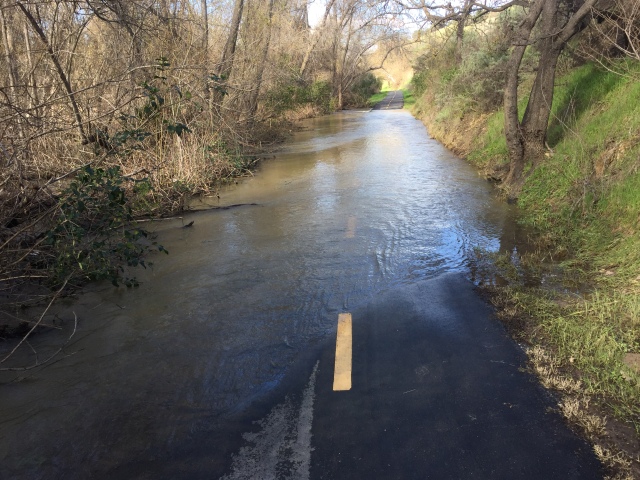
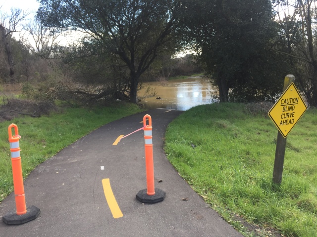
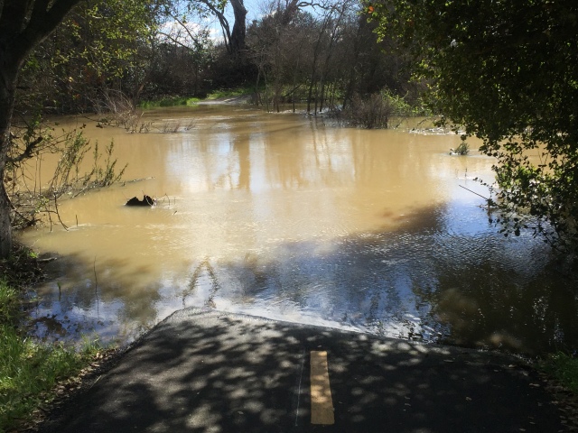
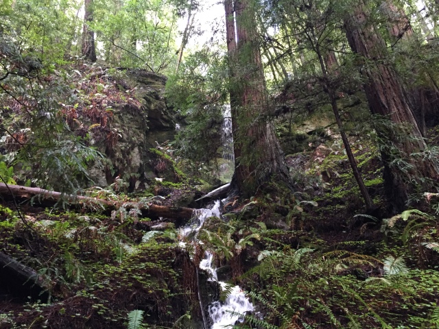
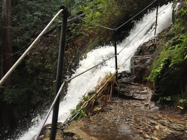
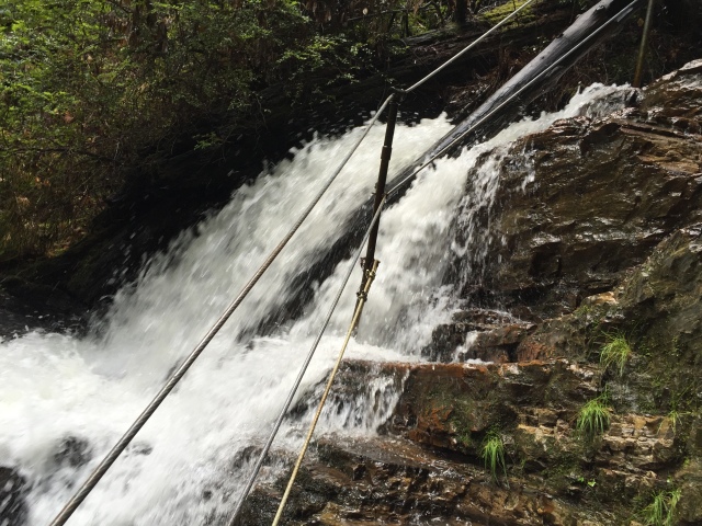
Below shows the forces of this past winter’s floods. This “trickling” creek left flood debris 8 feet up, in a wide channel!

IMG_5687

Flood debris, 8 feet up.

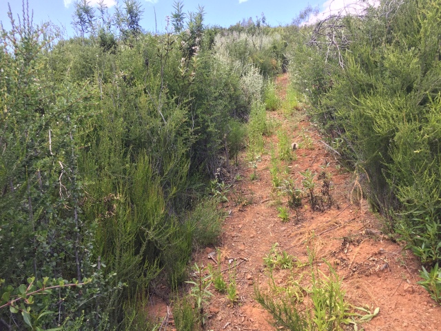
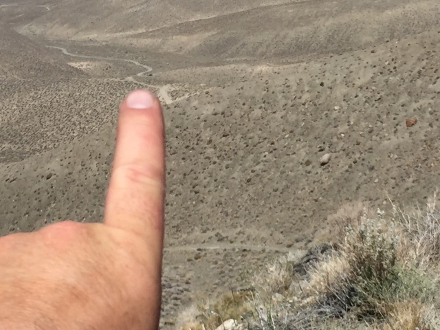
Finally, I see pink ribbons about where the steep side Walsh Peak Trail should be. No brown signposts yet, so you need to study the map and know where the trail should be. Below you can see how steep the climb is: 1000 feet, over one mile, and this is just the beginning!

IMG_5698

Starting my climb!

Below, the ecosystem changes as you go up. I saw one Horned Toad up around here. I couldn’t take a picture without my loaded bike falling off the mountain (seriously!)

IMG_5703

The ecosystem changes

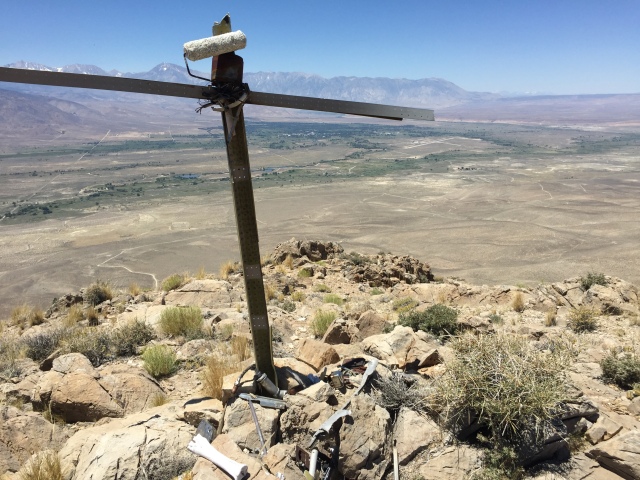
The summit register, below!
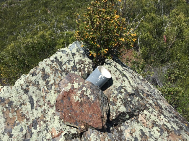
IMG_5721

The summit!

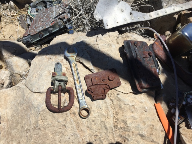
This log, below, was done by some influential people at Coe. I heard this hike helped start the effort to restore the trail
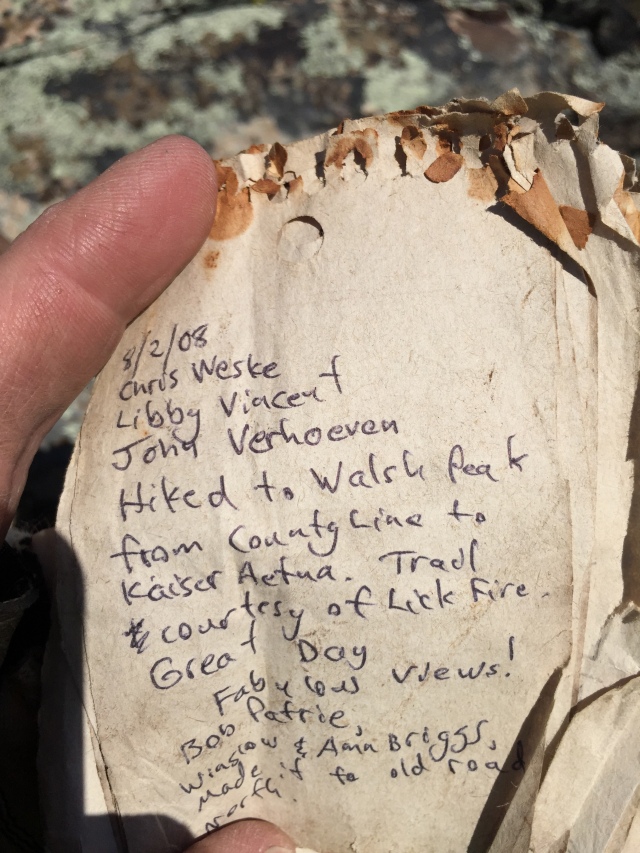
IMG_5722

Old summit register

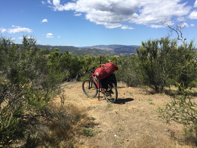
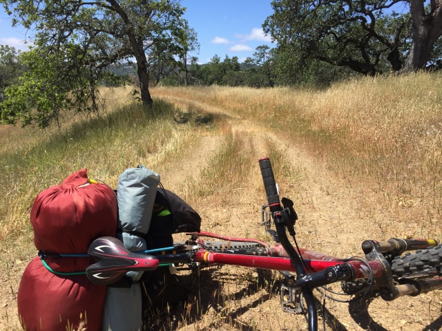
The loaded bike near the summit. About 65 pounds, in total, including my heavy winter sleeping bag. I was cold at Backcountry Weekend and this day was even chillier. It was worth carrying!

The climb was about 2/3 the height of the Mt Sizer “Shortcut” that I did 3 years ago. (Third photo shows the same bikepack rig, with more water and less sleeping bag! https://alpharoaming.com/2013/10/05/bikepacking-henry-coe-state-park-day-1/ )

IMG_5726

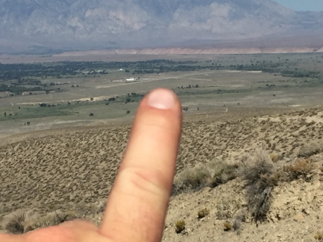
About 1/4 mile from the top

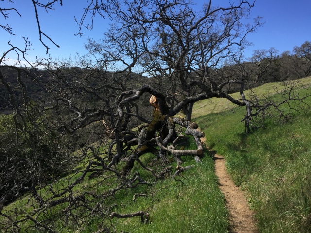
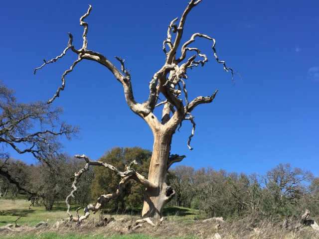
Heading down, with some random dead tree, to remind us that there hasn’t been a debris-clearing fire here in many years.
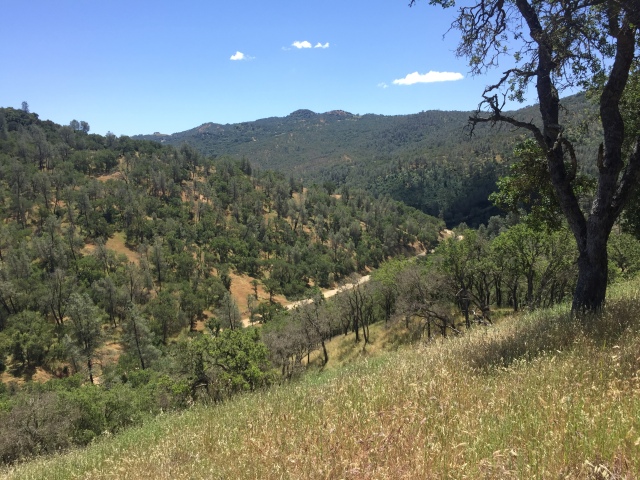
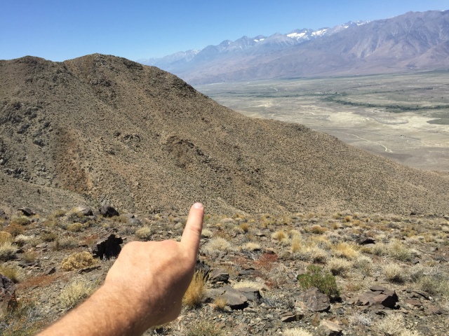
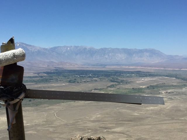
IMG_5730

Views!

The barbed-wire fence on the left is the line between Santa Clara County and Stanislaus County, which passes over Walsh Peak.
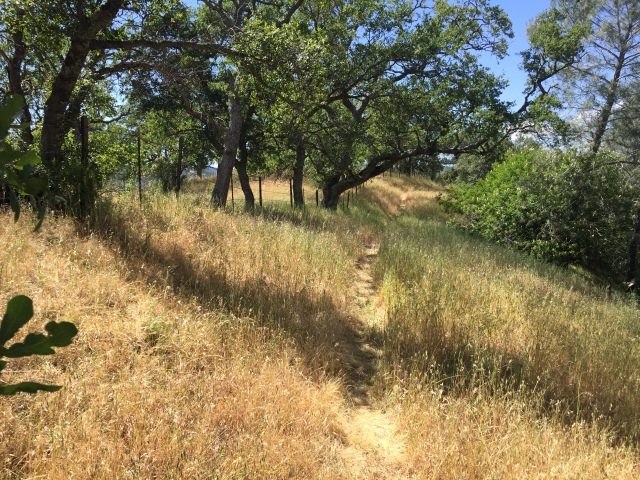
IMG_5733

The easy way out!

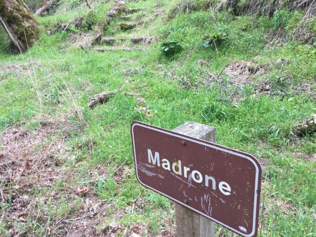
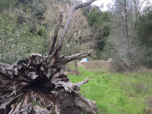
The camp! Enough sunlight to take a quick, chilly, shower, and lay out on a picnic table in the sun.
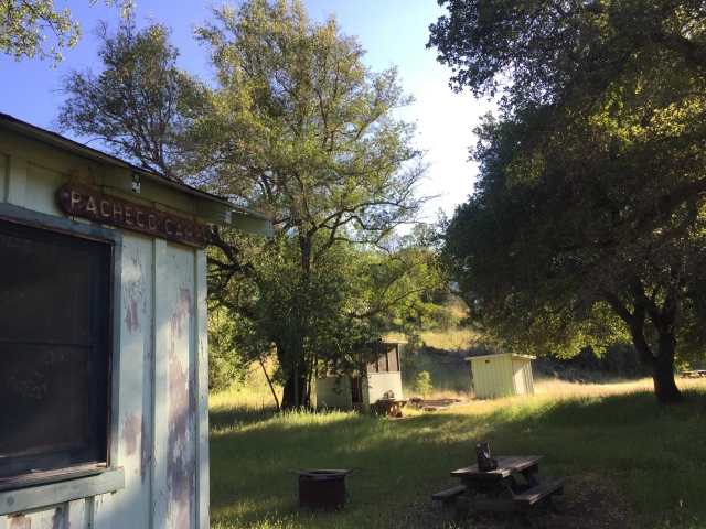
IMG_5743

Pacheco Camp

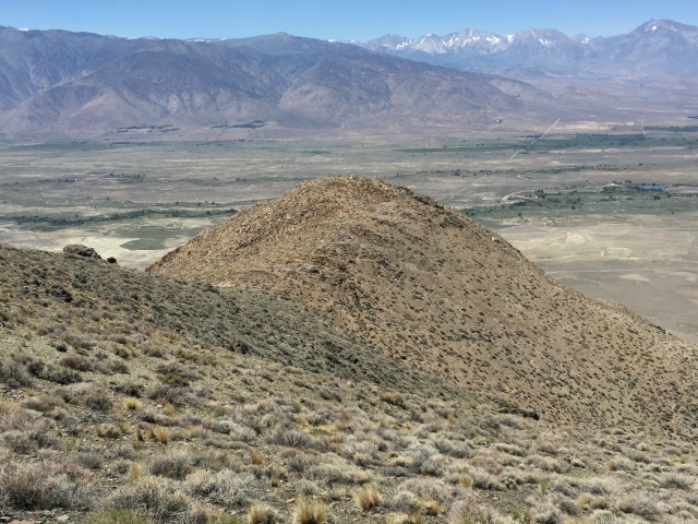
Headed back the next day, sweeping across the ridge to the right, and over the distant summit.

IMG_5762

Heading back, over yonder peak!

IMG_5764

Rest…I have all day!

Strava link, showing 16.5 miles and 3719 feet of climbing https://www.strava.com/activities/986641353

That’s it! Plan you trip carefully. Bring lots of water and tell someone your route! http://coepark.net/pineridgeassociation/ I also carry a DeLorme InReach satellite communicator. Cell phone signals are available on some ridges and peaks. Enjoy!

Posted in Uncategorized | 2 Comments

White Sierra Clothing Review #ThinkOutside #MyOutdoors

Recently, the local, family owned White Sierra company sent me a few items to evaluate. I’m happy to support them in my own little corner of cyberspace. They’re just down the road, here in Silicon Valley, and have a great “American Dream” story! https://www.whitesierra.com/pages/family-heritage They have periodic closeout sales in their Sunnyvale HQ, where I had a chance to meet the husband and wife owners, and connect with the company.

What did I get? Clockwise, from top-left: an “Insect Shield” bandana, an “Insect Shield” stretchy scarf or headcover, “Rocky Ridge II” pants, and a “Kalgoorlie II” Long Sleeve Shirt.

IMG_5859

Both the “Multifunctional Headwear” and the bandana contain a small amount of permethrin insecticide, which survives multiple washes, and is EPA-registered as safe for normal use.

IMG_5860IMG_5861

Below, you see the information card, confirming it’s safe for normal use. These two products seem quite interesting. Seeing that we don’t have any bugs to speak of, in this area, I’m anxious to give these a try on my next camping trip.

The headwear is $25 on https://www.whitesierra.com/collections/insect-shield/products/bug-free-multifunctional-headwear?variant=15311797894 There’s also a wide selection of similarly treated clothing https://www.whitesierra.com/collections/insect-shield

IMG_5864

The Kalgoorlie II Long Sleeve Shirt is a light fabric, offering full protection from sun (SPF 30). Excellent ventilation features include: interior mesh, a horizontal flap across the back, and roll-up sleeves with a retaining tab. I usually wear long sleeve runner’s shirts when I hike, but these ventilation features are superior. ($43.00 https://www.whitesierra.com/collections/mens-tops )

IMG_5862

The Rocky Ridge II pants offer a similar lightweight fabric, with simple and comfortable construction. Perfect for summer hikes where you want your legs protected and covered. Front slash pockets, rear Velcro pockets, elasticized waist, and a single snap closure.

I often wear “zip-off” or “convertible” pants when I hike. These pants are lighter, and faster drying. I rarely ever remove the legs of the zip-off pants, anyway, because it requires removing my boots. I’ll be giving these a try soon! ( $45.00 https://www.whitesierra.com/collections/s17-new-men/products/rocky-ridge-ii-pant?variant=36542283398 )

IMG_5863IMG_5868

White Sierra regularly publishes discount codes, as well as offering free shipping over $100. If any of their items interest you, check the hours on their Sunnyvale store fro closeouts, or buy their new items for 33% off list price, from their website (Code: “ALPHA33“)

The end! Go take a hike!

Posted in Uncategorized | Leave a comment

Madrone Soda Springs – Henry W. Coe State Park

On a steep side trail, not far from the HQ of Henry W. Coe State park, is a quiet meadow, by a creek. A few small remnants remain of what was once a hotel and resort. “Madrone Soda Springs” is not as widely known as Gilroy Yamato Hot Springs, but shares a similar background, when tourists and vacationers didn’t travel far from home!

Believe it or not, there is still valuable information that is not yet on the Internet! The best source of information I’ve found is called: “The Mineral Springs of Santa Clara County”, by Ian L. Sanders. ($19.95, plus shipping, on Amazon, as I write this http://a.co/7Jklu8J ) I’ll throw you a few teasers from the book, and if you want to know more, you’ll have to buy a copy!

The waters here were known to the early Ohlone natives, with a Mexican settler first claiming them in 1866. Cabins and a pavilion were built around 1880, and a Post Office existed from 1883 to 1895! From those bustling years, the property declined in the early 20th century, and was eventually added to the Coe family’s ranch in 1938. (Now “go buy the book”, which includes 8 pages of text and photos!)

Start your visit at the Henry W. Coe Visitor’s Center. The stuffed Mountain Lion watches over the cash register. $8.00 for parking, or else…(or else you can ride your bike here, or show your Annual Pass!)

IMG_4871

If you don’t already have an official map, you’ll probably do fine without one for this short trip. Follow the signs, about 3 miles, to Manzanita Point, and turn right.

IMG_4874

Down you go…about 900 feet, from Manzanita Point, to the creek below.

IMG_4882

IMG_4892

The creek is often dry in the summer, but in the record rainfall year of 2017, it’s likely to keep going well into the summer.

IMG_4886

Hang a left when you get to the creek. (There’s really no other way to go!). Soon, on your right, you’ll see the “Madrone” sign, with an old stairway behind it

IMG_4898

…and a basin, of some sort, in front of the sign, marked “1941”. One of Coe’s former Park Rangers tells me that this basin used to be where visitors could partake of the bubbly waters. It was from a shallow spring, below this basin near the creek. During my visit in March 2017, following a record winter for precipitation, I had hoped to find bubbly mineral water once again coming from the ground, but I failed!

IMG_4894

IMG_4895

IMG_4896

That’s about all there is to see here, except a small cobblestone “cooler room” a few steps further down the trail on your left, plus a collapsed cabin about 1/2 mile downstream.

IMG_4889

You may also wish to explore the meadow, which had two tents and four first-time visitors to Coe when I was there.

IMG_4900

In this same general vicinity, there is a VERY overgrown trail into the “Lakeview Zone” portion of the park. It has great views of the valley, towards Morgan Hill. Navigation is very tricky and involves large quantities of poison oak, ticks and thorns. Unfortunately, the area became off limits after my two visits.

IMG_4897

After poking around, and contemplating the area’s history, you can proceed downstream to China Hole, or head back the way you came.

IMG_4901

A newly falllen tree, below, after the particularly harsh winter we just had.

IMG_4908

This tree, below, made me realize that there hasn’t been any fires close to HQ in a very long time.

IMG_4909

Plan your visit! The park HQ is on a twisty mountain road, east of Morgan Hill, CA. The website is http://www.CoePark.net

At a different entrance to the park is the better known “Gilroy Yamato Hot Springs”. The Ian Sanders book, mentioned above, includes about 35 pages on Gilroy Hot Springs. He also has another book entirely dedicated to GYHS. GYHS has many structures still standing, and is well known for providing a temporary place to stay for Japanese-Americans after their release from internment in 1945. The area is closed, except for special events. They have a supporting organization, which (I think still) gives guided tours, though their website needs updating! http://www.gilroyyamatohotsprings.org/ It’s listed on the “National Register of Historic Places”. You can find quite a bit of information about it, as well as photos, on the internet, including Wikipedia https://en.wikipedia.org/wiki/Gilroy_Yamato_Hot_Springs

The End!


Posted in Uncategorized | Leave a comment

Washouts in the Hills, Flooded Coyote Creek down below!

It’s been about 3 months since my last blog post. Why? Well, three reasons: I’m working 5 days a week now, I’m short of ideas within an hour of home, and the weather has been, um, “interesting”!

Below is a photo of Skyline Boulevard (Highway 35) near Castle Rock State Park. It’s a major thoroughfare in the Santa Cruz Mountains. This will NOT be repaired quickly. It’s about 200 feet deep and very wide. Look at the people on the other side and the downhill side of the slide. (This photo was widely spread on social media, without credit to the photographer. I’d be happy to add credit if anybody knows the source.)

img_4414
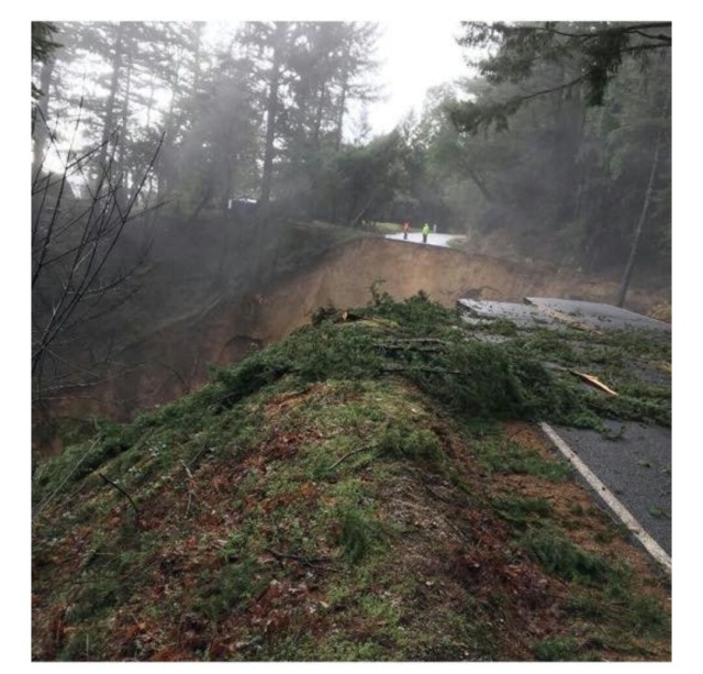
In addition to that photo, someone in the Santa Cruz Mountains is collecting various (unattributed) photos from around the area. It seems all the backroads have been affected in the area.
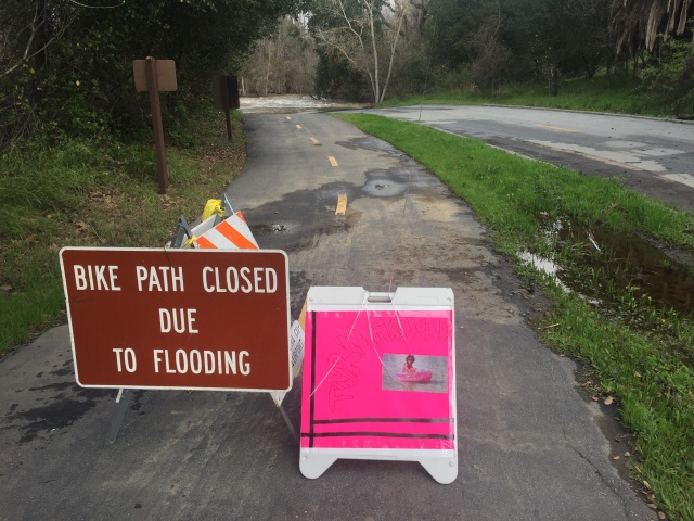
https://www.facebook.com/nick.moless/media_set?set=a.10154626617431284.1073741833.615776283&type=3

I got a late start, and decided to stay out of the hills. I went to investigate the Coyote Creek Trail, by driving to Hellyer Park in San Jose and heading south by bike. Oops! I got about 1/4 mile on the trail, near the Hellyer Velodrome (which is a great place to see or learn cycling on a banked track http://www.ridethetrack.com/ )

img_4418

img_4419

I checked my Google map, and found a way around, via a road bridge and a few residential streets. Here’s the view from the other side: Fast and deep. It might work for a high clearance vehicle, but it might not…

img_4422

After going around, I headed north from Hellyer, towards the northern end of the Coyote Creek Trail, and an area known to have homeless camps. Below is where I turned around. Fast, deep, and close to the northern end of the trail.

img_4425

Notice, below, the Great Blue Heron. It’s tough looking for lunch when the water is murky and moving fast!

img_4426img_4427

So..I managed a whopping 4 miles, round trip, until I hit fast water in both directions. (GPS track here: https://www.strava.com/activities/862955138 )

I put the bike in the car and headed south to where the trail crosses Bernal Road / Silicon Valley Blvd. About 2 miles of cycling northward, not too far from where I was before moving the car, deep water appears again. The creek is to my left, but spilling over at a depth of about a foot. Not moving dangerously fast, but I didn’t want to soak my hubs and feet.

img_4430

After that turnaround, above, I headed south from Bernal Road / Silicon Valley Blvd, and got in a few good miles and a glimpse of (gasp!) BLUE SKY and flowers.

img_4435

A little bridge, near the power plant and the small waterskiing lake. Usually a trickle in the summer.

img_4436

Below is allegedly the geographical center of the county, as marked by some IBM engineers about 30 years ago. The background engraving says “Santa Clara Valley”.Parlez-vous ASCII?

img_4438

Oops! a little past the power plant and http://www.coyoteranch.com/ , north of Bailey Avenue, I came across more “deep and wide”. Back to the car! (My second GPS track of the day. I managed 13 miles, round trip, between the flood plains! https://www.strava.com/activities/863031910 )

img_4439img_4443

The sign below is new and makes the point better than the usual type of sign!

img_4444

Back to the car, and a quick look at overflowing Anderson Dam, that’s releasing at the water you’ve just seen…followed by a stop at “The Running Shop and Hops” in Morgan Hill. 51 taps, nice people, and “BYOFood” or order from a nearby pizzeria for delivery.

img_4445

img_4446

That’s it! The mountains are crumbling and the lowlands are flooded. Maybe I’ll stay home and do a blog post and install TurboTax 2016!

Posted in Uncategorized | 1 Comment

Alma College (aka: Bear Creek Redwoods, Daybreak School)

(December 2018 update: An interesting video of the Daybreak School, that operated here in the 1970’s https://vimeo.com/19770829 …and, yes, the bulldozers have arrived and they are preparing to open the site to the public.)

How much do you know about the “Bear Creek Redwoods Open Space Preserve”? It’s right off Highway 17 and Bear Creek Road, just above Los Gatos, California.

Well…it’s not open to the public yet, but it’s very easy to get a permit to visit and it’s a very interesting place!

(Get your car’s license plate number and apply here a few days in advance: http://www.openspace.org/visit-a-preserve/permits/general-access-permits )

Why is it interesting? Well it was the site of a wealthy individual in the early 20th century. He had extensive fountains and a man-made waterfall. It was then sold to the Jesuits around the time of the Depression and was home to “Alma College” until 1969. There was then a small private school there for a few years, then it passed through the hands of  few owners. Since 1999 it’s been owned by the Midpeninsula Open Space District (“Mid-Pen”), which is taking the slow steps to open it to the public in 2019. Read about those efforts and more history here: http://www.mercurynews.com/2016/09/24/redwood-forest-near-silicon-valley-with-rich-history-to-be-opened-to-public/

Why am I blogging about it? Two reasons: (1) GO SEE IT before the bulldozers arrive. Mid-Pen is proposing to demolish all the buildings except the main chapel and library building. and (2) when I was there recently, we met someone who offered a collection of historical photos from when the Jesuits were there. She didn’t know the origin of the photos, but they do seem like they were taken by the Jesuits. If you know anything more about them, send me a comment (link at bottom). I’d like to give credit where credit is due, and maybe learn a bit more.

Anyway…back to YOUR upcoming visit and the photos.

After you enter the gated parking area, you’ll be in a small parking area. It used to look like these photos (below), but not any more! Note the pond in the background.

alma-011

alma-college-pics-012

From there, walk straight back, with the pond on your right, and you’ll see a lot of fenced-off derelict buildings.

img_3070

Study the roofline of the photo above and the photo below. Same building!

alma-college-pics-015

I believe this current photo (below) is the chapel building

img_3069

The chapel building (below). Again, study the roofline to be sure you’re looking at the same building!

alma-college-pics-009

More of the chapel (below), during a rare snowfall:

alma-010

More of the chapel, with the flagpole in the background, near the entrance area:

alma-college-pics-011

alma-009

Towards the rear of the main cluster of buildings, you’ll see these brick columns:

img_3072

I believe the above brick columns match the following three pictures. This place was beautiful “back in the day”!

alma-college-pics-017

alma-college-pics-018

alma-college-pics-016

Below, I believe, is the library building. (Photo credit: Sharon Lum) Notice the tall, smashed windows, then look at the second photo below. See also pictures #7 and #31 in the Mercury News article.

img_3566

alma-013

Below are a few more historical pictures of the grounds, including many of the same buildings, as well as the pond, which is at the right foreground of the main buildings.

alma-college-13

alma-college-9

alma-016

alma-college-pics-010

alma-012

The picture below, dated 5/5/1942, is in front of the chapel. An interesting rumor that I heard from this individual we met, was that the hilltop at the back of the property had a ham radio antenna, which received the first mainland report of the attack on Pearl Harbor. Is that true? Quicker than military communication channels? Who knows for sure, but I did send a comment to Mid-Pen suggesting that be investigated as part of the current historic assessment of the property.

priestairraidspotters

My advice is to go see it now, including walking counter-clockwise around the main buildings, onto the lower road. From down there, you’ll get quite a view of these (potentially historic) structures, as well as what looks like a huge (dry) man-made waterfall.

The adjacent historic stables, mentioned in the Mercury-News article, have an active Facebook page and some great programs! https://www.facebook.com/Friends-of-Bear-Creek-Stables-711644242283830/timeline

That’s it! If you have anything to add, please send me a comment. (Comments are reviewed by me, before publishing. If you wish to send me a note, that won’t be published as a comment, that works too!)


Posted in Uncategorized | 15 Comments

A Chill in the Air: White Sierra & El Corte de Madera

A chill was in the air here in Silicon Valley this week, unlike any I’d felt since spring. The lack of light coming through the curtains, at my normal wake-up time, told me that summer is passing.

On thursday evening I sent out my periodic “here’s my hiking plan, please join me” e-mail to about 20 friends. I can’t plan much more in advance than that, and I usually get about 4 others to join me.

At 9AM on sunday we met at the “CM08” gate of El Corte de Madera Open Space, in the Santa Cruz Mountains. (General info: http://www.openspace.org/preserves/el-corte-de-madera-creek Trail Map: http://www.openspace.org/sites/default/files/map_ECDM.pdf

It was chilly! A few weeks back I connected with White Sierra, a local outdoor clothing company. They provided me a few complimentary items for evaluation, including convertible zip-off hiking pants and a flannel shirt. They’d been sitting at home, waiting for an opportunity to try them out. In the summer I usually wear shorts and a long sleeve runner’s shirt. On this day, I was glad I brought the warm stuff!

Off into the beautiful redwoods the 6 of us went. (Did you notice the three people on the left, studying the ground? Yup…Geocachers! https://www.geocaching.com )

img_2498

The park is quite popular with mountain bikers, as all the trails are open to bikes and nicely graded (and quite steep!) All the cyclists we encountered were careful and polite. We even had a good conversation with a few of them, as three of us in the group also ride mountain bikes.

Below, you’ll notice three people who couldn’t seem to stay on the bridge. Yup! They’re called “trolls” and there’s a cache under there somewhere.

If you’re not familiar with this area, notice the stately old redwood stump on the right. Most of the redwood forests around here were clear-cut around 100 years ago, particularly after the San Francisco earthquake of 1906, when there was a huge need to rebuild the city.

img_2496

The photo below is a bit washed out, but it’s a good overview of what much of the park looks like: smaller, second growth redwoods in steep canyons. I highly recommend parking at one of the lesser-used gates, versus the bigger parking lot on Skyline. You’ll avoid the starting point for most cyclists and get into the quiet canyons quicker. (If seeing bits of plane crash debris is interesting, you can find them on the “Resolution Trail” if you know where to look. The story is here: http://www.mishalov.com/dc6-crash-kingsmtn-2july05

The lower part of the park borders on the property of Neil Young. (Yeah, you know: The Buffalo Springfield, Neil Young and Crazy Horse, Cinnamon Girl…) Some people claim to have heard him jamming from these trails. Here’s a bit more about the nearby roads and his property: https://alpharoaming.com/2014/02/26/neilyoung/

Here is a map and GPS track of our 14 mile and 3000 vertical foot hike https://www.strava.com/activities/700880179

img_2497

Oh yes, back to the clothing that kept me from freezing on this hike, at least until the sun warmed things up a bit. White Sierra’s “Trail Convertible Pants”

img_2404

…and the comfy cotton flannel shirt. One person commented that it looked like a classic Pendleton pattern. (Being cotton, you wouldn’t want to take it on a trip that might involve wet weather. For fair-weather hikes and casual wear, it’s great!)

img_2505

I’ve been using a pair of Columbia zip-off pants that I bought at REI a few years back. They’ve served me well and I was interested in a direct comparison. The White Sierra zippers worked easier, as did the belt buckle. I also liked the generous amounts of Velcro on the pockets, versus the smaller Velcro bits on the Columbia pants.

img_2506

Also (below) the White Sierra pants have both a vertical zipper and a horizontal Velcro flap at the bottom of each leg. This helps in converting the pants to shorts, without removing your boots or shoes. All are thoughtful design features. (The only advantage I’d give Columbia is the waist button is riveted, versus sewn.)

img_2511

White Sierra just introduced their fall clothing line, which can be ordered on-line. Their Sunnyvale HQ (right off Central Expressway) has an outlet store, with significant discounts on overstock and clearance items. Sign up for their mailing list. https://www.whitesierra.com

The husband and wife team that founded the company in 1979 sounds alot like other Silicon Valley success stories, except they’re not techies. They’re clothing experts! Their interesting story is here: https://www.whitesierra.com/pages/family-heritage

That’s it! Enjoy the hike, say hello to the mountain bikers, dress warmly, and maybe stop for a snack or rehydration at Alice’s on the way home! http://www.alicesrestaurant.com


Posted in Uncategorized | 1 Comment

Flight 802 Memorial Site (Bishop, CA)

I recently enjoyed a 6 day journey around the eastern Sierra, including 2 nights in the higher (cooler) elevations of Death Valley, plus a hike to a 1974 plane crash site. The hike was unexpectedly difficult, due to a navigational error, not having a 4WD, and it being 102F degrees when I got back to the car…more on that later!

The story: On March 13, 1974, on a dark moonless night, with calm and clear weather, a chartered Sierra Pacific Airlines Convair 440 took off from Bishop airport, headed back to Burbank. On board was an experienced crew of 5, plus 31 people from Wolper Productions, who were in town filming the “Primal Man” miniseries. Minutes after takeoff, with no radio calls or signs of mechanical issues, the aircraft impacted a steep mountainside. 36 people died instantly in a fireball that was seen from the town.

Full text of the crash report: http://libraryonline.erau.edu/online-full-text/ntsb/aircraft-accident-reports/AAR75-01.pdf

…and a shorter summary here: http://www.check-six.com/Crash_Sites/PrimalMan-N4819C.htm (The actual “Primal Man” film footage was recovered from the crash site, having miraculously survived in the tail section. After some consideration of the friends and families involved, was aired on television. I could not locate the show anywhere, but USC has a collection of all Wolper Productions work, which can be viewed by appointment.)

I found out about this site many years ago, via Geocaching.com https://coord.info/GC382A and have had it on my “to do” list for awhile. I’ve also visited and blogged a few other crash sites. (F-2H Banshee above Saratoga, CA, (https://alpharoaming.com/2015/01/10/banshee/) and an F-4 on the San Mateo County coast (https://alpharoaming.com/2014/02/11/plane-crash-site/)

After reading the experience of other Geocachers, I drove my 2WD car as close as I could to the memorial summit, and just started walking, bushwhacking, scrambling, and dead reckoning…there is no defined route.

IMG_1879

Unpaved turnoff to Redding Canyon Road

Using old USGS Topo maps, downloaded to the GaiaGPS App on my iPhone, I drove my regular 2WD car as far as I safely could. (A capable 4WD vehicle would have a been a big help, and cut at least 1/3 off my hiking time)

IMG_1894

That’s my 2WD car!

I headed up the gravel road for awhile, then at some unknown point, I headed off cross-country to the right.

IMG_1887

Bishop Airport

Most of the advice I read was to leave the gravel road when you’re at the same elevation as the crash site, which I did. It took me 3 hours from the car…a bit more than I expected, but I can’t give much advice on what I did right or wrong…at times it seemed I did it all wrong, but there was no obvious “better way”!

IMG_1902

The plane crashed 180 feet below this summit. Large reflective aluminum pieces are visible as far down as my finger is pointing


IMG_1904

Descending down to the memorial peak


IMG_1910

A cross on the peak, made of aircraft bits

At the summit there was very little wreckage. If you read the (above linked) crash report, you’ll note that the impact point was 180 vertical feet lower. Interestingly, several pieces, including a door, went up and over the summit, according to the diagram in the report. Most pieces impacted the side of the mountain and tumbled down.

IMG_1913

The Bishop Airport is just above the cross, on the right. About 6 miles away.


IMG_1912

Very few pieces were at the summit. The plane crashed 180 vertical feet below the summit.

That’s it! Time to head back. I attempted a route back along the higher ridge to the north, instead of scrambling along the sides of the ridges, in an attempt to save time. It did not! It took me just as long, and at one point I had to slide down a chute of small rocks, on all fours! My Cabela’s canvas shorts suffered minor damage. My pride and navigation skills suffered more.

IMG_1916

A lone sentinel tree I stopped at during my meandering return to the car

That’s about it! Get some good maps, lotsa water, and a 4WD if you can, and make an interesting day out of it!

At some point, I may try a more direct route from below, to the actual impact site. It “might” be easier and I’d definitely see the wreckage. There are some great photos here: https://joeidoni.smugmug.com/Aircraft-Crash-Sites/The-Bishop-Convair-340440/

Please remember, this is a tough, and potentially dangerous hike. Be respectful of the site. Don’t remove anything.

Note: If I knew an optimal route to get there, I probably wouldn’t publish it anyway! “The Code of Ethics” for Wreckchasers, and people who search out archaeological sites, is to not make it any easier to locate than it already is. The bigger the effort to research and visit a site, the more likely there won’t be any disrespectful visitors and souvenir collectors.

Posted in Uncategorized | 3 Comments

Steve Jobs is somewhere at Alta Mesa Cemetery (Shirley Temple Black, David and Lucile Packard, and William Shockley)

IMG_0932

On my local bicycle rides and hikes I usually try to see something new.  I use topo maps, Geocaching.com, others’ trip reports, and just a bit of exploring trails or roads I’ve not been on before.

I recall when Steve Jobs passed away that he was buried in Alta Mesa Cemetery. I had not heard of Alta Mesa before then, but I took a mental note of it. Some recent surfing, plus my recent “mysterious headstones” adventure and blog post, put me back on the track to look into this a bit more.

A little bit of time on Google is all it took to read that Steve is indeed there, but the location is a closely guarded secret. One Italian blogger and visitor even thought a freshly dug grave, not too far from David and Lucile Packard, must be the spot. That was later proven to be false. (How’s your Italiano? https://www.youtube.com/watch?v=T6eEXrguymY )

Anyway…I did find that there are also other famous “residents”, including David and Lucile Salter Packard, Shirley Temple Black, and (the temperamental genius that brought the silicon to Silicon Valley) William Shockley.

It’s 72 acres, right near the corner of Arastradero and Foothill Expressway, but fairly well disguised with landscaping, except at the main entrance.

First stop was the main building, where there was a friendly receptionist on the right, and the Steve Jobs memorial book to the left.

IMG_0959

The receptionist confirmed that Steve’s spot was confidential, but was very helpful in giving me directions to the others.

Shirley Temple Black was my first stop. (Insert obligatory “On the Good Ship Lollipop” link here 😉 https://www.youtube.com/watch?v=WLLSqpYyPD8 ) Looking at the map below, the orange line is my route from the office (top) to the Adobe Creek Mausoleum (yellow highlighter).

IMG_0954

Detail of the Adobe Creek Mausoleum below:

IMG_0953

In the door:

IMG_0938

Out the back door, into the “Redwood Grove”:

IMG_0939

Look along the wall on your immediate right:

IMG_0944

Shirley Temple Black was a resident of nearby Woodside and was also the Ambassador to Ghana and Czechoslovakia later in life. https://en.wikipedia.org/wiki/Shirley_Temple (Why is a Seven-Up or ginger ale, with a shot of cherry syrup called a “Shirley Temple”?)

There she is!

IMG_0943

Next stop: William Shockley. Refer to the first map (above), with the blue building. Below is the detail of that blue building. (The receptionist smartly used different colored markers for each destination!)

IMG_0952

Zig-zag through the courtyards to Section 8, in the back-left corner.

IMG_0948

Towards the lower-left part of that wall, where my finger is pointing..

IMG_0950

…lies the remains of William Shockley and his wife. I looked around on Google for the meaning of “W=SHOCKLEY” and could not find it.

IMG_0951

William Shockley was a controversial character, who made major breakthroughs in transistor technology at Bell Labs, on the east coast, then later at his own company in Palo Alto.

Hewlett and Packard may have helped spawn “Silicon Valley” a decade or two earlier, but they built instruments, not silicon! William Shockley brought the silicon to Silicon Valley and his company spawned many other young companies and pioneers. https://en.wikipedia.org/wiki/William_Shockley

Speaking of Hewlett and Packard, David and Lucile Salter Packard are buried near the main office. In the image below: there are 2 redwood trees at the center and at the left side of this photo. Between the trees is the Alta Mesa office, and at my feet are “David and Lucile”!

IMG_0937IMG_1001

Lucile Salter Packard was known for her philanthropy, including the “Lucile Salter Packard Children’s Hospital” at Stanford. http://www.stanfordchildrens.org/

And below is a touching sculpture in a section which I believe is for children.

IMG_0957

That’s it! Come have a look around, if you want. 72 acres, non-denominational, founded in 1904. http://www.altamesacemetery.com/


Posted in Uncategorized | 3 Comments

Return of the Mysterious Headstones!

IMG_3991

The Local “San Jose Mercury News” ran an article today with the happy ending of my “Mysterious Headstones” discovery of 2013.

http://www.mercurynews.com/scott-herhold/ci_29724209/herhold?source=rss

The original blog post: https://alpharoaming.com/2014/09/29/headstones/

Even in busy Silicon Valley, you never know what you might find if you venture on the road less traveled!

IMG_3979

IMG_3978

IMG_3945


Posted in Uncategorized | Leave a comment

Berry Creek Falls Roaring in the Rain (Big Basin State Park)

Last week, on Martin Luther King Day, I met a friend at Big Basin State Park for a hike to Berry Creek Falls. We’d both been there several times, but never when the ground was soaked and about 2 inches of rain had fallen recently. We expected quite a bit more than the usual trickle and we got it!

It’s about an hour from most places in Silicon Valley, including the last few miles of twisty winding road down through the redwoods.

IMG_8042

Roadside sign, coming from the upper entrance

IMG_8045

Park HQ, with the big log slice on the right. (Notice the pay phones! No AT&T signal here)


IMG_8108

Yes, this bridge near HQ, really was as wavy as it looks. Note muddy water underneath. It was muddy and high throughout the park. The aeration of the falls masked most of the brown color.

IMG_8050

Headed to the falls, passing by a fallen giant (or a fallen “medium size”)

IMG_8059

Ducking under. I suspect this tree has been here 100 years and will be here for many more

IMG_8083

Lotsa sporadic “rivulets” coming off the hillsides

IMG_8061

First sight, zoomed-in, of the falls as we head upstream

IMG_8064

Silhouettes on the observation deck, as we head up

IMG_8072-Upright

The main fall, from the observation deck.

IMG_8077

Looking from the top of the main falls. Notice the red jacket at right, on the observation deck

IMG_8094

The “famous” cable steps at the second fall, as we head upstream

IMG_8097

Close-up of water tumbling on the edge of the steps

IMG_8080

Sometimes the trees provide a size reference, and sometimes the trees are huge too!

IMG_8103

The third fall, as we head from bottom-to-top


IMG_8100

The uppermost fall, I think…

IMG_8111

Not to far for a day trip from major cities. Though the last few miles are SLOW!

Details: As you can see in the last picture, it’s not a bad day trip for most Bay Area folks. It is a VERY popular park, however, in summer tourist season. It gets busy and the campgrounds book well in advance. The park’s site is here: Big Basin State Park and our GPS track is here:
https://www.strava.com/activities/473466785/embed/8d0917b8bcc7ee4e52e31bc4a0f48fce923786ed

Posted in Uncategorized | 1 Comment