
I recently enjoyed a 6 day journey around the eastern Sierra, including 2 nights in the higher (cooler) elevations of Death Valley, plus a hike to a 1974 plane crash site. The hike was unexpectedly difficult, due to a navigational error, not having a 4WD, and it being 102F degrees when I got back to the car…more on that later!
The story: On March 13, 1974, on a dark moonless night, with calm and clear weather, a chartered Sierra Pacific Airlines Convair 440 took off from Bishop airport, headed back to Burbank. On board was an experienced crew of 5, plus 31 people from Wolper Productions, who were in town filming the “Primal Man” miniseries. Minutes after takeoff, with no radio calls or signs of mechanical issues, the aircraft impacted a steep mountainside. 36 people died instantly in a fireball that was seen from the town.
Full text of the crash report: http://libraryonline.erau.edu/online-full-text/ntsb/aircraft-accident-reports/AAR75-01.pdf
…and a shorter summary here: http://www.check-six.com/Crash_Sites/PrimalMan-N4819C.htm (The actual “Primal Man” film footage was recovered from the crash site, having miraculously survived in the tail section. After some consideration of the friends and families involved, was aired on television. I could not locate the show anywhere, but USC has a collection of all Wolper Productions work, which can be viewed by appointment.)
I found out about this site many years ago, via Geocaching.com https://coord.info/GC382A and have had it on my “to do” list for awhile. I’ve also visited and blogged a few other crash sites. (F-2H Banshee above Saratoga, CA, (https://alpharoaming.com/2015/01/10/banshee/) and an F-4 on the San Mateo County coast (https://alpharoaming.com/2014/02/11/plane-crash-site/)
After reading the experience of other Geocachers, I drove my 2WD car as close as I could to the memorial summit, and just started walking, bushwhacking, scrambling, and dead reckoning…there is no defined route.
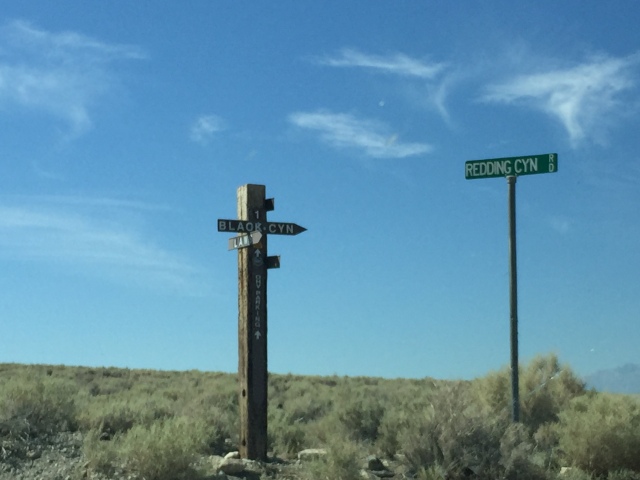
Unpaved turnoff to Redding Canyon Road
That’s my 2WD car!
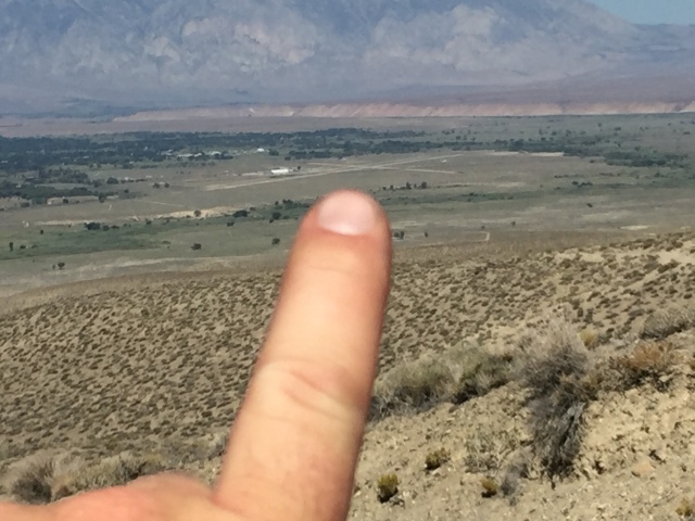
Bishop Airport
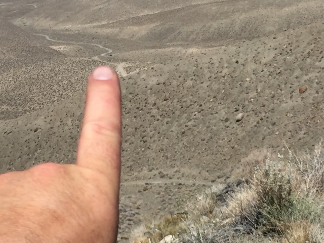
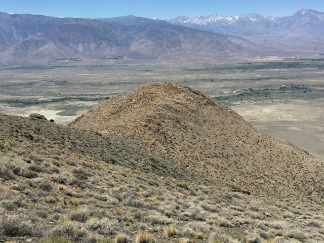
The plane crashed 180 feet below this summit. Large reflective aluminum pieces are visible as far down as my finger is pointing
Descending down to the memorial peak
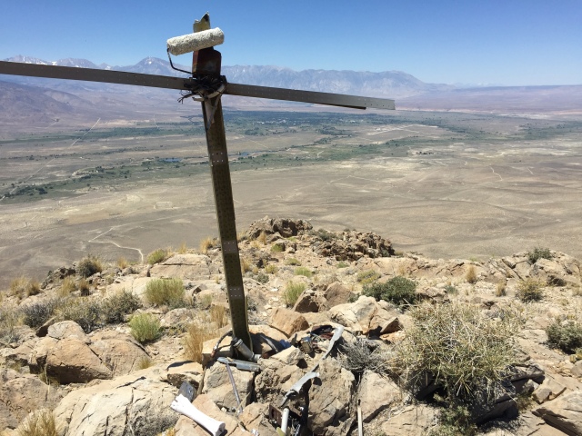
A cross on the peak, made of aircraft bits
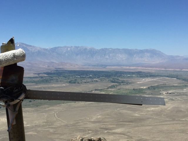
The Bishop Airport is just above the cross, on the right. About 6 miles away.
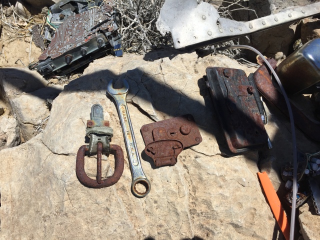
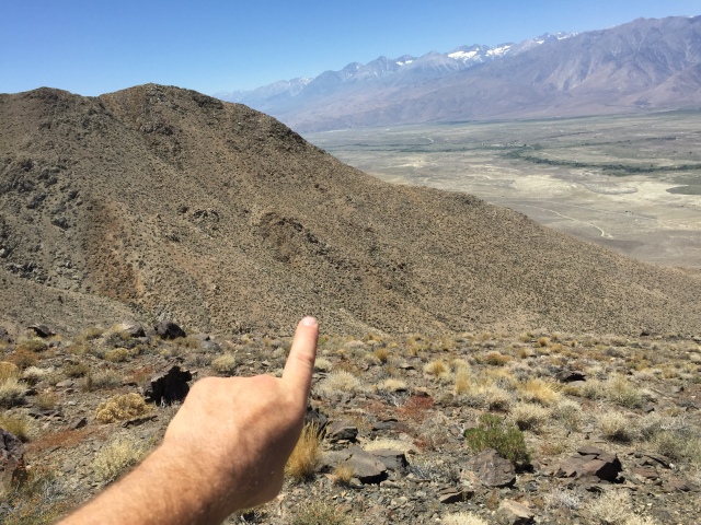
Very few pieces were at the summit. The plane crashed 180 vertical feet below the summit.

A lone sentinel tree I stopped at during my meandering return to the car
At some point, I may try a more direct route from below, to the actual impact site. It “might” be easier and I’d definitely see the wreckage. There are some great photos here: https://joeidoni.smugmug.com/Aircraft-Crash-Sites/The-Bishop-Convair-340440/
Please remember, this is a tough, and potentially dangerous hike. Be respectful of the site. Don’t remove anything.
Note: If I knew an optimal route to get there, I probably wouldn’t publish it anyway! “The Code of Ethics” for Wreckchasers, and people who search out archaeological sites, is to not make it any easier to locate than it already is. The bigger the effort to research and visit a site, the more likely there won’t be any disrespectful visitors and souvenir collectors.


")


My best friend Mary Parker was the flight attendant on board. Could you tell me directions from Main Street in Bishop? I just want to get to the general area. I don’t have a 4WD In 2004 I tried to reach summit but didn’t have right gear and enough water. Thank you for sharing this.
It means a lot to me
Mrs Terry Lozinsky
My uncle was killed in that plane crash. He was a cameraman for the series. They recovered his wedding ring and my aunt kept it on a chain around her neck. The loss devastated our family. I came across this post because today marks the anniversary.
Wow! Thank you for the comment, and sorry for the loss of your uncle!