One of my favorite “quick but challenging” bicycle rides (MTB and road bike) is in nearby Cupertino, CA. It starts at the Stevens Creek Reservoir, near the quarry.
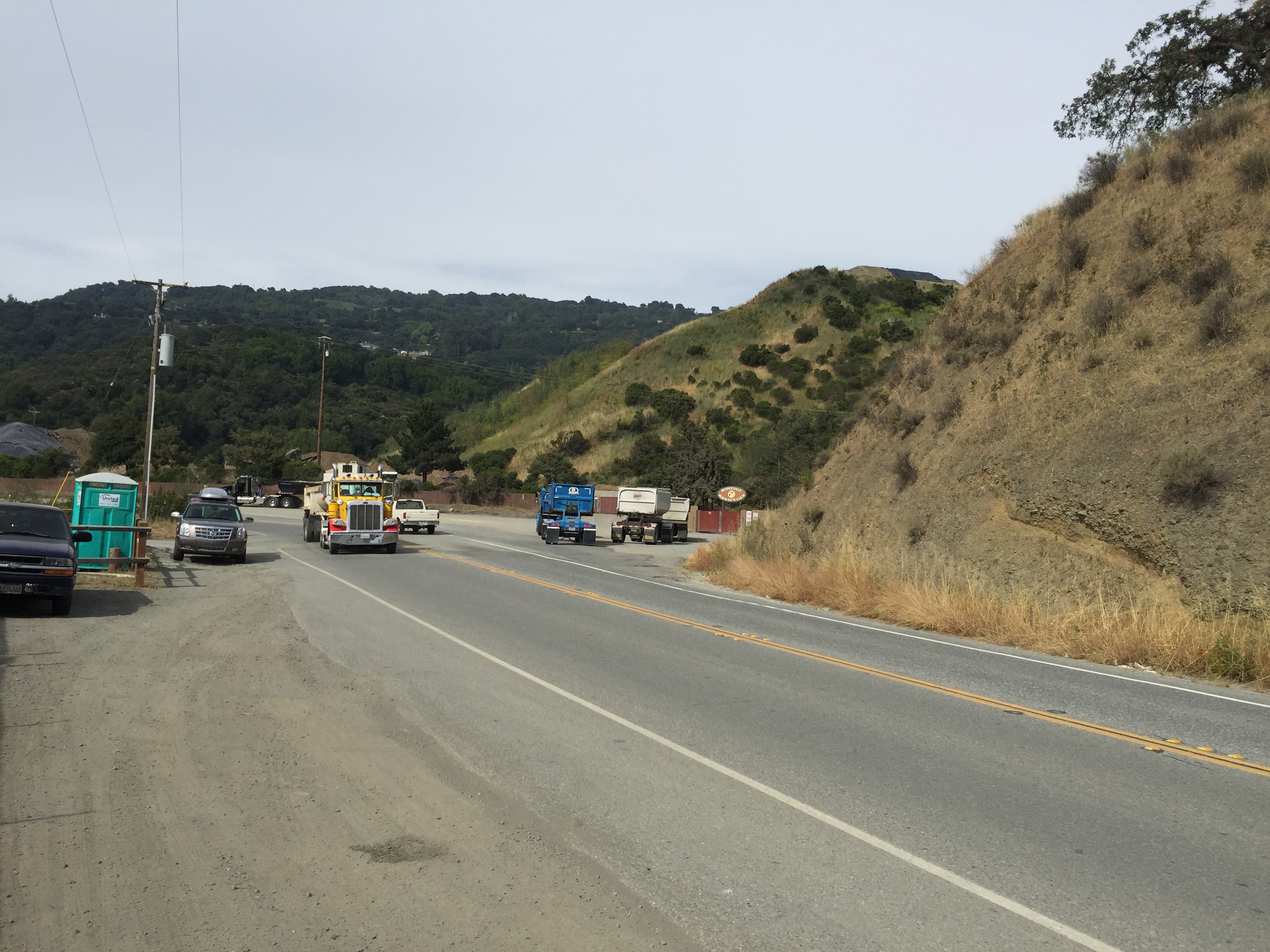
Park along the wood fence near the boat launch, outside of the paid area, if you want to save a few bucks. On weekdays watch for trucks for the first half mile, until you’re past the quarry.


Gravel trucks, viewed from roadside parking

Pass the quarry and turn right onto Montebello Road. Up you go! (It’s about 2000 vertical feet to the end of the pavement and a bit more if you’re doing the scenic MTB loop.)

Montebello begins (right turn)
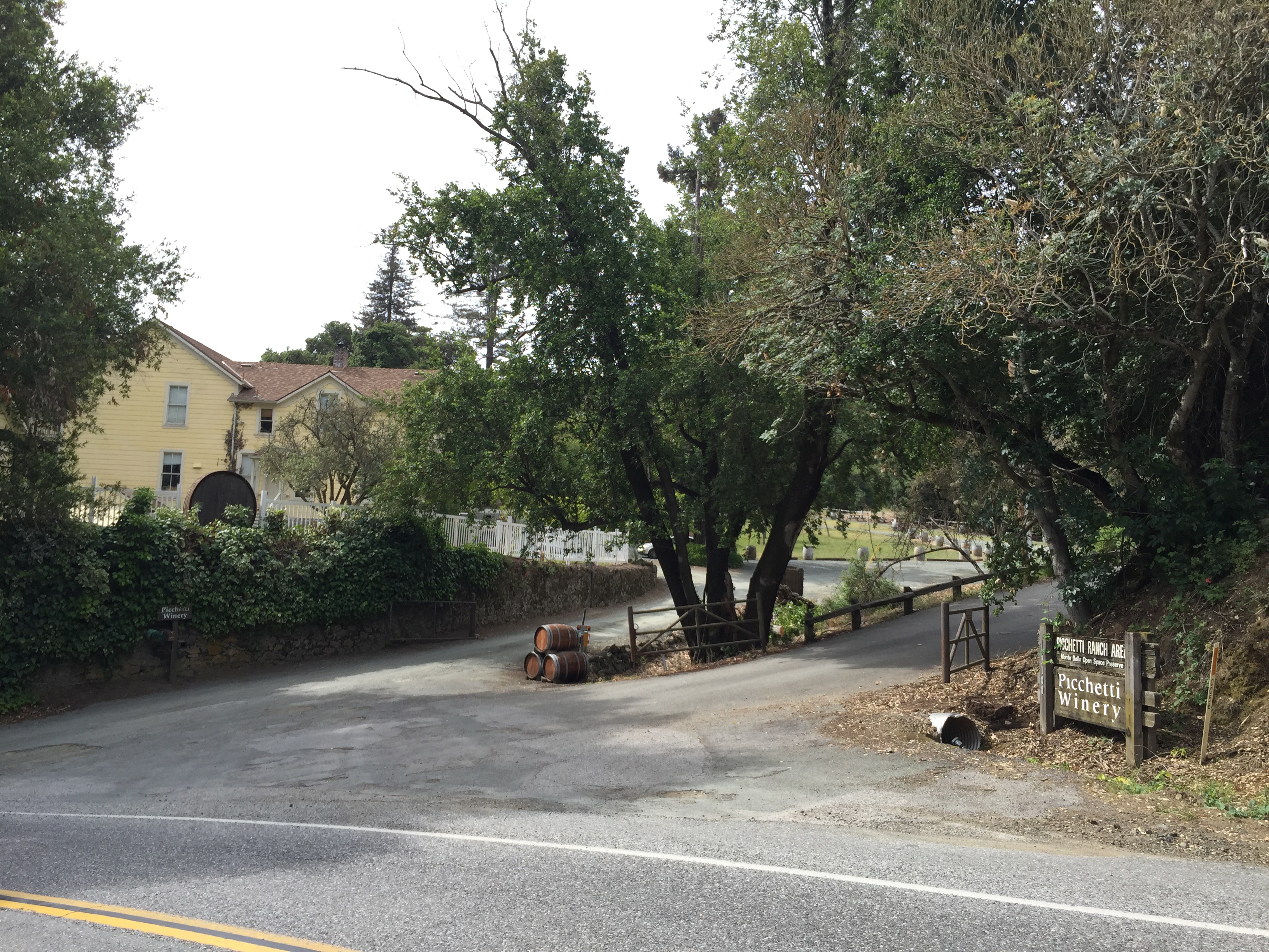
After about a half mile you’ll see the Picchetti Winery on your left. It’s a nice little picnic area for the kiddies, with some peacocks roaming the ground, as well as hiking trails. (Tasting room details:
http://www.picchetti.com/ The Picchetti Open Space Preserve has parking in the next driveway up the hill. Trail map and details:
http://www.openspace.org/preserves/picchetti-ranch )

Picchetti Winery
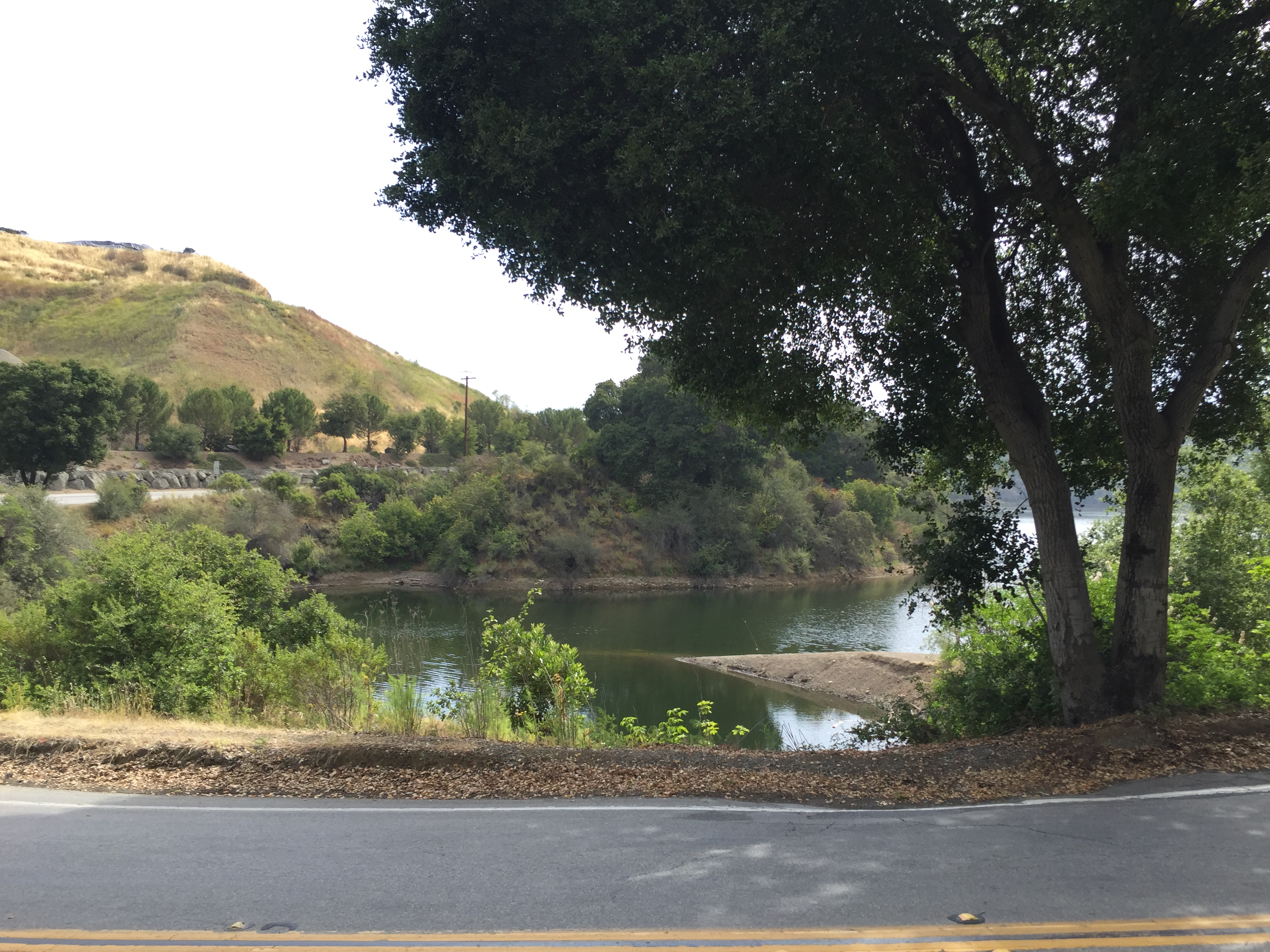
Keep climbing Montebello Road and you’ll see the reservoir in the distance and a bit of dust rising from the quarry (on weekdays when they’re working)

Reservoir and dust from the quarry
Keep grinding uphill, past the now-closed Montebello School (closed in 2009, after 100+ years, due to declining enrollment
http://www.mercurynews.com/localnewsheadlines/ci_11889156?nclick_check=1). When you see the Ridge Winery
http://www.ridgewine.com/ on your left, you’re getting to where climb starts to flatten out (…relatively speaking!)

Ridge Winery
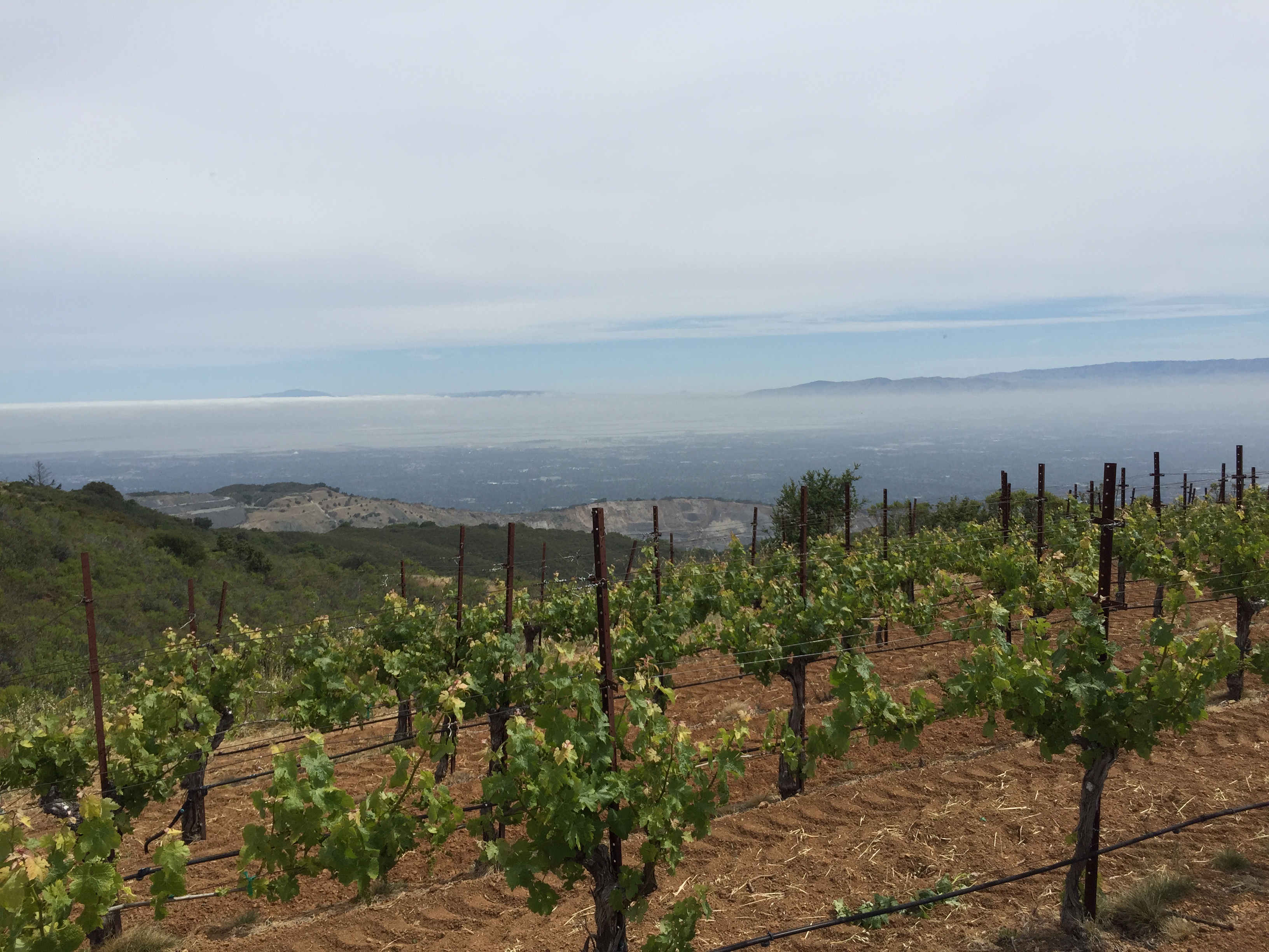
In the home stretch, at least if you’re on a road bike, you’ll see a big vineyard coming up on your right:

Getting close and flattening out

Silicon Valley below!
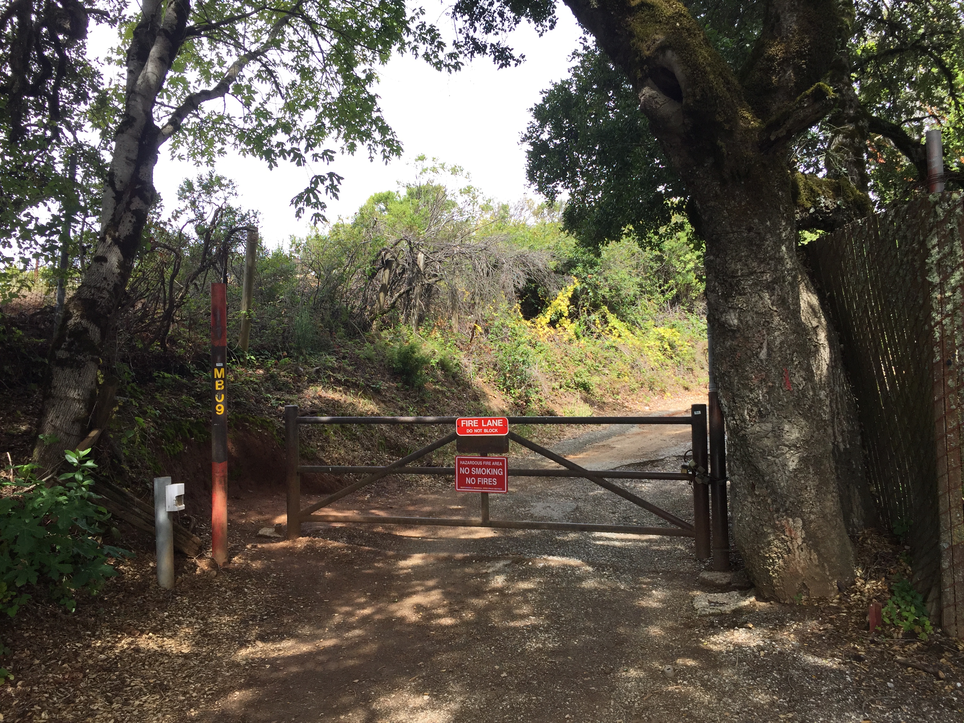
Side note: All of Montebello Road is “No Parking”. There is a “workaround” if you want to hike or bike from near the top. Apply for a parking permit a few days in advance and you’ll be given the combination to this gate, where you may park. Easy and convenient!
http://www.openspace.org/visit-a-preserve/permits

Waterwheel parking
…and a little further is the end of the public road. If you’re on a road bike this is your turnaround point….and come back and do it 4 more times in the same day, like a local endurance athlete did!
http://www.jilloutside.com/2015/04/cures-for-springtime-mehs.html

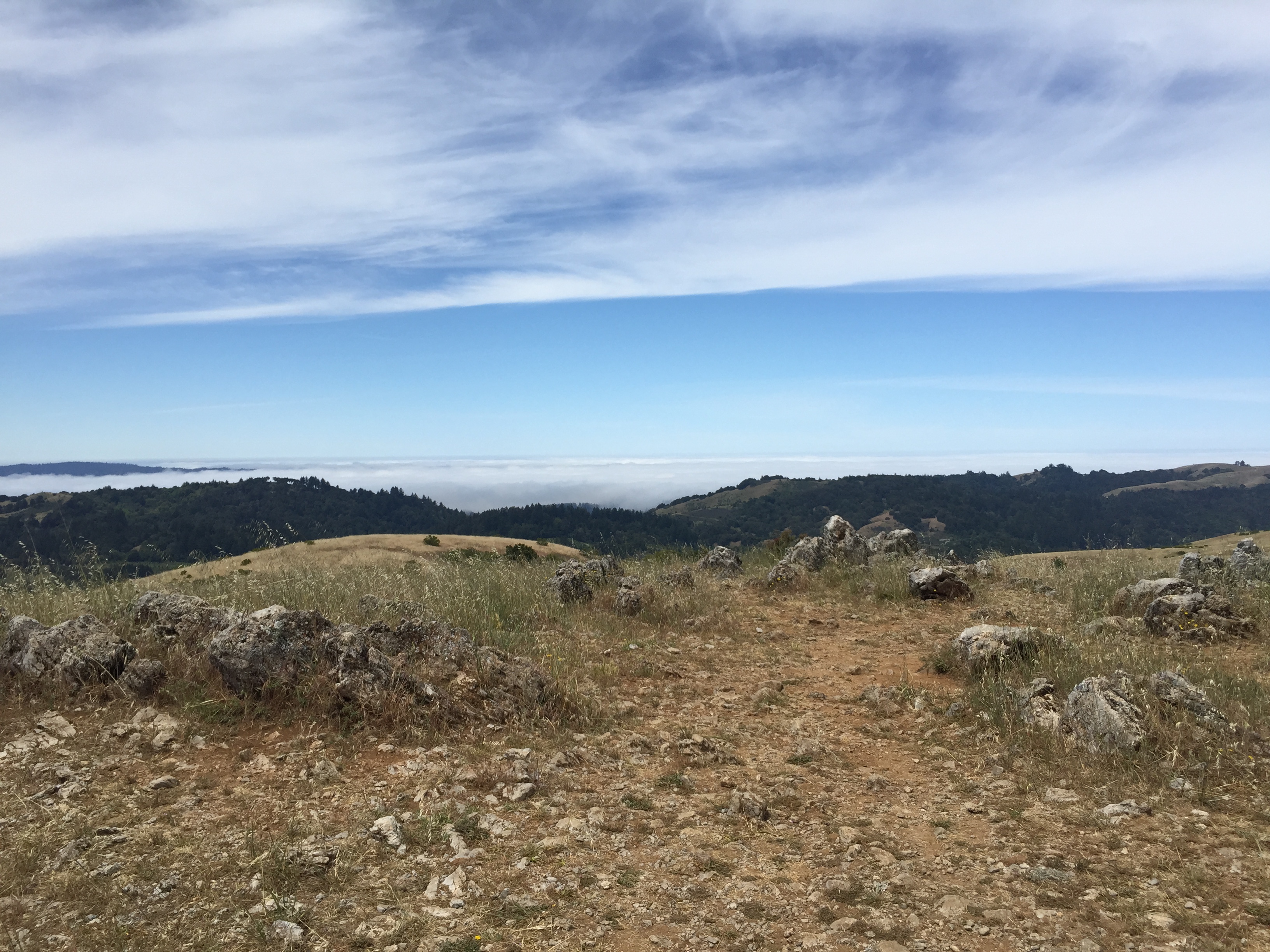
If you’re on a mountain bike and want a nice descent through the canyon, go around the gate and head up another 15 minutes, or so, until you see the second set of towers and the vague summit of Black Mountain:

Black Mountain summit, with the Pacific Ocean under the fog layer

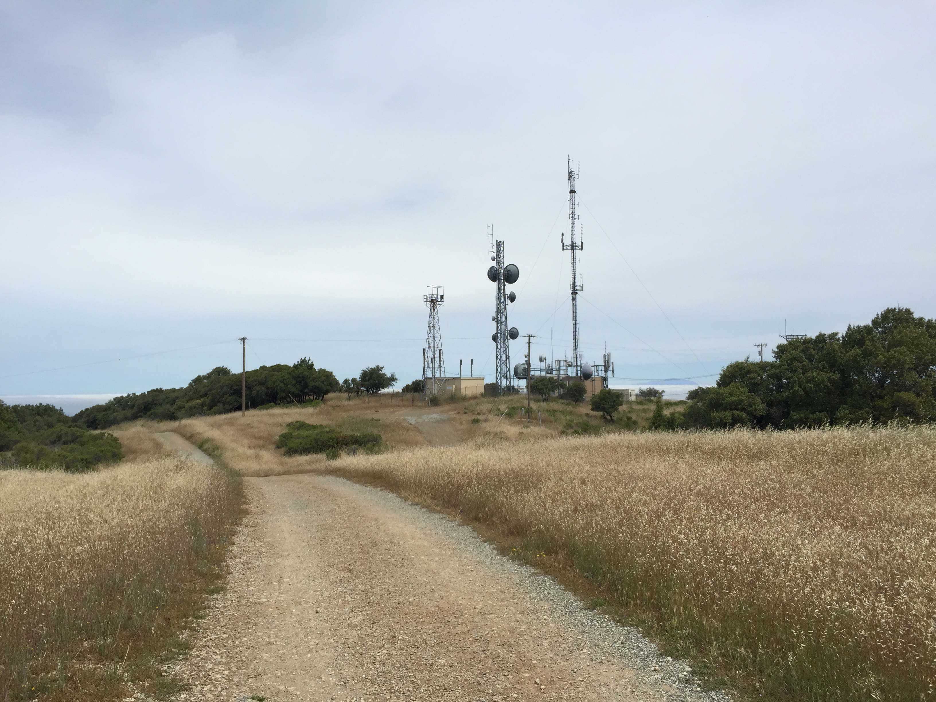
Towers close to the actual summit
When you’re ready for the descent, continue on the gravel road, with the towers on your right, and bear left at any forks in the road. When it gets really steep, you’ll be on “Indian Creek Trail” and soon making a left onto the canyon trail, where it is more gradually graded.

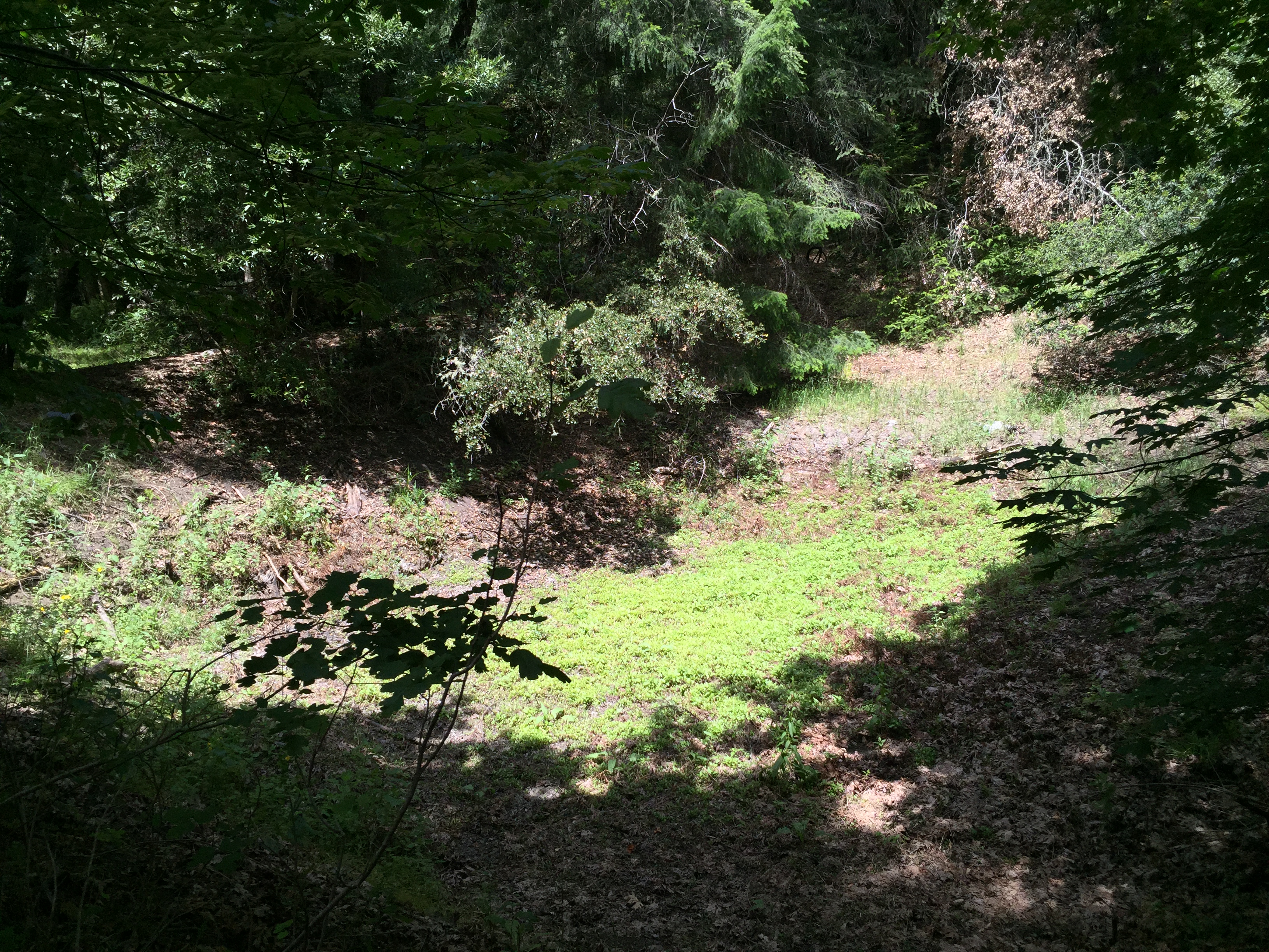
If you have a GPS device and are curious, there is a seasonal pond, just a few steps off the right side of the trail at N 37 18.779 W 122 9.675. In the spring (non-drought years) this fills with water. I’ve seen a bunch of newts lounging around here in late March or April in previous years.

Seasonal newt pond (dry!)
And, yes, at some point you’ll leave Palo Alto and re-enter Cupertino! (FYI: There occasional reports of radar speed traps way out here in the woods, enforcing the 15mph limit for cyclists)

Does it really matter?
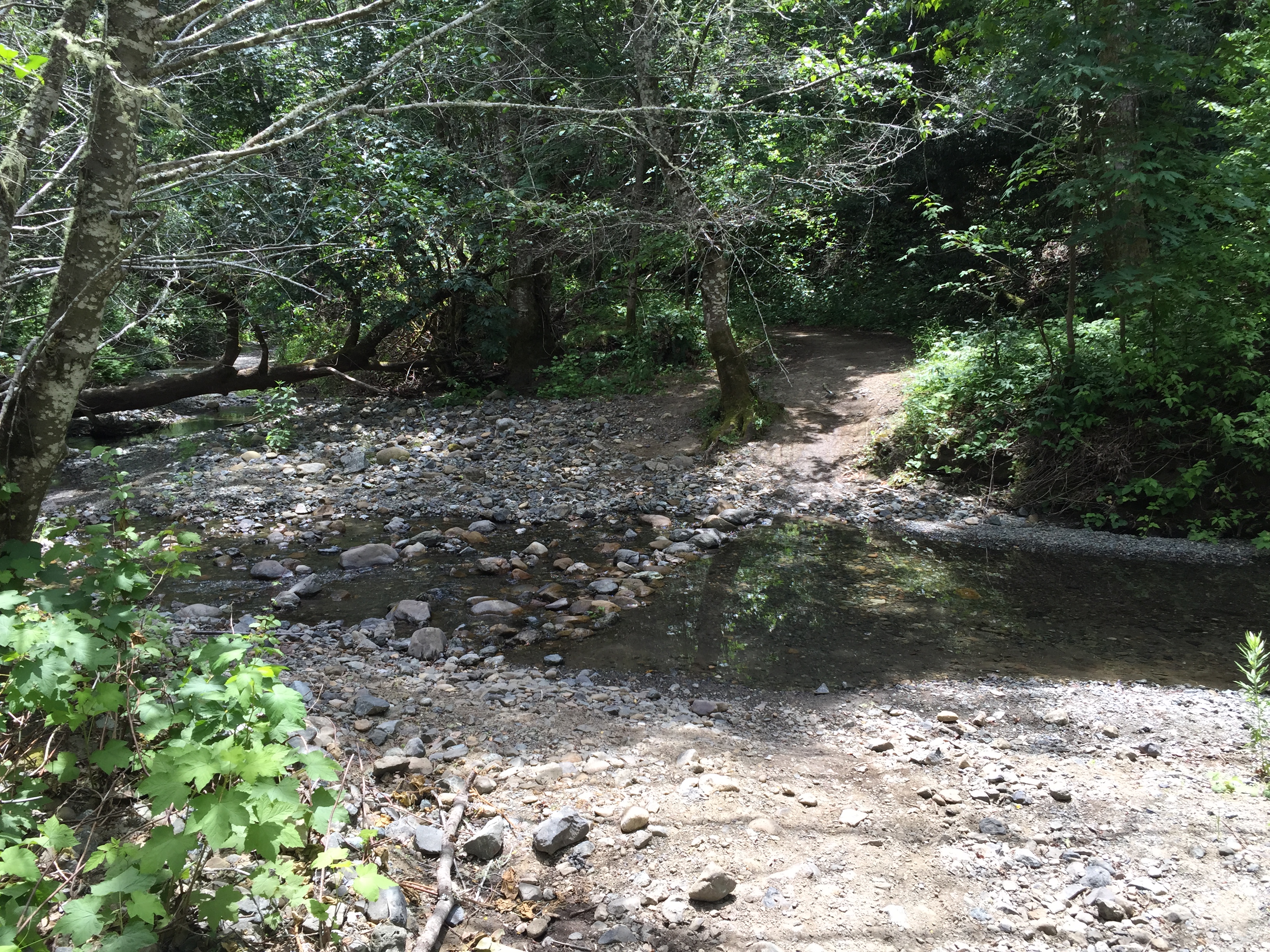
There is one creek crossing, which does become an uncrossable raging torrent after major storms. Today it was a pleasant trickle, about 4 inches deep.

Dangerous during a storm
Eventually you’ll get back to pavement and see a few rustic homes. Below is the intersection with (crazy steep) Redwood Gulch Road. There is roadside parking here for about 4 cars if you’re interested. No parking further up the canyon.

Redwood Gulch intersection
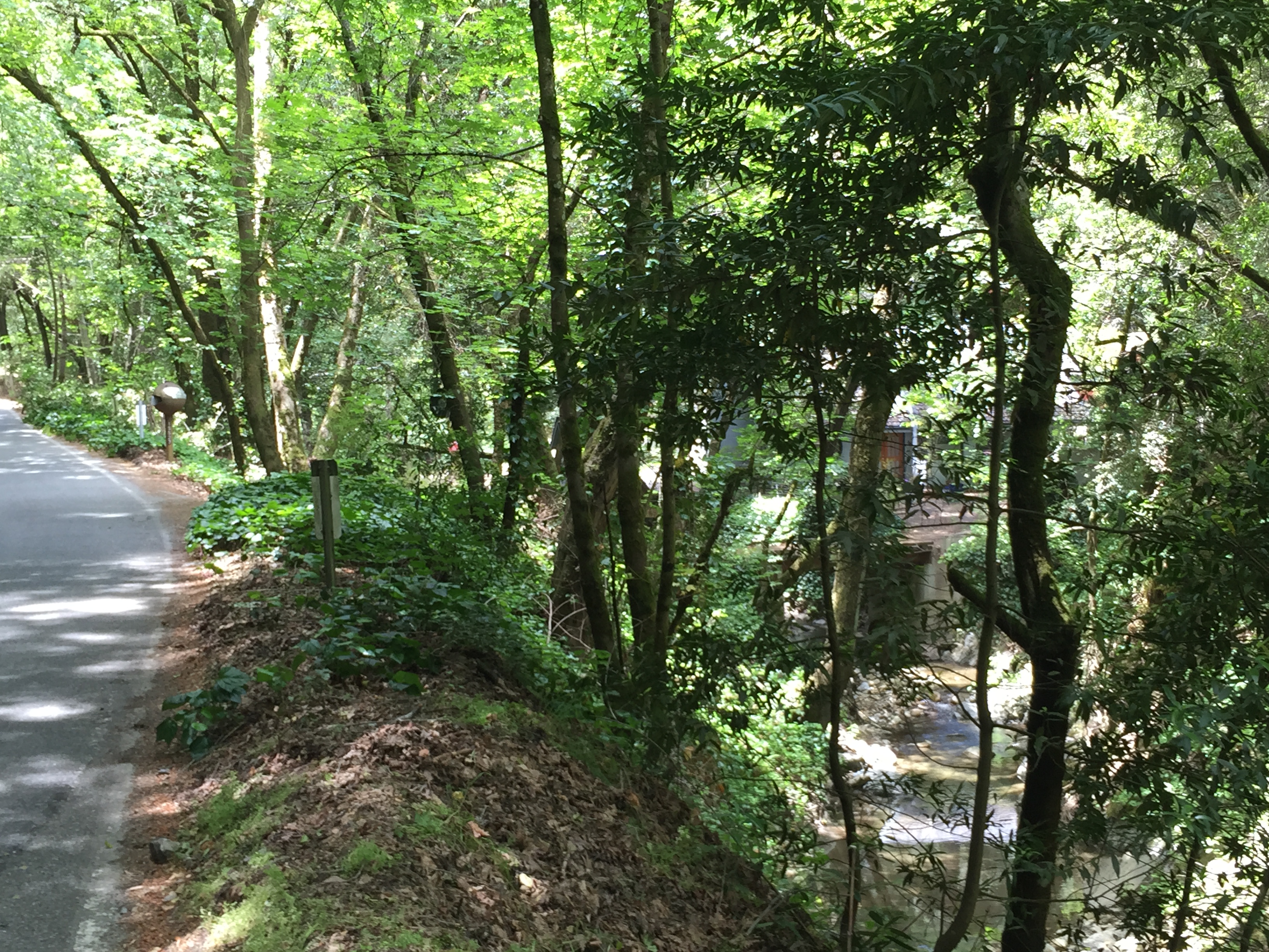
A few more miles of peaceful pavement follows the meandering Stevens Creek to where it empties into the reservoir near the quarry.

Following the creek to the reservoir
Small side trip: Kristy Gough and Matt Peterson were killed nearby in 2008 by a Sheriff’s Deputy who fell asleep at the wheel. If you parked on the side of the reservoir, like I did, you passed the Ghost Bike on your left and the accident site on the embankment before that on your right. Both were accomplished athletes, with Kristy having won the Hawaii Ironman in her age 25-29 group and was expected to be on the US Olympic team.
http://velonews.competitor.com/2008/03/news/cyclists-are-remembered-by-friends-and-teammates_73139

Kristy Gough and Matt Peterson, 2008

The actual spot
That’s it! 20 miles and ~2600 feet of elevation. My Strava track, which can be downloaded in the “tools” section, where you see the wrench, is here:
https://www.strava.com/activities/313781592
Enjoy this cycling loop, or come here as a hiker to (permit only) Waterwheel Parking, Picchetti Ranch, or Redwood Gulch
About AlphaRoaming
Random outdoor roaming: hiking, cycling, camping, backpacking & plotting more of the above
Grew up on the edges of the Adirondack mountains of New York, just a bit west of Vermont. Now living in Silicon Valley and venturing out when and where I can!


")


It’s fun to read some background/history about one of my regular cycling routes. Thanks for posting this.
Thanks for the comment and good luck on the Tour Divide!
I miss that loop… spent may years grinding up and flying down Montebello Rd/Canyon trail and the rest of the rest of MROSD. I don’t live in the area anymore and as the old saying goes, “you don’t know how good you have it until it’s gone” 🙂 Nice writeup; brought back some good memories.