

The lesser-known Dowdy Ranch entrance to Henry Coe State Park is open seasonally to cars on weekends starting in May. Four of us enjoyed a lengthy hike on the first open weekend of 2015. (Details and location of the park entrance: http://coepark.net/pineridgeassociation/planning-your-visit/visitor-centers-and-park-entrances/dowdy-ranch-visitor-center
After driving the 8 miles of well-graded gravel from Highway 152 (Pacheco Pass), we parked the cars and were soon walking past the summit of Burra-Burra Peak.
(You can also enter the park 24/7/365 by leaving your car down by Highway 152. The gravel road is always open to hikers and cyclists. It’s about 80 minutes uphill if you’re a reasonably strong cyclist and ALOT of fun coming back down, despite the posted 15mph speed limit! https://alpharoaming.com/2013/02/24/orestimba-corral/
(History geeks will want to know that a Civil War-era copper mine was briefly attempted at Burra Burra Peak. It was named after the Burra Burra copper mine in Tennessee that became part of the Confederacy, necessitating the Union to look for an alternate source of copper. http://en.wikipedia.org/wiki/Burra_Burra_Mine_%28Tennessee%29 )
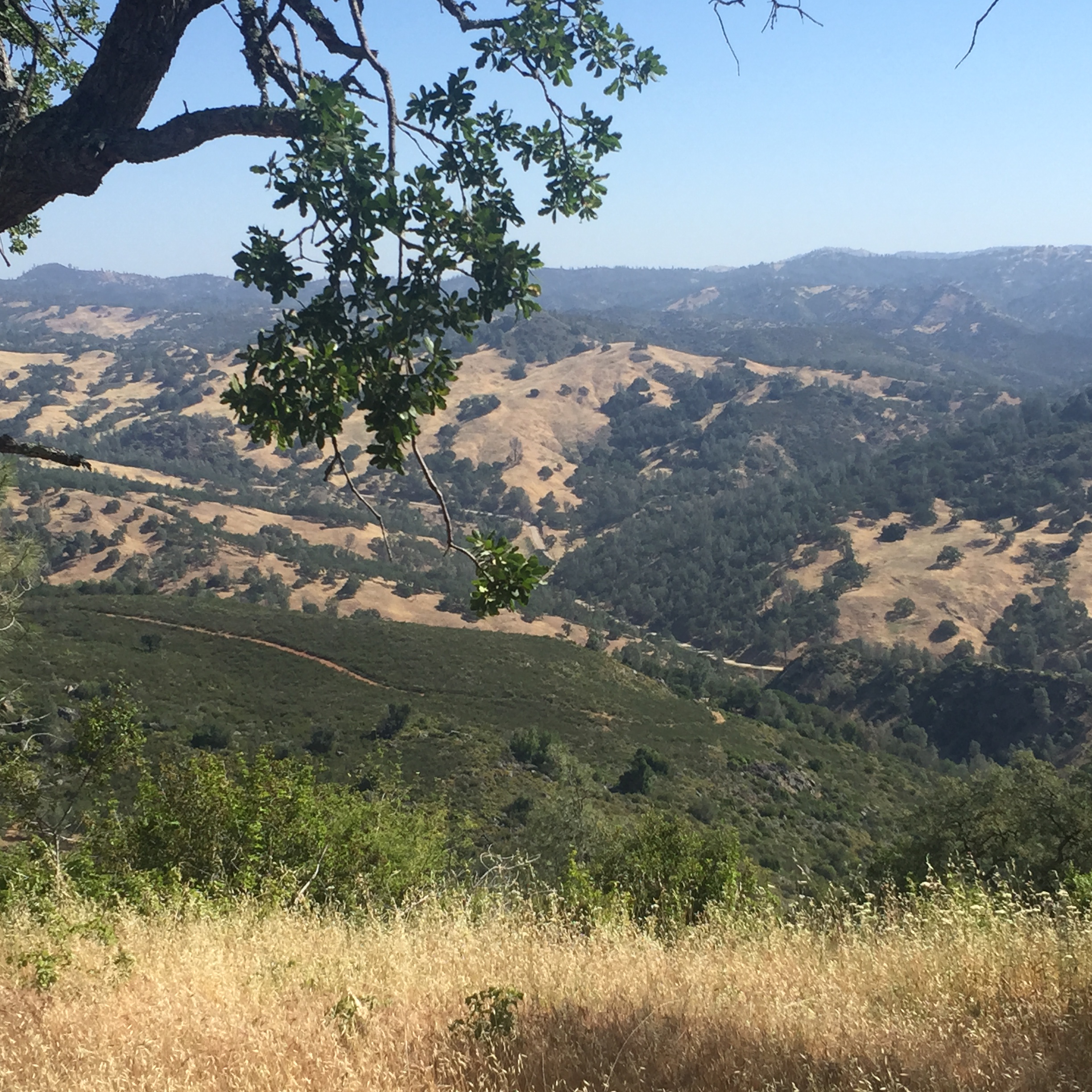
Below is a view from the backside of Burra Burra Peak, on the Center Flats Road. The chaparral-covered ridge includes (a trail I can’t figure out on the map) and the far valley includes Kaiser-Aetna Road, north towards Orestimba Corral.
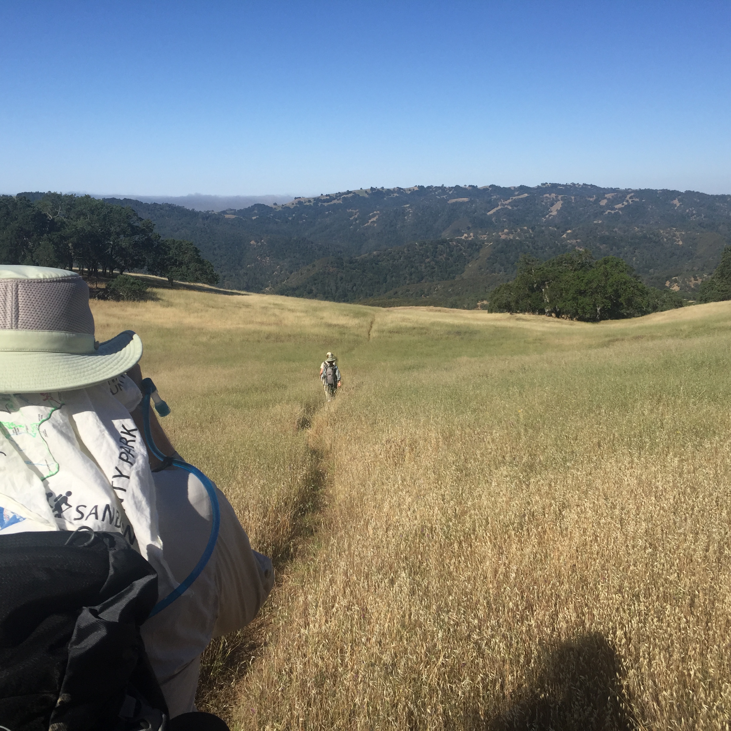
After a bit, we turn right onto the Walsh Trail and start down, down, down… Few hikers come this way and even fewer bicycles.

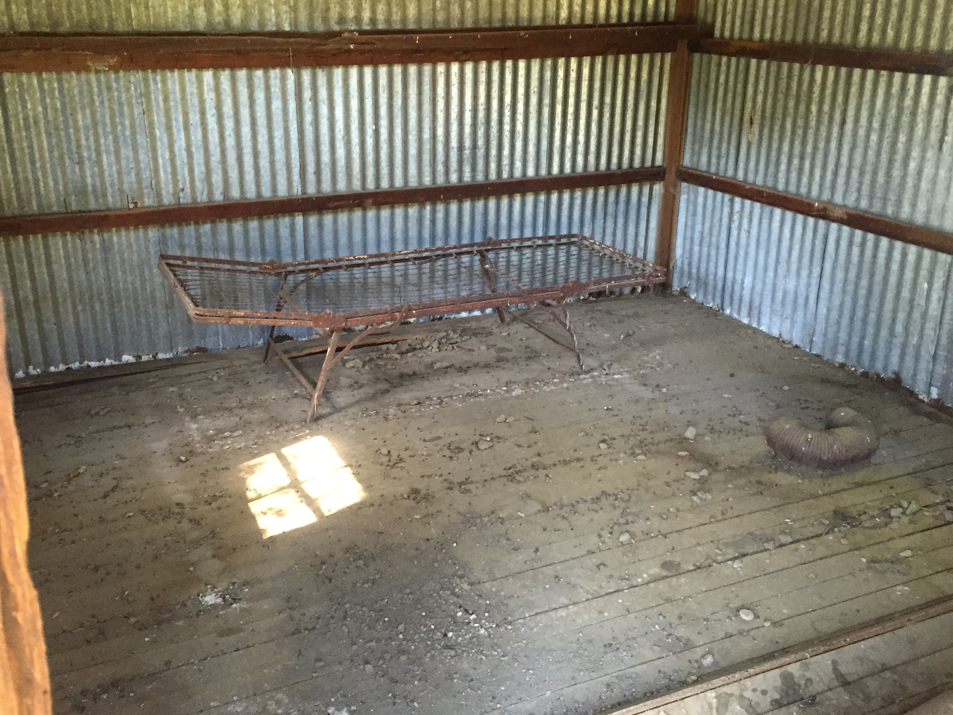
Finally at the bottom, we find the creek and the Tin Cabin:

Complete with two broken bedframes and signs of rodents spending some time there (i.e. “hantavirus”).
As we cross the creek, the first in our group spots a turtle (not very effectively) running for cover. Just below the dry rock, notice the smaller underwater “rock” that’s shaped like a turtle!

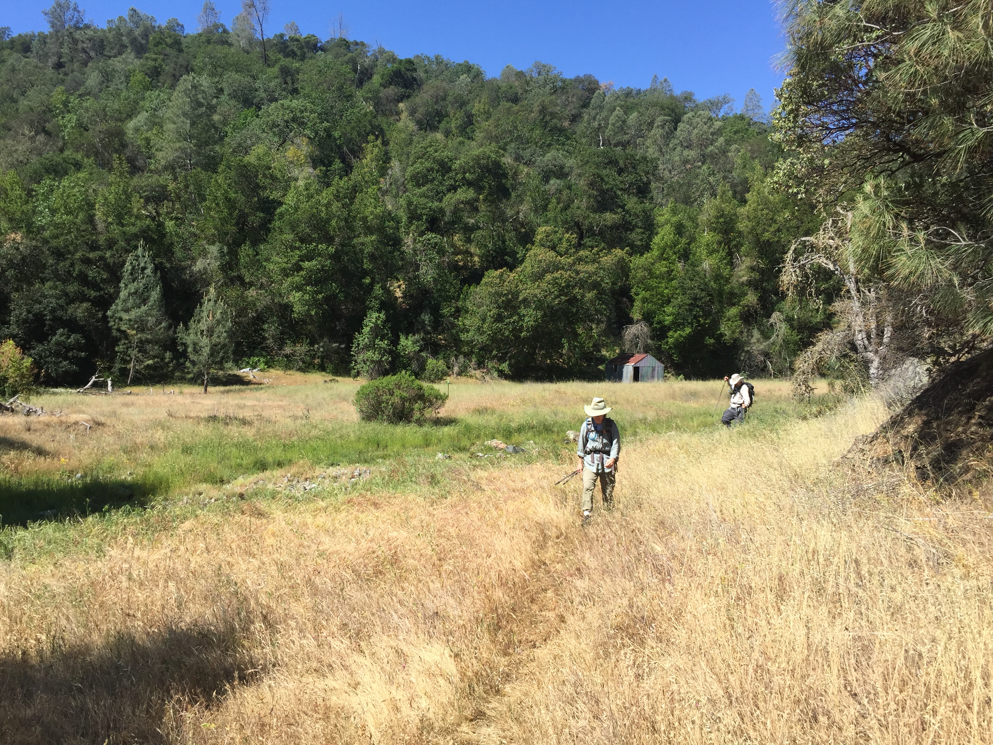
..and crossing the meadow, with the cabin and creek behind us, ready to climb out of the canyon:
We reach Pacheco Ridge Road after a very steep climb (“steep” like Steer Ridge and the Mt Sizer “shortcut”, if you “know Coe”. My Strava track shows 500 feet of climbing in 0.4 miles = ~25% grade.)
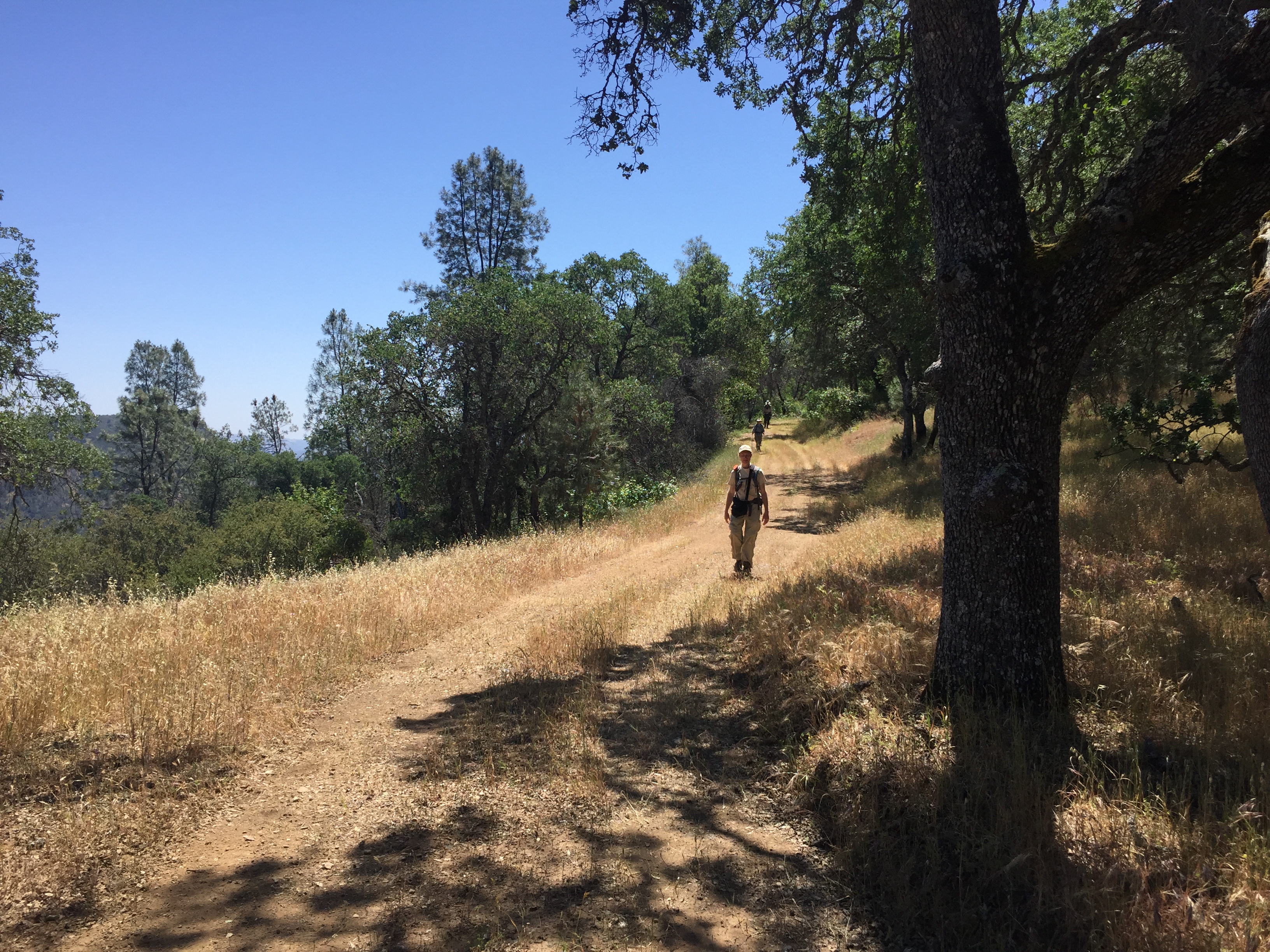
Finally we get to “Coe normal” roads, versus the “Coe steep” Walsh Trail:

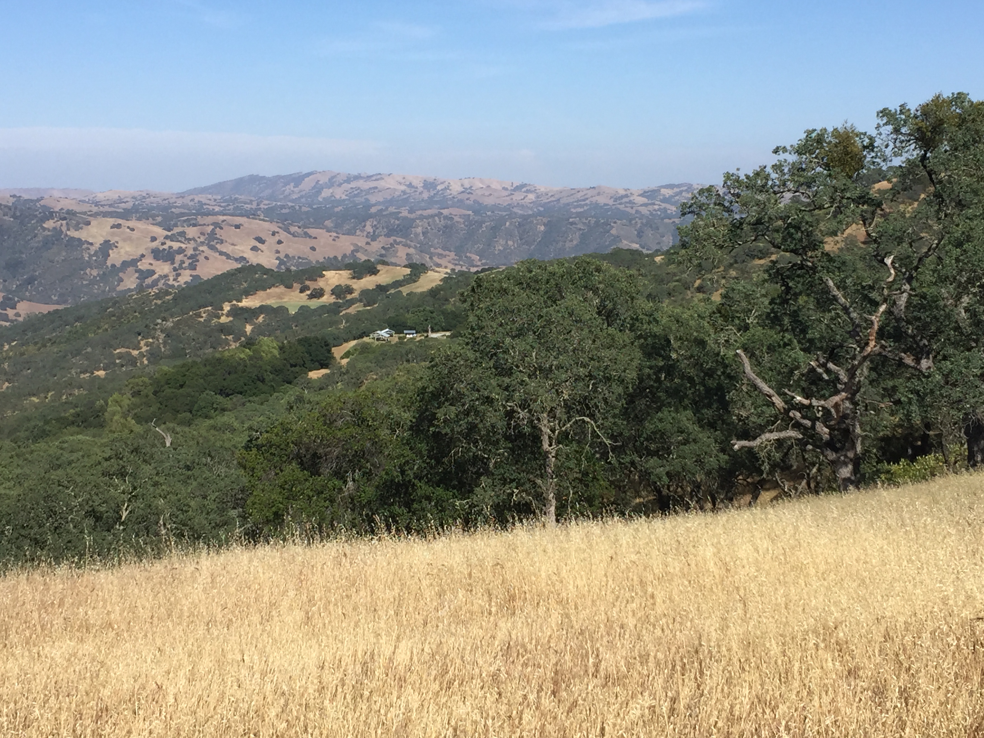
From Pacheco Ridge Road we see the currently-dry Pacheco Falls area.

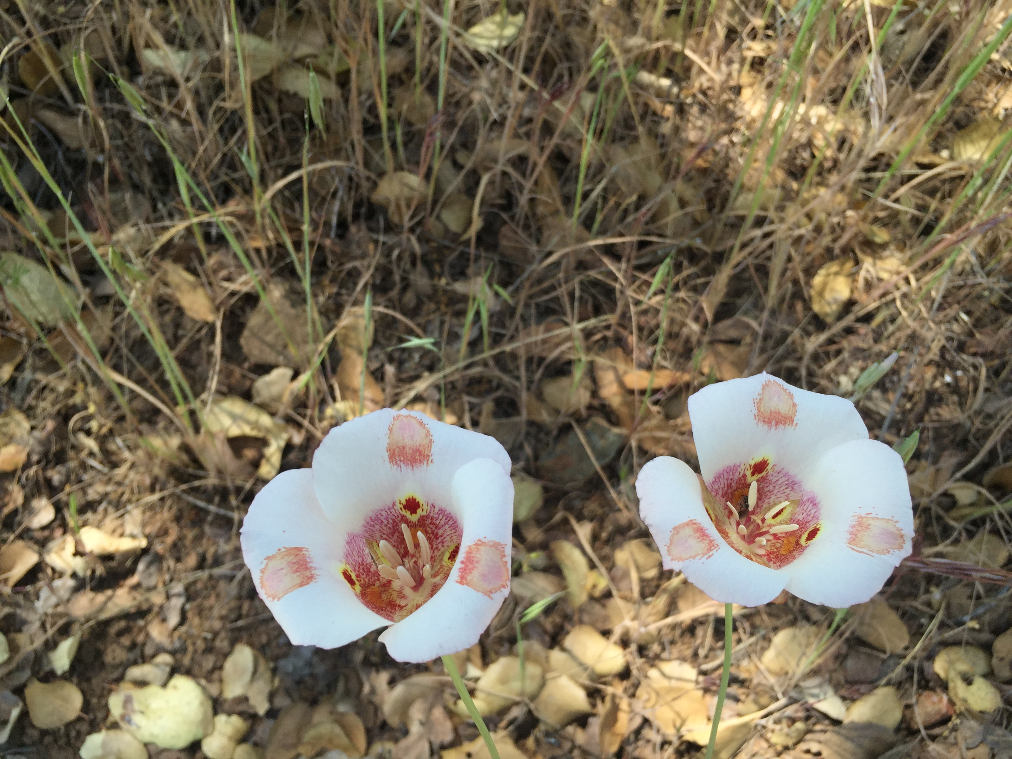
…and many scattered Mariposa Lillies prospering in the drought and poor soil
The occasional shade and flatter stretches of road are welcome after the climbing we’ve done so far.
Soon we see Pacheco Camp:
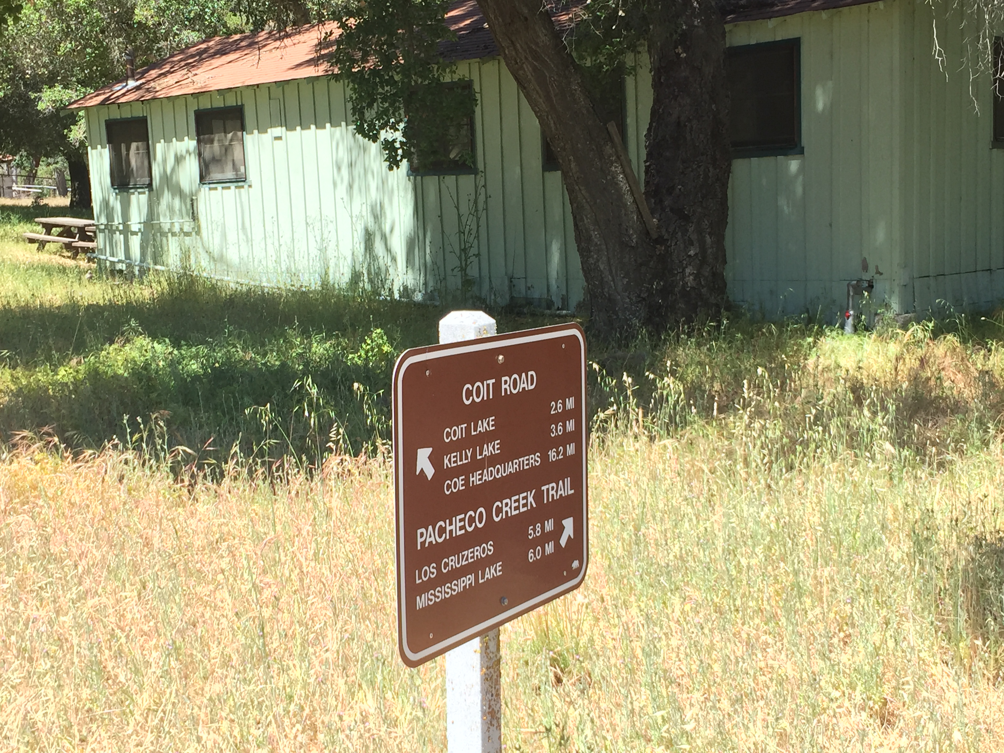
Pacheco Camp is a maintained and padlocked building, with kitchen facilities, used for various official State Park activities. (I think…I’ve asked the question of who gets to use it and under what circumstances. I’ve never been able to get an answer of who has the keys and makes the decisions. If anyone knows, please let me know. If it’s a benefit of being a Coe volunteer in the backcountry, it may be a motivator. As a secret, it’s demotivating…)
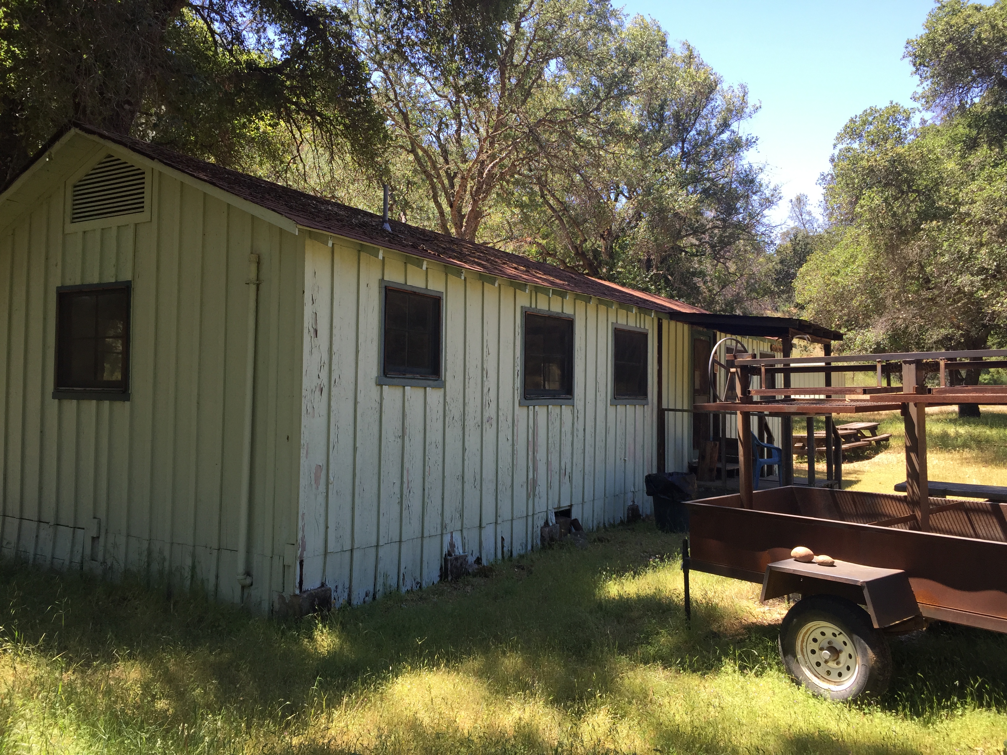
Anyway…it’s an awesome place to visit regardless, including shade, picnic tables, pit toilets, and a reliable source of great water. The water is gravity-fed to a sink and a shower house(!) from way uphill at the Live Oak Spring. Kudos to park volunteer “Paul L” and others for their work in improving and maintaining the water sources in Coe. http://coepark.net/pineridgeassociation/planning-your-visit/water-resources/water-conditions-springs
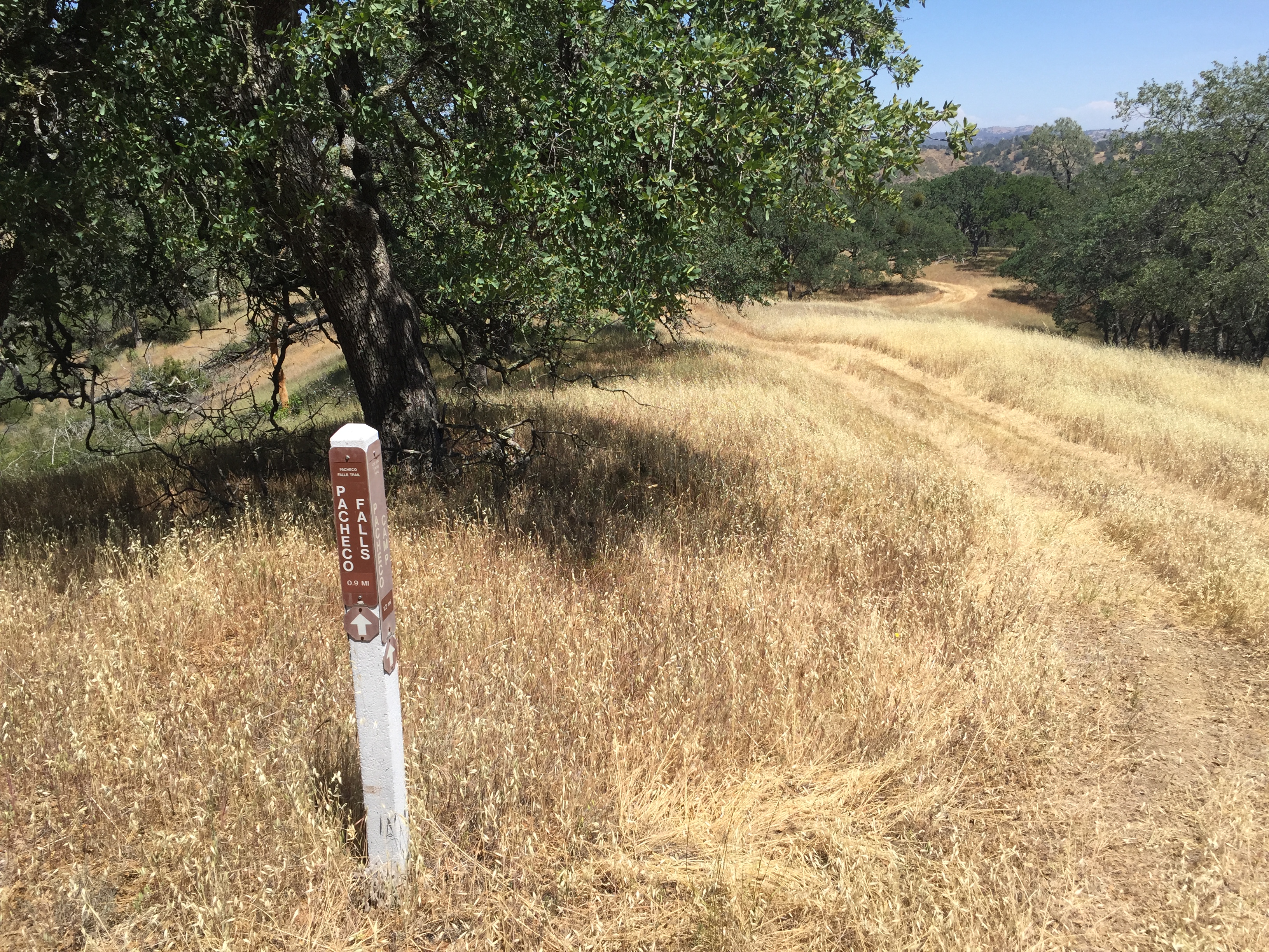
Time to start the return trip, this time down the other side of the canyon, past the proper trail to Pacheco Falls:
Here’s an older picture of Pacheco Falls, late April 2012, a few hours before sunset:

A little further down Wagon Road we pass Wilson Tower, peeking above the trees, just to the right of center. The tower is for backcountry radio communications. There’s a great logbook near the tower, under some rocks. It was placed by geocachers, but is well known by cyclists too. Fun to read, but we didn’t stop this time:

Finally we head down the Hersman Trail and soon see the buildings and picnic area at Dowdy Ranch in the distance.
That’s it! About 16 miles and 3500 vertical feet. My Strava track missed the last few miles: https://www.strava.com/activities/297694932


")


Always enjoy reading your adventures. Great photos, beautiful.
This does look like a Coe-tastic route. I’m considering getting back out there once more before the full heat of summer.