
On September 7th I did a big hike of 20 miles with a few friends. Due to the warmer weather, we decided to head towards the coast and redwoods. Michael suggested starting at Waddell Beach in Big Basin State Park. Great idea!

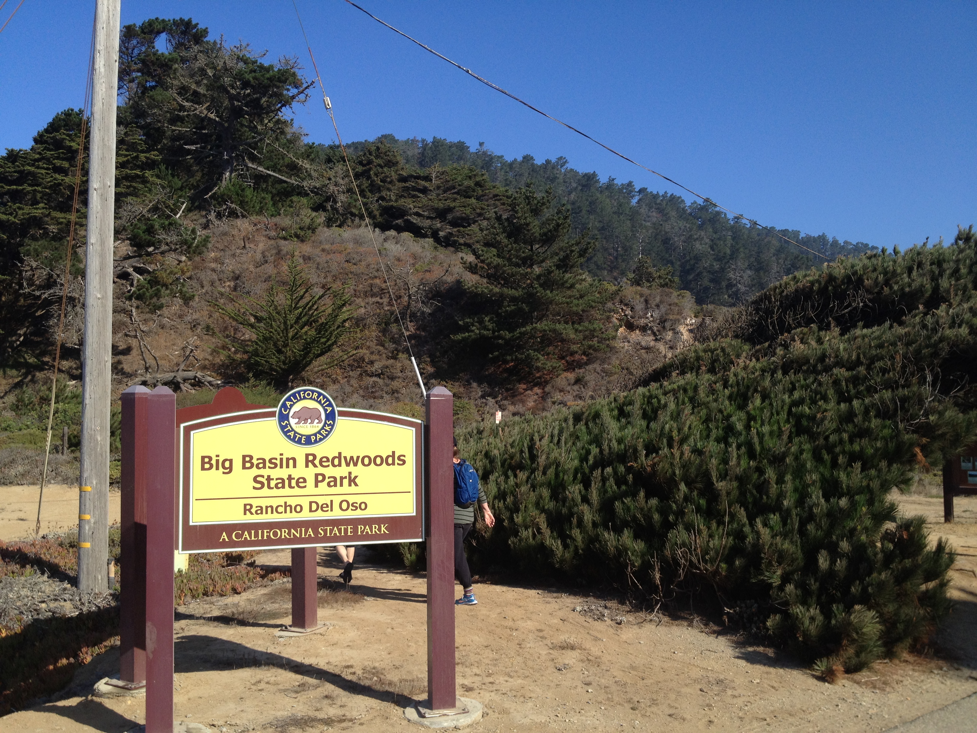
Big Basin State Park was California’s first state park and one of the most popular. The campgrounds book-up very far in advance in the summer with families and tourists. There ARE several other entrances to the park for us “locals” who avoid the crowds and Visitor’s Center.
Park information: http://www.parks.ca.gov/?page_id=540
Park brochure and map: http://www.parks.ca.gov/pages/540/files/BigBasinRedwoodsFinalWebLayout030311.pdf
From the scenic beach, with quite a few kite surfers, up we went!

After awhile we’d left the beach behind and enjoyed the cool, calm redwood forest.
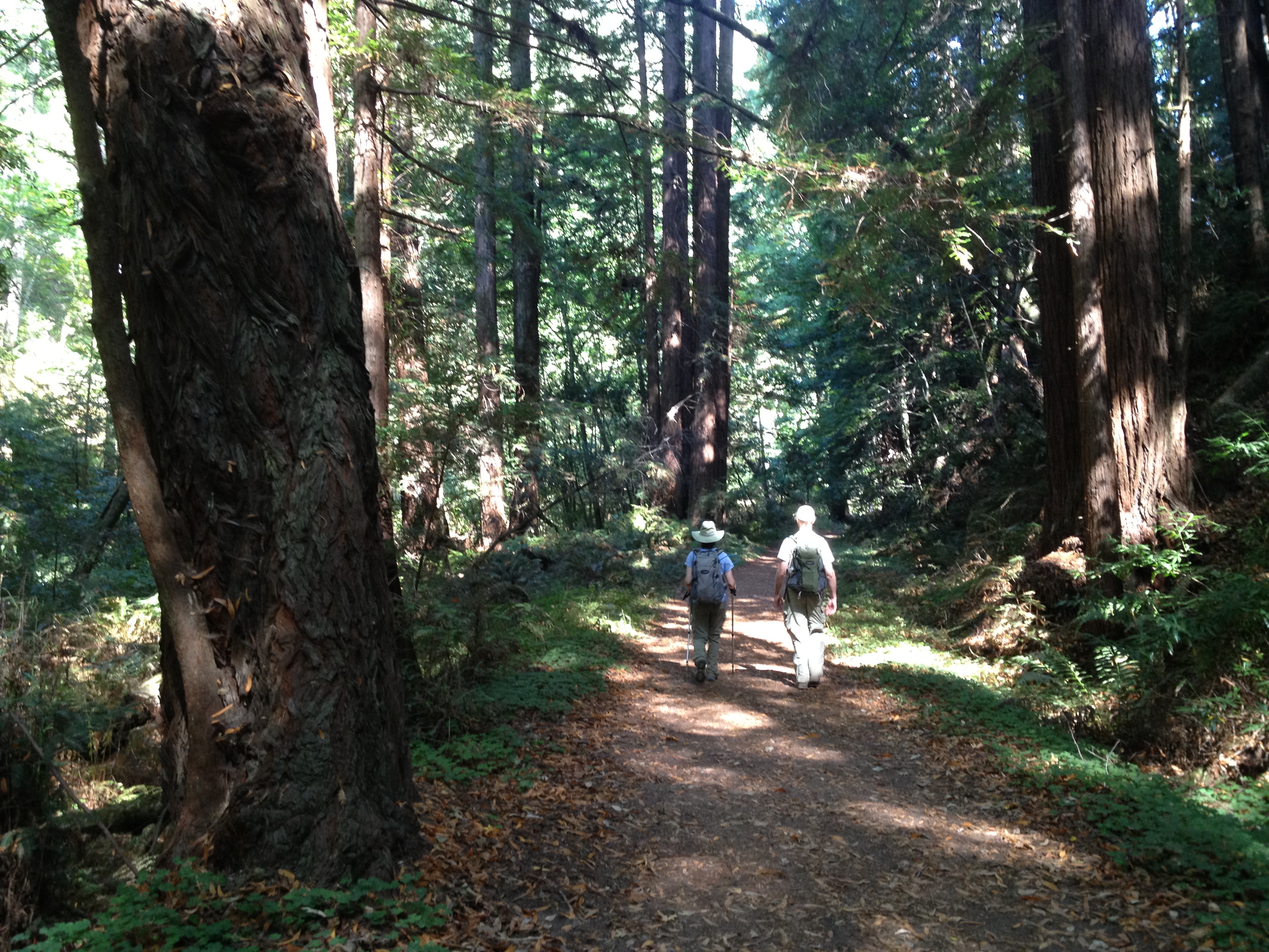
The park has many trails, which are well-marked, though you do need a map of some sort!

Interestingly, we spotted this piece of old equipment. It was likely used to move logs out of the forest at some point. We noticed the large balloon tires, as well as the un-rusted wheels.
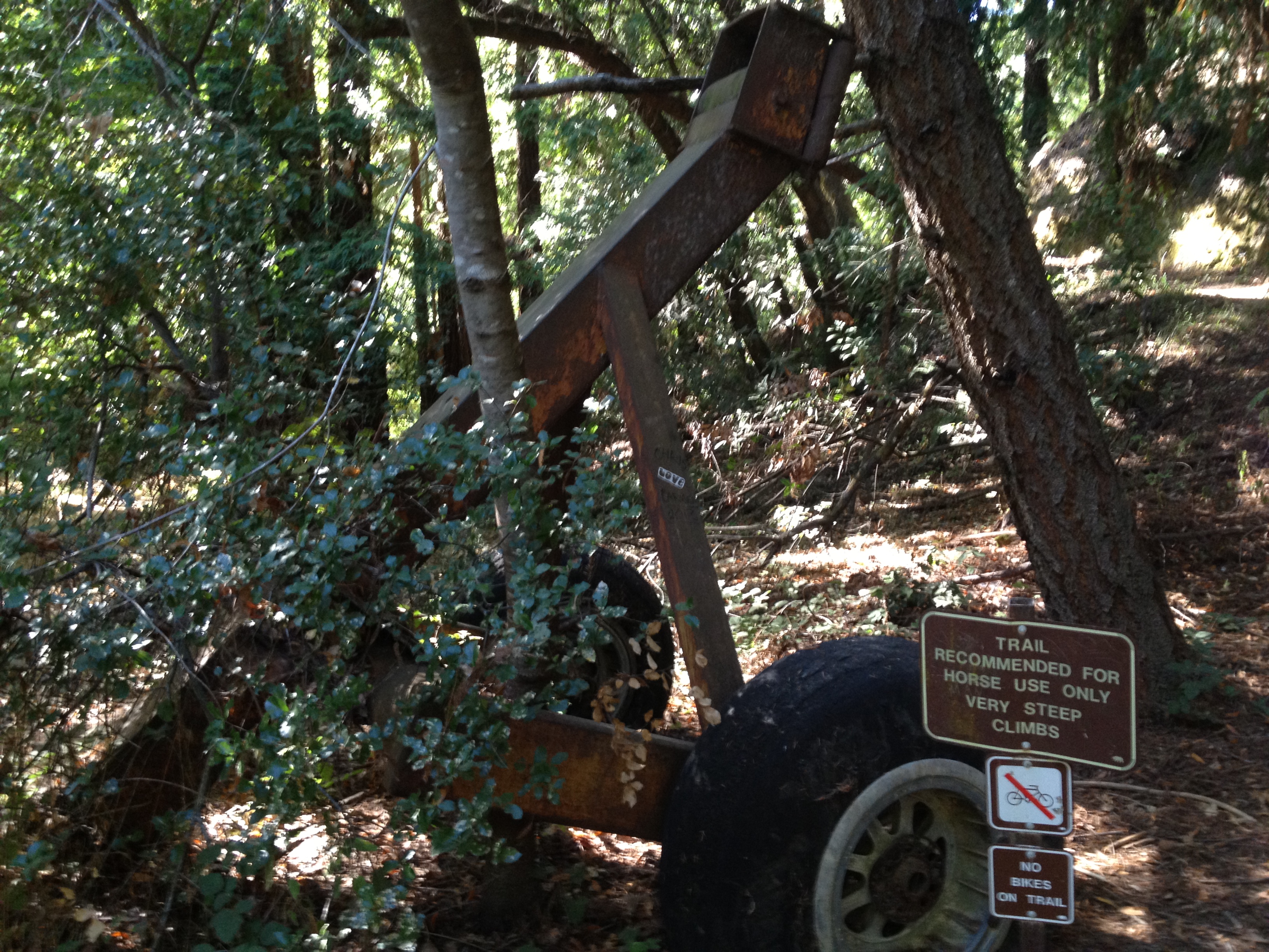
Upon closer examination we found the wheels were aluminum and had serial numbers, as well as a date of manufacture from 1942. Re-purposed aircraft wheels! …which were likely available right after the war at scrap metal prices.

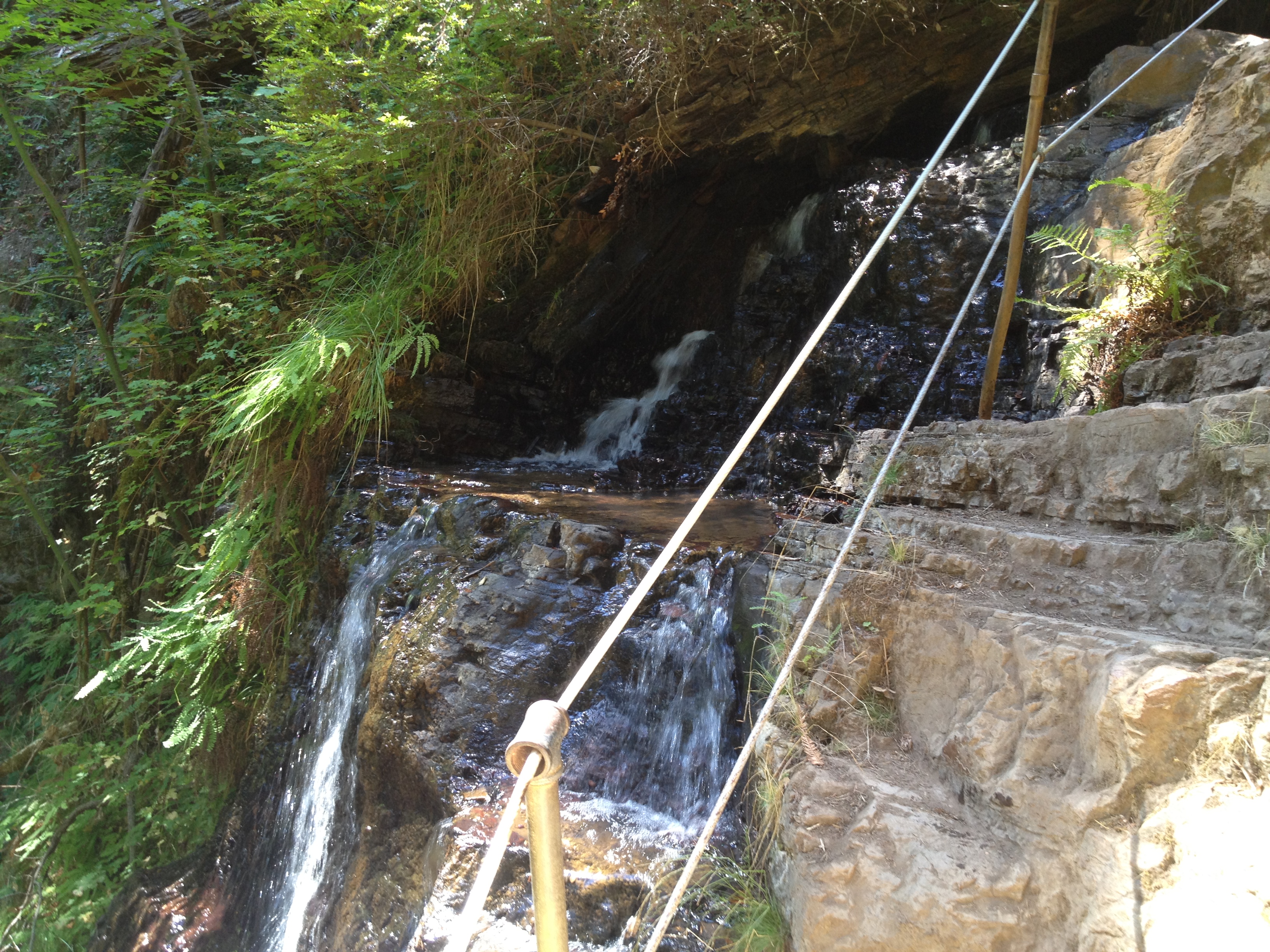
It was wonderful to see and hear flowing water as we went uphill, given the extreme drought we’ve had recently.

Soon, we approached Berry Creek Falls, which, besides the large redwoods, is the most popular attraction in the park.

Most visitors to the falls walk downhill from the Park HQ, versus our uphill direction from the beach.


Above Berry Creek Falls, the waterflow is quite close to the trail. I suspect this may be closed and/or dangerous after a rain.
Sunset Camp is one of several “Backpack Camps” in the park. They take a little effort to get to, including packing your own water, but can be quite peaceful!

Continuing higher, we eventually lost all traces of water and redwoods. Like the neighboring “Chalk Mountain”, the soil is dry and less fertile than lower parts of the park. It appears to be ancient beach sand.

Chalk Mountain in the distance!

Getting ready to head down. Time for the redwoods again!

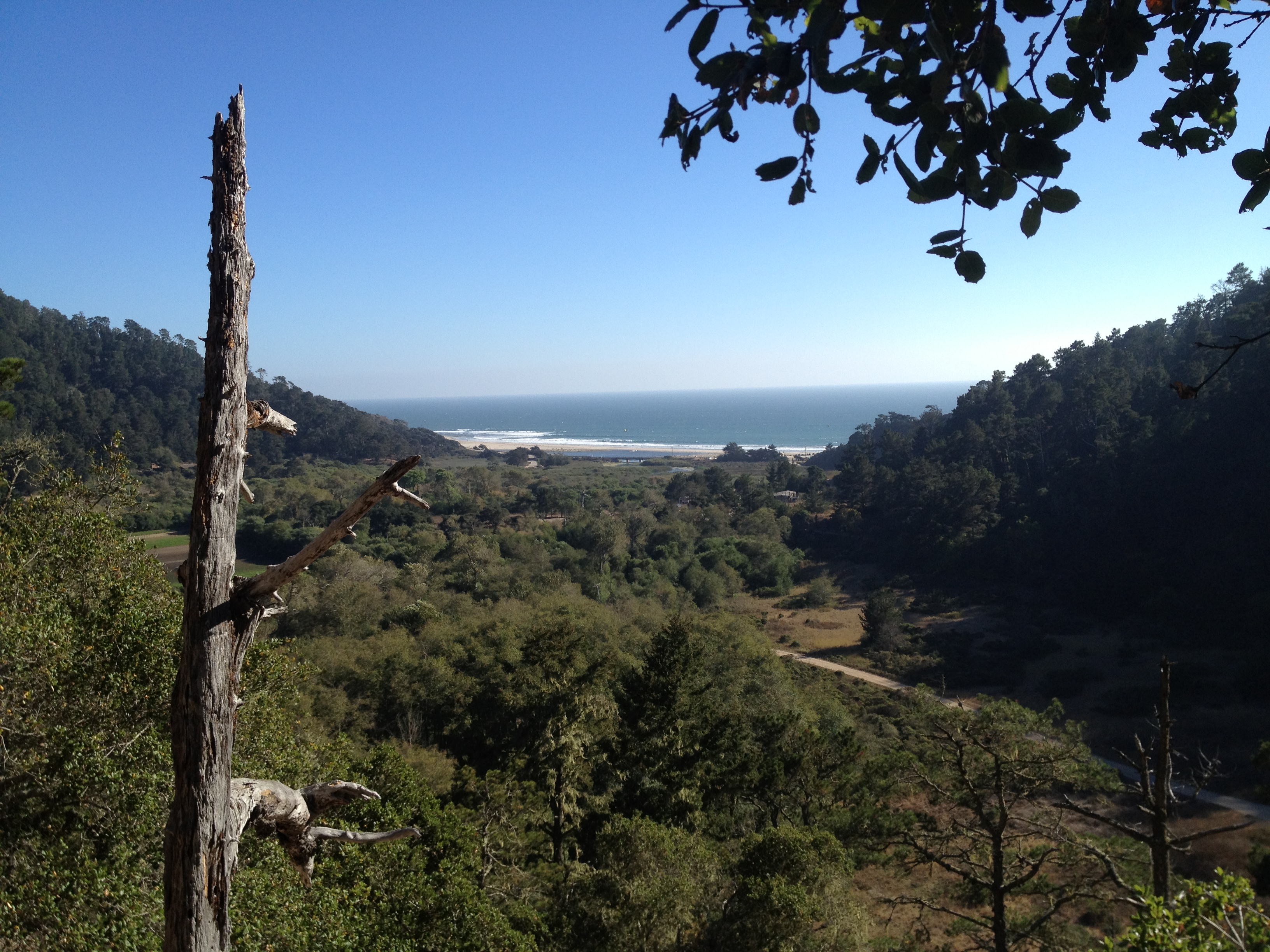
Let your eyes follow the valley, from close-in to the far horizon, just to the right of center. This was our route to/from the beach, which is just out of sight in the distance, about 8 miles as the crow flies.

There’s the beach! Almost back!
Details!
The park brochure and map are linked above. The beach entrance is on the coast about 20 minutes north of Santa Cruz (no cell reception!)
Here’s a link to the Strava track: http://www.strava.com/activities/191481024

")


