
Back a few weeks ago I carpooled with a retired friend from San Jose up to Antioch California to visit Northern California’s former coal mining district. http://www.ebparks.org/parks/black_diamond
Moderate rain was in the forecast on that wednesday, but we had planned it well in advance and we’re hardy and (mostly) prepared souls. Off we went! It ended-up pouring later in the afternoon, but we had FUN!
About 75 minutes later, which is a bit outside our normal driving radius for a daytrip, we arrived…at a historic district which included 5 small towns in the 1880’s. A dozen mines in these hills produced lower quality “lignite” coal. The mines shut down as transportation improved and better quality coal was brought in from elsewhere. The towns withered away and the homes and buildings were moved in their entirety, or scrapped for their materials.

We could only imagine how toasty these hills are in the middle of the summer. It frequently gets over 100F with very little shade. Our hike was cool, gloomy, and (later) very wet!

The park district, as well as Mother Nature, have reclaimed the mines and townsites. All that remains are a few mineshafts and a historic cemetery.
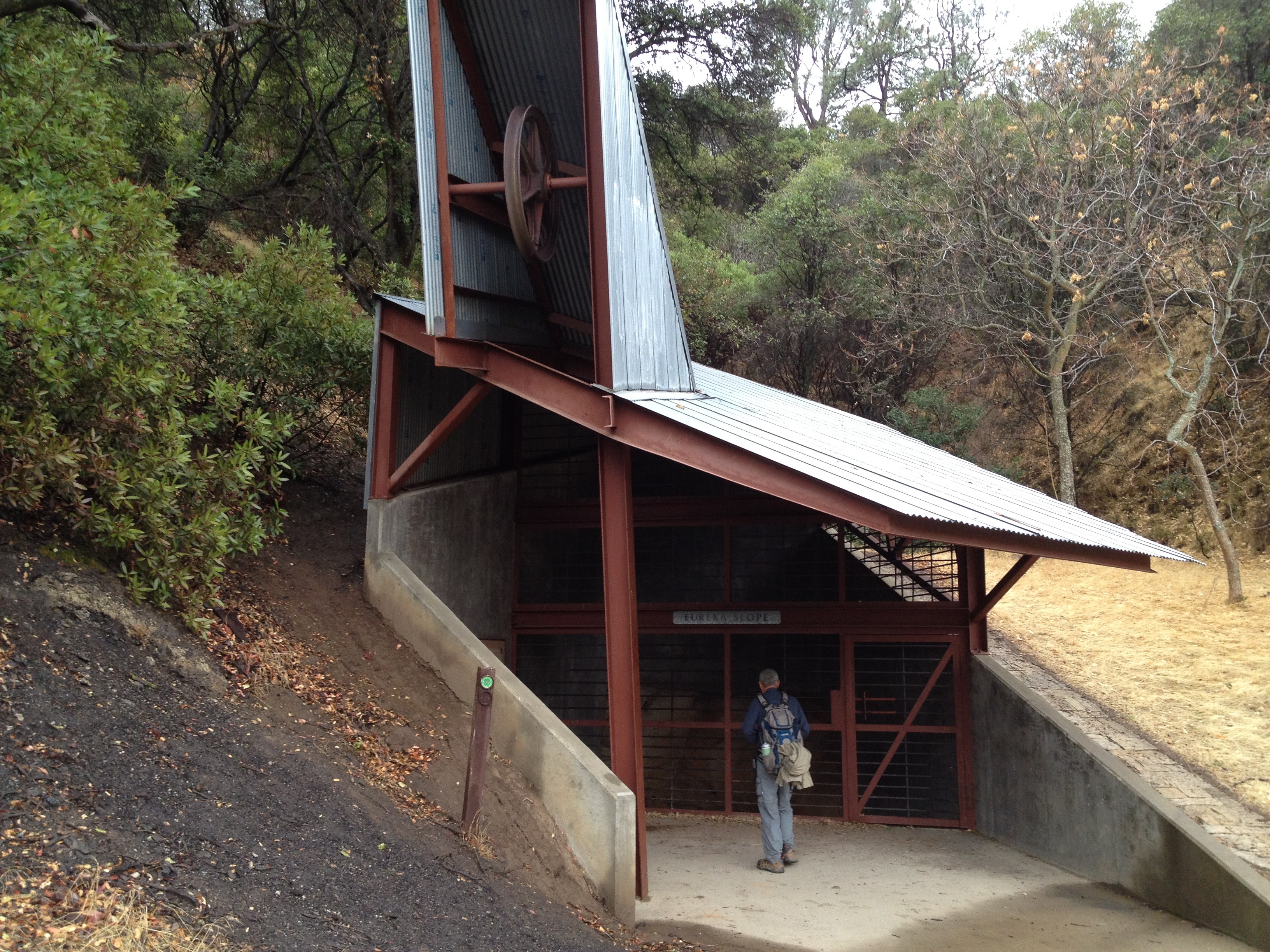
One preserved hoist and mine shaft:
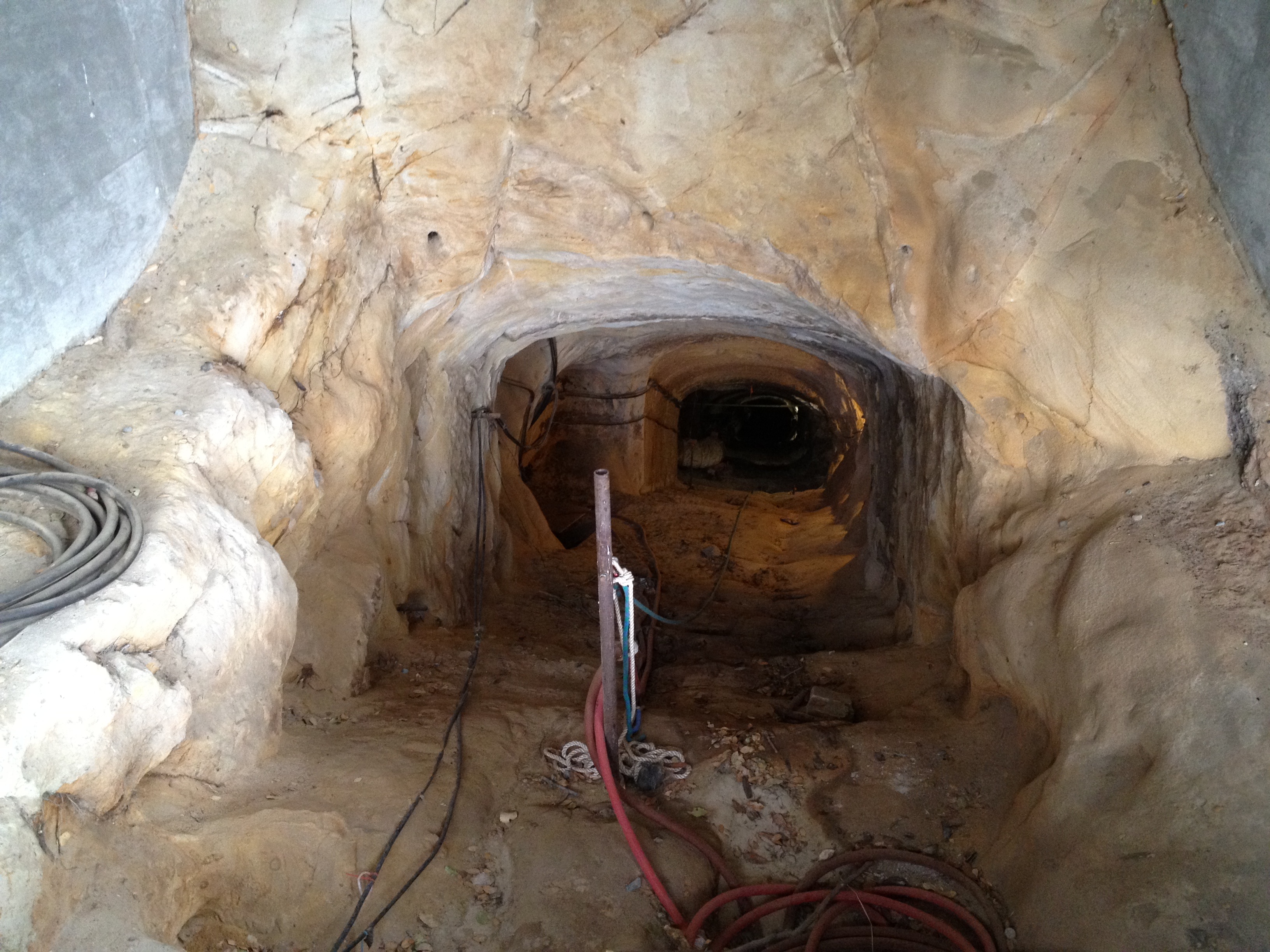
A shot down the diagonal tunnel, holding my camera up between the metal bars
Up on a barren hillside, between the sites of the two largest of the former towns, is the local cemetery.

A few dozen headstones remain, with most of them revealing roots in the United Kingdom. As in the California Gold Rush a few year earlier, many immigrants came to California looking for a better life. The Welsh, as well as the natives of Cornwall England, were quite well known for their underground mining skills. Here’s one headstone (1876) of a native of Troedyrhiw, Merthyr Tydfil, Wales (say that 3 times fast!):

Below is one of the small tunnels that were open. You can see my buddy’s flashlight inside, which was as far as we could go.

Later in the day our circular hike took us above the valley into higher elevations and the weather took a turn for the worse.

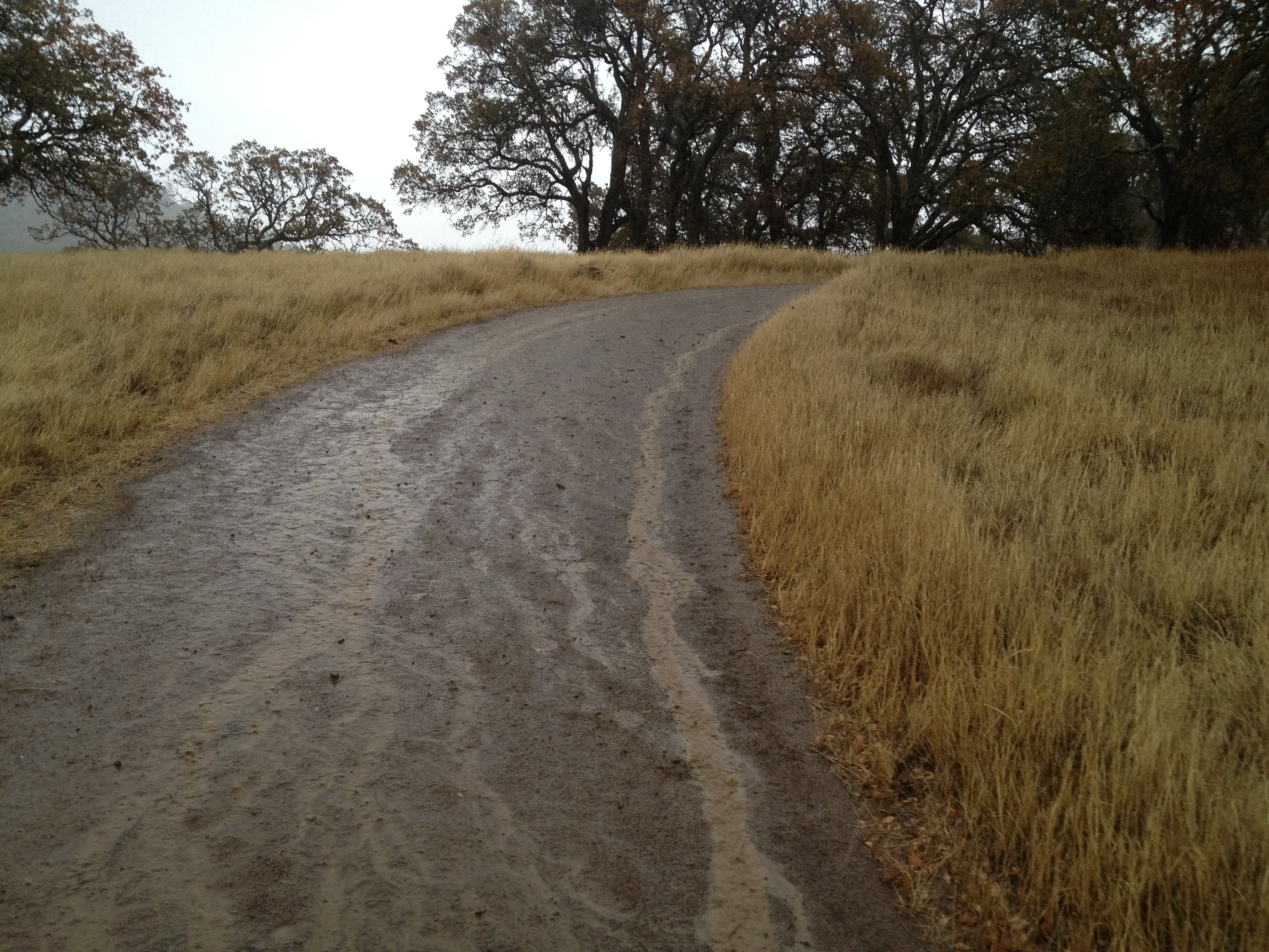
The “moderate” rain in the forecast turned into a significant downpour…the most rain we’d seen in over 6 months. We both had hooded rainjackets and a good attitude, but rain pants would have been helpful. We were a bit soaked, and glad to get back to the car!
A picture of MUD, and little rivers of water! (…it’s something we haven’t seen around here in awhile!)
GPX Track: http://www.everytrail.com/view_trip.php?trip_id=2473108
More pictures: http://www.flickr.com/photos/59666465@N00/sets/72157638256572814/


")


Pingback: A Troedyrhiw native far from home | friendsofsaron
You need to go out there now! I like Black Diamond in all weather, but it’s pretty stunning right now, and I saw not ONE other person once I got over the ridge, heading toward the backpacker camp, etc.