Orestimba Corral – no Backcountry Weekend crowd (Henry Coe – Dowdy Ranch)

IMG_4363

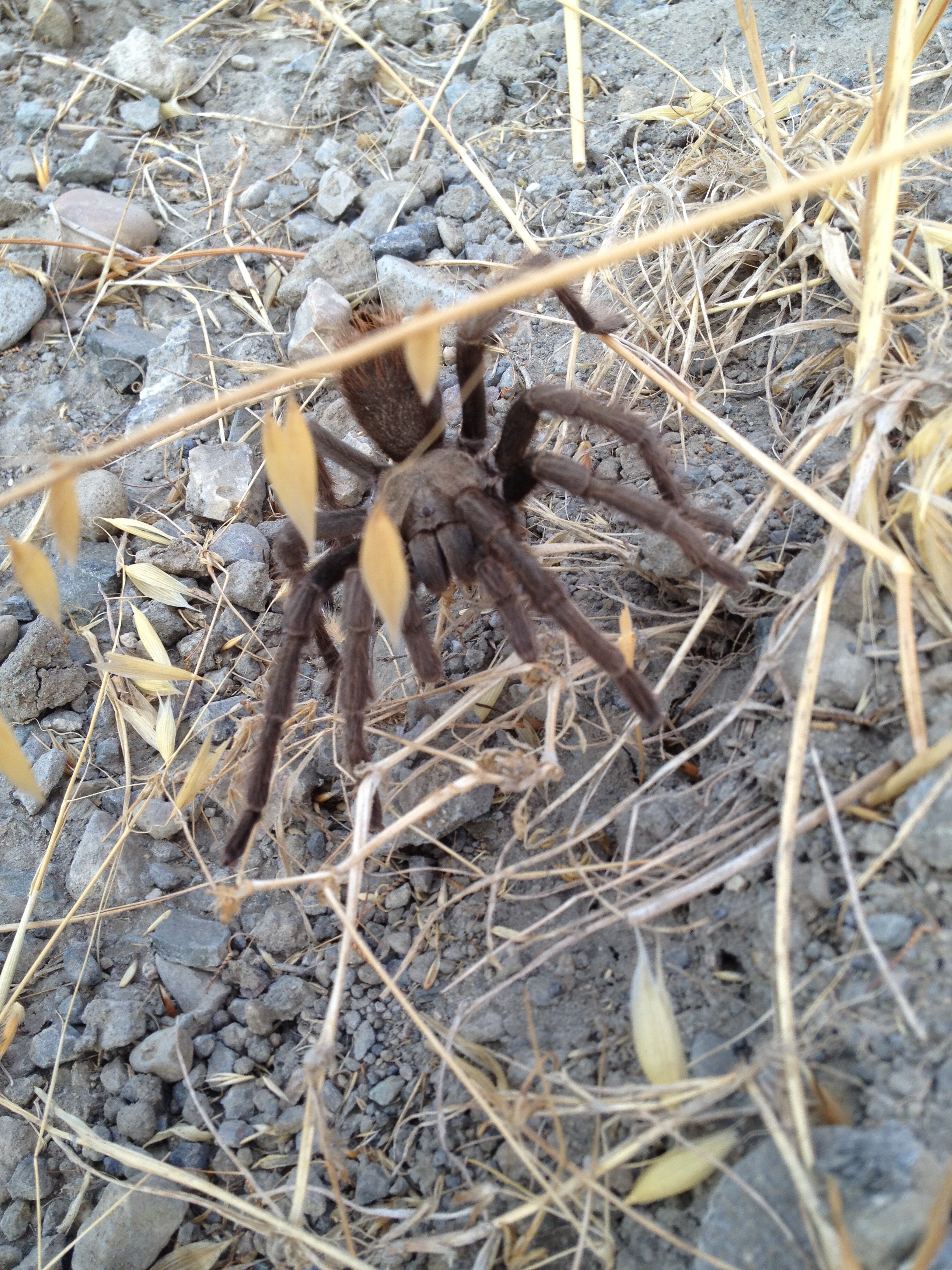
I’ve been to Henry Coe’s “Backcountry Weekend” three times now. http://coepark.net/pineridgeassociation/pra-event-list/details/61-2014-backcountry-weekend

During Backcountry Weekend the Orestimba Corral area becomes a buzzing hive of activity, including probably 100 cars, trucks, horse trailers, and tents. I thought it might be interesting to visit BEFORE the mobs arrive!

It was a 27 mile roundtrip from where I parked my car at Highway 152 (Pacheco Pass) http://www.everytrail.com/view_trip.php?trip_id=2029004

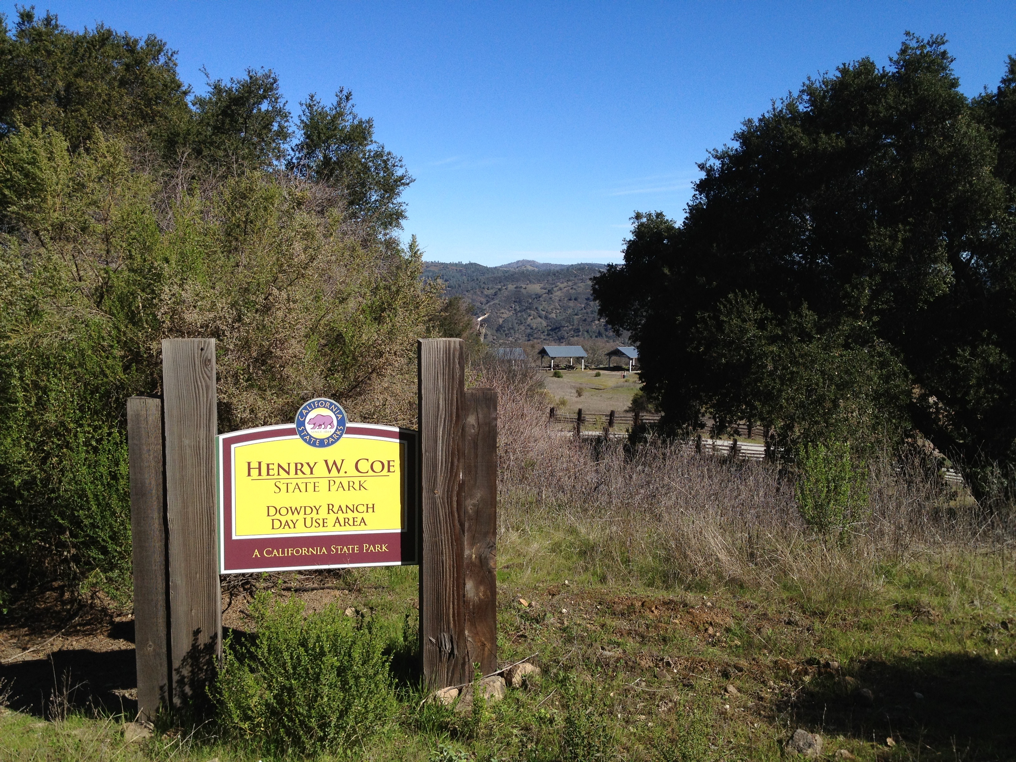
I parked at Bell Station, as this is the closest you can drive until the spring/summer when the gate is open on weekends http://coepark.net/pineridgeassociation/planning-your-visit/visitor-centers-and-park-entrances/dowdy-ranch-visitor-center I was also curious to see the water level in the stream crossings (a little higher than the 3 BCWs I have been to) and to see if there were permanent signs against mountain biking north of Orestimba (there were temporary signs last year during BCW. No signs today. Apparently some small parts of the road cross into the Wilderness just north of the Corral area.)

It took 90 minutes to get to Dowdy Ranch, which is similar to my past 2 trips last year. After that, it was just under 90 minutes more to get to Orestimba, at a more leisurely pace and less climbing.

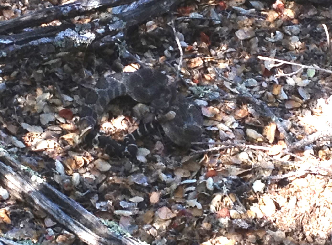
I took some pictures of Tie Down Peak, which was scene of a VERY close rattlesnake encounter back in the fall. I did NOT bushwhack this time! http://www.everytrail.com/view_trip.php?trip_id=1785673

IMG_4375

I saw 4 kinds of flowers: Some poppies in a sheltered spot, some large fields of Shooting Stars which are peaking now, plus some 4-petaled white ones and multi-petaled yellow ones

IMG_4370

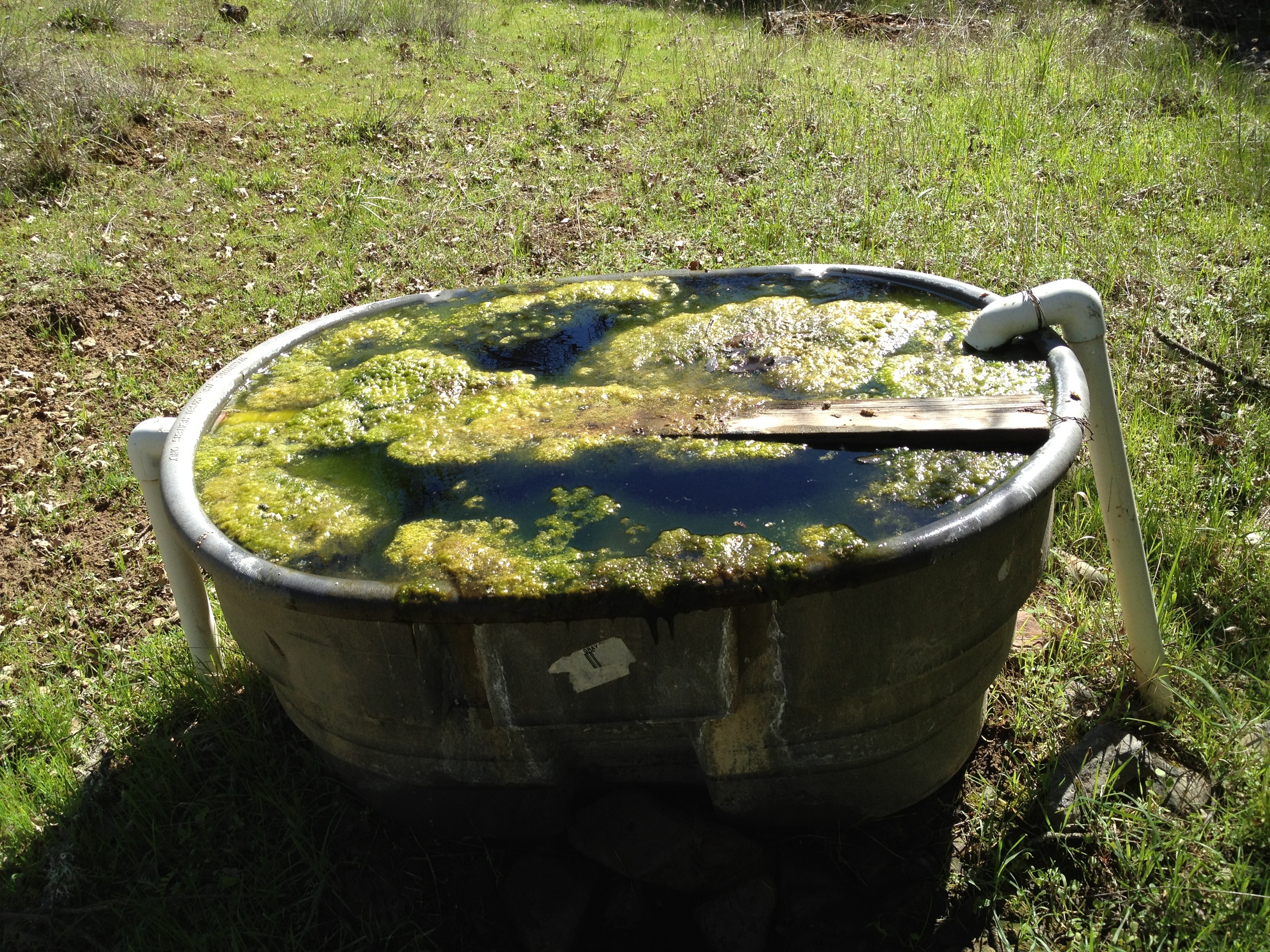
Also visited the James Spring for the first time, which is on the map. Peaceful spot just off the road. The spring was barely trickling and full of algae. I also visited another spring about a mile north of Dowdy on the east side. It’s not on the map, but there’s a marker post there. That spring was also trickling, though with alot less algae and crud in the Rubbermaid trough.

IMG_4381

IMG_4382

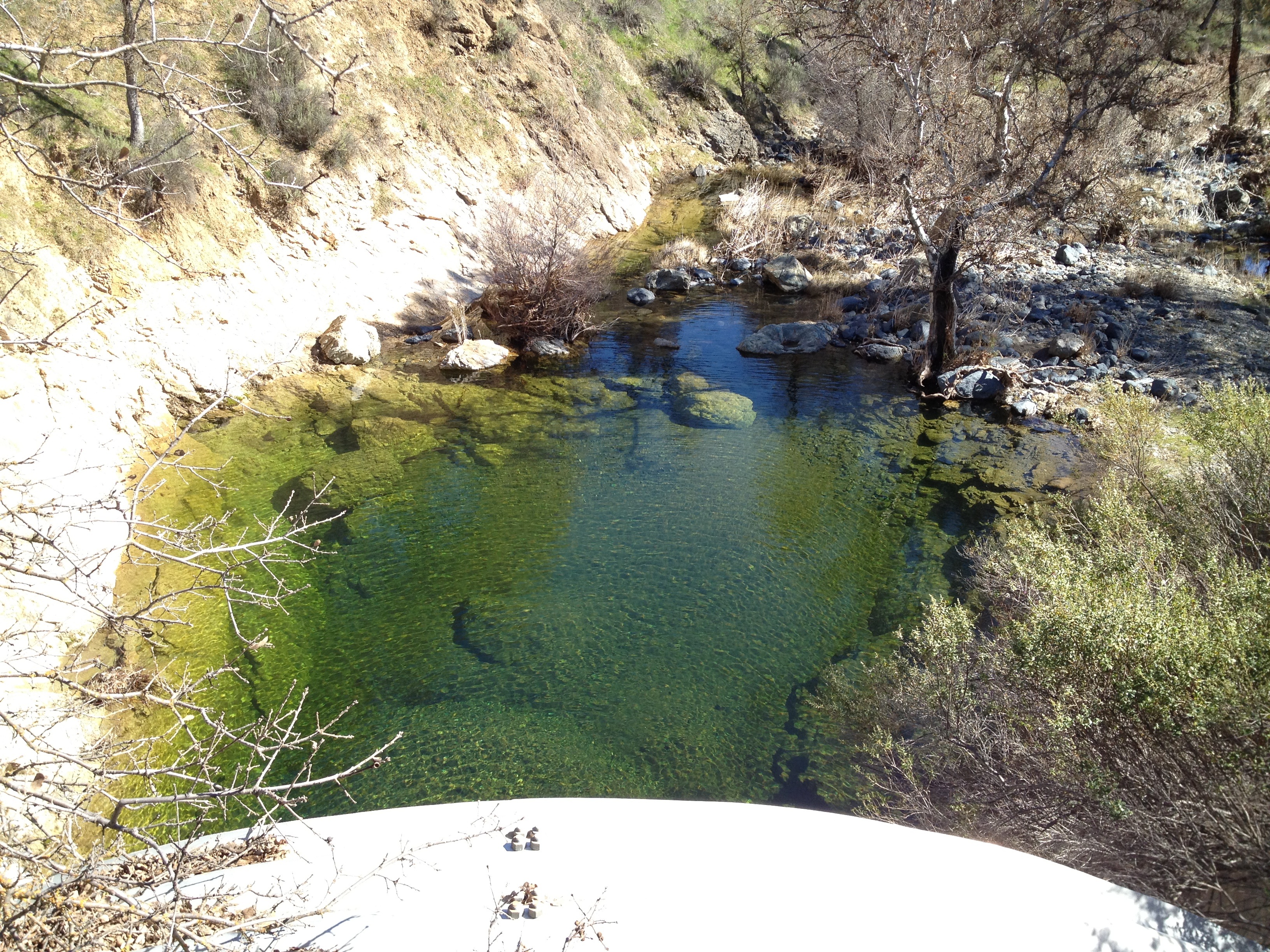
The Pacheco Creek undercrossing was full and lightly flowing

IMG_4378

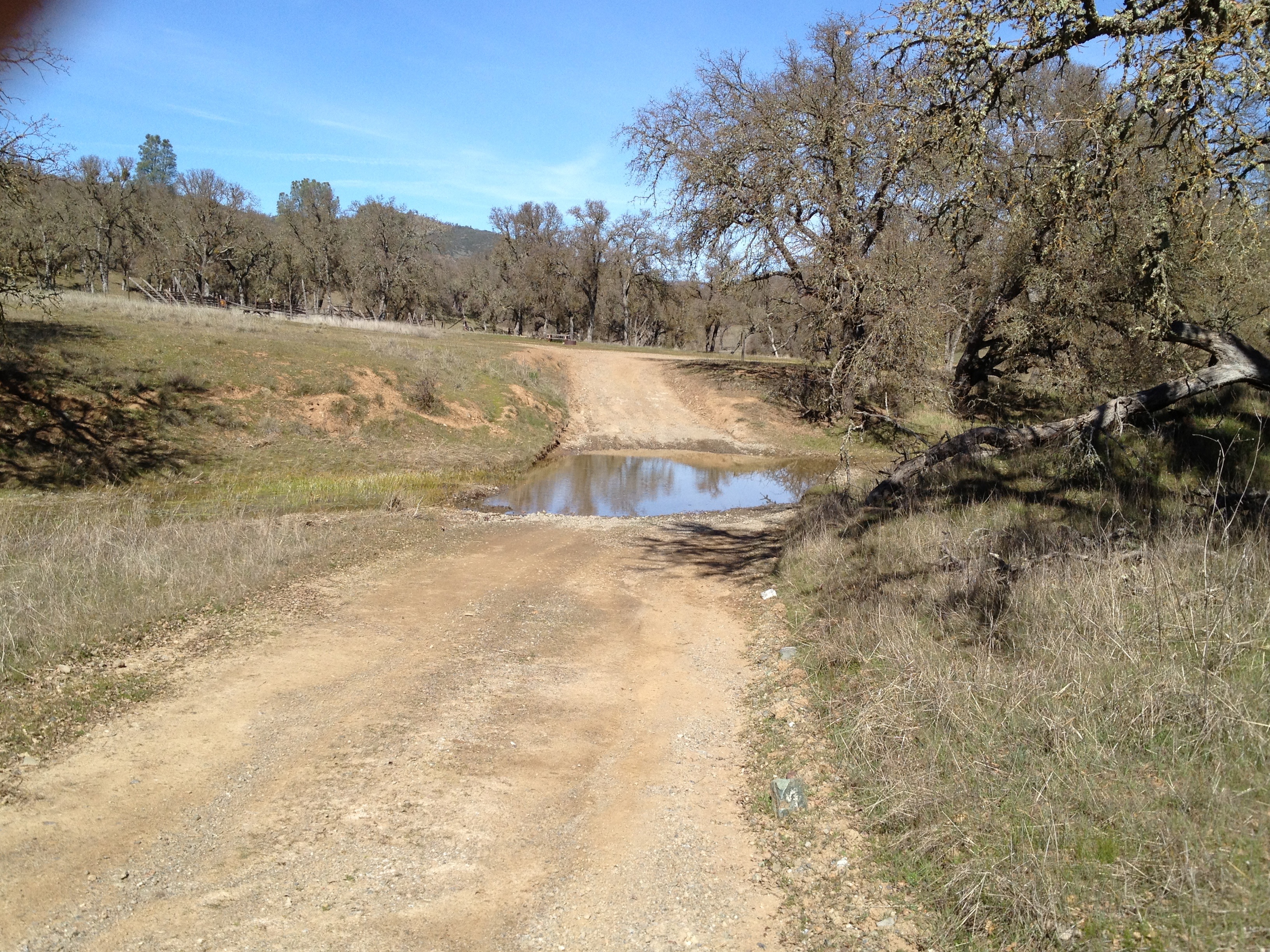
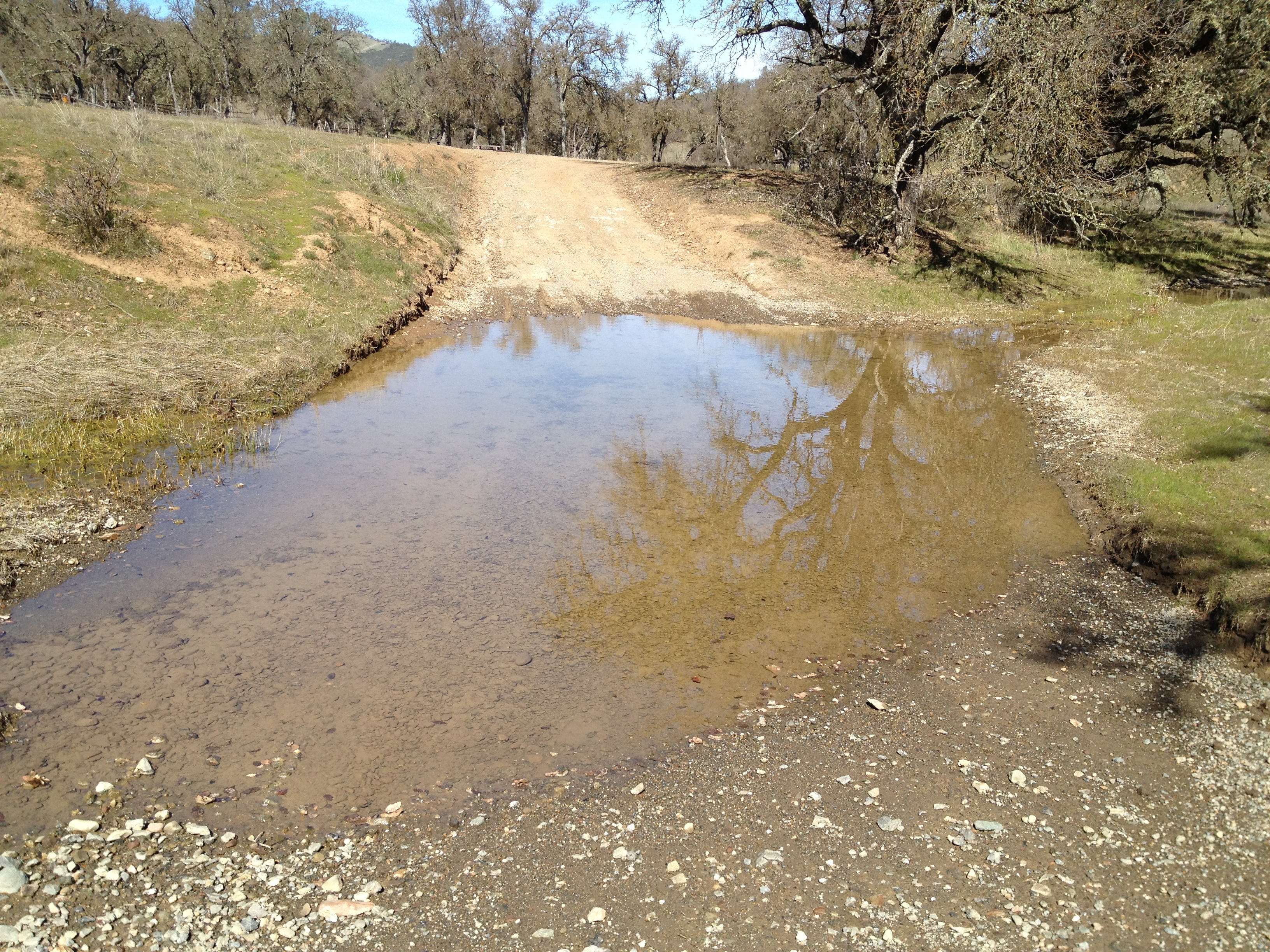
The last water crossing, right at the edge of the Orestimba Corral, was a bit lower than usual.

IMG_4386

IMG_4387

…and here we are! The corral area!

IMG_4388

Empty, quiet, and the trees barren in the winter!

IMG_4389

IMG_4390

IMG_4391

Nice trip, except for the steep hill on either side of the Dowdy Ranch HQ. The weather was perfect! About 65 degrees when I finished, and I only required a minimum of water to be comfortable (1.5 liters)

Posted in Uncategorized | 2 Comments

Rattlesnake Adrenaline Rush: Tie Down Peak at Henry Coe (Dowdy Ranch area)

IMG_3112

So where do I start? Well…my first experience in the Dowdy Ranch area was 6 years ago as a novice Geocacher. I asked on www.theGBA.net for any unfound caches in the Silicon Valley area, and I was pointed to 2 that had been sitting for 4 months http://coord.info/GCVT3D and http://coord.info/GCTNBG Since that time, I’ve been back to Dowdy a handful of times, both by car and under human power.

This particular time, I was “inspired” by 2 friends who recently went to Tie Down Peak and documented their mis-adventures. http://www.everytrail.com/view_trip.php?trip_id=1771571 http://www.everytrail.com/view_trip.php?trip_id=1772344  On a day that was about 20 degrees cooler (83F at Bell Station when I returned), I decided to go for it, alone!

I departed Bell Station at 8:45 by bicycle, and summited Tie Down peak, 2hr 45min later, after leaving my bike at the intersection of the road and the Tie Down Trail. Other than being surprised to see a lonely tarantula on the side of Kaiser-Aetna Road, it was uneventful until I got near the summit.

IMG_3092

As you can see from my track, I did not take the most direct route! My iPhone failed to download AntonyW’s previous track, but I had a general idea how to approach the face of the peak, while trying to stay on the marked trail as long as I could.

Scrambling up the left side of the cliff face is probably the same as what Antony did. The other parts of the peak are covered with VERY heavy undergrowth. It looks like this area hasn’t burned in over 100 years. I made it up, on the loose rock, but was not happy about having to go down the same way! The rock scramble to the top didn’t look bad, but everything was loose and crumbly. Ugh!

After a short while on the summit, I started looking at exiting to the north-west, through deep underbrush. Some scratches were inevitable, but it seemed easier and safer than going down the way I came up. I started picking my way down, stepping over numerous logs and downed trees. Indeed it was a good decision UNTIL I almost stepped-on a very large and angry rattler. I froze in place, well within striking distance of this bad boy (or girl). I was wearing my rattlesnake pattern Dirty Girl Gaiters at the time.

IMG_3115

IMG_3099

I wonder if the rattler delayed striking me, due to my similar coloration? Anyway, after slowly backing away, and waiting for the HUGE adrenaline rush to subside, I headed down to the open meadow and back to the road. Whew! (I had a friend who once put his hand on a surprised rattler while climbing…another good reason not to step or grab where you can’t see!)

On my return trip on the road, Ranger Cameron Bowers passed me 4 times in his truck. We stopped and chatted the first time. He asked about my trip, asked where I came from, and checked to see I was OK. (“I faked it”! I was happy to be alive and in a place where my body would be found, but I was still a bit shaken.)Until then, I had not seen anyone else the entire 6-hour and 20-mile roundtrip. My snake encounter was off-trail, over a mile from a desolate road with no phone signal. Hmmm..what did I learn today?

 Would I do it again? …maybe next year on a different peak…maybe after I buy a SPOT locator…maybe not alone

Photos here: http://www.flickr.com/photos/59666465@N00/sets/72157634896967755/

GPS Track here: http://www.everytrail.com/view_trip.php?trip_id=1785673

Addendum, May 2014: My local hiking friend at http://www.Calipidder.com just did Tie Down Peak. Whereas I went up the rock face and down through the brush, she did the opposite. There is no easy way and nobody does Tie Down twice! http://calipidder.com/wp/2014/05/burra-burra-tie-down-henry-coe-state-park/

Posted in Uncategorized | 7 Comments

Nesbit and Fitzgerald Ridge @ Henry Coe

I’ve always been attracted to “blank spots” on the map. In this case, the map was “blank” when looking at thisarea on Geocaching.com and was also interesting in that it’s not too far from Coe HQ, but gets almost no visitors.

I had been from Manzanita Point to Madrone Soda Springs a few times, including a “scouting trip” in this area once before. During April 2010 I got a late start in the day and made it part-way up the OBSCURE Sycamore Canyon Trail and attracted the attention of about 30 ticks. Today I got an earlier start, had my navigation plans prepared a little better, and saw ZERO ticks.

Like last year, it was very slow-going on Sycamore Canyon trail, but I at least had the trail entry point scouted-out (and a Geocache placed theer last year as a navigation beacon). It helped me quite a bit to get up and out of the Madrone Soda Springs canyon much faster.

After completing the “on-trail bushwhacking” and breaking-out into higher elevations on the Sycamore Canyon Trail, I found my path to be wide-open, as I expected it to be from my satellite route-planning. BEAUTIFUL!

There were absolutely no signs of hiking or bicycling tracks, new or old. There was one set of recent truck tracks, presumably a local rancher. (One of the senior volunteers at Coe HQ said nobody from the park had been there for several years. A rancher used to allow a Park truck to drive-up on Fitzgerald Ridge Road, but not any more.

If you’re tempted to go: The navigation from the Madrone Soda Springs trail to lower Sycamore Canyon Trail is a bit tricky. The trail is overgrown and seasonal ticks are waiting in large quantities. Good navigation skills and a sense of direction are important. Also, look for faded pink ribbons and newer orange ribbons as a partial guide. I can answer some basic questions by e-mail if you’re thinking of trying this.

Photos: http://www.flickr.com/photos/59666465@N00/sets/72157634903356292/

Track: http://www.everytrail.com/view_trip.php?trip_id=950770

Posted in Uncategorized | Leave a comment

Dowdy Ranch (Henry Coe) first visit Sept 2006

CoeBell_Sep06-017

CoeBell_Sep06-034

CoeBell_Sep06-044

Waaaayyy back in Sept 2006 I visited Dowdy Ranch for the first time. It was a huge slog on my wife’s too-small mountain bike from Bell Station, but I did it….and I toured the ranch buildings a few months before they were fenced-off.

Photos: http://www.flickr.com/photos/59666465@N00/sets/72157634896780991/

Posted in Uncategorized | Leave a comment