
A friend, who moved from Santa Cruz to Grass Valley a few years ago, pinged me with a backpacking idea. It sounded much more reasonable than some of the crazy bushwhacking adventures he had been known for. It wasn’t!
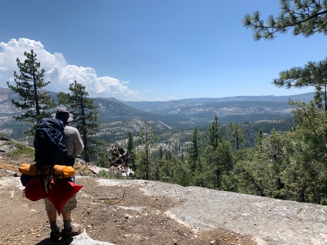
We met at the Blue Lake trailhead versus carpooling, as this is the “year of the COVID”. It was a reasonable hike, with our 30 pound packs, up a gently inclined trail, to our campsite, near Baltimore Lake. We had started at 11AM, so the plan was to crash there, then get an early start on a day hike to Old Man Mountain.
(The red baggy thing is his sleeping bag, in an oversized stuff bag. He’s a novice backpacker, so I encouraged him to locate a better stuff bag, and shift some of the weight up higher.)
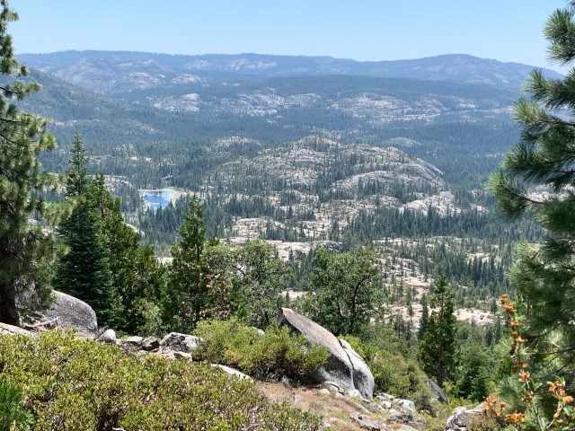
The view to the west, where we came from. I was VERY happy to see granite and alpine lakes much closer than Tahoe or the Eastern Sierra. The Yuba Gap area is where Highway 20 meets I-80, about 25 miles west of Donner Summit. NO PERMITS OR RESERVATIONS NEEDED!
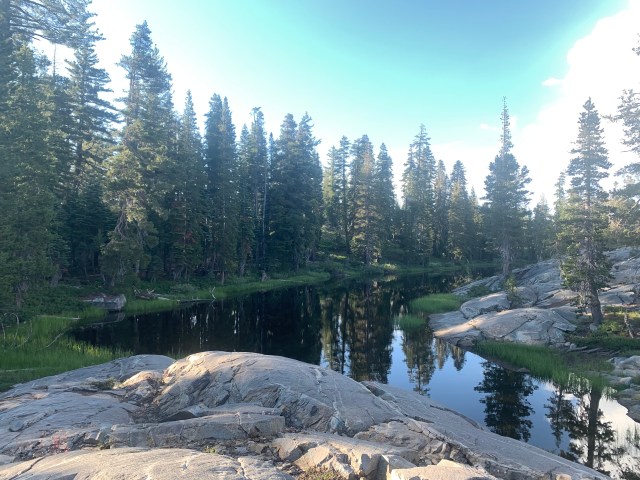
Below is the un-named pond, just south of Baltimore Lake, as viewed from our campsite.
Our plan for the next morning was for an “easy” off-trail morning hike to Old Man Mountain, via a lake with a small island. We’d then return to camp, grab our packs, and head back to the car.
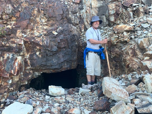
Below is an old mine shaft, noted on the USGS Topo maps. That’s as close as we got!
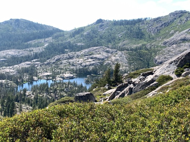
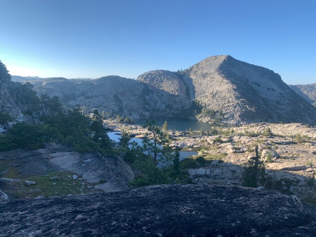
There’s Old Man Mountain, with the further lake, in it’s shadow. We had no idea what we were in for.
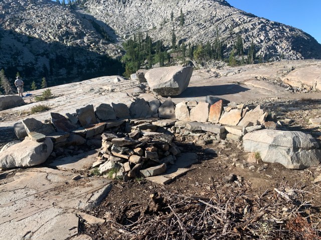
We got down to the shore, and found a nice gathering circle, made of arranged rock and a fire circle.
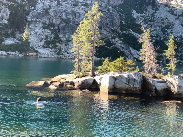
Below, my friend swims about 100 feet to a small island. Why? Geocache…
After Dan’s swim, that “easy” morning hike became quite an ordeal, with a few dangerous spots. We proceeded around the right side of the lake, only to find a very fresh rockfall of 10 foot boulders, going straight from a cliff into the water. We carefully scrambled over and under the boulders, hoping that they were setttled into their permanent resting places.
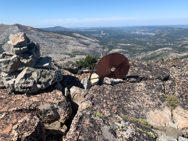
We then started uphill, to the trailless summit, through the thickest brush I’ve ever seen. Dan was ahead of me, and knew I wasn’t happy when I asked if he was interested in turning around. We eventually found a clear “path” to the summit, pictured below.
From the summit, we studied our downloaded USGS Topo maps, and decided to make a loop around the other side of the lake, to avoid the rockfall. It looked fine, until we found ourselves peering over an edge, looking down at treetops. The 50 foot gradients on the map seemed to have hidden an impassable 75 foot drop. (I wasn’t taking pictures at this point. It was getting late, and I was not happy…)
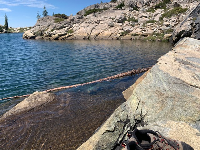
We circled back the way we came, and instead of climbing over and under the rockfall, Dan suggested swimming across the lake! It would be safer, as well as saving at least an hour. One problem: Phones, electronic car keys, and my DeLorme InReach. Solution: one holey ziploc, and float them across on a log, that kept wanting to roll my stuff into the water. We made it. Below is a picture of that log, which barely had enough buoyancy.
After the successful swim, it was just a looonnnggg slog to the campsite, to grab our gear, and head back to the car. Below is the one photo that I managed to take on the way. Probably the only time I noticed my surroundings.

We got back to the cars at 10PM, after 15 hours of hiking! I would happily go back that area again, but with a bit more time in the schedule, and less reliance on topo maps to show us new rockfalls and impenetrable dropoffs!
11 miles and 2130 vertical feet to camp, on the first day: https://www.strava.com/activities/3824509689
5 miles and 2239 feet, roundtrip, to the Mountain and back to camp. 8 hours slogging time, whereas we had planned on 2 or 3 hours! https://www.strava.com/activities/3829909923
9 miles and mostly downhill, from camp to the cars: https://www.strava.com/activities/3831034703


")


“Dan” and “hike” in the same sentence is always a red flag. 🙂
Yes indeed! His reputation is intact.
I also climbed Old Man Mountain last year, though it was less of an ordeal. You might want to consider logging your ascents on the Peakbagger app—it also has maps, tracks, trip reports, etc. It would have helped you avoid some of the extra “adventure”.
I very much enjoyed this report. What an ordeal but accomplishment.
We’re headed up to this area very soon. If you remember, where was this photo taken from, and what direction are you looking? That looks kike a very scenic basin/region.
This pic:
